
March 19th, 2023
9.25 miles + 200?? ft – 4,200 ft
Campsite Elevation 4,492ft
I wake to a firm knocking on my car door. I am in the middle of a dream and get ripped out of it. It’s too dark to see outside and decide the noise is most likely a large animal. Then the knocking comes again and I see Rockin’ through my window. I fumble to grab my keys and unlock the door. “sorry to wake you up” she whispers, “do you know what time it is?” I take a look at my watch, it reads 5:08am.
She has a perplexed look on her face and as I slowly come to, I realize she is all dressed. Then I remember that last night when I went to set my alarm, my phone said it was an hour later than it really was. This happened also last week on the AZT down near the Mexican Border, so I knew what was going on and set my alarm accordingly. I suppose Rockin’ didn’t look at her watch last night, only her phone. She has been up already for an hour. Shit. That means I have to hurry up and wake up. She says to take my time and that I can go back to sleep. But she is ready, there is no way I can fall back to sleep now, not with a wake up like that and not knowing she’s all set to go. Welp, I guess that’s one way to start a new adventure right!?
I am SO glad I planned ahead and brought my coffee from home and even a little half and half, as I am able to make a pour over nice and strong. Since I only got about 5.5 hours of sleep, I need that caffeine hit. I am so excited for our adventure to begin though, so that overrides the mental tiredness for the most part. I move as quickly as a tired me can move, and we are on the road by 6:13am just as it is getting light out.
The area where we leave Rockin’s car is called Cave Creek. Wow! This place is something else. You know how when you drive into a place in the night and you finally get to see it in daylight, and it is such a treat? Well this place is stunning. Not only that, we get to see sunrise light on these giant rock walls. I immediately think about rock climbing but don’t know if the quality of rock here is good for that. Nevertheless these walls call to me and I am super excited now for what we are about to see and all that we are about to do.


I will spare the details of how long it took us to actually get on the road back to Safford, as we needed to stage her car at the Silver Peak trailhead where we will finish and that took a while. It was not clear to us where we were allowed to park. It was too early to knock on the Rangers door too. Nevertheless we can tell this is a popular site with birders and other recreators. People recreate here.
We decide to drive out a different way than we came in avoiding all that rutted out dirt road and washes we drove in on and thus crossed over into New Mexico, my very first time in NM ever!

On the way to Safford we stop to cache our food buckets and water. We drive through a gate that we are actually able to unlock and there is a dead coyote laying there. We drive up the dirt track a little ways to get off the main road and search for a tree, which is hard to come by down here. As I exit the vehicle and gather my bucket and water jug I wonder what it will be like when we walk this dirt track in a few days time. What will have transpired by then? It is very cold and windy out here and thus we both are wearing our puffy jackets outsie the car. The sky is smeared with wispy clouds and our surrounding area consists of rolling hillsides of bleached yellow grasses that stretch out as far as the eye can see. Nothing is green quite yet. I don’t know if these grasses ever turn green? Maybe it’s still Winter here.


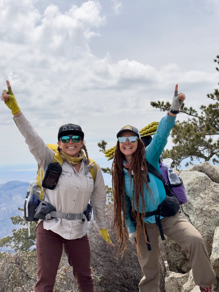
We finally make it up to the trailhead just before noon. You know what, that was sort of what we expected anyway, so we are fine with this late start. Hey, we are starting! We are no longer talking about and thinking about doing the thing, we are now doing it. We left our microspikes in our re-supply buckets, saving them for the second half of the trip when we will be at higher elevation for a longer stretch than we will be today. We may hit snow here but it shouldn’t last too long nor be too sketchy. People do Recreate here so it should be safe, right?
We stop in Safford to get another coffee and I am wanting a real breakfast meal, so we Google coffee shops and everything is closed because it’s Sunday. But, I don’t give up. In an hour, we are in town and I try again. Bingo! The place we stopped in yesterday is open and they serve savory breakfast crepes. Heck yeah! We chow down, drink our hot brew and post a couple things on social media. I finish up my last blog post from Day 4 of the AZT with the Wander Women, meeting my goal of posting four blogs in four days, or close to that. It’s not my best work, yet I wanted to get something out and it was a fun little challenge for me to have that project last week while I was back to work and getting ready for this trip, definitely helped to keep the momentum going..


The Sky Islands Traverse here climbs right to the top of Ladybug Peak, so that is the first order of operations. We have dirt trail to start out on too, Whoo Hoo! Things are looking up and we make it to the Peak very quickly with just a little bit of snow. From the peak we cannot see our exact route down and we first try the dirt on the South side but quickly get choked in with thick Chinquapin. We are already scrambling and heavily bushwhacking within only minutes of leaving the peak and we really shouldn’t have to, there IS a trail somewhere up here. We get ourselves re-oriented and really look at our maps and then re-calibrate. Turns out we need to go on the opposite side, through the snow. Dang it.

We aren’t in the snow too long but it does require us to do a few moves to get across a steep setion, then the snow comes and goes sporadically and finally we meet our first trail junction at the one mile marker. Hooray, we made it a mile! Here we connect with the Dutch Henry Trail #297 and start to head downhill on the South East aspect of the mountain. The views open up here so we can take a gander at the scope of our route this afternoon.


The trail flows down into Bear Canyon and eventually ends up at a drainage where there should be a lot of seasonal water flowing. We are theoretically on a “trail” here but we soon discover it’s a long forgotten one as it disappears all the time and is way overgrown. This is the kind of trail Rockin’ and I both love because it is like a game trying to find it and imagining how the trail builder thought, it is a great way to engage the mind.

We begin our descent, very slowly losing elevation, finding water along the way. It’s a sweet little Spring coming right out of the mountain, but the temps are cool enough today that we don’t need to collect any yet. From here there are several bushwhacky setions and we are already learning how to navigate the Cat Claw. This plant will turn out to be our nemesis and is the reason you do not wear shorts or short sleeves out here. This plant is named very aptly, there’s a reason we are dressed the way we are.
Shortly we drop out of the Conifer zone and enter the Oak and Alligator Juniper zone. There are several types of cacti here too and believe it or not we find a cactus growing out from a rock that actually also has a fern growing out from it’s underbelly. I have never seen this symbiosis anywhere before. Quite unique!


The energy in this area is very peaceful, there isn’t any wind surprisingly and the air temperature is so comfortable. The cloud cover that has grown this afternoon offers a soothing cool to the day that we are grateful for. It feels like we are in a very remote place, the sense of discovering a peaceful distant land that we somehow popped into through some sort of portal. Granted, there is evidence of cows having been here, but we have not seen a one all day.

We finally reach the botom of Bear Canyon and at the creek crossing there is ample clear running water. Such a gift! Yet, we still do not need to collect it. It’s just not been a hot day and we’ve done a lot of downhill. We take a short break to drink and eat a few snacks and look over our route. Down below we will join a dirt track that parallels a paved road and we will have more water soon. We are at quite a low elevation now, as we topped out at Ladybug Peak at 8,780 ft and now we sit at 5,500ft.


When we reach the road we have dropped even further, to 4,800 ft and when we look back to where we came from it actually looks like we did something today. I check my Strava and it reads only 6.6 miles that we’ve covered, but it feels like we went much further. That is cross country travel for ya. We have been averaging just a little over 1 mph. And that is to be expected as well.

We have to walk a short section of the paved road, maybe one mile, and we take advantage of that speed to try making up a little distance as we will have just a couple more hours of daylight. Looking out on the open road we walk with big smiles on our faces. It’s that don’t fence me in feeling. I start singing that song, you know the one…“give me land lots of land with the starry skies above“….We are feeling free, walking in this big open country, and we are on our way. Yes, this adventure is certainly under way.
Eventually we leave the road and enter the land of choked in Cat Claw for a fair spell. We also have to go through another gate and wind around a large rocky feature to get to some water and here we decide to finally guzzle what we have and collect enough for the night. Rockin’ says to me that it’s my job to find us a camp site that has the following features: up higher to have warmer air, away from the road, no ants or ant hills, flat, no Cat’s Claw or other snags that will rip our tents, and some protection from the elements since it now looks and feels like rain is on it’s way.
Dark gray clouds are stacking up near the peak and we smell the metallic wet Earth scent of impending rain. We have 2L of water each, enough for the night, and our next source is 2.5 miles away, so we are good to go and start looking for a place to call home for the night.

We travel cross country through very long grasses on a hillside dotted with chunky rocks and eventually we spot a small cluster of trees that look inviting. They have not leafed out yet, nothing has, so this whole area still has the look of Winter. However, earlier I did see some Spring green grasses coming up out of the Earth, it was an interesting juxtaposition to see the green intermixed with the old yellow grass of last season. Super cool if I do say so. It’s like a window in time that one often does not get the opportunity to witness. We traverse over the lumpy slope to the trees and find that we are in good hands here. This site is actually perfect and it has literally everything we were looking for.

We make camp just as it’s getting dark and since we have cloud cover tonight there won’t be any stars unfortunately. Rockin gets a weather forecast from her father in law, Retired Ranger John, and he says there will be two days of rain, and wind, but we just don’t know how much. For that reason I am conserving my cooking fuel in case I need to make more hot beverages tomorrow, so I don’t get to have my tea tonight.

I am tired enough that I think I will fall sleep just fine without it. I do my PT exercises while my food is hydrating and then finally it is time to eat. I tell you what, this might just be the best dinner I’ve had on trail in a long time. Chickpea Pasta with Spaghetti Sauce, Zucchini, Onions, Eggplant, Trader Joe’s marinated artichokes and Olive Oil. Heck Yeah! I sit outside eating my meal and hear coyotes howling in the distance. We later hear them again as we chat through our paper thin tent walls. It’s been a great and successful first day.

” Make it known “. Milissa Jayn Gillen , So your adventures started with half dome. I used to hike half dome every may when the snow melt was raging. Nice start for the hiking season. Your need for finding a way to build your existence around the sierras was cathartic and very brave. With your positive determined energy , it looks like you found your way. The sierras have their champion and will not let you go!
Hi Ed! Well thank you for such a kind comment, indeed the Sierras have my heart, they are no doubt my first love and the focal point that I will always return to. I do hope they will continue to embrace me over the years 🙂