
“Any sense of aimless wandering may well be exceeded by the joy of exploring the trip’s engaging itinerary in full” ~ Brett Tucker
The Sky Islands Traverse is a cross country route in Southern Arizona’s landscape where the Chihuauan and Sonoran deserts overlap. All together the route spans roughly 520 miles making a corkscrew or spiral shape as it weaves through several of the regions Sky Islands and crosses the desert basins in between.

“The term “sky islands” refers to bold, forest-clad mountain ranges isolated from one another by expansive valleys of grassland or desert. In the arid basin and range country of southeast Arizona and southwest New Mexico, these mountains receive sufficient rainfall and snow to support a wide diversity of flora and fauna whose habitat is elevation-dependent. Unable to migrate between “islands” due to the intervening desert “seas,” many of these species have evolved in comparitive isolation, as on Darwin’s Galapagos.

Besides being ecologically rare and unique—the southernmost spruce-fir forest in the U.S. is found here, while many bird species more common to Central America occur no farther north—the Sky Island ranges are also stunningly scenic and alluring, in many ways defining the very character of this region. While some ranges are well known, such as the popular Santa Catalinas outside Tucson, others like the Santa Teresa Mountains remain obscure and infrequently explored by the region’s burgeoning human numbers, in no small part due to their physical ruggedness and difficult access.” (courtesy of Simblissity.net)
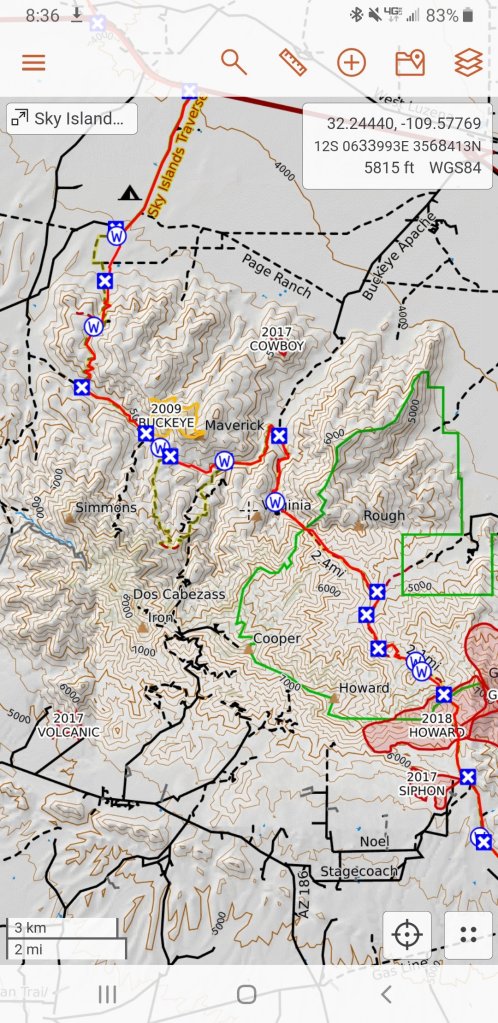
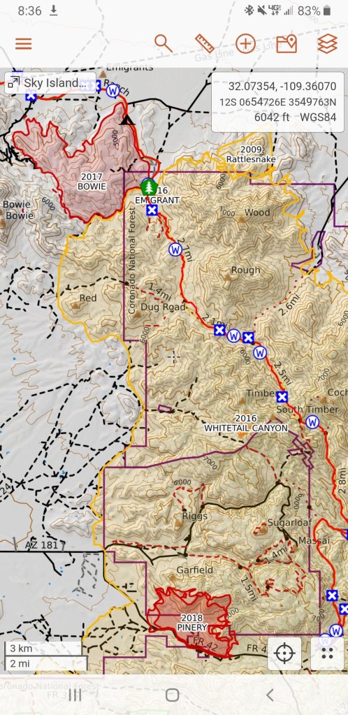
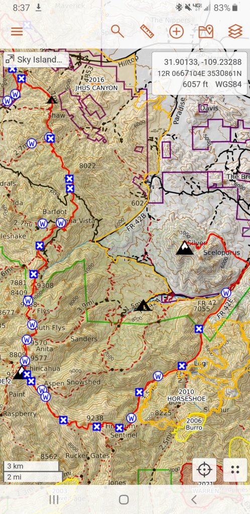
Planning and Resources: With about a week’s time to explore this route, Rockin and I decided to tackle the last two sections of the route, sections 7 & 8. The Sky Islands Traverse utilizes around 93 miles of the Arizona Trail, which we have both hiked, so we will be biting this off in chunks in the areas we have not explored. Sections 7 & 8 make up rougly 121 miles, from Ladybug Peak in the Pinalanos to Silver Peak in the Chiricahuas and includes the Dos Cabezas Wilderness, Fort Bowie, Emigrant Canyon, Cochise Head and skirts the Chiricahua National Monument.
If you are reading this far and are interested in planning your own route in this section of the SKIT, I will just go ahead and say now that nearly this entire area has suffered from burns and as such we encountered a lot of picky, sketchy terrain that really slowed us down in places as well as posed a few type II fun situations.
Additionally, we ran into issues with Private Property and had to re-route and skip a considerable number of miles due to this. I would only recommend attempting this section of the SKIT if you have a partner, a second vehicle and the ability to jump around and pick your way through in smaller chunks. Right now it is not possible to “thru-hike” this route. We did not research the fire history before setting out, had we done so, we might have selcted a different section of the SKIT. Ironically, the section we had to skip due to private property interest, was the ONLY section on our route that was not previously burned!

March 18th, 2023
In the morning I wake at 6:00am in the dark. I am at my home in Flagstaff, it’s 20F out on my back porch. I start my day with a really wonderful cup of coffee and begin working on my blog. I eat breakfast and then it’s time to pack up. I am not moving very quickly, and I have a lot to do. There seems to be a lot of detail and micro tasks that I still have yet to complete, like measuring out portions of coffee and cococut sugar to take on my trip. These things are majorly important. You never want to run out of coffee. I then decide to take a shower, something I have not done for a few days and will not do again for about 9 more days so here’s my chance and I even wash my hair. That was amazing. Next thing you know I’ve gone and sarted my period. Well, I wasn’t expecting it for several more days, so there you go. Why is it every time I hike with Rockin’ I am bleeding? It’s like a thing.
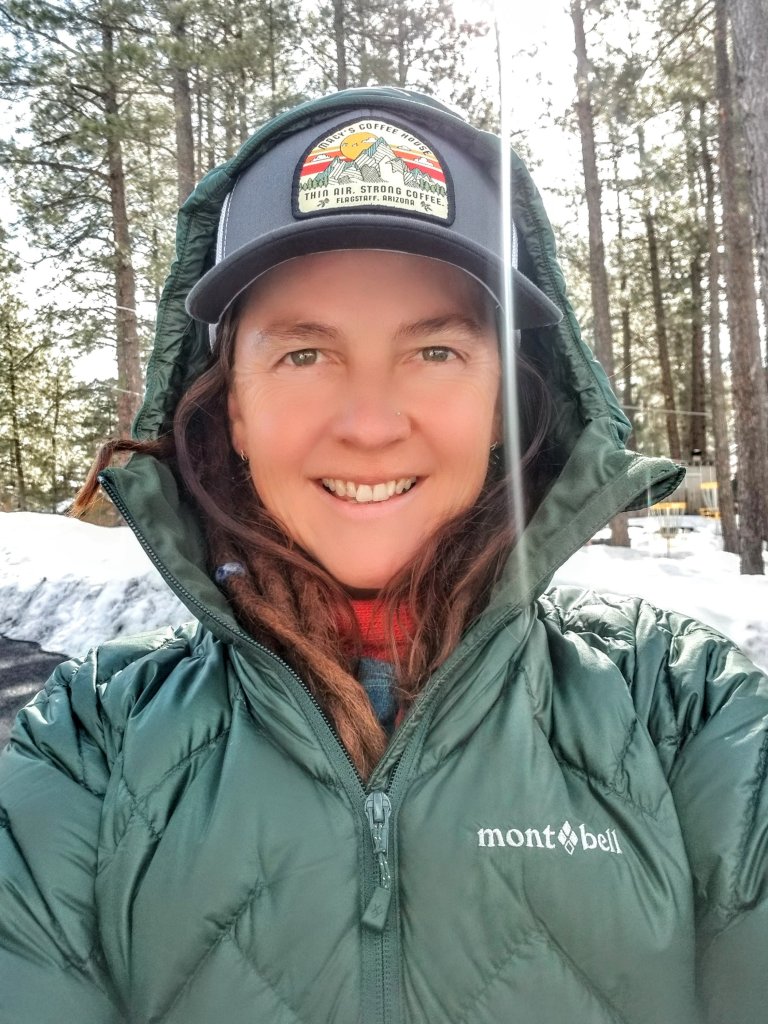
Oh, by the way, I finally got a new puffy and a new hat. I’m going to try wearing a hat.
I leave my home at 9:30am to make my way down to Safford, AZ. Along the way I stop at Roosevelt Lake Marina to drop off a hiker box for a friend who is coming in from Canada in a few days to hike the AZT. I will be meeting up with them in a couple more weeks. This is a busy Spring of hiking for me and my friends. It is the most social hiking season I have ever had actually. Rockin is texting me she got stuck in massive traffic in Phoenix and she is set back but now actually we should arrive in Safford at the same time.
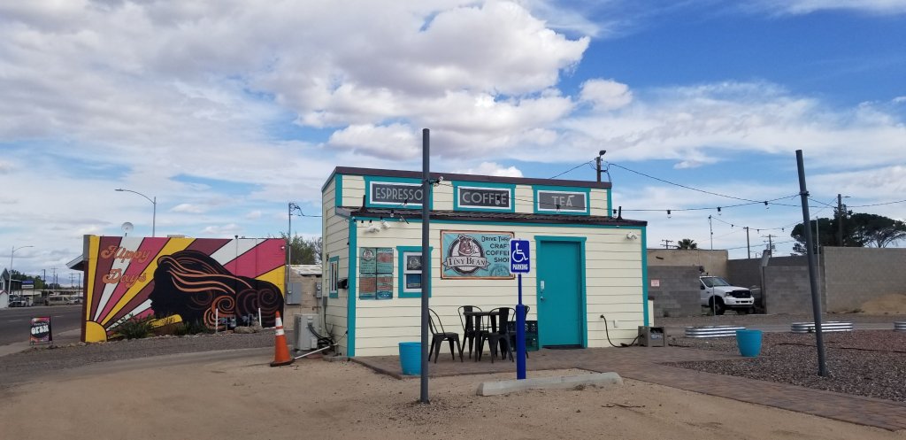
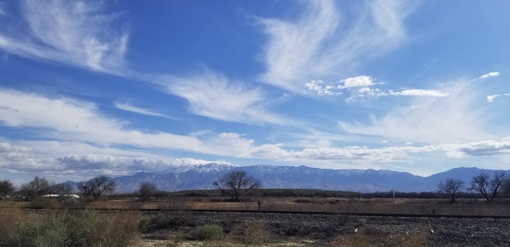
She directs me to a place called Tiny Bean in Safford and when we get there it is just a drive thru coffee hut. No seats or table, no Wifi. We sort of needed the Wifi. And, as we are driving in, we both could not help but notice the heaps of snow on the surrounding mountains. The exact mountains we are about to go hike into, the Pinalano’s which are home to Mount Graham at 10,724 ft. From down here it looks impassable.
We immediately start to think up plans B and C, which does include heading to New Mexico to section hike the CDT. However, we decide to take a drive up to the Ladybug Peak Trailhead to see for ourselves. Along the way we start seeing snow at the 7,000ft level and it gets deeper and deeper. The road is amazing, reminding me of several of the roads up to TH’s in the Sierras.
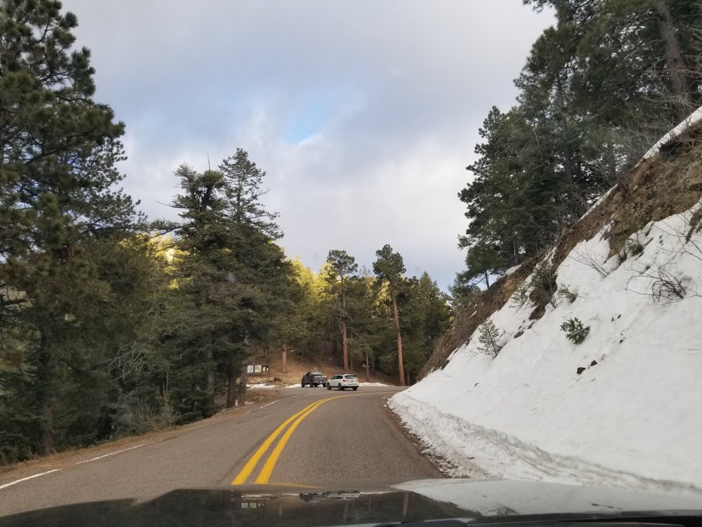
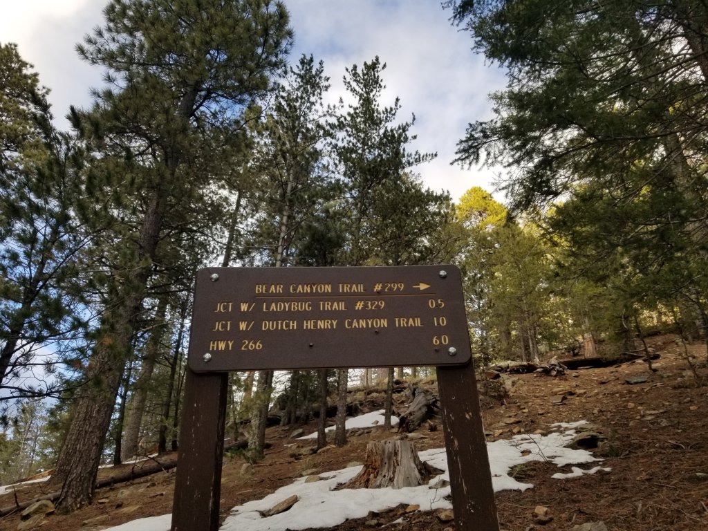
To our great surprise and joy, we find our trail is made of dirt! It seems that the aspect of these mountains does make a difference in how much snow there is. We glance over the South side and see it’s pretty clear of snow, so we decide are good to go on our start up to Ladybug Peak. But first we have to shuttle our cars, so we decide to drive down to Portal, AZ to a campground down there. It is going to take close to three hours. Long Day.
The Google maps directs us to I-10 and eventually to another surface road that leads West towards Portal. Suddenly it turns into a dirt road and it is dark, dark, dark out here. I have to shine my brights and there are signs that say things like “watch for animals” and “do not enter when flooded” and it reminds me of that scene from Pee Wee’s Big Adventure if y’all remember that one. Pretty funny. We have to drive through two creek like washes with water flowing. I stop to check the first one as who knows what it may hold?
When we reach the Campground it is after 8:00pm and first we pull into a campground where people are having a disco party. Not kidding. We sit there aghast and take a couple photos. This is not normal. Or so we think!
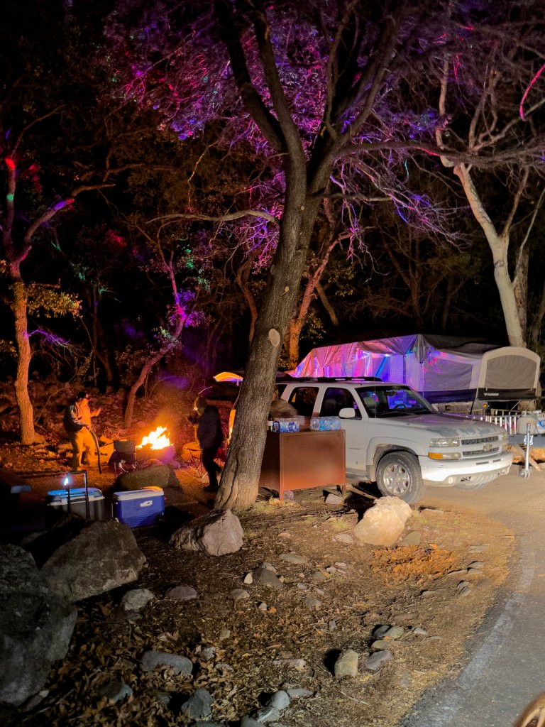
Eventually we find a different, quieter spot in the other, non RV Campground, Sunny Flat. There is a good creek flowing and the stars are amazing. We park our cars level as we are both planning to sleep in our cars, then settle in. I really need to eat. I fix a hot meal of Indian Lentils and Rice and it is so delicious. I eat while listening to that large rushing creek, kicking back in my vehicular abode. I love my little home on wheels, it’s like a travelling bedroom.
After dinner, I make tea and we both get settled into bed after discussing logistics for tomorrow. The stars are absolutely stunning out here as there isn’t any light pollution. We’re in the middle of nowhereville. Seriously, amazing. We are planning to hit the road at 6:30am tomorrow. We have to cache our food and water at HWY 191 and then drive up to the TH for Ladybug. We aim to start hiking by noon at the latest, but hopefully earlier. It’s good to be here, I am excited about stepping into the unkown and stoked to be sharing it with Rockin’ It’s going to be No Small Adventure.

We like the area in Rodeo, NM, near Shaw Peak. We often stay at Rusty’s RV Ranch in Rodeo. Beautiful place.
Yes, Cave Creek blew me away! I had no idea, this was my first time even crossing into NM and we didn’t wind up going to Rodeo, but if I do return I will look up Rusty’s!