
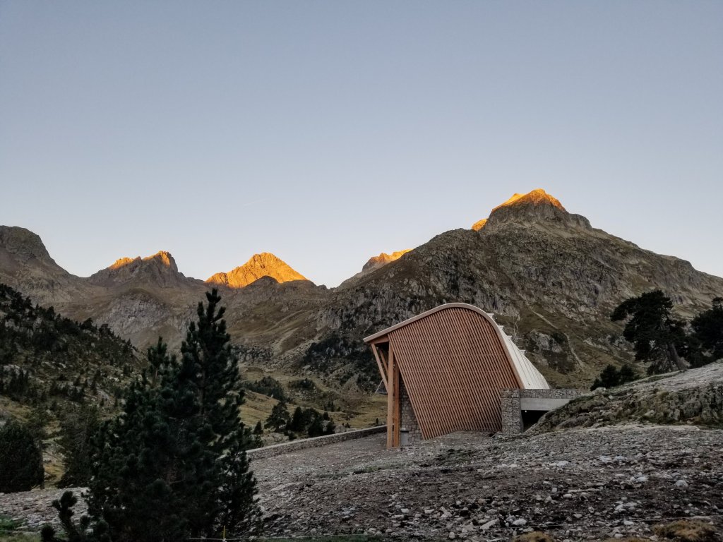
Refuge Wallon to Grottes de Bellevue
12 miles +4,300 ft / -3,200 ft
Sept. 17th, 2022
At 7:00am it is barely light out. I can feel a nip in the air around me and there’s a ton of condesnsation. When I get out of my tent to pee I am so pleased to see clear skies! I check my thermometer, it’s 35F, the coldest morning I’ve experienced yet and I am only at 6,000ft elevation here. Fall is surely on it’s way.
In my mind I had been stewing over trying to get to Gavarnie today and pull a 19 mile day since the terrain and navigation should be pretty straight forward. Sitting here now in this cold, sipping on my coffee and looking over my maps I can’t seem to get motivated for such a big day. And, if the terrain today is anywhere near as beautiful as it was yesterday, I won’t want to rush it since yesterday I hardly saw any of it. I’m going to want to soak it all in today.
I pack up and get walking after a bowl of my own granola from home which tastes amazing compared to the breads I’ve been eating at the refuges. It’s 8:45am when I get on the trail and immediately I bump into the Brits. They greet me excitedly and it seems we’ve all had our coffee so it’s a high energy first quarter mile together. When I reach a signpost pointing me in the direction of Col du Mulets I part ways with the girls. Their trail to civilization goes down, my trail deeper into the mountains goes up.

I am beginning to really notice that I’m craving more of a wilderness experience than I’m getting here. I realize I am hiking in Basque Country so it is inhabited by humans and sheep, but I may not have realized there would be so much of the route that has this. In choosing the “Haute Route” I expected it to be more remote. Maybe I’ve not gotten to that part of it just yet. Having been forced into spending more time at refuges than I planned is another part of that feeling. But, that’s not to say I haven’t had amazing experiences in the refuges, so I would not change that. I am just glad I don’t have to do that every night, it would feel too civilized for my liking. That is the reason I am not hiking the GR20 in Corsica as there is no wild camping allowed on that trail.
The scenery and terrain yesterday made me feel a deep longing for the Sierra Nevadas, especially because I couldn’t see much of it and passed through it so quickly. It was this fleeting dipping of the toes into a world that I crave. I am missing California’s High Country and missing friends that I’ve met on trails out West and you know what else? I would kill for an American “town breakfast” right about now. I need some eggs, potatoes and avocado. I wonder if I can at least get an omelette in Gavarnie? The French tend to serve omelettes for lunch, so if I can time it right that would be fantastic. I would also love some vegetables. I’ve had none on this trip except for my own dinners I packed. Okay, enough of my litle rant, I just needed to get that out.
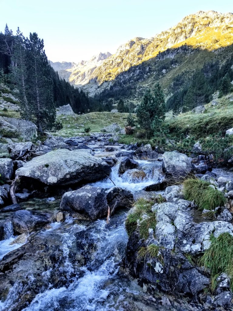
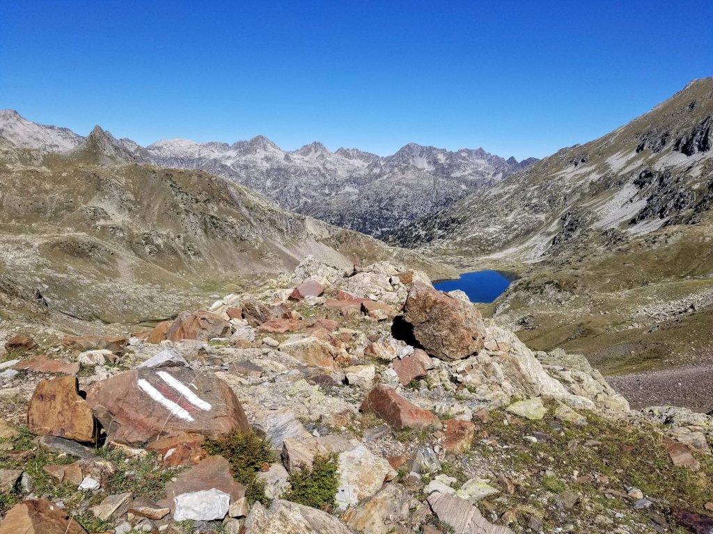
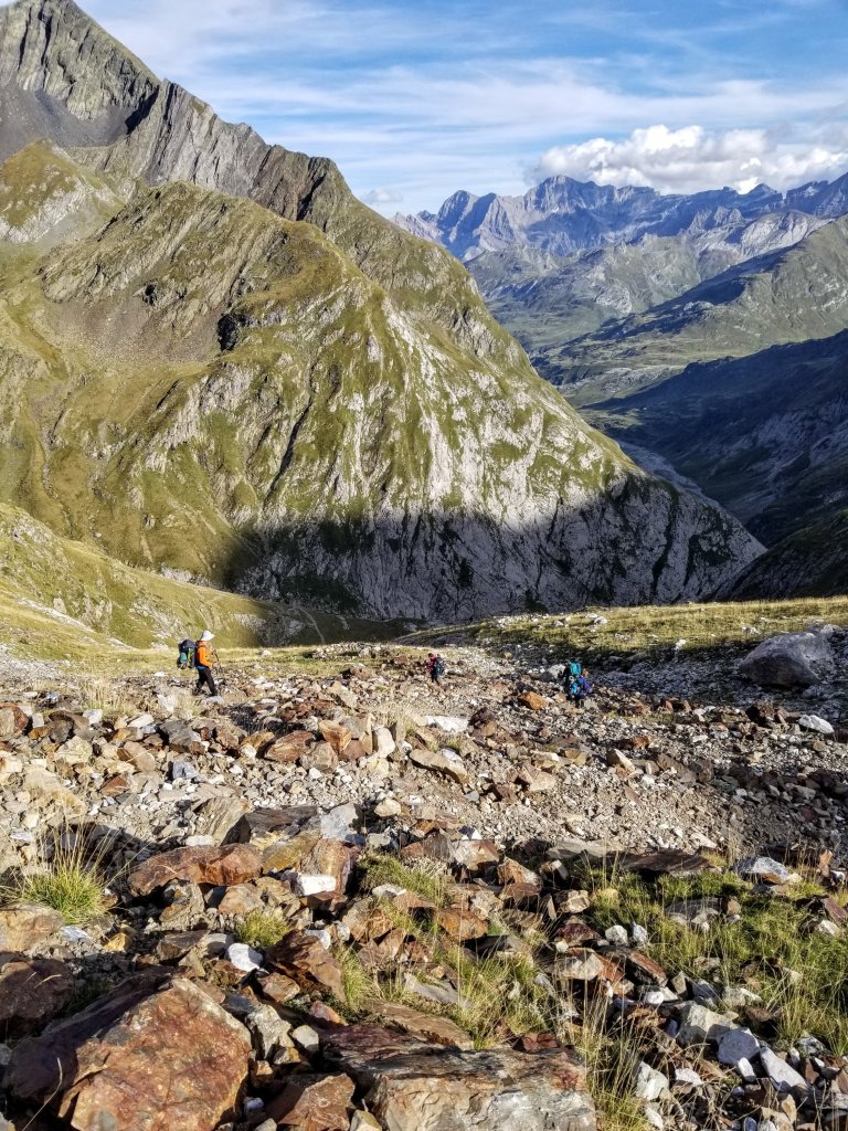
The morning starts out with climbing up along several brilliant waterfalls gushing down the main drainage of the Valley below Lac d’Arratille. The air temps along with the moisture make for a really cold morning. My toes are actually numb and I am wearing my gloves. I know once I get into a good climbing rhythm I will warm up so I settle into it and hope to reach a patch of sunlight soon. It’s a quiet morning and there are a few fresh footprints in the mud but I don’t see any other humans for the first hour and a half. Around 10:30am I crest a little ridge that hugs the outlet of the lake and find a perfect spot to plop down in the sun. I need to dry out my gear and warm up. From here I can actually see the entire route that I came down yesterday which is super cool as it’s a crystal clear day!
It’s time for second coffee and second breakfast too. And I actually feel hungry and am not nauseous this morning like I’ve often been. Maybe it’s the cold weather or maybe the fact that the trail does not have a bunch of stinky animal poop here. Either way, I am feeling pretty good this morning, especally now that I have some sun. While I sit sipping my coffee, several folks walk by in the opposite direction and I am surprised to see them, I wonder where they are coming from, where are they going? This area is quite beautiful so there is an aniticipation welling up inside me to see what’s ahead.
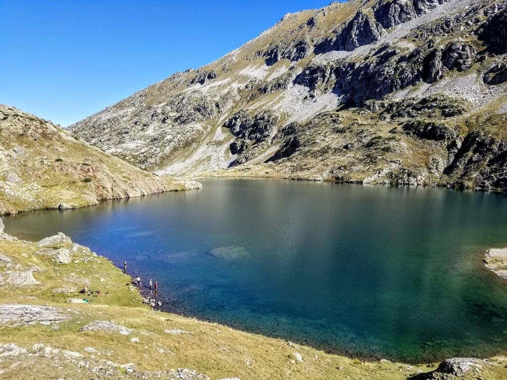
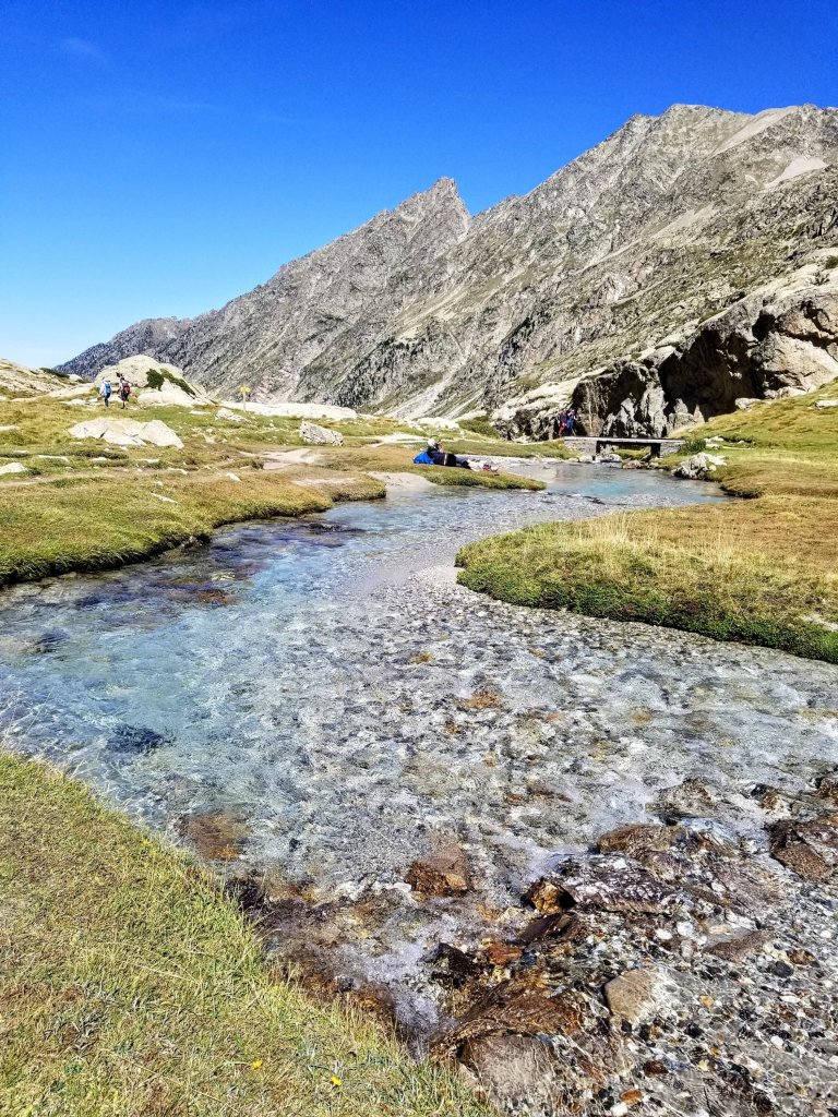
When I start walking again I note that I spent an entire hour there taking that break. Whoops! It was so lovely though and I got my tent all dry, and I am fed and caffeinated. All is right in the world. As the trail continues generally uphill I pass by the gorgeous Lac d’Aratille. It’s waters have that sunndy day shimmer on turquoise green goin’ on and if it were August I could most definitely see how going for a dip would be hard to resist. In fact, from up above as the trail leaves the lake I see three guys wading into the water, looking like they are about to dive in. Despite having sat in the sun for an hour, I still feel a chill in the air, so I’m not inspired to get into that water.
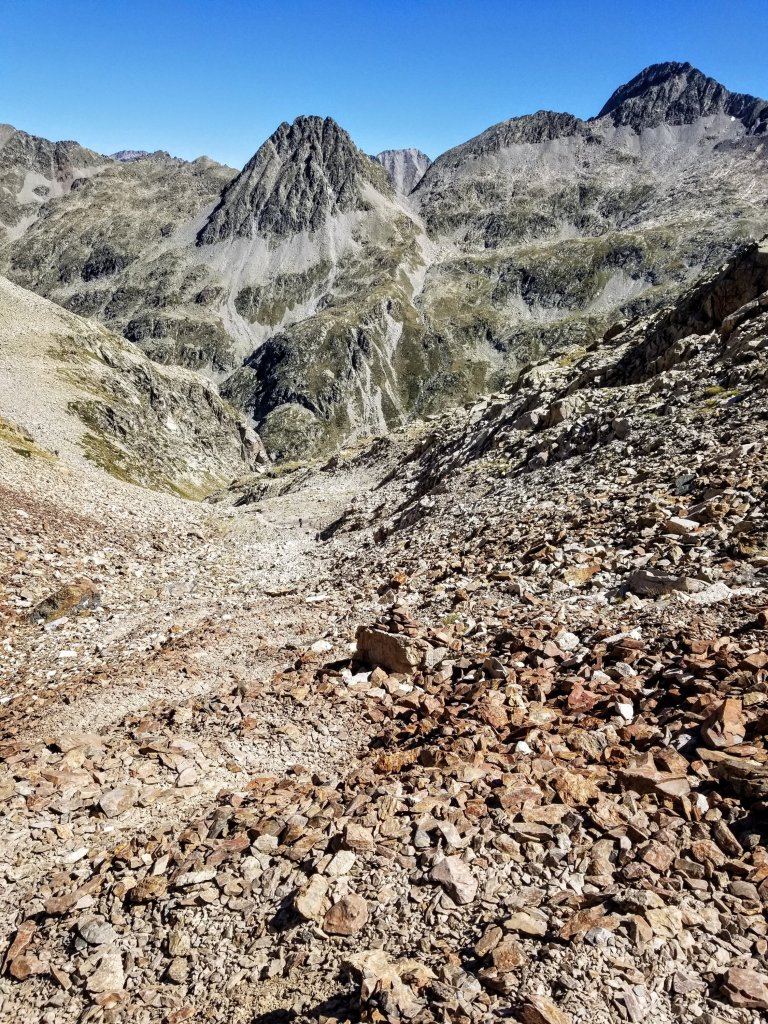
The climbing continues and soon I am headed to the Col d’Aratille which is on the French-Spanish border. The trail gets quite rocky and steep but I am feeling strong after that long break. A couple men come up behind me, they are runners and have the standard knee high compression socks and running vests. Again, I wonder where these people with day hiking gear come from? There has to be a nearby trailhead. Perhaps the one that the girls were headed to. I admit I am clueless as to the access points for all these places, the only overview map I’ve seen was back at Refuge Larribet and it was a bit overwhelming.
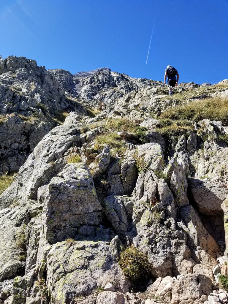
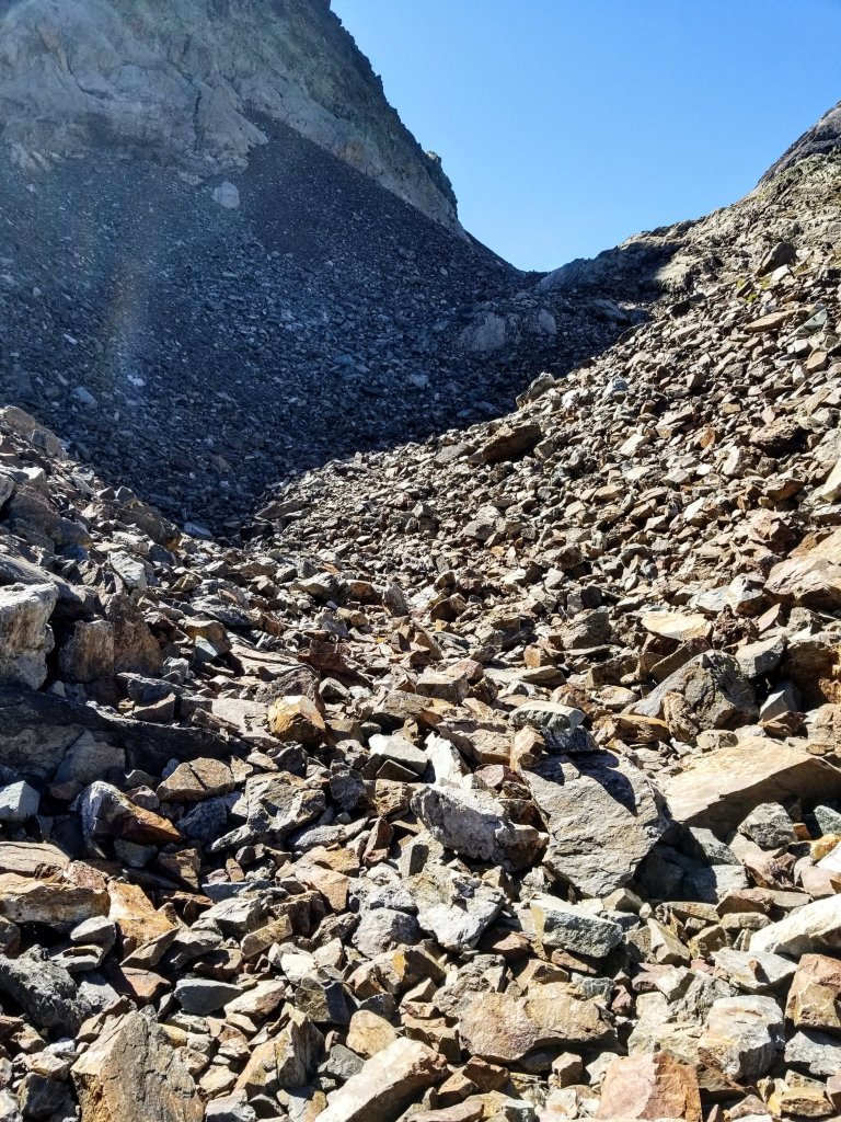
I play leap frog with the trail runners and decide to push myself to see if I can keep up with them. The terrain along the way gets quite rocky and a little scrambly for a minute so they are no longer running and I surpass them. Minutes later they cut up a use trail and I get bogged down in some talus and they surpass me. It was a fun little race! They disappear from my view as I push the final segment through the talus. Shortly the route levels out and finally reaches the Col after a flatter talus traverse where I cross paths with a few other folks moving in the opposite direction. I sure have seen a lot of people in the past hour, I’d say I’m up to eight now.
At the Col d’ Arratille 8,294ft (2528m) I enter into Spain and the wind picks up quite fiercely as it tends to do in Cols. I am very sweaty from pushing myself and get instantly chilled. I can tell this is going to be one of those days when you can’t decide if you are hot or cold. Usually it’s both, which means a lot of gear changing. I am wearing shorts still, but have compression socks on too as they keep my legs just a little warmer, and then my t-shirt and a long sleeve button up, a buff and sun visor. The long sleeve and buff comes off and gets put back on repeatedly, and the compression socks get pulled up and pushed back down repeatedly. I decide not to put on the wind shirt, as it looks like where I’m headed is in the direct sun. I’ll probably be sweating again soon. That all said, it is a truly gorgeous day with a nip in the air and a good ol’ bunch of sun and I’ll take it!
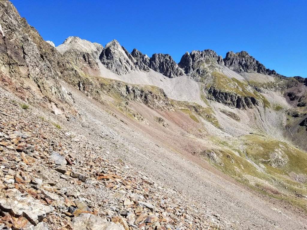
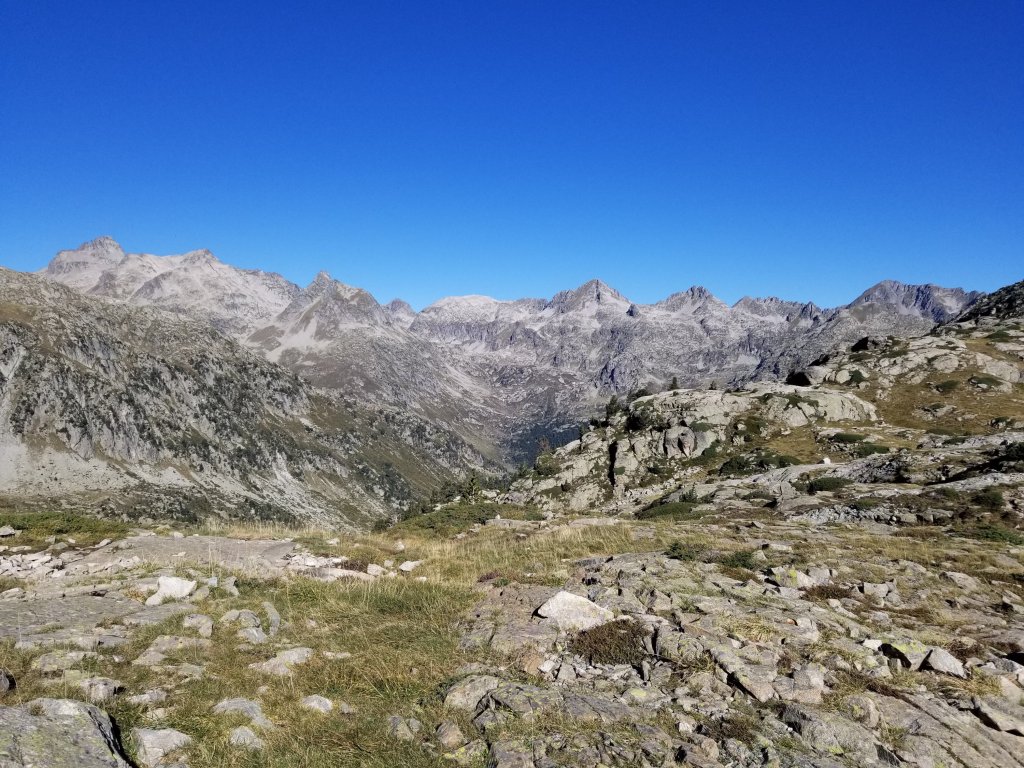
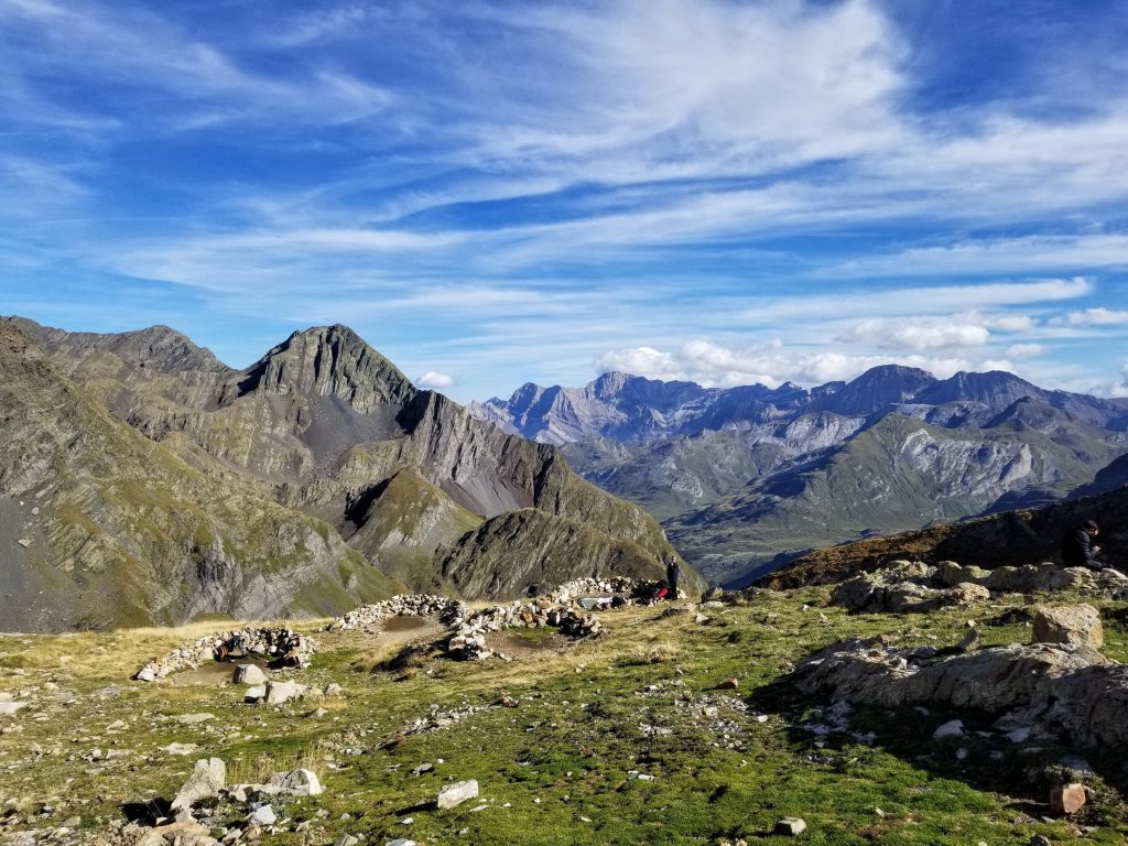
There is a really cool sweeping traverse from Col d’Aratille to Col du Mulets overlooking a massive valley called Valle de Ara in Spain. Looking down into that valley the terrain is completely different than where I just came from. It is steep but much less rocky, the low part of the valley almost looks smooth. The yellowing grasses are evidence of this valley getting a lot of sun and there are towering rock formations lining it’s edges. Aspects of it remind me of the Uinta Highline Trail in Utah.
After a short, exposed drop, the trail here stays high following a contour and eventually makes a steep pitch up to the Col de Mulets, which is again on the border, crossing back into France. In the section I’ve hiked thus far on the HRP I’ve mostly been in France with just a few dips into Spain such as this one. There has consistently been a visible difference in the landscape and it’s making more sense to my brain to see it again now, as the division line between the two countries is truly the ridgeline of the watershed. The divide.
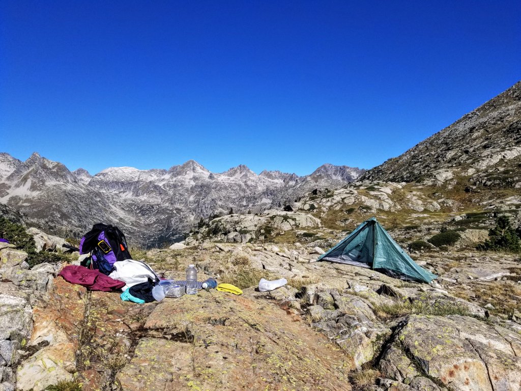
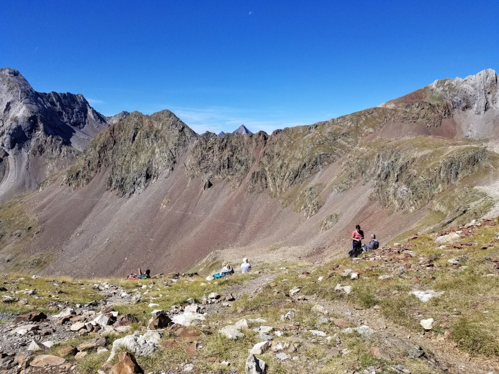
When I reach the Col du Mulets at 8,501ft (2591m) it is clearly lunchtime. There are about 10 people spread across the slope on the Spanish side of the Col, sitting in the long grass, soaking up the sun and eating. It’s 1:20pm when I arrive so it’s a perfect time for my lunch as well and I am hungry. I find a good spot to plunk down, remove my shoes and the usual bit. I don’t get out my air mattress today though, just my little sit pad.
Since I will re-supply in Gavarnie tomorrow, my lunch today is mostly a little of this and that. I have just a two inch piece of salami left and a small bit of bread that I took from Refuge Larribet which was from two days ago, so it’s all crumbled. I also saved a half piece of bread from last night, so all together I have some bread and and salami and a few spoonfuls of chips. I finish it all and then eat half a brownie that I also saved from last night’s dinner. I feel quite satisfied.
I do a lot of people watching as I eat my lunch. Everyone seems to be taking in the scenery and enjoying the quiet downtime. From what I can ascertain, I am guessing they did a huge climb to get here, so they are tired. They look like a group, with a younger guy as maybe their guide, some of the folks are of retirement age. One woman is laying down. Others just staring off in the distance. Nobody is talking much but I think they are passing around a bar of chocolate. There is a young couple down below me, they are very sweet with each other, and another two people who arrive at the Col huffing and slowly staggering to the top and then they disappear on the other side. By 2:00pm I am feeling ready to get going. The big group is still there resting, the couple has left. I wonder where everyone came from and what country they live in and where they are going?
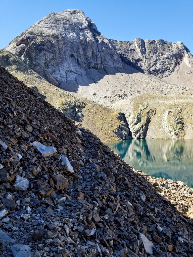
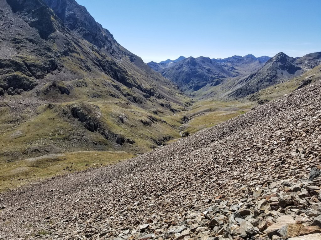
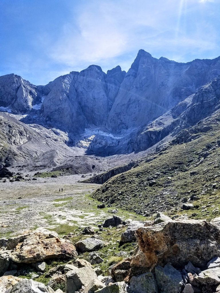
On the East side of the Col de Mulets the trail plunges about 1,500 ft down through a rocky precipitous landscape to reach the Vallee de Gaube, a flat river bottom dominated by a famous rock face, the Vignemale. Now I know what those folks at the pass just climbed up, they worked for it, good on them! Despite it’s steep, rocky nature, the path is clear to navigate and I get into a good flow on the descent, taking about an hour to get to the valley were I’m met with some truly impressive views.
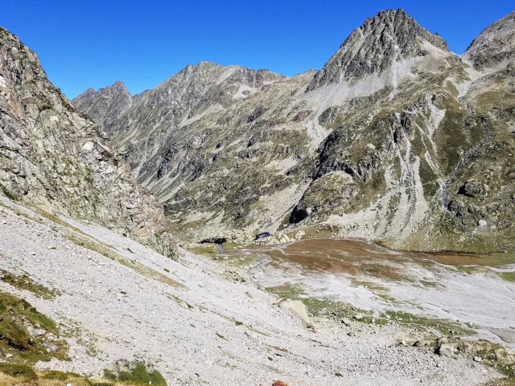
I had no idea what was here nor did I have any expectations so this certainly makes my jaw drop for a minute. The topographic relief certainly has a Yosemite-like impressiveness. I had read about the Vignemale and about the Refuge des Oulettes de Gaube in my guidebook but now that I’m here, wow! The Refuge is poised on the edge of the valley with fine views of the North face of the Vignemale and it’s glacier. There are other trails that climb from far below to get to the refuge as well but I’m not sure how far or from where since I lack that overview map. It is quite a sight and seems like you people do hike up here in a day, so it’s no wonder when I get here it is packed with people.
My guidebook says you can bivouac here with “a view that has no equal in the Pyrenees”. I could see all the bivouac circles outlined with rocks from above. Now, as I walk among them across the valley floor I see people lounging about, claiming their spots for the night. It has a very relaxed atmosphere. I’m not planning to camp here so I continue walking along the perimeter of the valley. It is quite expansive and reminds me a little bit of walking in places in Death Valley just because of the completely flat, wide terrain with a stream coursing down the middle and the towering rocks surrounding me. The scale is not as wide as Death Valley yet there is a sense of spaciousness here I haven’t felt on other parts of the HRP and I’m loving it. I am particularly enjoying walking along the water as it’s so clear it dazzles me. How can there be such beauty in this world?
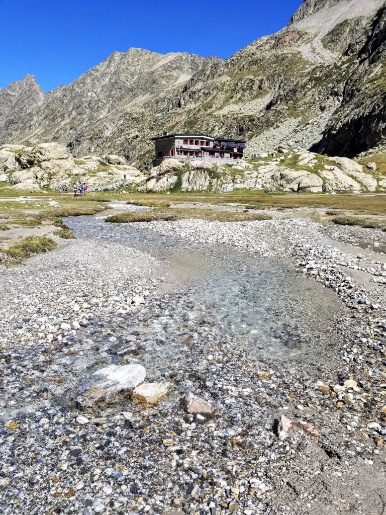
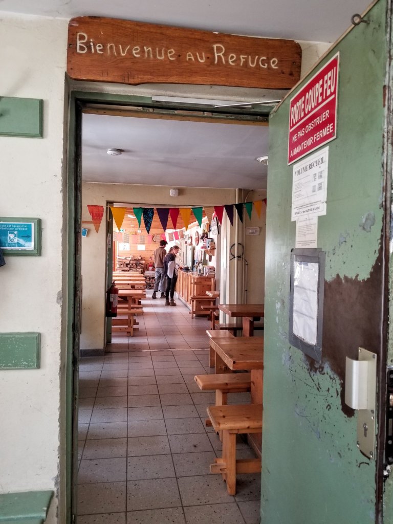
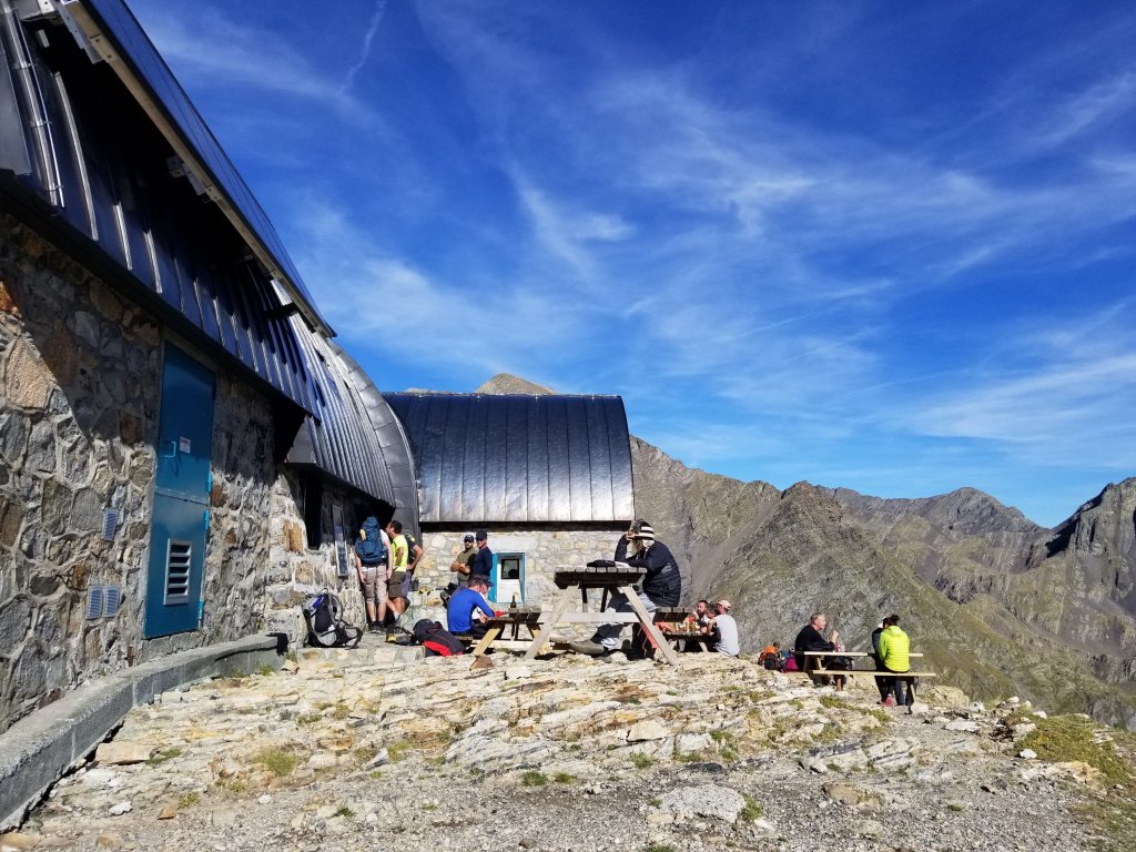
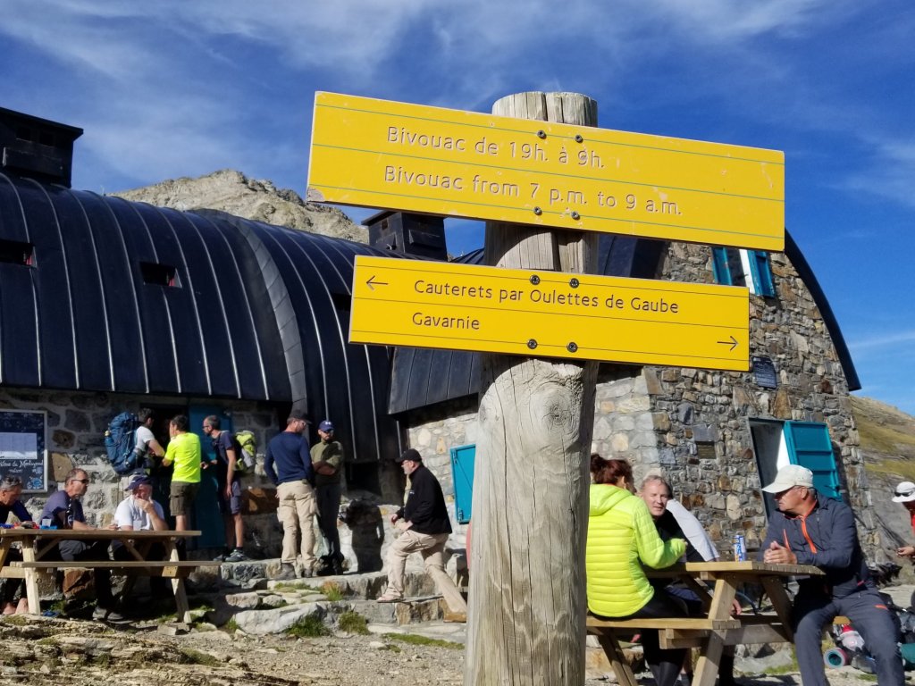
The HRP leads one directly to the Refuge and from there links up with the GR10 all the way to Gavarnie. When I reach the Refuge I navigate through all the people milling about, then plunk my pack down next to an open spot at a picnic table. I don’t need anything to eat or drink, but curiousity draws me inside to have a peek around.
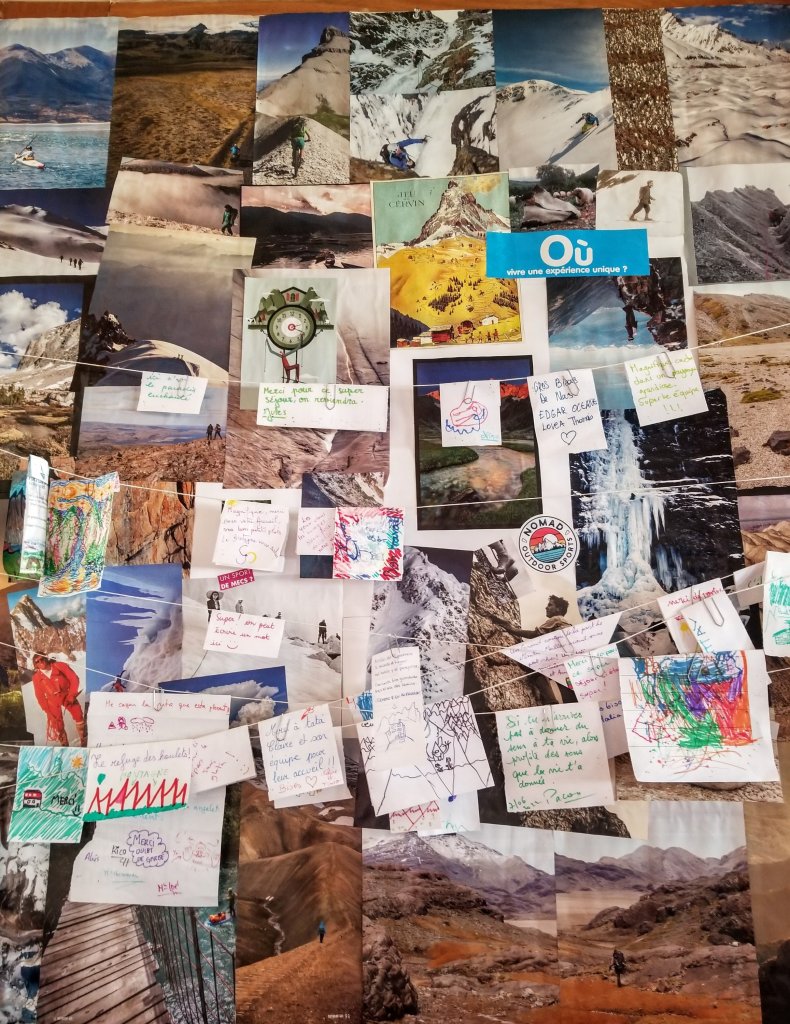
It’s a really cool little place with a lot of character and charm and it clearly sees a lot of visitors so there is a vibrant energy throughout. If I were in no hurry to make progress, or were refuge hopping, I would stay and hang out and enjoy the vibe here, maybe grab a beer! But alas, not what I came here for. People here are sitting on the balcony in the sun imbibing, eating and chatting as they soak in the view. I find a guest book and enjoy flipping through the pages, looking at people’s hand written messages and doodlings. Because I forgot to sign the one at Refuge Pombie, I decide to sign the one here, I need to leave some evidence that I was here right?
After spending about a half hour checking out the refuge I am ready to hike on. Of course the afternoon hike has a 2,000 ft climb up to another Col called the Horquette d’Ossoue. This will be the third Col of the day. When I stood at Col de Mulets a couple hours ago, I could see all the way across the valley to a bunch of zig-zags going up the mountain on the other side. At first I thought Oh wow, there’s a trail over there, then I realized that was probably where I’m headed. And yep, I am. It’s one of those drop 1,500 ft and immediately climb 2,000 ft kind of afternoons, but I’m down. Or I’m down and then up. Ha!

Thus, I dial in my climbing mindset and set off with focus and determination. Once I am in a good groove I am sweaty and back down to just a t-shirt and shorts. I feel good climbing and there is a lot of fresh water along the way so I stop to dip my BeFree into the trickles of clear, cold liquid and guzzle as often as I can. I feel energized by the cold water, my legs feel strong and I’m loving where I am and how I feel. It takes me around an hour and a half to make the climb and on the way up everyone I cross paths with is going downhill. I see around 15 people, wondering again where they are coming from and where they are headed? Many of them don’t have big backpacks so perhaps they are staying at the Refuge. Some are clearly climbers, coming down with all their gear, so likely a climb of the Vignemale. Impressive!

When I reach the Horquette d’ Ossoue at 8,970 ft (2734m) there is a guy sitting there next to three backpacks and seems like he is sulking which seems odd to me. I say bonjour but he just sort of grumbles, not really engaging at all. I feel awkward just standing there so I take out a snack and gaze at the amazing views for a minute, meanwhile keeping an eye on him.
I wonder what is going on? Is he okay? He seems like he is not injured, just maybe not feeling well? He must be wating for some friends. As I begin the descent, it occurs to me, the guidebook describes an ascent of the Petit Vignemale from the Horquette. I totally forgot about that. It was something I originally considered attempting, but this late in the day and with being behind on my schedule, I had erased it from my mind. I bet that’s why he’s here, maybe he just didn’t make it. Maybe the altitude got to him. I hope his day gets better, he looks super bummed and what a place to be in and not feel well!
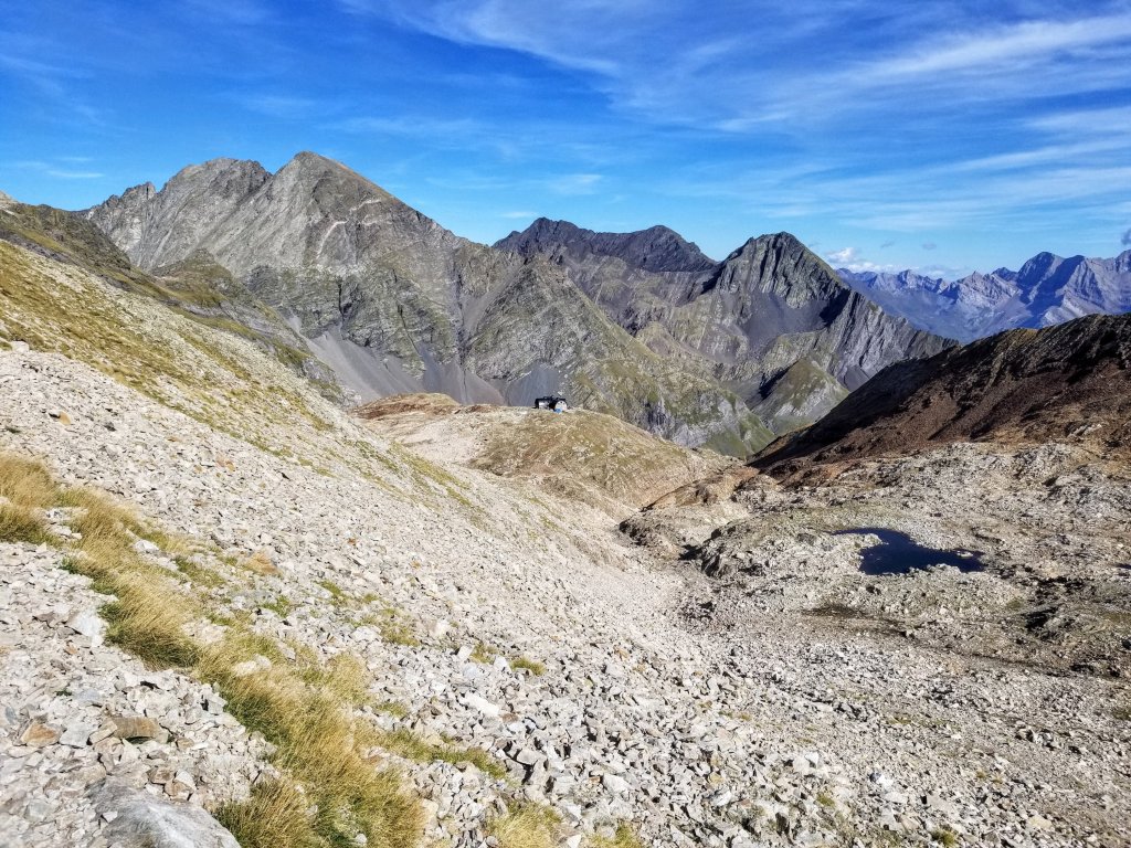
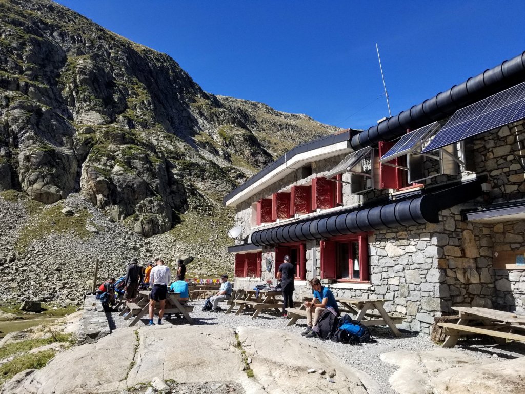
In less than 30 minutes I have descended to the next refuge, Bayssellance, the highest altitude refuge in all the Pyrenees sitting at 8,697ft (2651m). It is a super cool looking place, particularly due to where it is situted. The views are stunning in every direction and the deep valley below is dizzying. That valley also happens to be where I am headed. It’s a long-ass way down. From here to Gavarnie is only 10.8 miles but you drop almost 6,000 ft. Good times. It’s comparable to coming down from Mt. Whitney.
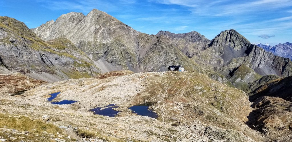
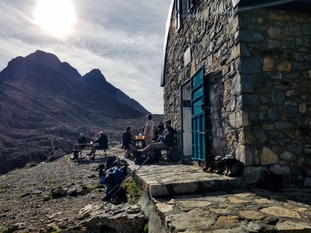
Everyone here is hanging around outside on picnic tables or setting up camp in the bivouac sites. I don’t bother going inside this refuge as it’s a lot smaller than the last one. I walk down to the bivouac sites and briefly contemplate staying here for the night. I think the views here are even better than in the Valle de Gaube. It’s only 5:30pm though and I want to walk more, this is my favorite time of day for being on the trail. And besides, I would have nothing much to do between now and setting up my tent at 7:00pm which is the rule posted here and I’m not feelilng super social.
There are about 30 people here too and while I am sure they are all cool folks and it seems pretty chill right now, I can tell it’s not going to be a quiet night here. I am craving a private, quiet bivouac site tonight, not a party. My guidebook describes a bivouac site that is about two hours down the trail. I decide to aim for that and if I happen to see anything sooner, I will jump on that opportunity.
Happy with my decision to keep going, I plunge into the abyss. After walking for about 30 minutes I see an amazing bivouac site with a few rocks built up to block the wind from up above. It still feels too early to stop but I decide to check it out. This could be a bird in the hand. Now following a faint use trail, I’m lead through billowing grasses, crossing two little rocky streams along the way. The site itself is perched on a flat in the fold of two hillsides with three separate cascades shooshing down with the flow of gravity. I can’t pass this up, this is too cool. Apparently I have manifested my quiet site for the night and these cascades lend that perfect white noise and a fresh water source to boot. I think I’ve found the sweetest spot!

This may sound silly but I am excited to eat my macaroni noodles tonight. I decide to fix an early dinner and get to bed early so I can start early tomorrow since I am hiking into Gavarnie. We’ll see how that goes but I am still hoping to make it to town early enough to get an omelette at a restaurant. At least that’s what I’m hoping for. So I open the package of macaroni and realize its not mac & cheese, it’s mac & butter, and it’s not really even buttery at all, it is super bland, that’s so ironic.
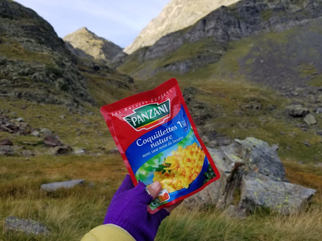
I add a little water to heat it up, and a half a boullion cube that Sara also gave me, then add pepper and believe it or not, I actually mix in some of that mayo stuff to add some fat and flavor and it’s not terrible but what I was really craving was my Annie’s Mac & Cheese from home. Oh well. I think eating here in this amazing spot helps it taste better though. Imagine how disappointing it would’ve been last night in my tent in the cold, dark, mist and fog. I would have been sitting there in the dark staring at my tent walls as I ate. Tonight I get to sit gazing at these amazing views, enjoying the peace and solitude of my surroundings, which more than makes up for the lack in my food.
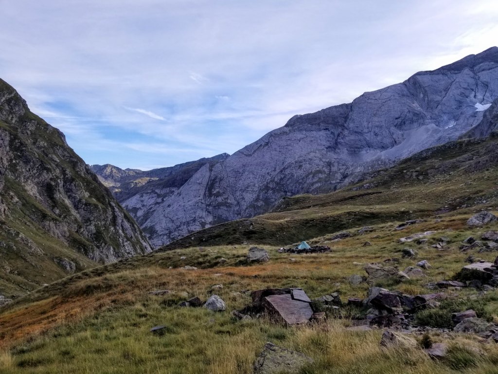
You know, all in all it was a good day. I know I was saying earlier how I miss the Sierras and how it’s so civilized here by comparisson, but I am so thankful for the sunny skies I got today, the challenging terrain with all the climbs and the dramatic beauty I got to see and walk through. It was definitely a day of joy and this magical spot I get to call home for the night punctuates it perfectly.
It’s now only 7:30pm and I’m tucked away in my tent. Since I have extra time on my hands, I spend a bit reading over my guidebook for the upcoming sections. I have so many thoughts about Gavarnie and what I need and want to do there. There are yet again, a lot of logistics to consider in the coming week’s walk. I had originally hoped to climb the highest peak in the Cirque de Gavarnie, Le Taillon, yet doing that would require an extra day which I now feel I don’t have in the budget. Then, there’s route choices for the HRP after Gavarnie and considerations of where I will finish and how to get back to civilization.
Two of the days in the next section of the HRP are grade “E” which I’ve discovered is akin to say class 3 in the YDS. So it means navigation with map & compass, a lot of scrambling on talus and boulders and you must have good weather and good visibility. With what I experienced earlier this week, I know why they say that now. If any storm system is forecasted, the guidebook recommends taking the Variant, which is the GR11 through Spain. It’s a lower elevation route on a straight forward trail. It’s not my first choice, but I may be at the mercy of the weather Gods.

Very informative narrative and images.
Annies Mac…Enjoy.
Thanks William! Gotta love that Annie’s Mac, it’s a staple in my backpacking meals, I like to add dehydrated veggies such as brccoli or kale…good stuff!
Congratulations belated on PCT and LTH accomplishments, The images of the xmas lights adorning your backpack as you hiked through the final section of the trail very nice. And the Low to High with Mr. Hurl Goat excellent as well. Stay well safe…
https://www.amazon.com/s?k=annie%27s+mac+and+cheese+pack&gclid=CjwKCAiAvK2bBhB8EiwAZUbP1PzuU2xhk2WEXxrrpsiuVN1wdF7UWhK236p3mSyh9Gira5gDDzD6RRoCD9UQAvD_BwE&hvadid=550100604859&hvdev=c&hvlocphy=9032080&hvnetw=g&hvqmt=b&hvrand=14264198765652122414&hvtargid=kwd-1433362950947&hydadcr=4853_9629488&tag=googhydr-20&ref=pd_sl_6kcnvuo326_b
Thank you for sharing so many details and photos. It gives me a full appreciation for the experience.
Hey jan! Well thanks for reading and I am so glad you enjoyed it! More to come, I’ve got a lot of writing to keep me busy for the upcoming Winter season 🙂 BE well!!
YAY for writing and reliving our adventures. Mine will be posting for a few more weeks as well.
May the weather gods be good to you! Be well and stay safe out there!
Thank you Sarah!
Hi M
These photos are stunning! So much so — along with your alluring prose — that I’m considering a few weeks to hop over from Northern California and take a stab at a part of this range. So, a question for you: how difficult would you say the route finding has been, say compared to Roper’s High Route? I recognize the G10 and G11 are easier to follow, but am curious about your take on the navigation. Really looking forward to the rest of your trip, and thanks for any comments you can share.
Hi Tom, well how cool! Okay, so the navigation is nothing as difficult as the SHR, at least in the sections I did. That said, there are several, and I do mean several, routes that could be considered the HRP. I discovered that different guidebooks have different routes. There is a section between Gavarnie and Andorra where you might have more route finding, high technical passes etc, but unfortunately I didn’t make it that far. When are you thinking of going? Feel free to pick my brain anytime, there are lots of logistics…also, I made all my own maps on Caltopo to familiarize myself with the route and then had that app on my phone to cross reference my guidebook and paper maps…a sokid trio!
Thanks so much for the feedback and the kind offer to help. It’s so reassuring to hear your comments about the nav vs. the SHR. I recently retired and have to arrange some things before starting the next part of my life, and I don’t know anything about what seasons to consider or anything, so not sure when I’ll be going, but your blog has made it clear that this is destination I would really love. Currently learning Norwegian (in anticipation of a dogsled/Aurora Borealis trip one day) but guess I’ll have to change over to French, eh? I’ll have to check out CalTopo and see what I can do with that. I guess Guthook doesn’t have an HRP module? LOL
It’s so kind of you to offer…if you are serious about being a resource, you have my email. I wouldn’t presume to do that on your blog, but you can message me if you are willing to make yourself available for questions…in between all your adventures, that is. 🙂
Hi Tom, always appreciate your reflections on the blogs, thank you! So if you can shoot me an email at this address: milissajayn@movingmountains.press that would be great and I am more than happy to chat with you about the HRP and planning or whatever other questions you may have! To answer your Q’s above: having some French and Spanish are indispensible for the HRP…and no Guthook for this trail…lol…but I downloaded a GPX track from the Doing Miles website for my traverse and found it worked really well. That is the track I used to overlay on CalTopo and did my planning with that and my guideboook: The Pyrenean High Route by Tom Martens (Cicerone)…your Norway trip sounds amazing by the way!
Hello milissa, big question. Did you get your French omelette? You never said. I bet the three words that came to mind were, Bishop, Jack’s and Schat’s. Seriously though I know how you feel. When I go to Idaho to see my cousin, its beautiful, but it makes me really miss my sierra! Ed aka ZR ( zero residual).
Hey there, ZR, I love that! Welp, yes, you nailed it. I usually hit up Schat’s first for a chocolate croissant and fresh squeezed OJ and then on to another place such as Jacks for that full on American omelette breakfast….well, sorry to keep you in suspense all this time….you will find your answer in my latest post, Day 8 🙂