
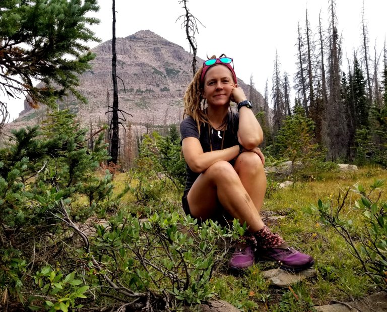
August 17, 2021
Miles hiked: 20.4
Passes: Dead Horse, Red Knob
Vertical: +4,225 ft
Campsite elevation: 10,900 ft
PM temp: 49F
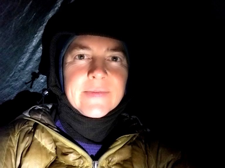
Today was one for the books. That is, especially because of how it ended up. I am sitting in my tarp tent in the pouringest rain, trying to check all my stuff to ensure it is staying dry. I had to backtrack about .5 miles from where I was at 7pm to find this spot protected by trees, as the storm was rollling in in earnest at that point. Prior to that it was off and on thunder, the bowling alley kind, and little spits of rain but nothing serious. Now, it feels serious.
Today, however, was also intense in it’s own way, but very lovely. I feel like there was so much that happened! It was one of those days where by the last few miles I was already feeling like so much had happened, and now the finale of crazy weather just provides the icing on the cake.
Why is it when you are out hiking it seems this way? Is it because the terrain is constantly changing and that affects your mood? Is it the changing weather? Not knowing what is around every next bend in the trail? It often feels like so much more happens in a day out on the trail than in regular life.
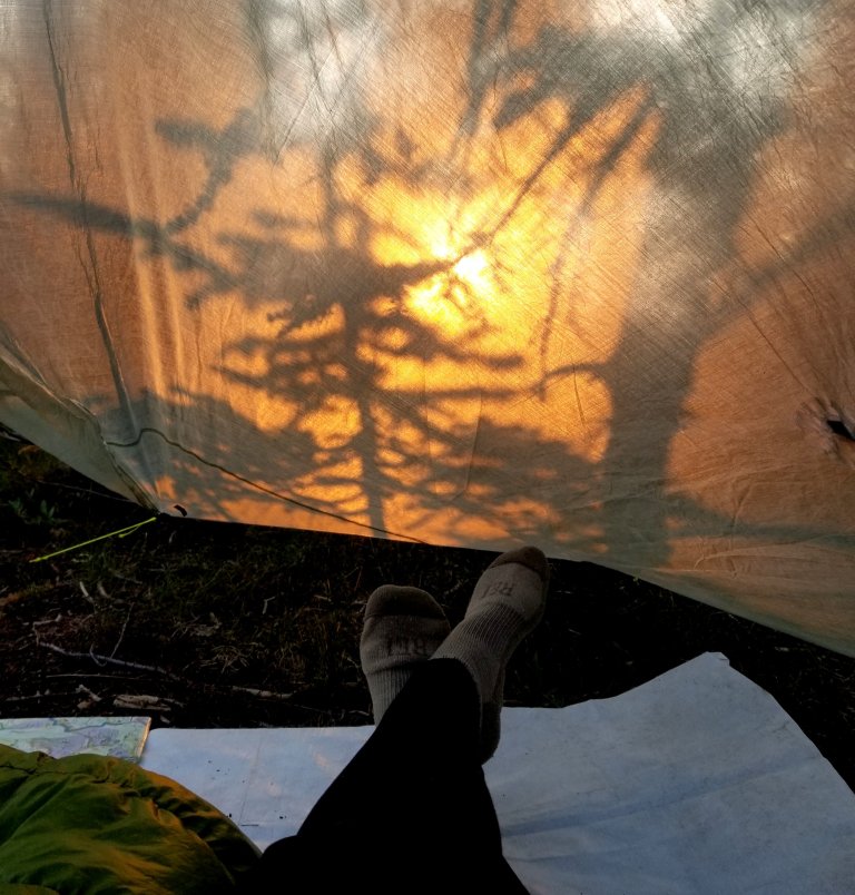
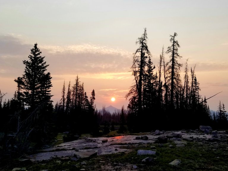
This morning I woke just as the glowing orange sun crested the horizon, it’s warm rays dimmed by lingering haze casting a glow through the trees through my tent. I started hiking an hour later than I had planned, no surprise there, as I just felt like I needed more sleep.
Still, I was on trail before 8am. I opted to try hiking the burn section that others had warned about avoiding. This is a part of the official Highline Trail, but I believe it was burned last year. I heard through the grapevine to take an alternate over by Lightening Lake that was a few miles longer. With my late start and my itinerary calling for 25 mpd, I opted to try the burn section and hoped it would get me through faster, being the shorter distance. Plus, I wanted to go see for myself how it was and I happen to have an odd affinity for burn areas, to me they have always had a beauty all their own.
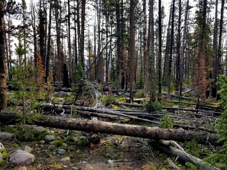
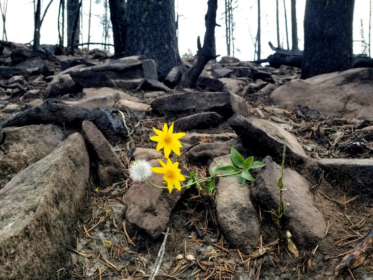
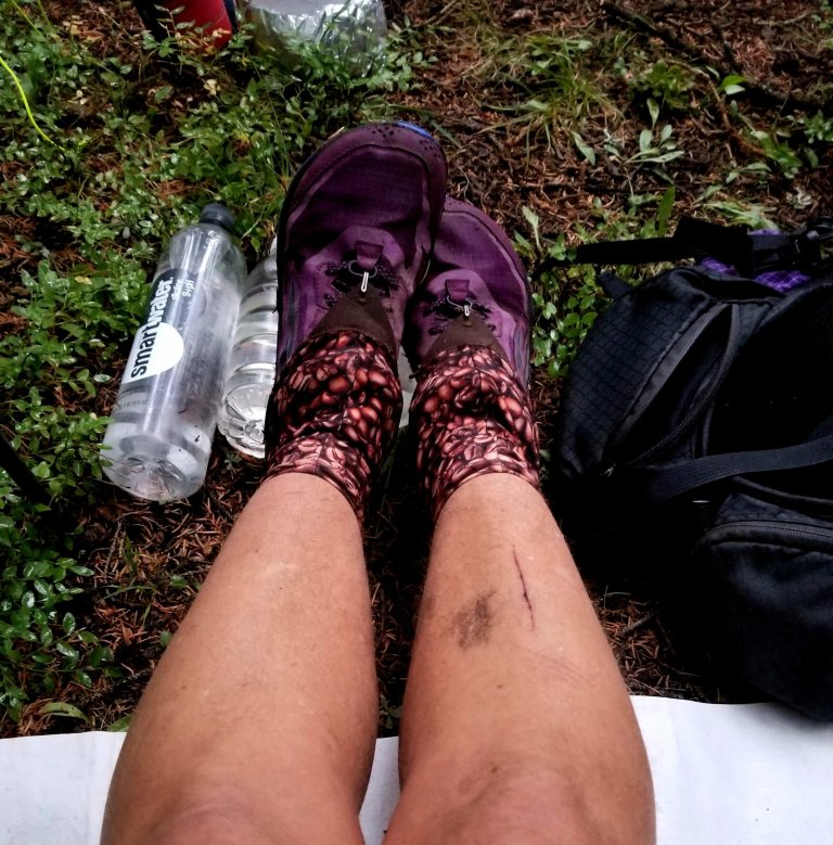
It was definitely a little bit rough in spots, but not as bad as others had projected. It really was fine to me, just a bit slow. It took me 2.5 hours to make about 3 miles. I would often loose the trail, but, I rather enjoyed picking my way around and looking for it, like I was on a scavenger hunt. It was fun crawling over blowdowns and getting soot all over my legs, and I did get a big gash somehow but don’t recall when or how. As I meandered through fresh burn scar, I found myself admiring the re-growth of the forest, especially all the little wildflowers that pop up in the ash.
I somehow passed where the alternate trail links back up, and eventually realized I was through the worst of it when the trail became more clear and vegetation re-appeared. It was 11am by then, so I re-grouped next to a lovely little stream and ate my breakfast of grain free granola, a high fat, high calorie delicious snack, mixed some electrolytes, then started making my way uphill toward Dead Horse Pass.
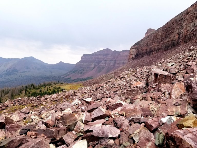
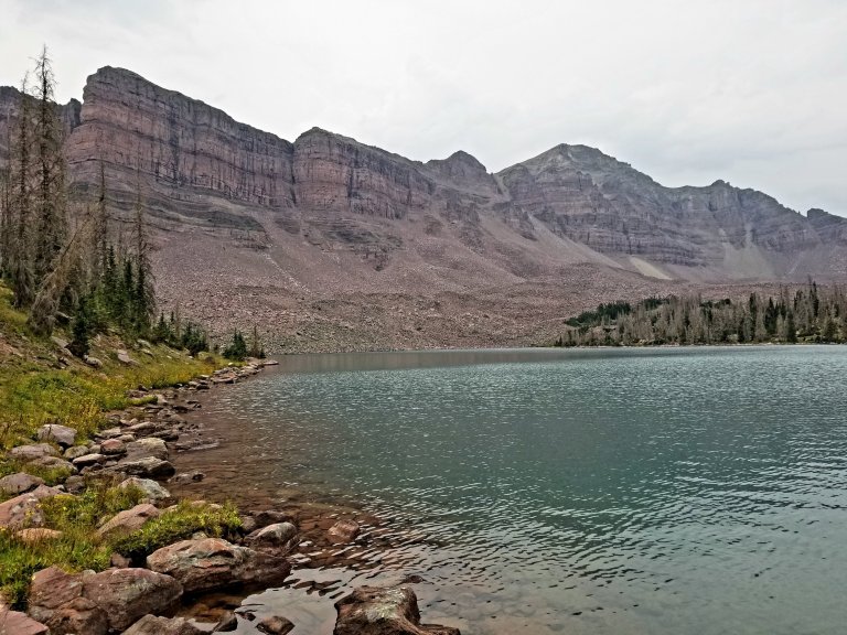
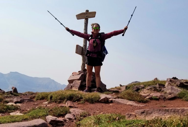
The walking was now much more pleasant through the trees with a clear trail to follow. I reached the top of Dead Horse Pass at 11,545 ft and the winds had really picked up, so I took in the expansive views of Dead Horse Lake which is at the bottom of a basin enclosed by the South arm/ridge of Mount Beulah.
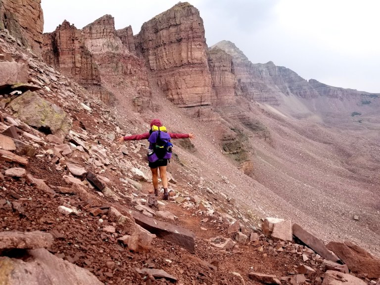
The range of these cliffs to the North are imposing and beautiful in an austere way. From Dead Horse Pass, the trail does a big switchback, before you begin to drop down quite steeply, hugging the walls of that basin. I dropped down and out of the whipping wind joyfully, taking in the sweeping vast views and energy of the enormous craggy cliffs.
On the way down it began to rain, enough so that I stopped to put on my rain jacket. It was short lived however and by the time I made it down to Dead Horse Lake, the sun was poking through the haze again and I greeted the green trees with a blissful heart.
It is difficult to discern the difference between haze and being overcast. All day today seemed to have a bit of both, but then patches of light blue sky would appear, as would hefty clusters of thicker, darker clouds.
The distance between Dead Horse Pass and Red Knob Pass is only about 3.5 miles. I figured I could potentially make it through Red Knob Pass before stopping for lunch, so I pressed through the little valley in good stride. The weather continued to toy with me, sending in rapid gusts of chilly wind, then spitting enough rain to warrant my rain jacket, then in minutes it would disappear as fast as it came in, never really amounting to anything.
This happend twice, and the second time it was at treeline just before the pass. I made mental notes of these patterns through the day, as this is my first time hiking the Uintas, thus I am not familiar with what the weather does. From what I researched, I learned that afternoon thunderstorms are pretty predictable. The clouds stack up, drop rain, then dissipate, so I expected to have a point in every day where I waited this out before a pass.
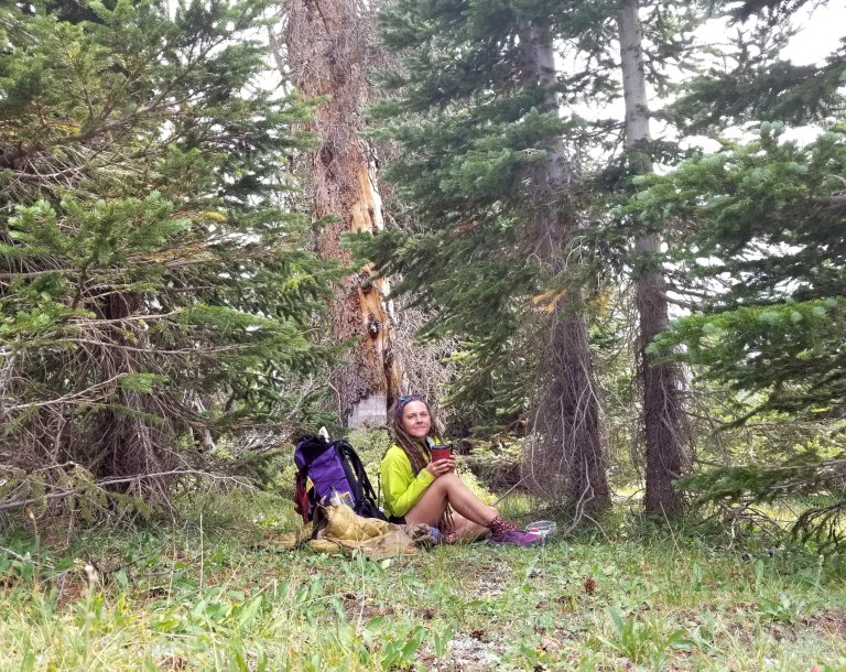
This is exactly what happened today. Just as I left treeline, the wind moved in, the temperature dropped and wow, the clouds were thick and hovering dark atop Red Knob Pass. It didn’t look like a good time to go up there, so I found a spot in a nest of trees to hunker down and wait it out, fixing myself an early lunch and a hot cup of earl gray tea, which really hit the spot!
Shortly, and as predicted, the storm passed, it did not drop a lot of precip, and soon the sun was out and the air was still. I gathered up my gear and started climbing above treeline again. There are some steep sections on this climb, and this was the first pass that I actually felt the need to stop every so often to let my heart rate come down. I didn’t need more than a minute break, and it felt good to be working hard.
I love climbing and getting into that rhythmic zone, breathing and stepping, pushing myself mentally and physically to reach the reward of a peak or a pass where the views pour out in front of you and you really feel a sense of accomplishment, you feel like you are a little dot on the top of the world.
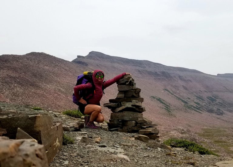
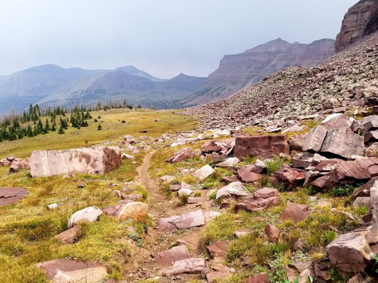
So that’s how this pass went, Red Knob Pass is the highest pass thus far, at 11,978 ft. Below me now was a sweeping valley, reminding me of the views from Forester Pass in the Sierra’s when you look down to Bighorn Plateau. I can see the trail cutting through the wide, long valley, and know I have to cross it over the next many miles. My goal for the day was to get to the base of Porcupine Pass, to set myself up for tomorrow, where I would climb three passes in a row (Porcupine, Tungsten, Anderson).
Down in the valley the trail is faint, I followed cairns throughout and eventually stumbled upon a flock of sheep. They were clustered right in my path and when they saw me, they’d run away, staying in a loose amorphous shape of the herd. I saw a white sheep dog and he came close to me but is not interested in me at all. I saw a blue tent in the distance, pitched smack in the middle of the giant valley. It is such an exposed place to camp, but I gather they know what they are doing.
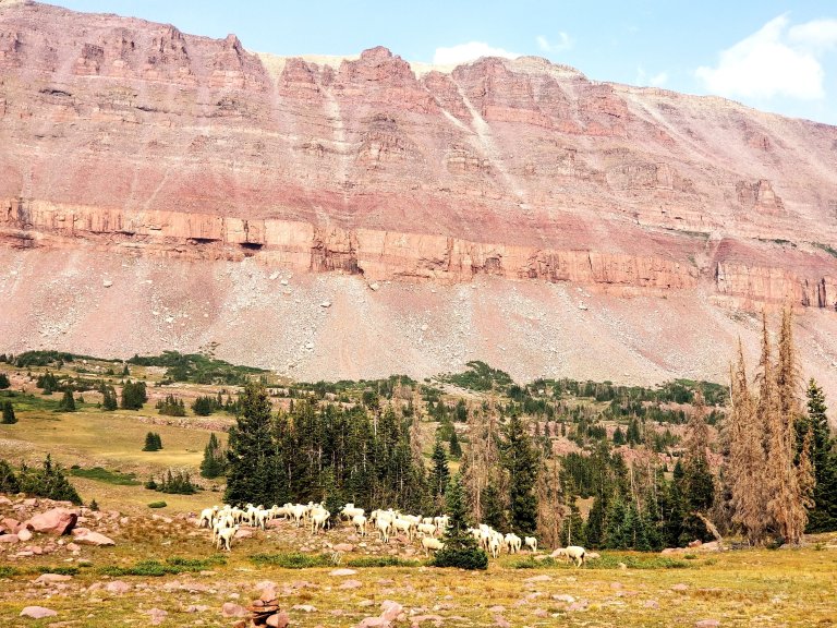
I took lots of phtos of the sheep and too many videos trying to capture their movements. In the photos, they come out like tiny little dots of white against the backdrop of two thousand foot walls of earth. To give you a persepctive, the valley follows along the base of Mount Lovenia, the floor at 11,500 ft and the ridges of which tower over 13,000 ft, the summit of which is at 13, 219 ft. It is some stunning and dramatic scenery here I tell you!
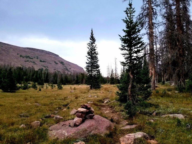
Onward ho! I get over the novelty of the sheep and quicken my pace. I realize I’d slowed down quite a bit, and I need to get some more miles under my belt. I dove deeper into the trees and then reached a lovely creek where I stop and fill up my water bottles for the night. Not too much, but just enough. Adding that 4lbs of water felt heavy and I soon had more climbing to do but I like to have my water on me toward the end of the day, as I feel it frees me us to stop and camp wherever I want.
Around 6pm I came to a trail junction where the Highline Trail meets the Lake Fork River Trail. I hung a left up the hillside toward Lambert Meadow. It does not look like much of a climb on the map, but maybe because it was getting later on in the day or maybe because I got all that water, I felt like my legs were working and I simply had to shorten my stride and slow it down a bit.
I had noticed at the trail junction there might have been good camping there, but I felt I could still hike 2 more miles given the daylight I still had, so I pressed on until I was nearly at treeline again in Lambert Meadow. When the trail leveled off and I was cruising through the high meadow, the clouds became dark once again. The winds picked up again as well. And, of course, that is when it began to rain again. I popped open my umbralla and continued onward, figuring as long as I was in the treeline, I could find some protected camping.
I checked my GPS, Iwas at mile 19.3 for the day, and it started to feel like this rain storm was not going anywhere anytime soon. I began to feel like there were fewer and fewer camping options too. Against my will to get more miles in, I decided to turn back to the lower elevation in the forest, where I had spotted a small area that looked flat and protected and was near a little stream. By the time I made it back there I had surpassed my 20 miles but in the opposite direction, ha!
I was lucky and got a brief enough break from the rain to pitch my tarp and get everything set up. By the time I was eating my dinner it began to dump rain quite heavily. I became very thankful that I did what I did. Up higher it would most definitely have been worse weather. I had been waiting to get a weather forecast from my InReach and it oddly took hours to get to me. I’d finally got a message with news that made my heart sink.
The weather forecast for tomorrow is 97% chance of rain, high of 47, low of 35, Thursday snow showers 90% and a high of 41, low of 31, Friday looks a little better with only 32% chance of T-storms, partly cloudy by Fri nite, low of 36. I mulled this over while I ate my dinner and found that my appetite had dinimished. I’d made a really delicious dinner of red lentil pasta with spaghetti sauce and eggplant, it turned out so great, but I think because I read that weather forecast I started to get nervous and just could not finish that dinner. Grrr…leftover pasta = more heavy weight to pack out!
I made hot tea and looked over my maps, calculating all my options, which were few. I double checked the corners of my tarp and the tyvek ground sheet, noticing how water was already pouring into my tent and pooling underneath my bed. I worked to de-puddle my tent and used up my small dry pack towels to soak up that water, now they are soaked and will stay that way. With them, I made a pile of my soaked stuff, including my hiking socks and bandanna.
I still had one dry pair of hiking socks and I my sleep socks on my feet, so I was still okay there. I had to pee before going to sleep, and there was no way I was going out in that rain, so I managed to pee into my cook pot, and filled it up all the way!
I tucked into bed, with my feet raised off the ground, trying not to let them touch the inside of my condensation ladden tarp. Laying down felt amazing and I really wanted to give in to sleep at this point. I had one last thought before I shifted my consciousness to dreamtime, was that given how the weather had changed, I was definitely not in favor of hiking deeper into a remote wilderness.
I fell asleep with the plan to backtrack toward my car starting as early the next morning as I could. It’s going to be a big day of 31 miles including that alternate around the burn scar area, including three high passes to get out. I figured I would try and get as far as I could, I still had plenty of food and fuel, if I could just stay dry enough to avoid hypothermia, I believed I could do it. At least, that was the plan for now. Good night.

One thought on “UHT Day 2: A Lot Happens on the Trail”