
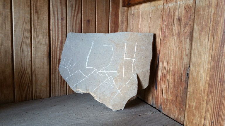
The L2H, or Lowest to Highest Route, traverses 135 miles from the lowest point in the Western Hemisphere (-282 ft below sea level) in Badwater Basin, Death Valley to the highest point in the continental US, Mt. Whitney (+14,505 ft). The route crosses Death Valley/Badwater Basin, the Panamint Mountains, the Panamint Valley Salt Playa, the Inyo Mountains, the Owens Valley, and finally ascends the Eastern Sierra Nevada, with a total elevation gain of approximately 31,000 ft. Most of the route is cross country, though there are many faint trails from both people and animals, cairns creatively placed, some dirt roads and a few miles of legit, lovely trail.
This adventure came into my brain several months ago when I started hearing about it from other long-distance hikers, who either knew of it, knew someone who had done it, or had actually done it themselves. I’d heard about the Ultra Marathon from Badwater to Whitney, had read about it, and never really conceived that I might do something similar. Hiking the L2H is definitely not the same as running from Badwater to Whitney, in July no less, but it does have it’s challenges, and that is what attracted me to it.
I did most of the research on this route online and would like to thank a few folks who already posted some very useful information on this route, without which I would never have attempted it. Carrot Quinn, whom I had the honor of hiking with in WA on the PCT last year for a couple weeks, told me all about her experience, and so I used her blog as an initial resource. You can check her blog out here. From there, I was connected to the Simblissity website, which is all L2H all day long. That website can be located here. There are a few good Youtube videos out there, the most helpful one was John Amorosano’s video that he made when doing a L2H thru with a group in 2015 (he does L2H guided hikes).
The route has a few alternates and options, and since it is a route and not a trail, no two hikes are exactly alike. We followed the main route up to Telescope Peak, then down into Tuber Canyon to the Spring (rather than the Wildrose alternate), crossed Panamint Valley and after Panamint Springs went up the alternate through Darwin Canyon to China Garden Spring. From there we followed the main route and eventually crossed through the Lee Flat Joshua Tree area and then took the alternate up to Cerro Gordo Ghost Town, then followed the ridge from there all the way to the Salt Tram, took the main route down Long John Canyon, across Owens Valley to Lone Pine. From there we took the Alabama hills alternate route, the Mt. Whitney National Recreation Trail and finally the Mountaineer’s Route (alternate) up Whitney.
As I did more research on this trek, unfamiliar words and places began to take form more clearly and started to roll off the tip of my tongue. Places like Panamint and Cerro Gordo and Darwin Canyon, Tuber Spring and Saline Valley Road. Until then, they had been new and strange words that represented new and strange places, places that I would soon visit, and get to know for myself, intimately. I loved this process and loved how the seeds of images of these places were being planted in my mind. Time to water the seeds…
Besides the allure of trying something totally new and different, the reasons I really felt drawn to hike the L2H are as follows:
- Learning how to better navigate cross country (using map & compass, & GPS) to find the route, to locate water sources, to locate our food, and resources
- Being OK with getting “lost” or off route and taking the time to figure it out
- Planning and calculating mileages between water sources, caching water in the desert ahead of time (and finding it!)
- Carrying LOTS of water through the desert and understanding how that works (what my carrying capacity would be, and what would actually be enough)
- Caching food in the desert (and finding it!)
- Going stove-less=eating all cold meals (to save weight so I could carry more water)
- Keeping my pack weight as light as possible without compromising safety (ended up with a base weight of 12 lbs, with no shared gear)
- Pushing my body to ascend steep mountains with loose talus and scree in 100 F heat and seeing how that compares to big climbs I’ve done on actual trails
- Walking across vast expanses of desert with no end in sight and no shade, carrying loads of water, and seeing how I like it
- Cowboy camping every night (until we got to the Sierras)
- Class 3 rock scrambling with a full pack (ie: Darwin Falls/China Garden Spring and the Mountaineer’s Route)
- Walking to Whitney Portal from Lone Pine (I’ve always driven in my car…)
- Hiking in the Alabama Hills (a lovely alternate route vs. road walk)
- Climbing Mt. Whitney on the Mountaineer’s Route in the Spring (aka: snow) and climbing the Chute above Iceberg Lake in the snow
Most L2H hikers do this Route in September/October, when the Summer temperatures in the desert begin to abate and there is almost a guarantee of no snow yet on Whitney, thus the main Mount Whitney Trail can be hiked to the Summit. When I did the initial research it was very limited as to anything published on a Spring L2H hike. It made logical sense to me, that it would still be cooler now in the desert than in the Fall (pre-Summer as opposed to late-Summer) and that also meant there would be more water from natural sources (ie: creeks and springs). The reason most people are deterred from hiking this Route in the Spring is snow on Whitney. It was something to consider, and all the while, I decided that I would simply go as high as I could safely go and if it got too sketchy, I would call it a Summit then and there. That was my plan all along. My Winter mountaineering experience includes growing up skiing and snowboarding, hiking the Sierra’s on the PCT in the snow (May-June 2016 Nobo), and snowshoe hikes in the Lake Tahoe area near my home. I know how to use an ice axe, self arrest and how to use crampons, but not ropes, not harnesses and I don’t know how to belay. I bought a climbing helmet to wear in case of loose, falling rocks, or a bad fall, and considered that my life insurance. $60 bucks, not bad.
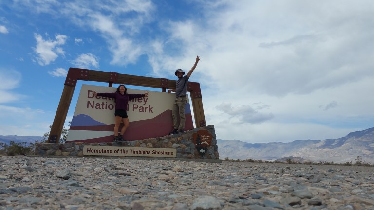
When I officially decided I wanted to hike this Route in the coming Spring, I was driving on my way to Moab to meet up with a PCT friend. This was was around the end of March, and I texted my hiking partner Hurl Goat (who lives in Ontario, Canada) to see if he wanted to join me, and within minutes he responded with “I can buy my plane tickets tonight”. Now that’s a good hiking partner! From then on, we both spent loads of time researching the route and what we needed for resources, and soon we had a plan, and he had a plane ticket for April 17th from Toronto to Los Angeles. We started our hike on the L2H on April 20th, 2018, the day after we drove all around Death Valley caching our water and food. Check out his YouTube channel: Hurlgoathiker : he will be posting videos of our hike soon, and has awesome videos of his 2017 PCT Sobo thru.
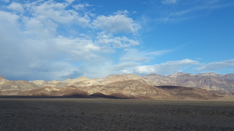
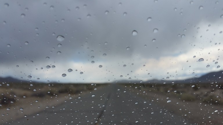
On April 19th, we drove up to Death Valley from the LA area and reached the Southern end of the park by early afternoon. We were graced that day with deep gray-blue clouds and little spits of rain came and went, splattering on the windshield. We were amazed that it was actually raining in Death Valley and took this to be a great start to our adventure. As we drove, we would stop to take photos of the gloomy clouds and noted how they contrasted with the deep beiges of the never-ending sands of the flat valley. But this place is anything but flat, the mountain ranges on any given side of any given valley here are imposing. Their layers upon layers of water-color painted pinks and purples and earthy yellows cast over with shadows and texture were mesmerizing to us. What a gorgeous place!
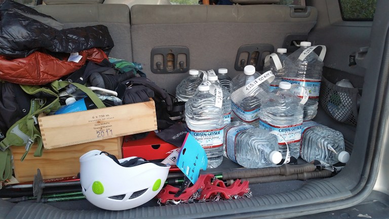
We drove all over the National Park and vicinity of our route, caching our water at three locations (1. beginning of Hanapaugh Canyon at the dirt road intersection, 2. Saline Valley dirt road crossing of Hwy 190, and 3. Cerro Gordo Ghost Town) and food at two locations (1. Panamint Springs Resort and 2. Lone Pine). We gave ourselves roughly 9-10 days to complete the hike, thus dividing our food re-supply into three segments of 3 days of food each. It took us until dark to do the first two water caches and the first food cache, plus visit two Ranger Stations to try to get information on water sources along the route (they had no reports, and one of the rangers actually gave me an email address to send water info to after the hike). After a long day of driving we decided to do our last water cache (Cerro Gordo) in the morning, before heading out of town from Lone Pine, since driving up that road was questionable at best, even in broad daylight.
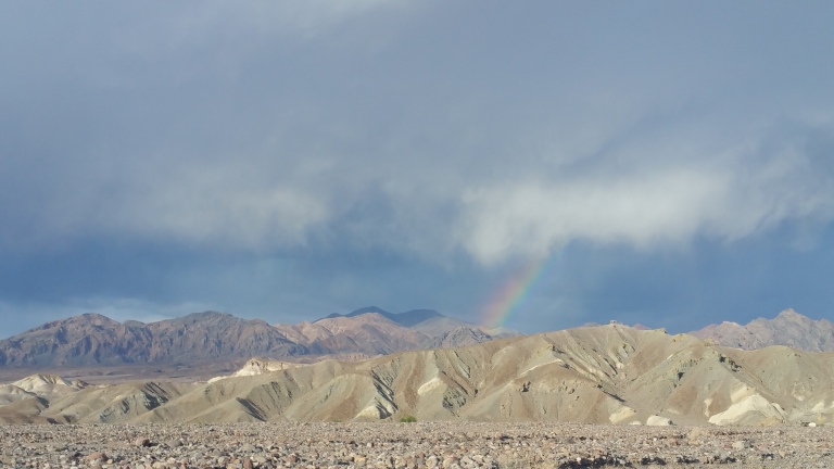
We departed Dealth Valley as the sun was setting and the thick blue clouds were still full of water, threatening to rain even more. We said we hoped it would rain on our hike, or that at least there would be clouds. We drove nearly our entire route that day, and we observed how interesting it was to actually be able to see much of the Route beforehand. Looking at the Western side of Telescope Peak and the Panamint mountains that cascaded down into the Panamint Valley was quite intense. I felt their presence-monstrous and unforgiving. We are actually going to climb up, over, and then come down those mountains in a matter of days…..I thought as we whisked by….and all the way down into this valley….then walk across yet another flat, seemingly endless desert, and (hopefully) find our food. Cool.
As we drove, we talked about what had changed in us since thru-hiking the PCT and other long trails, and how when you first start out, everything looks so big and so intimidating. I thought how I look at this challenge now,compared to a few years ago, and while it was big and it was intimidating, never did it cross my mind that I could not do it. It was more like “bring it on” and wells of butterflies stirred in my belly as we drove the windy roads in the dark, into the desert night.

Been watching you two every night since you two started the PCT, you both have done an awesome job of reporting on these hikes! The scenes are beautifull, the best to both of you!! Thank you!
Thank you for your support!