
March 25th 2023
~4 miles (to mile 493.8 of the route) + ~2 miles on FR 42
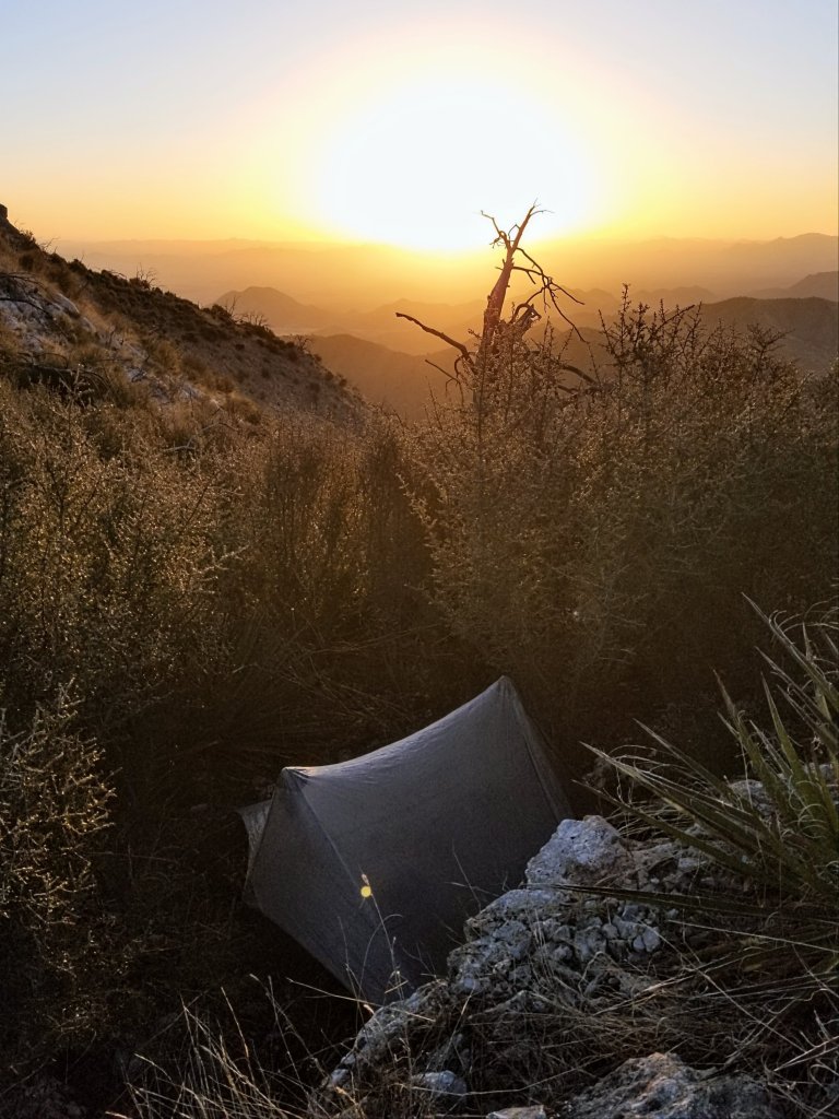
Campsite Elevation 5,604 ft
“In nature, two grapevines will reach out to each other, collaborating to climb closer to their life force – the sun. Inspired by this natural pursuit of harmony, Two Vines Cabernet is blended from distinctive vineyards, each contributing to create a wine greater than the sum of its parts.” Two Hands Cabernet Sauvignon, Washington State
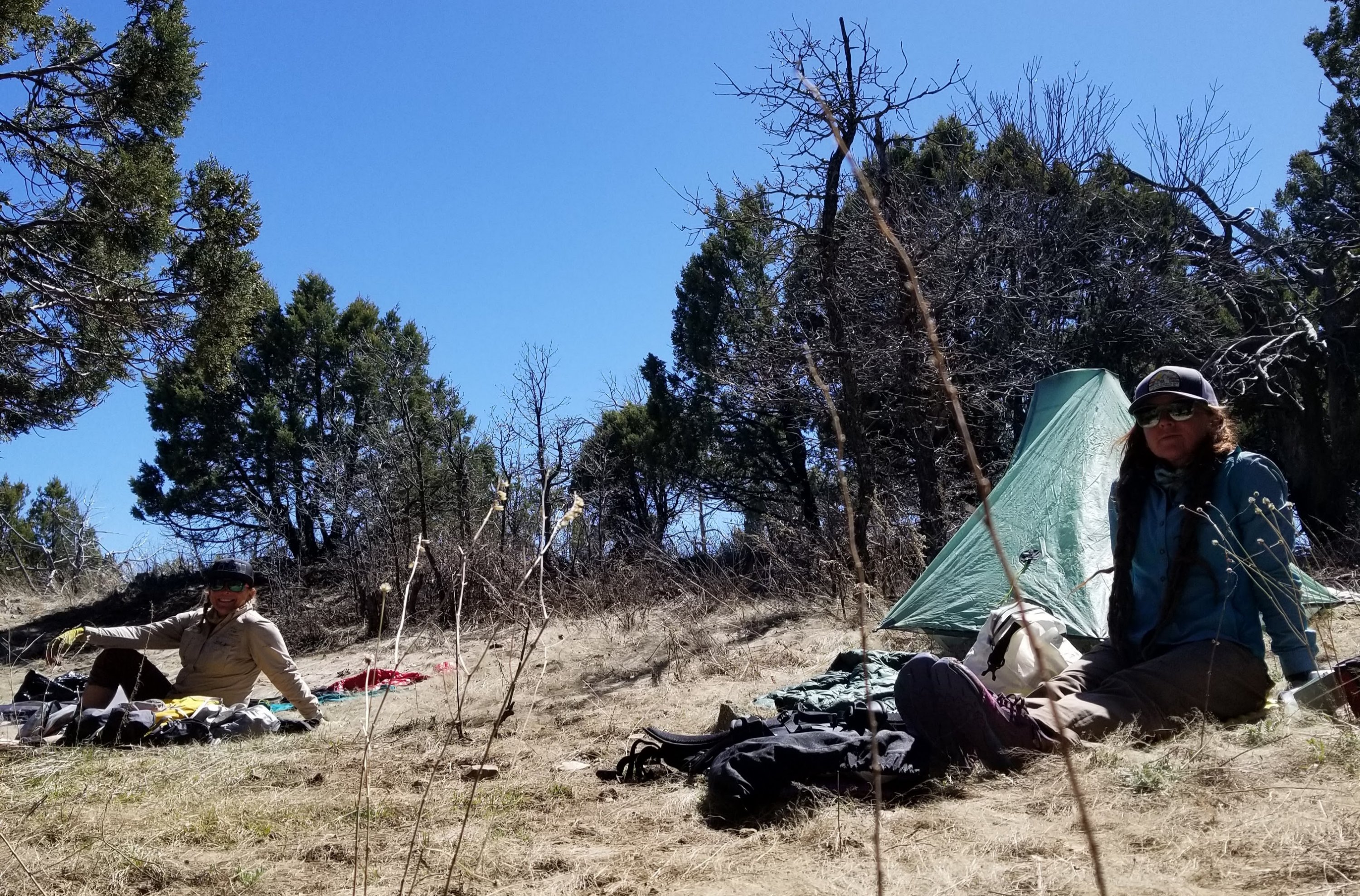
I would not have thought I could sleep through all that wind, but I did. It must have died down in the night, as when I woke at 5am this morning it was quiet and surprisingly still. Bodily functions were immediatly asking for my attention this morning. Of course, being the coldest morning we’ve had at 28F, I have to immediately get out from my warmth and bushwhack to a good spot to dig a hole. There is ice inside the walls of my tent, it feels so cold, when I do my business I am shivering. I’ve been here before, I know this too shall pass.
Back inside my tent, Rockin’ calls over, she to has ice inside her tent too. I hear her fire up her campstove, and shortly I do the same. I am running real low on fuel. I probably only have enough to make my dinner tonight and if I am lucky a luke warm coffee tomorrow. Last night before I went to sleep I had to come to some sort of reconcilliation with what the rest of this trip is going to look like, meaning that I really don’t think we should or can continue on our route as planned. I am relieved to know that Rockin’ is thinking the same thing.
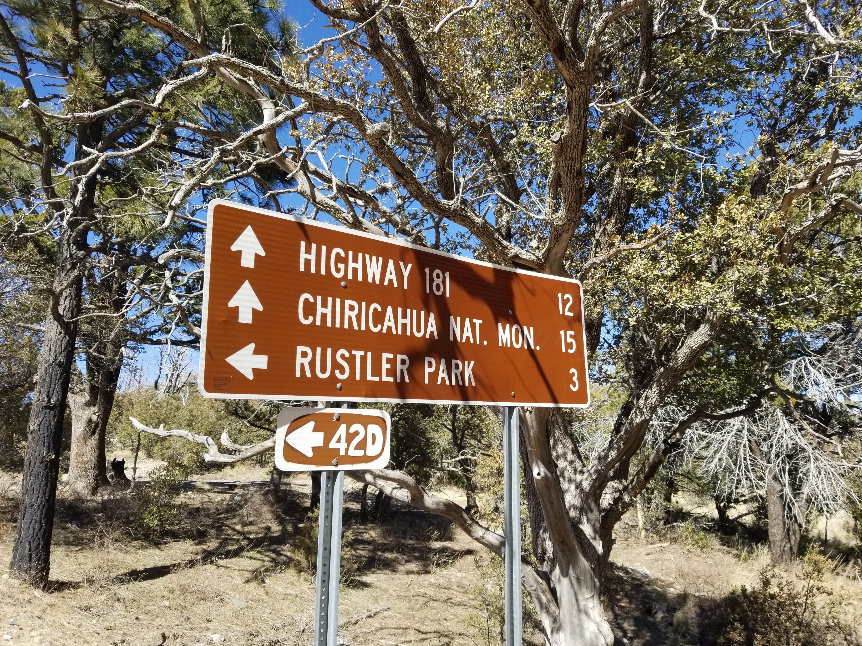
As we converse through our ice crusted tent walls, I see on the map there’s a junction with Forest Rd 42 up ahead, Pinery Canyon Road. Looks to be in about four miles. That is probably going to be our best bet to bail out. It is a long ass road to be walking, and I would hope it’s in walkable condition. Even if it’s bumpy and lumpy, I am sure it beats what we would otherwise be trying to get through if we stay on course. There is so much burn in the area and so much overgrowth, and we are slated to hike to over 9,000 ft where the element of snow will be added. It just doesn’t bode well and doesn’t sound like any fun, not even type 2 fun.
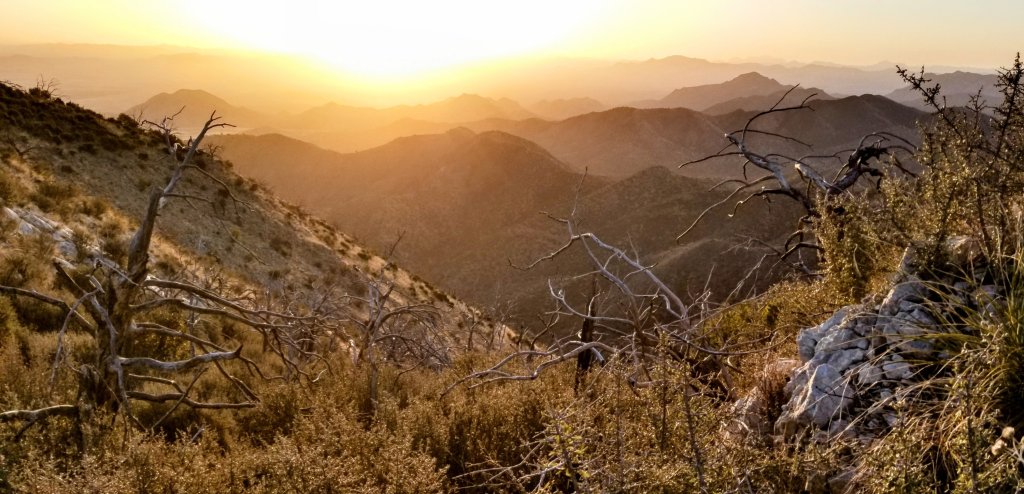
As we are packing up I jump on top of a rock oputcropping to witness the sunrise and try to get a photo of our campsite. There is a lot of smoke on the Eastern horizon and we wonder what fire might be happening and where. It is windy up there so I duck back into my tent and tuck back into my sleeping bag again. We both play the game of waiting until the last minute to get out of our sleeping bags and packing up for good. The rays of light from the sun do help some but we know where we are headed is on the West facing slope, in the shade, and it is super windy out there.
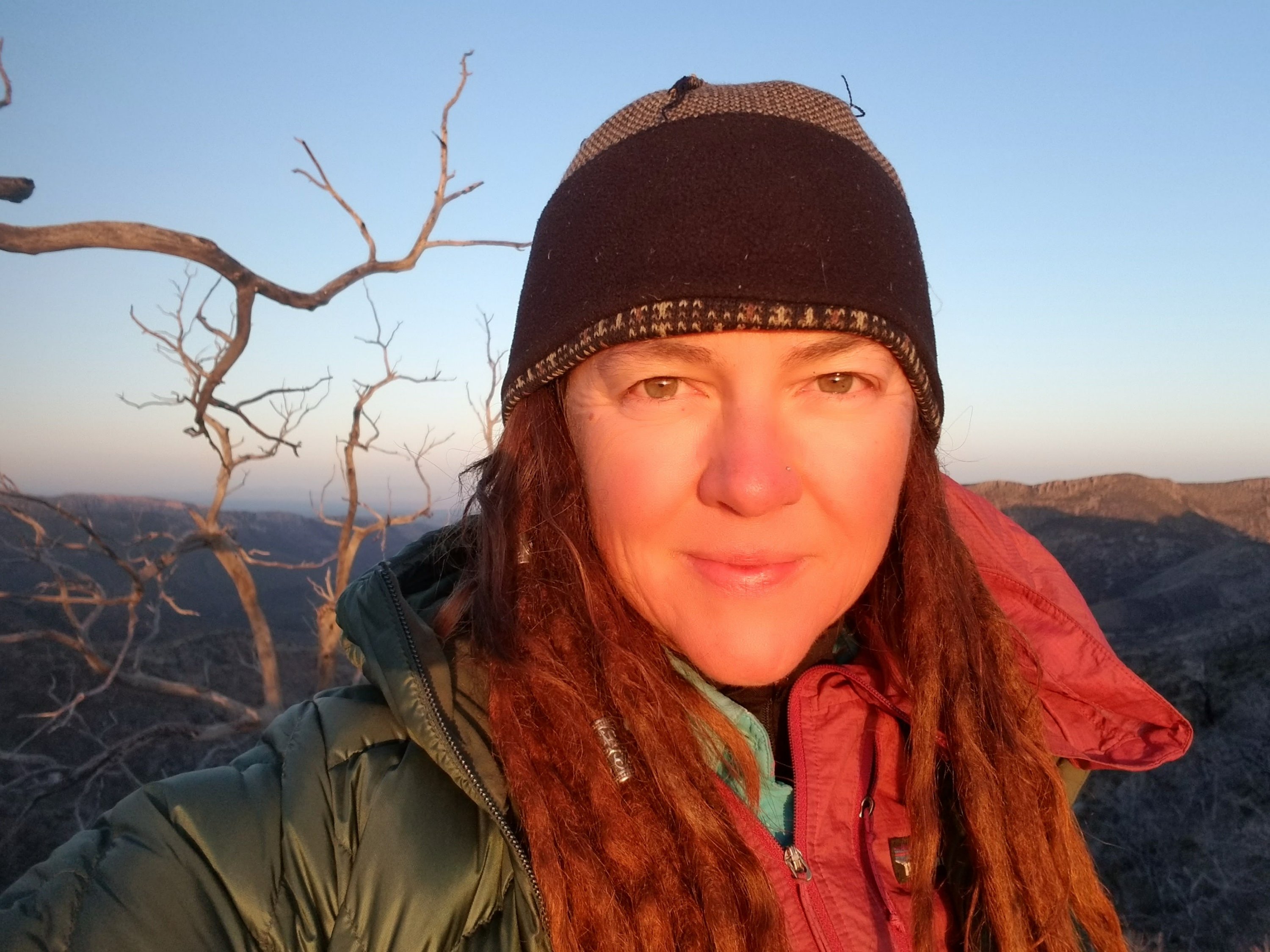
It’s 6:30am when we are walking. Rockin’ looks me in the eye and says to me just as we are about to leave camp that I am a real good hiking partner and thanks me for yesterday. She may never know how much that means to me because I look up to her tremendously. I let her know I feel the same way and we share a solid hug before we are on the move once again. I do believe we make a good team.
I was thinking last night how much I appreciate her 30 years of experience and last night felt like that kept me hanging on. It was a lot, and the fact that we both hung in there and did not melt down at all says alot as to our strengths. We both have the mentality that when the shit hits the fan or when the going gets really tough or dangerous, you have to hold it together. But I know that is not easy for everyone. She said we did some really great team work these past few days and I agree, we really did, and we didn’t lose our personalities!
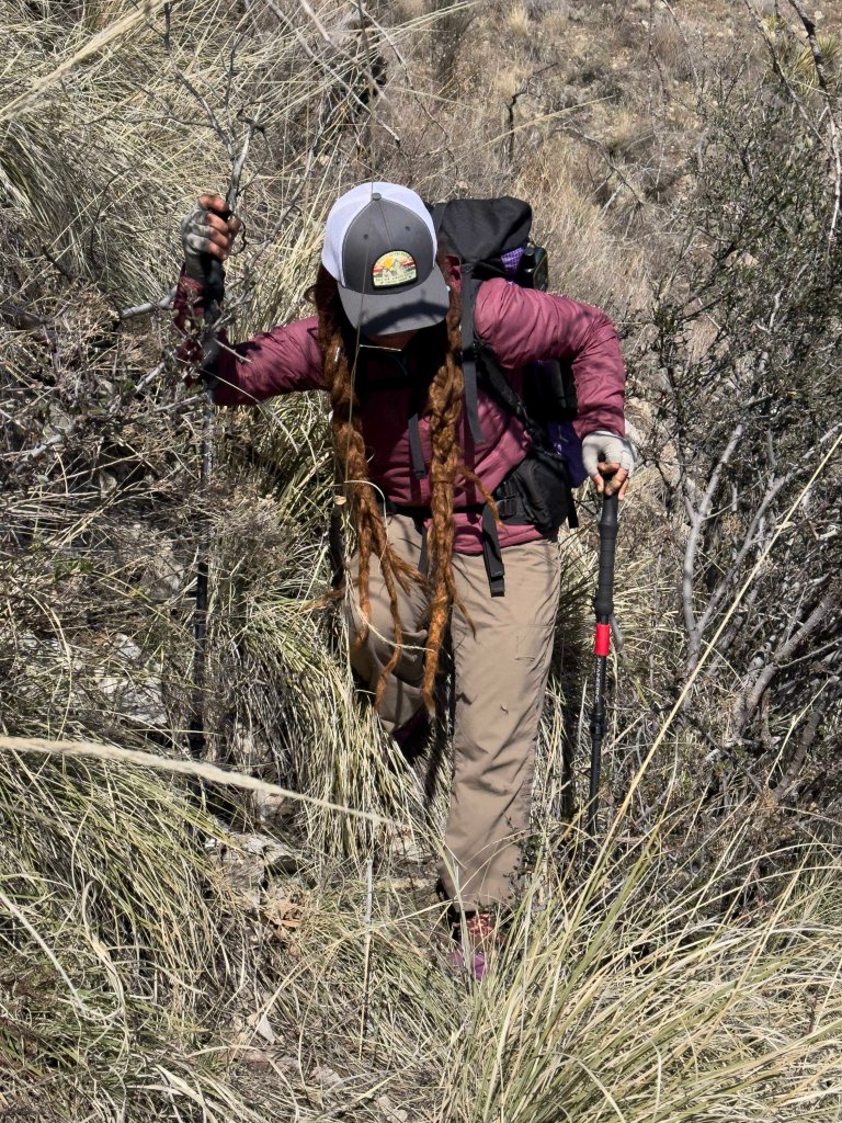
When we pop onto the ridge the going is terrible. Just as terrible as last night except that now we have to traverse a very steep downslope and right off we are in the thick brittle bush and agave that pokes at you with razor sharp tentacles. We make it down to what is supposed to be the trail and start contouring over toward the first saddle that has sunshine.
We both have absolutely freezing hands and I have to stop to change out my gloves because what I’m wearing is not working. We stand in the sun for a few minutes trying to warm up, that sun is such a wonderful feeling. Sometimes it’s these simplest of moments that make me the most grateful. We take in the views to the East and gather up as much sun as we can, as if we could hold out our coffee cups and fill them up with light, before slipping back to the shade and pressing into the frigid wind.
The entire slope here is so damaged by the fires and there are charred downed trees everywhere that interrupt the trail and slash at our legs. We are constantly having to negotiate not only the downed trees but the vegetation that is thick, overgrown, sharp and pokey. There is a little less cat claw however so we are thankful for that.
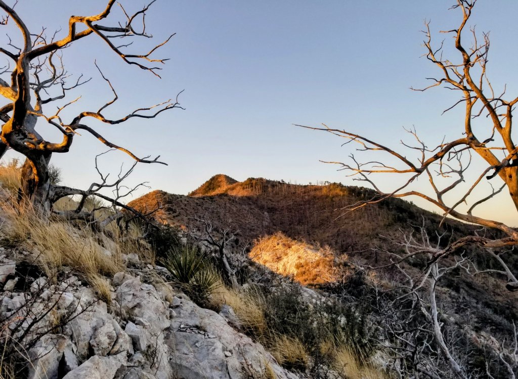
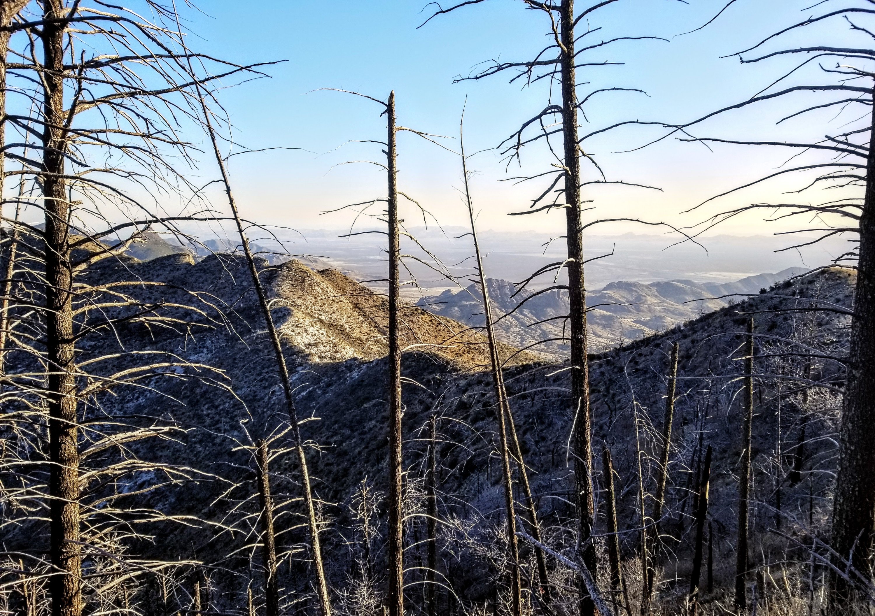
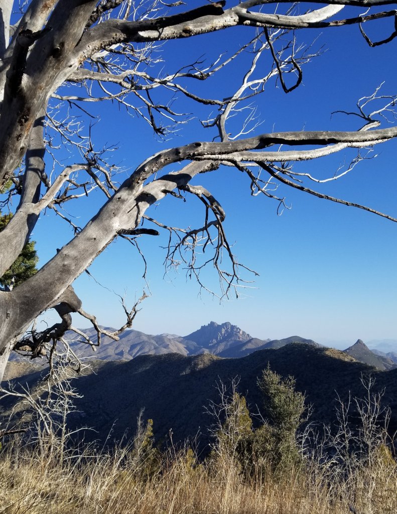
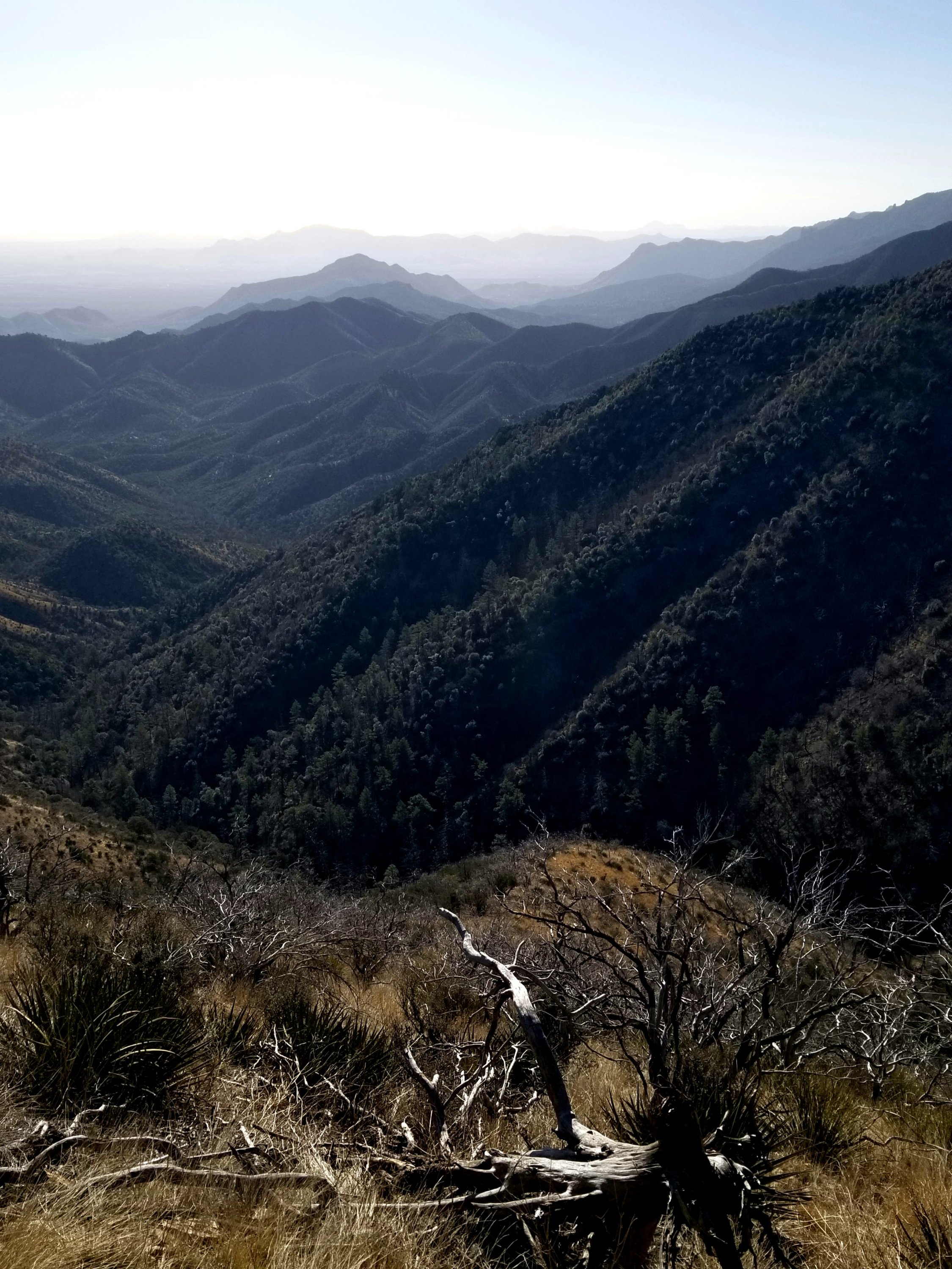
The agave or bannana yucca are probably the most treacherous here and while we don’t encounter them as often as when we had the cat claw, the consequences of a jab are greater. The slope remains steep and we are side hilling still, though the views looking back where we came from are impressive. Eventually we have a view of Cochise Head where we sarted our day yesterday and we can hardly believe we did all that, especially considering the tedius nature of the terrain.
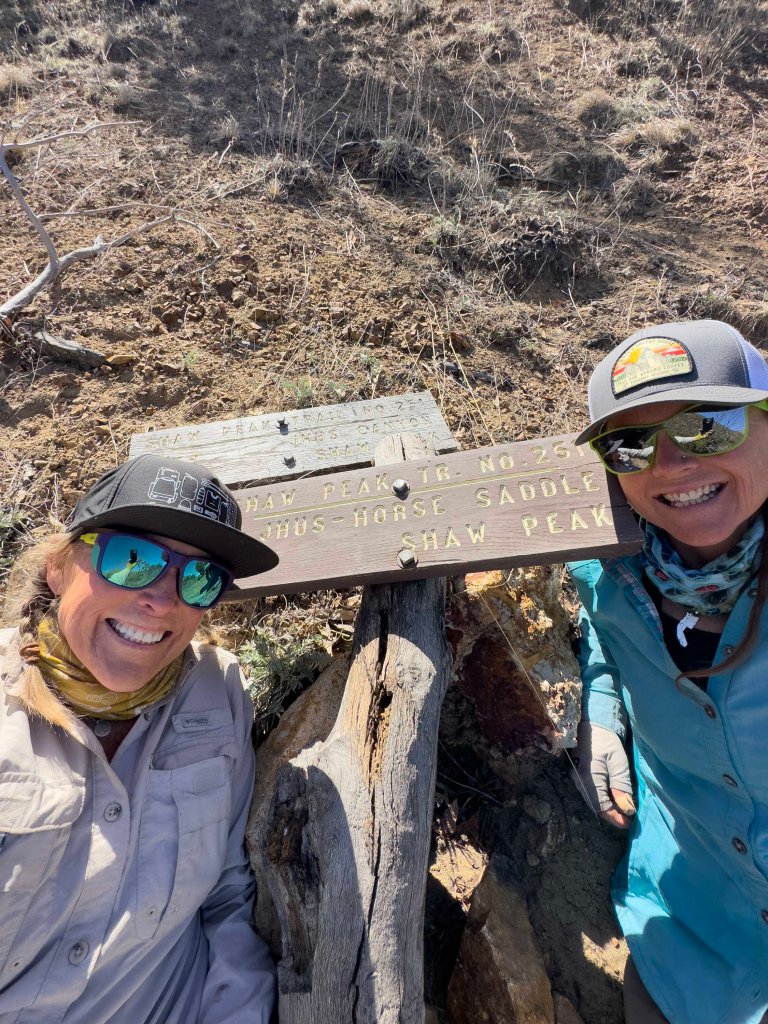
Our first goal of the morning is to make it to Shaw Peak Saddle, which we arrive at by 7:30am. This means we travelled at a speed of 0.7 mi in one hour. You see where this is going. There is a fallen sign on the ground here marking a trail junction. It’s nailed to a downed tree, which we can’t lift. We take our maps out, orient the compass and pull out the GPS. We need to double check our trajectory as the aim is to head to the South East side of Shaw Peak.
Once confirmed, we are on our way again, it is super slow going still and while we do occasionally have a trail to follow, we lose it every 50 feet when we have some sort of obstacle to negotiate. At one point we are over 80 ft above the trail and have to figure out a way to drop down to it again. It is tedious to say the least.

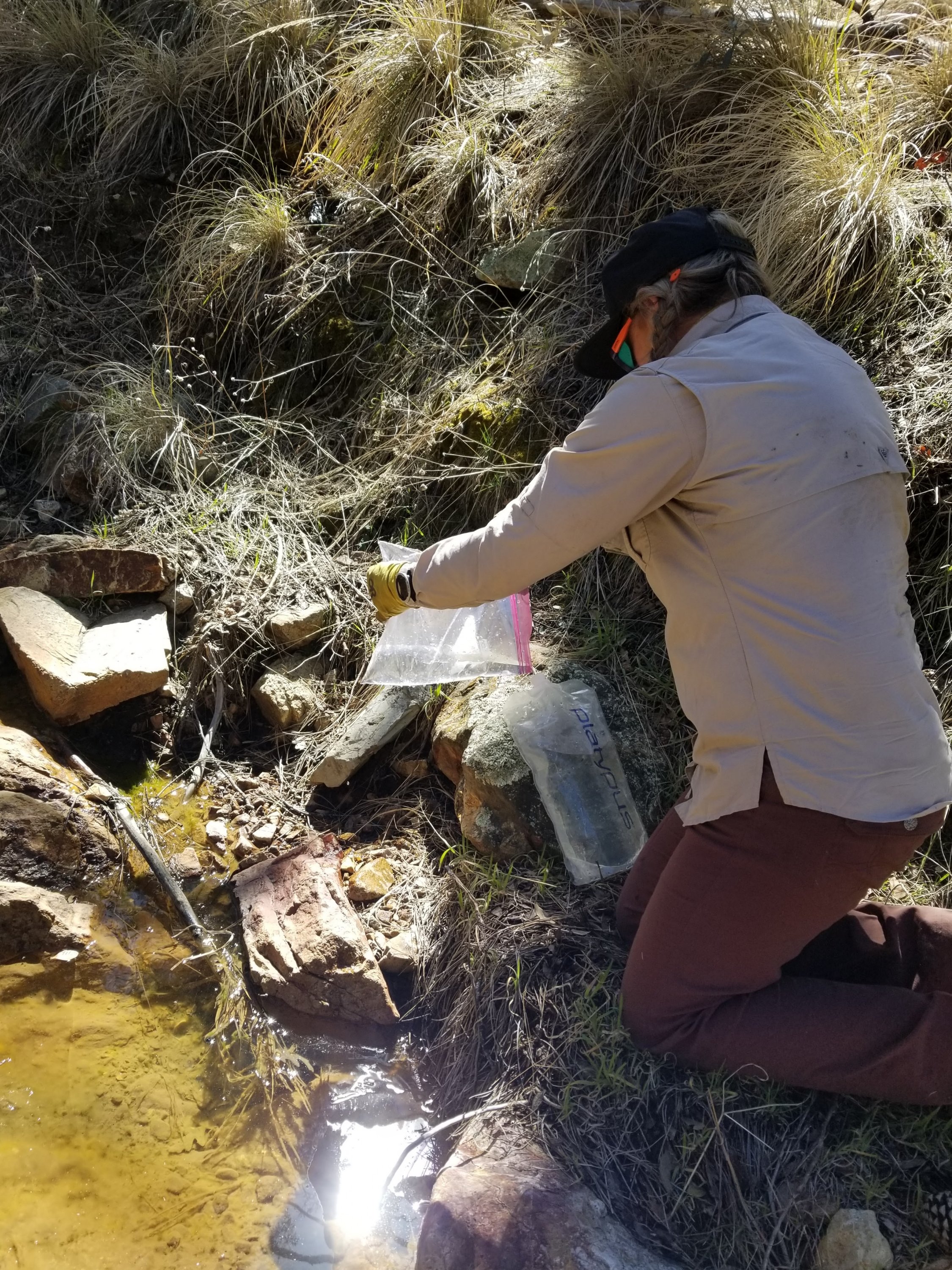
Our next objective is to make it to Jhus Horse Saddle where there is a four way intersection. Here we will walk down to Iron Horse Spring, a 3/4 mile jaunt down to get water, our first water since about 4pm yesterday. We have really stretched those 2L out! This off trail water source reminds me of hiking to all those Springs on the PCT in NorCal, such great memories.
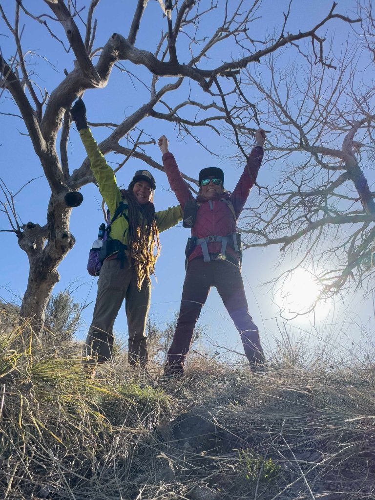
When we arrive at the four way junction we are elated to see alot of intact signage so we dork out and take a bunch of selfies at the sign. Sometimes seeing a sign is just so exciting!
We take off our packs and sit for a short break here as we study the route ahead. We are thirsty so we leave our packs at the trail junction and walk down to the Spring, hoping we will be able to intercept it sooner than 3/4 of a mile and we do. We are able to drop to it within a half mile on good trail and we hit a perfect little pool from which to collect. It is covered in a thin sheet of ice and we break through it and start scooping, It is cold and fresh and perfect.
We take a lovely little snack and water break back at the trail junction, fueling up for what mysteries lie ahead. When we set off again we immediately get confused as to which way to go, wasting time walking in circles. The trail is not clear at all, but as it turns out we were going the right way all along.
We start a big climb that utilizes actual switchbacks to assist in the grade but since we now have a full water carry we both feel super sloggy and tired and heavy. It’s pretty funny you know, that we can complain about carrying 2L of water on a cross country route in the desert, boy we’ve been spoiled in the water department this entire week. I think had we done this hike any other year, a 4L to 6L water carry would have been par for the course.
The goal from here is to hike another two mile segment of “trail” to reach an intersection with a 4WD track. From there it should be easier walking, so we make that track our lunch goal and hope to be there by 1:00pm. Thankfully, the trail is in much better shape in this section. Yes, it is overgrown, but with grasses now. There is only the occasional blow down and so much less of the brittle bush, agave and cat claw, so much easier to negotiate. We see a TON of bear scat along this section of trail, I mean so much there were easily 20 piles of scat in one mile. This bear really likes to use this trail.
We enter a forest, a very healthy forest, where there is beautiful dappled sunlight coming through the tree branches. We hear the wind whooshing in the pine trees, telling us they are strong, and the yellow grasses sway softly in the breeze. We see several Coous deer, which are the ones with the fluffy white butts and tails. We think they are magestic as we stop in our tracks, becoming still as statues to enjoy watching them. They are skittish and run away but I notice they move differently than most deer, they don’t bound and leap, they float through the brush like apparitions.
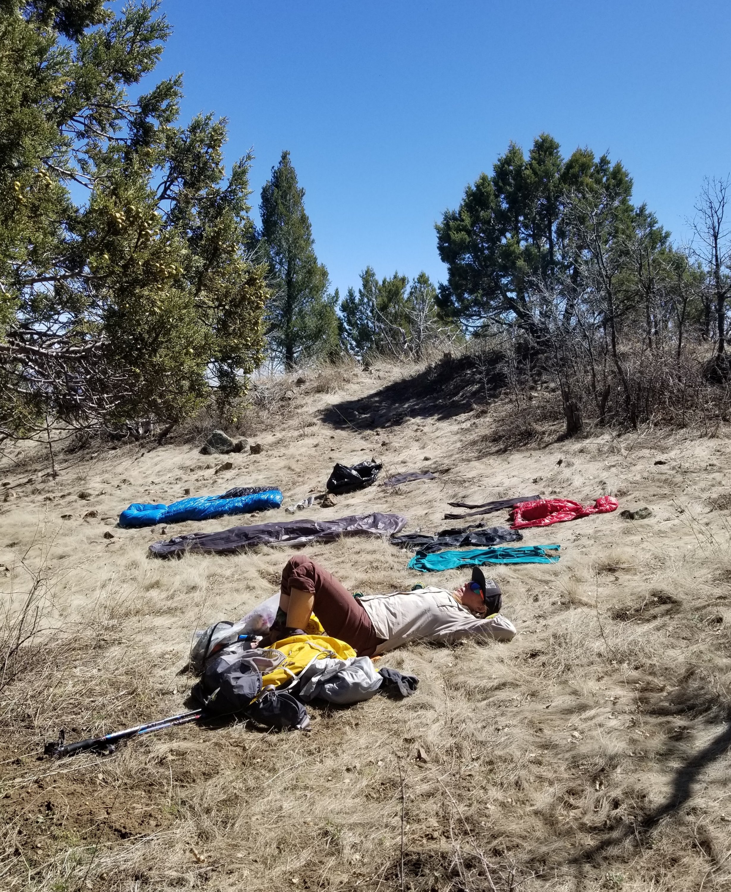
When we reach our lunch spot is is 12:42pm and we are doing really really well. We find a great spot to yard sale all our gear as we need to dry out our tent and sleeping bags and everything. We take over the area and have a nice long leisurely lunch. It is really lovely, we even lay down for a little bit, soaking in the sun.
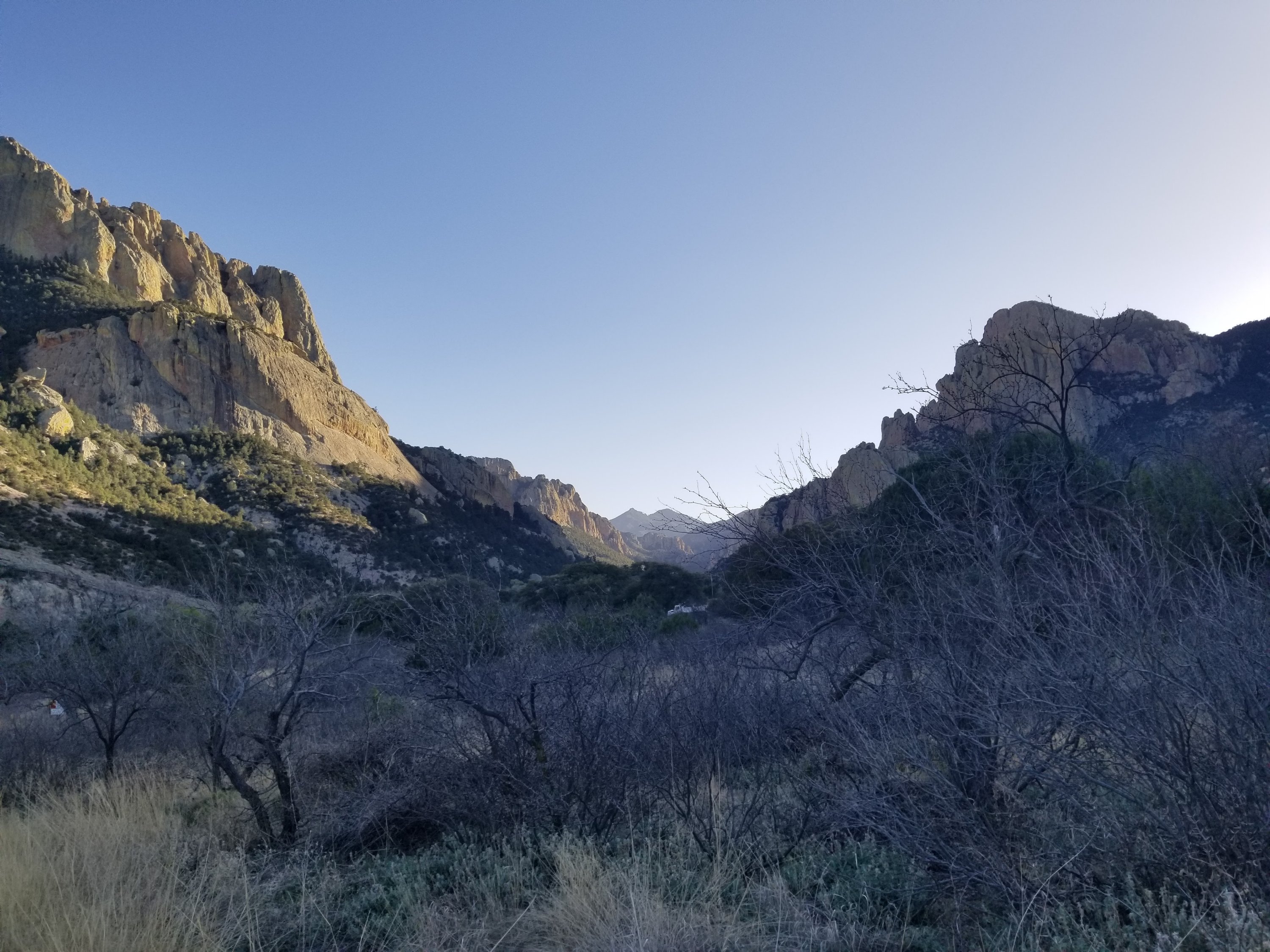
From here we can see the mountains ahead, where we would be traversing had we decided to stay the course. We feel we have made a very good decision not to continue on our original route when we see more burn areas and they are covered in snow. The trail would be climbing up to 9,000 ft and the combination of burn and snow along under used and unmaintained trail, limited and unreliable water access all seems like a bad situation, especially since we only have two more days to finish this thing.

We wrap up from our nice long lunch break and trek onward, finally reaching our dirt track and suddenly it seems we are walking so fast. It is unbelieveable how easy the walking feels now on level ground all of a sudden. It’s a total 180 from what we’ve been doing the past 48 hrs. A strange feeling wells up inside me, actually it’s been brewing since lunch time. That realization that the journey is almost over.
I was thinking yesterday that we have three more days left and now with our bail out strategy, we are on the last day or perhaps with a short day tomorrow. Nevertheless, the tough stuff is over and suddenly all we have left is a dirt road walk. It all seems to have changed so fast. We are no longer surviving on adreanaline, we are simply walking with a lulling effort on smoothe dirt road for who knows how long. This kind of walking numbs the mind and pounds down the knees. For as challenging as this hike has been, I am already mouring the end. I wish it could go on. I do not regret our decisions though, I know we made good, sane choices.
Along the way down we stop at a stream to change out our metallic tasting Iron Spring water for a fresh source. It is wonderful. We stop to look out into the valley and canyons below and we can identify Silver Peak, our final destinatoin on ths route. As we stand there gawking at the peak, a truck with a camper comes rumbling along the dirt road. The folks stop to check on us, they are curious what we are up to. They offer us a ride which we gladly accept. They are Dave and Sue from Oregon and they let us clamber into the back of the camper which is really fun.
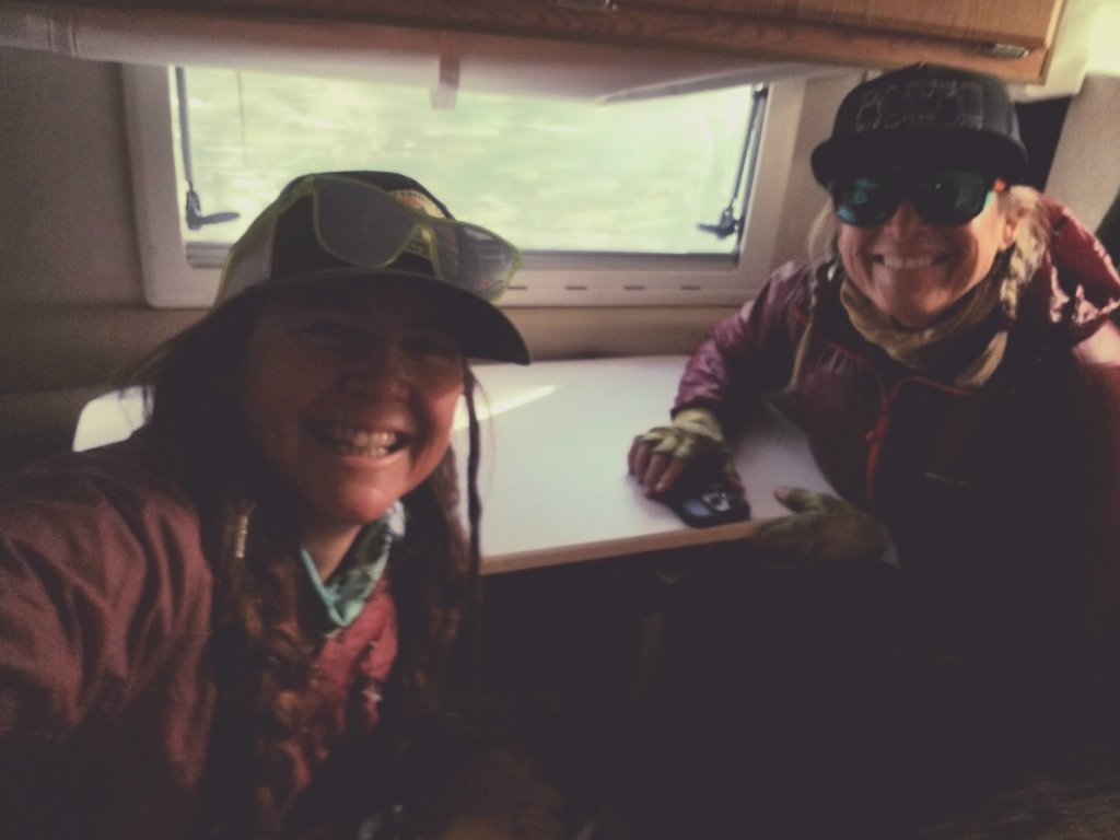
We bounce around as we make our way down the dirt road, they save us 8 miles of dirt road walking with about 3,000 ft of knee and ankle pounding descent. We do not need to prove anything by road walking we say. In the truck I tell Rockin that I feel a little sad that it’s all of a sudden coming to an end and she says it feels like we have been out for a month rather than just a week. So much has happned. I agree. That is the best feeling, time has really stood still. We decicde that we want to hike up to Silver Peak tomorrow as long as the trail is in good condition. So that is reconciliation for the abbreviated finish.
Dave and Sue drop us off right at our car and we are happy it is still there, yay! The Rangers come by and we chat it up with them for a while and gather a lot of useful information about all kinds of things including the trail conditions for Silver Peak, which they say people hike every day. Excellent news!
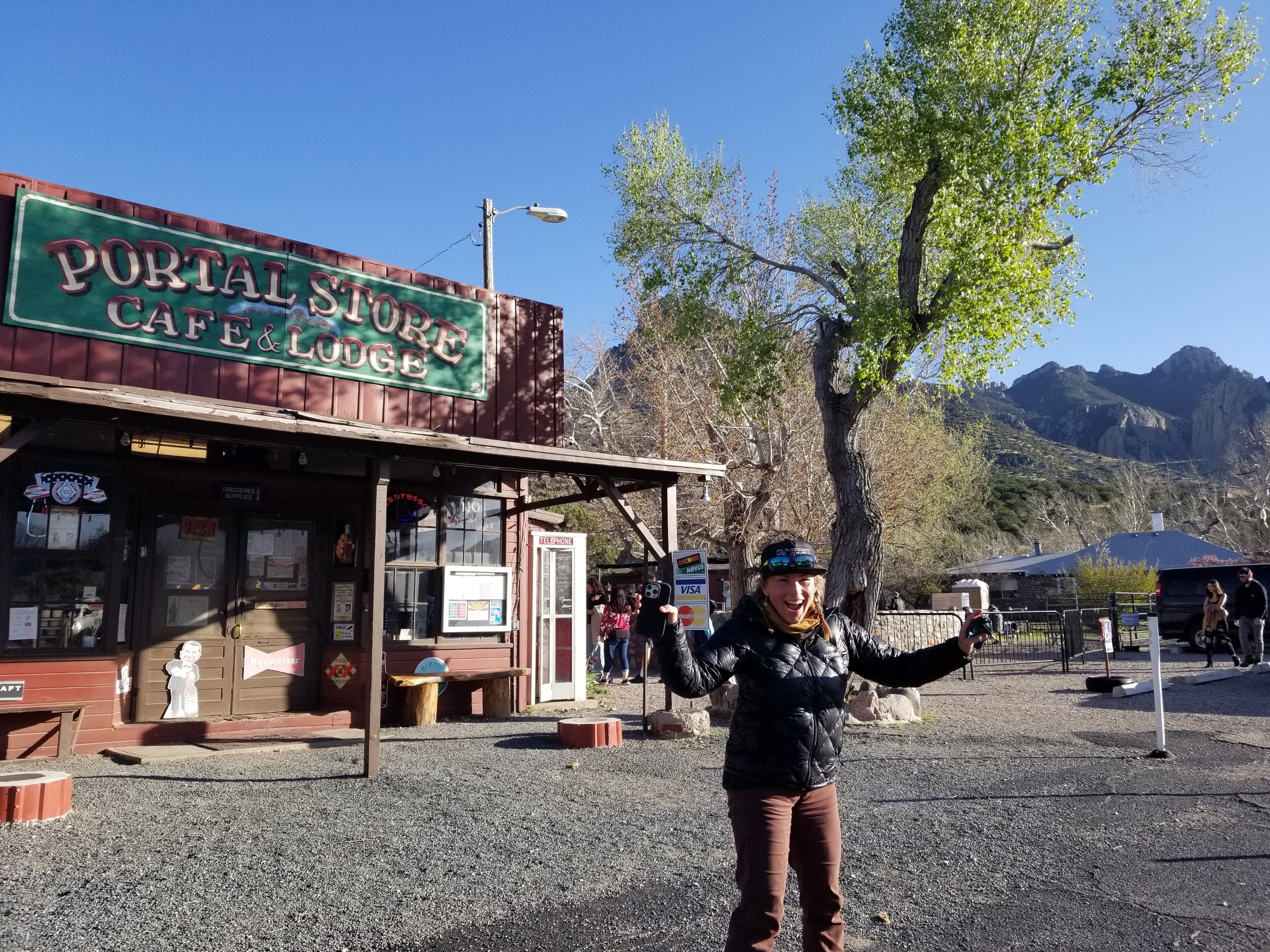
We drive into Portal to the General Store to check out what is going on there and purchase a celebratory bottle of wine to take back to camp with us. We drive all around looking for a good place to call home for the night and laugh that it is easier to find a campsite in the back country than out here, but finally we get to the John Hand Campground where you can park and walk in and set up, so that is like luxury for us.
We are camped right next to a rushing creek and we sit and cook our meals while sipping on wine, chatting and laughing about things that only hiker trash like us can relate to. It is blissfully relaxing. We are so thankful for how everything came into alignment today and where we ended up. Honestly things could not have worked out any better. I think our combined energy really gets us to good places and we are able to manifest some great things.


Hello Mary Poppins. My computer seems to have developed a mind of it’s own lately. Treacherous behavior !! With computers I am low tech I guess. The desert mountains are not the Sierras , but they have a stark beauty of their own, very primal with their sharp and pokey flora. Cooking your meal while sharing a bottle of wine, a nice way to finish your trip. I remember sharing a bottle of champagne in a sierra cup at glacier point in a tent on new years eve. Ah , memories. I am heading to bear lakes basin and royce lakes for five days, can’t wait ! Ed
Hey Ed!! Those are fantastic memories, thx for sharing 🙂 Have a great time in Bear Lakes Basin, that is a magical place. Im headed in at Shepherds Pass tomorrow for a week of XC in the So SHR area. Should be fun. Catch ya on the flip side!