
March 24th 2023
12.2 Miles
Campsite Elevation 7,250 ft
5:35am. It is cold. 30F. The air is moist. I was again having all kinds of busy dreams when I heard a cricket chirping and I thought that was odd. I tuned in more carefully and realized it was Rockin’s alarm. It’s 5:15am, time to get up. I make my coffee and it is piping hot so I place the mug in between my legs to warm up and when I take it out to drink it I realize I made me a super potent cuppa Joe. Heck yeah, I’ll take it!
There is a gorgeous sunrise when I go out to poop in an extremely awkward spot, but it has a stunning view. It is windy still, and butt cold, desert cold. Back in the tents, we are both looking at maps, strategizing on the day. We reheat coffee a 2nd time and stay in sleeping bags as long as possible. What layers to wear? Wind, cold and snaggy stuff ahead. Our first aim for the morning is to make it over to that saddle we were originlly trying to get to, picking up our route once again.
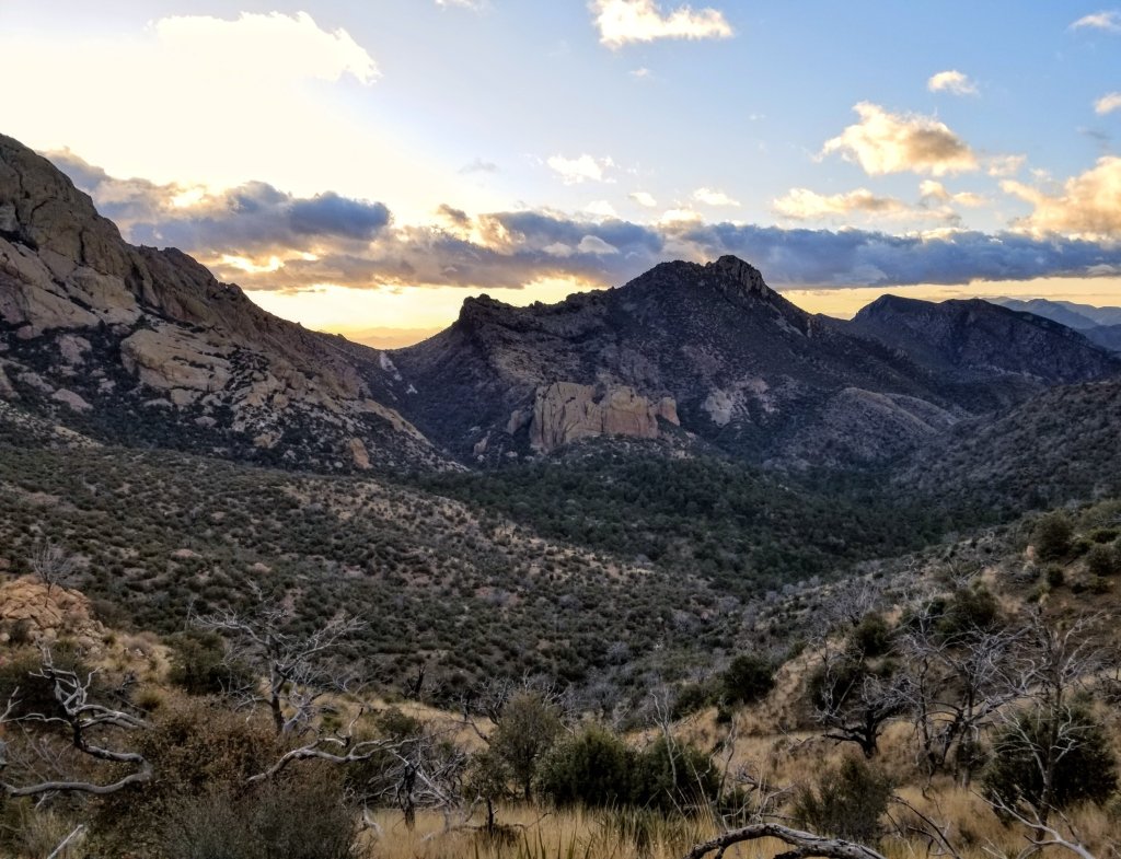
The morning starts out fine enough yet there is more picking and it’s really slow going but we make it to the saddle. Our first small victory. From there we must descend a ridge then dive into a canyon that looks beautiful but heavily overgrown. When we stop at the creek bottom for our first morning break it’s 8:45am. We have been hiking for 2 hr 15 min and we have progressed 1.8 miles. Wow.
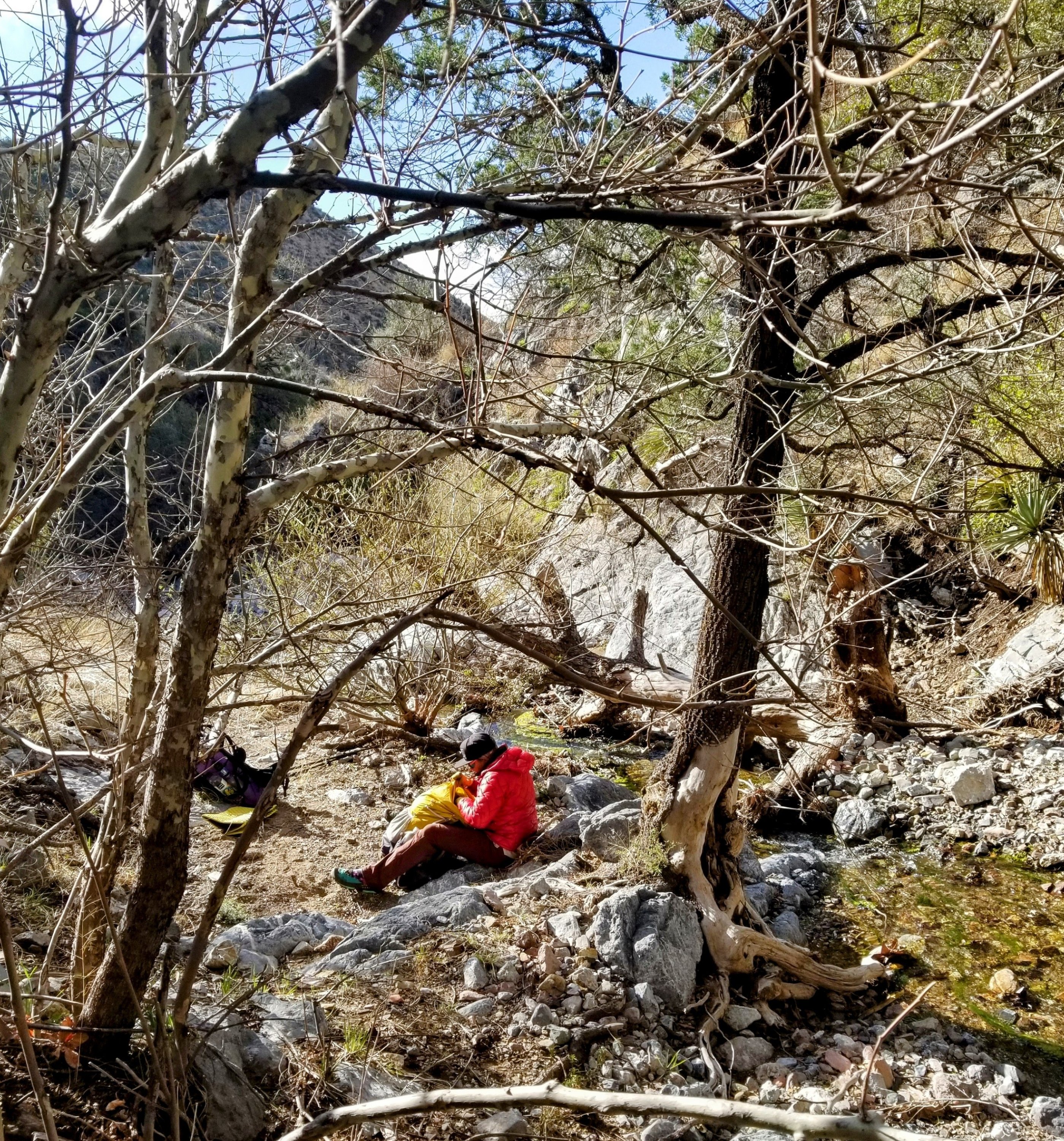
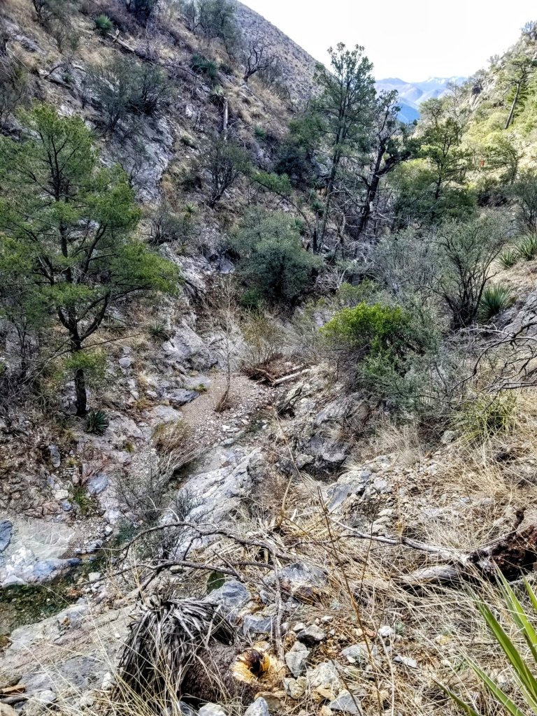
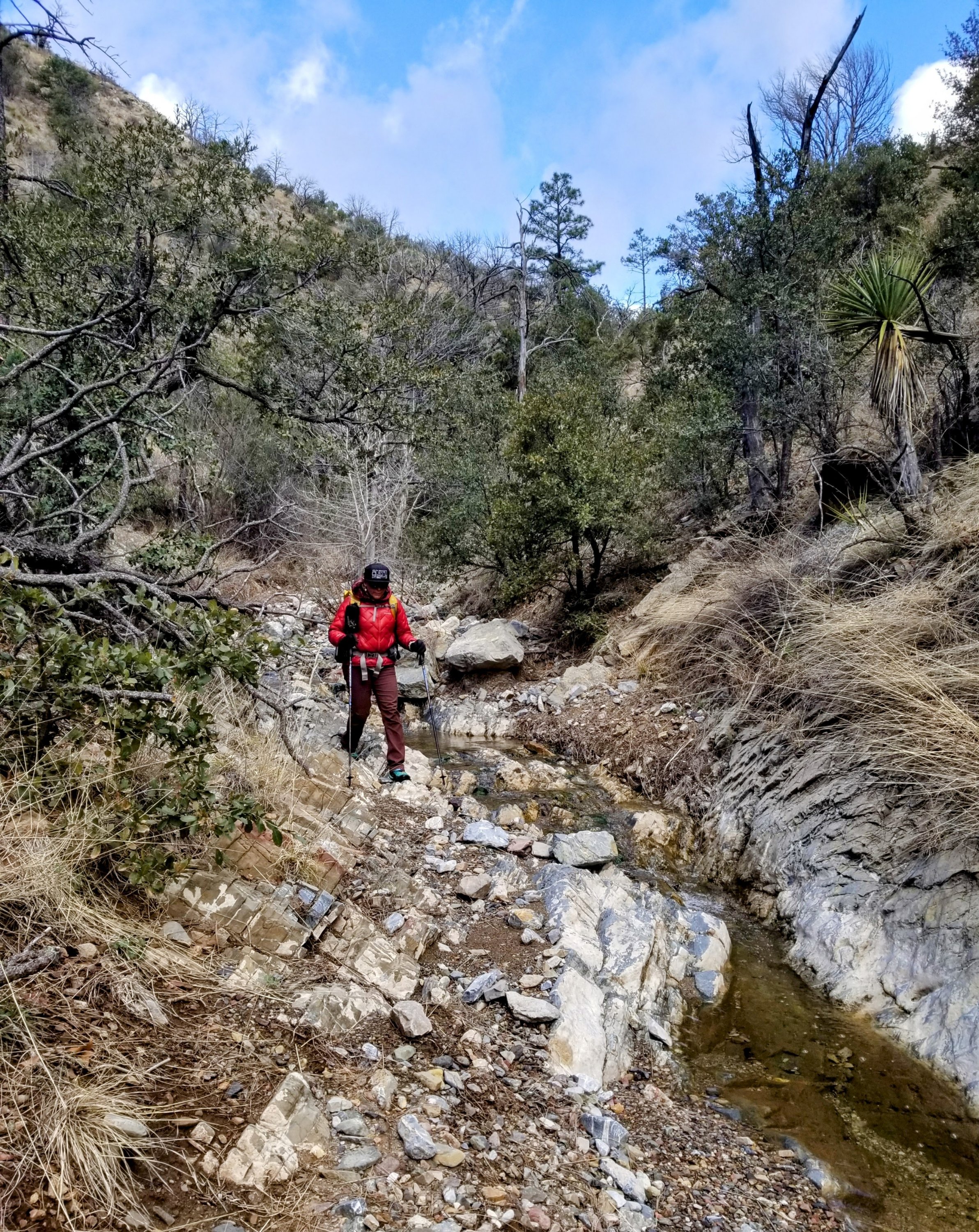
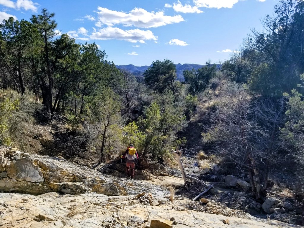
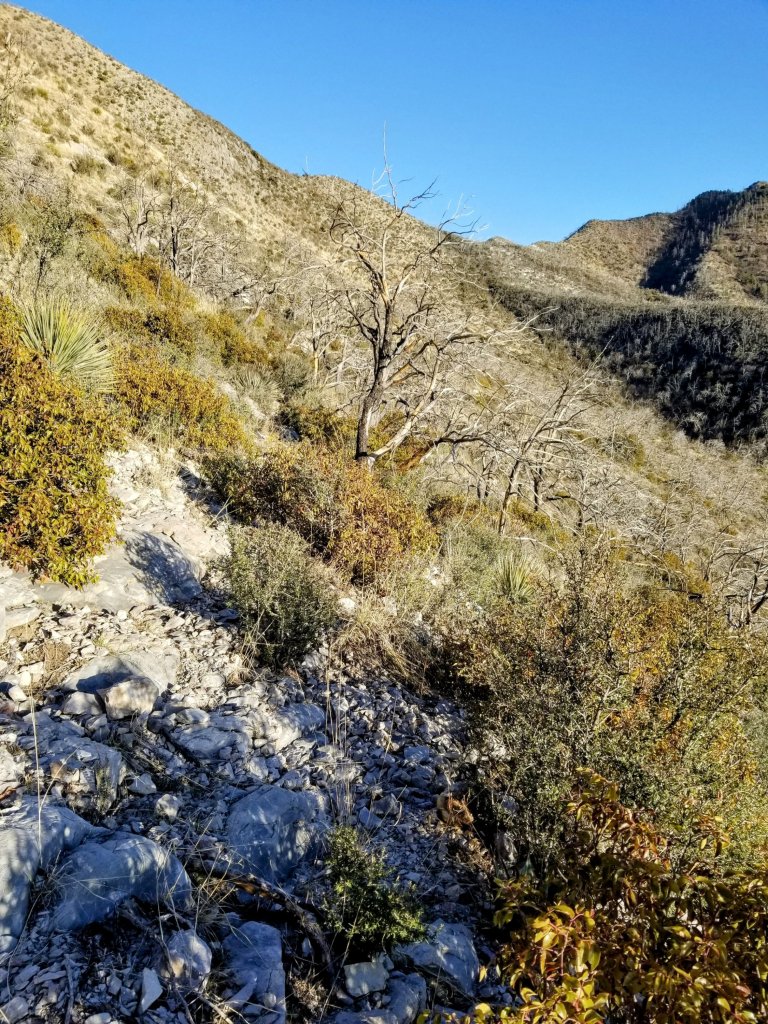
We follow Indian Creek where several impassable areas appear. Most of them due to dramatic narrowing of the caynon walls with steep pour offs and waterfalls. It is such that we have to climb way up high on game trails to bypass the waterfalls, but then there is a lot of bushwhacking and eventually too much vegetation, cat claw or blow downs in the way. We have to figure out how to get back to the creek bottom again. This rhythm continues. There seems to be slight progress, then something is either impassable or just too dang steep. We do this through the morning and then finally we are able to stay down at the creek bottom indefinitely once it widens out and opens up.
The air temperature is darn cold and snow feels palpable on my skin and in my lungs. When we stop around 11:00am to eat more snacks we have our down puffy jackets on the whole time. It is a hard day for gear as we are one minute super warm in the sun and the next it is 20 degrees colder under the cast of a cloud. We wear lots of layers and adjust frequently.

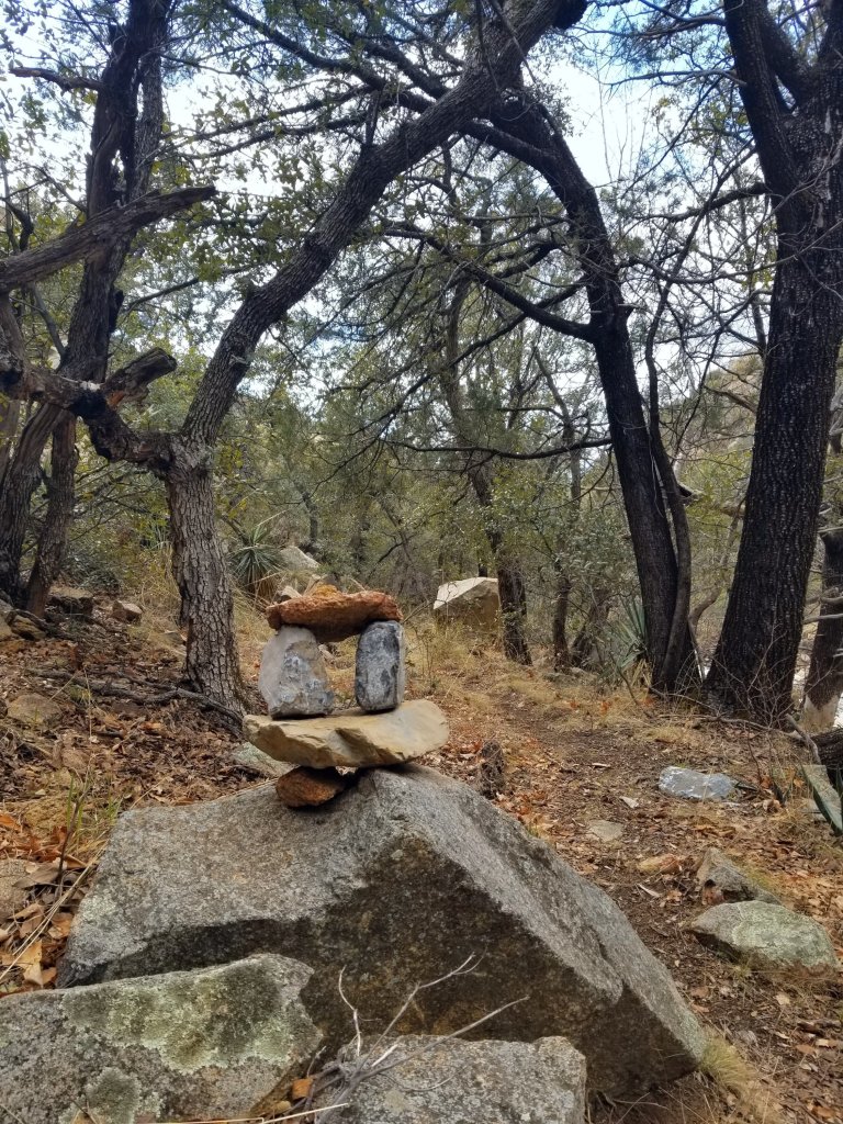
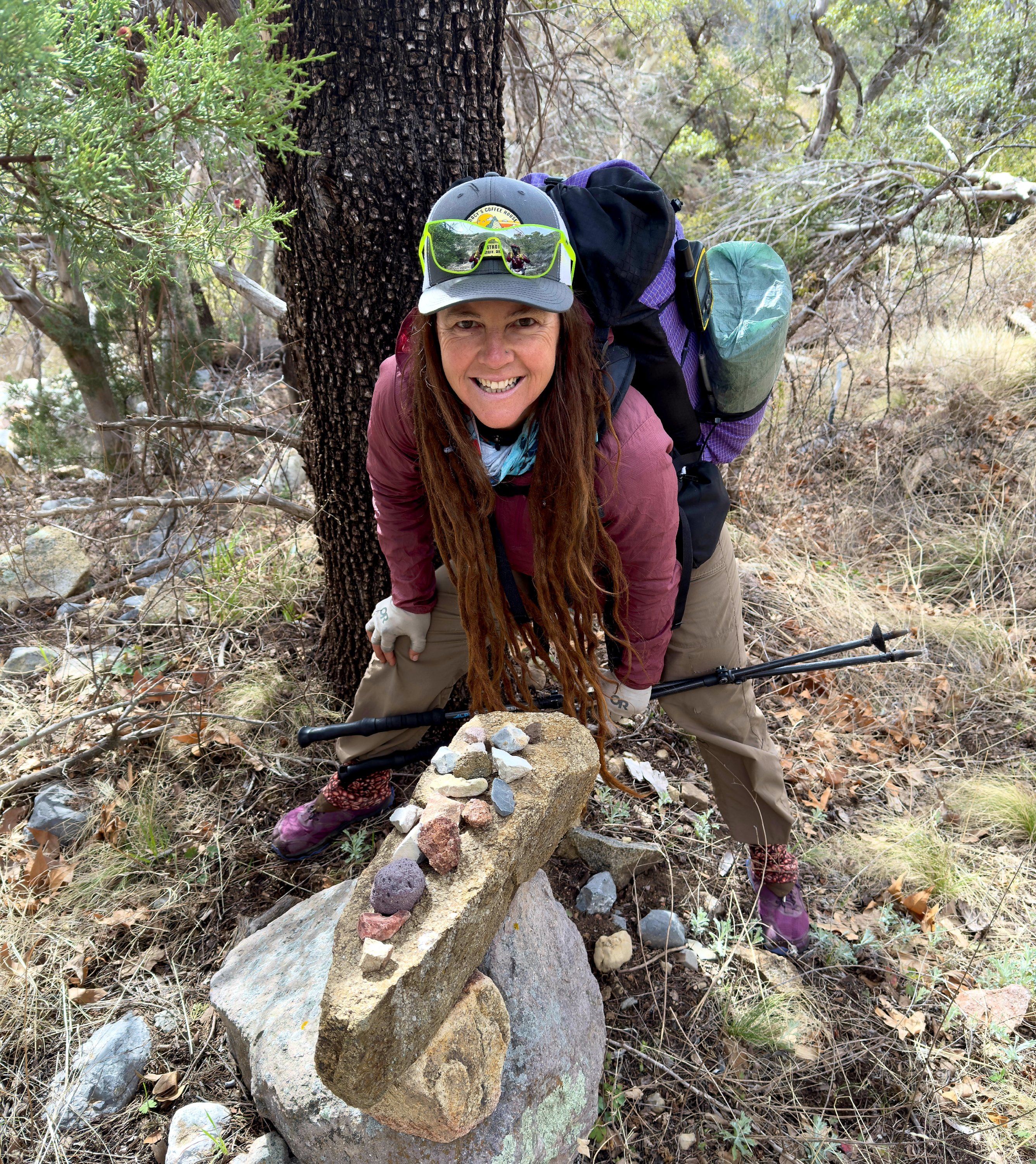
Picking our way along Indian Creek we find remnants of the trail here and there. We discover several cairns along the way, each one seems to have been placed with a lot of intention by it’s builder. The best of them all has a collection of small rocks placed neatly on the surface. We hover over this for a few moments, picking up on the good energy we feel it has. We need all the suport we can get out here!
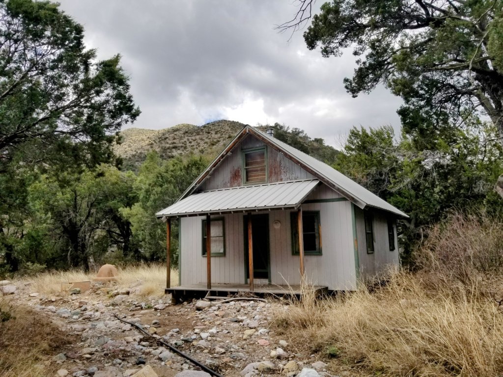
We finally make it to the end of the canyon where we take our lunch break around 1:00pm. There is an abandoned home down here. It seems really out of place and the underside of the dilapidated building looks like it got washed away and flooded, perhaps repeatedly, but it is a house that someone once loved and cared for.
We don’t know it at the time, but if one were to follow the track East from here, one would wind up walking along Hilltop “road” along the East section of Whitefork Creek. Our datasheet notes Chiricahua National Monument Foot Access here. It would be a long walk, but one could access the town of Portal here if needed. (See Green Trails Maps #2934S Chiricahua Mountains. Did not find this map until after the hike!)
We find spots in a clearing on river rocks that gifts us some sun under which to sit and eat. I make my new favorite drink: a Hazelnut Teaccino with a small spoonful of coffee and coconut sugar, it is a nice hot earthy drink and sure hits the spot. Rockin gestures to give me a faux birthay present which is a deflated party balloon we picked up a couple days ago, attaching it to my pack. Thanks friend! I feel special 🙂
As we sit having our lunch we witness little snow flurries coming down from the gray clouds and the sun occasionally pokes through, which we turn our faces towards. The snow flurries glitter in the sunlight bringing a magical feel and when the light hits the creek, the sparkle on the moving water is transportive yet so fleeting I can’t quite capture it, like sand in your hand, it slips through and disappears.
We wrap it up after a haf hour, knowing we need to make more progress, thus stuffing our puffy’s back into our packs as we turn North West following Whitetail Creek. Here we have another creek running strong and we feel so fortunate we don’t have to think about water. We are amazed at how much water we have had all day. Purple Haze’s trip report from this section said he was scrounging for puddles of water here and struggling with the climb up ahead because of the blazing heat. Clearly we are not having that same experience.
Continuing now along the creek we enjoy the afternoon route following the water flow. I keep thinking what a gift it is to have the sight and sound of constant water. There is also a healthy, intact forest here, the trees have not been affected by burns like a lot of other areas have, so we are appreciating that beauty. Shortly, we start a climb on a two track up to Hands Pass. The climb is steep but pleasant enough and the walking and navigating becomes easy so we are pleased to get a break from the slow picking as we fall into a good climbing rhythm.
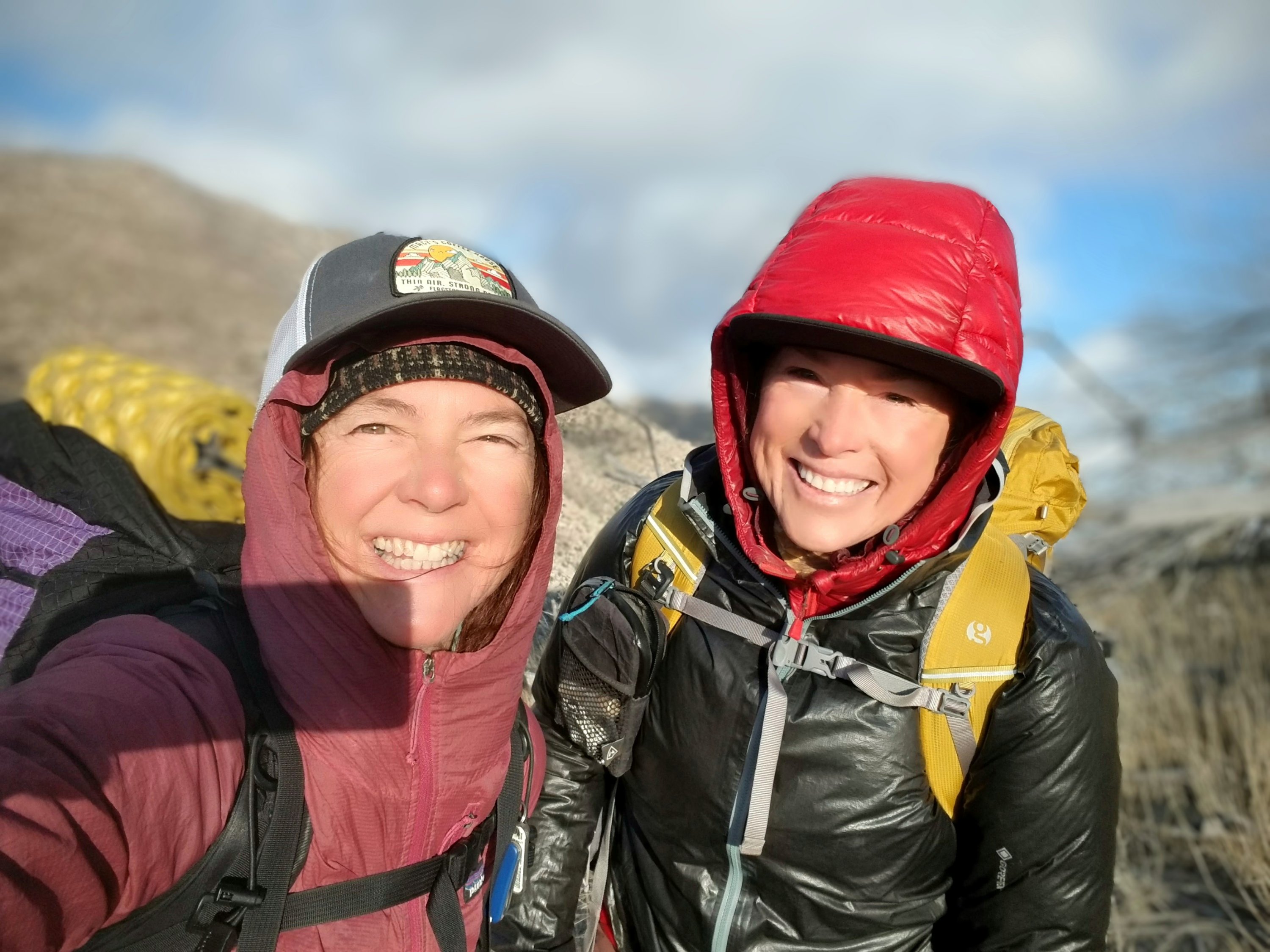
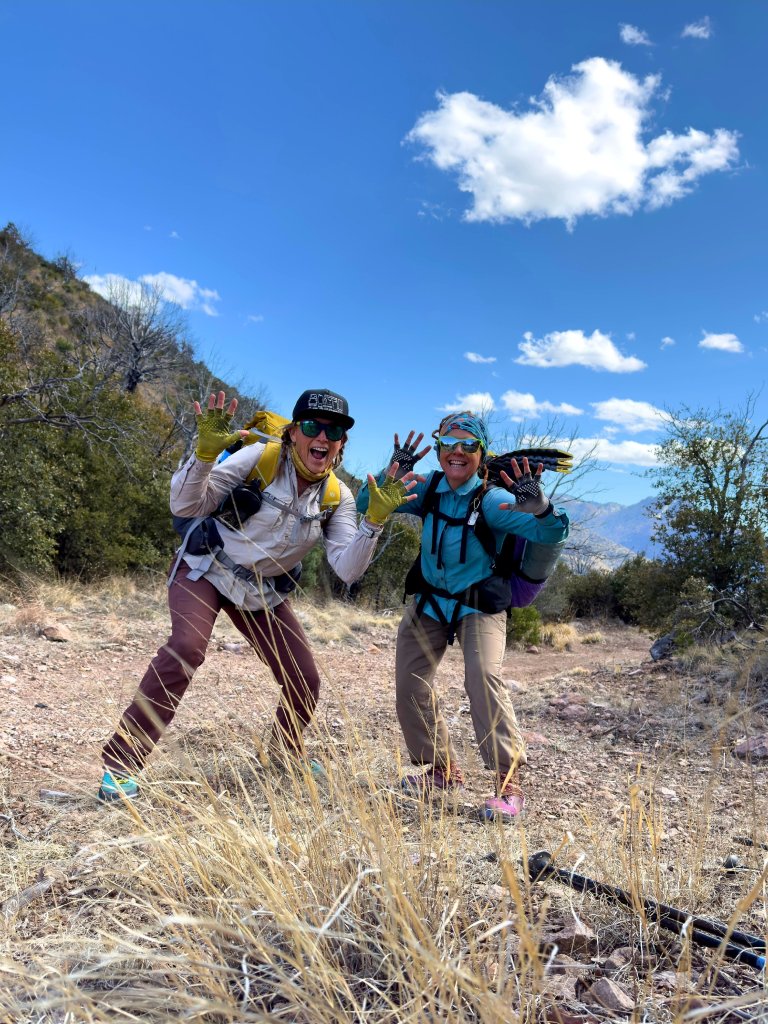
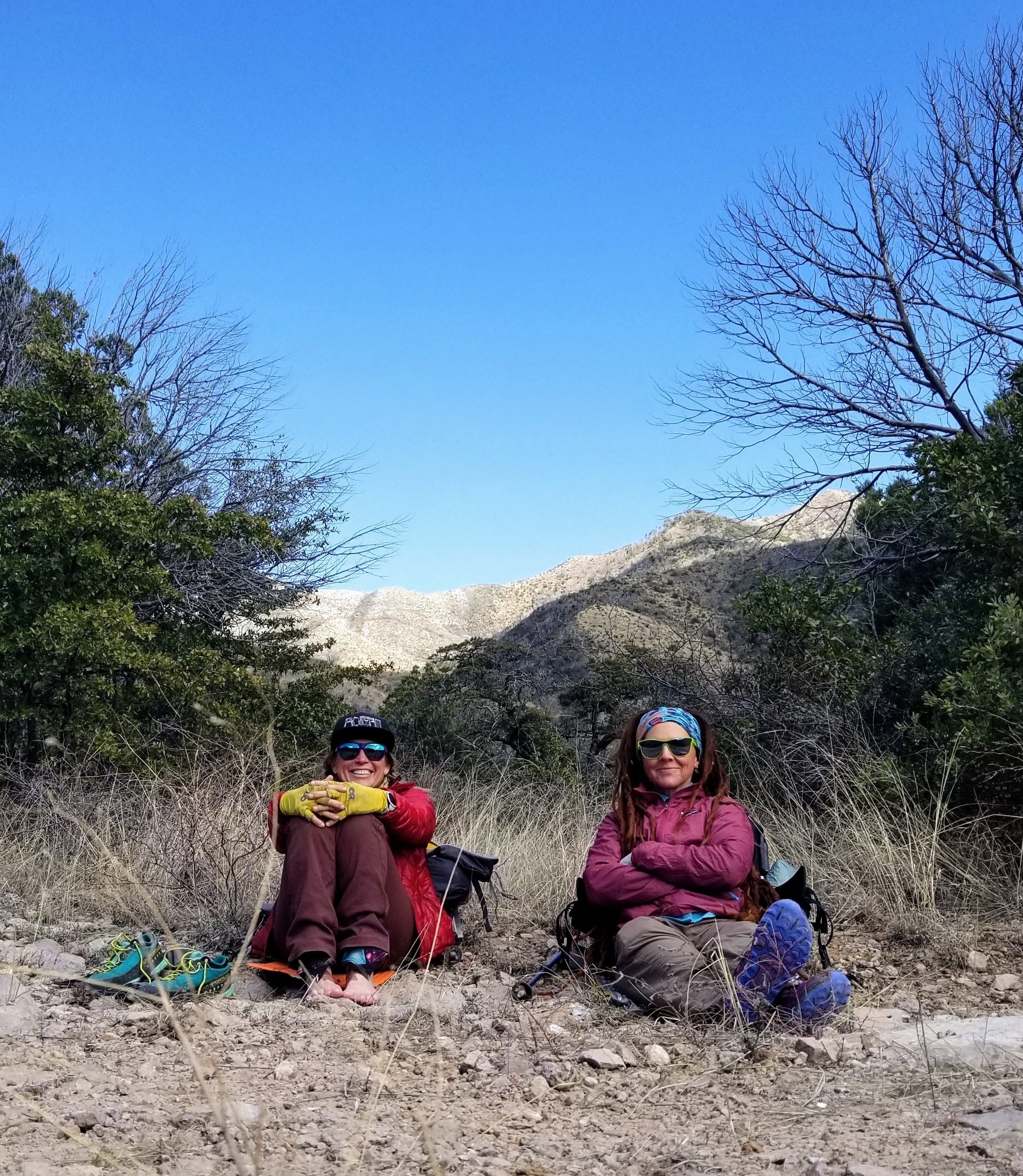
The wind is fierce at Hands Pass and of course we are sweaty from the climb so we get chilled very fast. Before we layer up once again, putting our puffy jackets on, we snap a quick victory photo at the pass. It’s all about the Jazz Hands!!
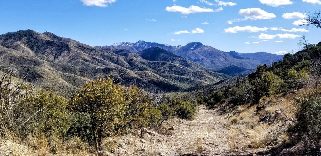
There is a long drop now and we stay on the dirt track for a couple miles feeling relieved to have a bit of easier walking. We finally get some views from up here and we can see where we came from this morning. It looks far considering how slow the going has been. Eventually, we reach the next intersection where we stop once again to regroup, which means eating snacks, drinking water and looking at maps. This is how we make good choices.
We are studying the maps carefully now as we have a two track for just a short bit and then it turns into the Shaw Peak Trail, where it may or may not be a trail anymore. Along the way to the Shaw Peak Trail we realize we need water. The two track parallels a drainage that we planned on having plentiful water like everything else, yet it is dry. Dry!
We wind up pulling from small puddles we find after scrambling down a pour off in the drainage. There is no water on this side of the mountain. Things have changed. The entire terrain has changed. We scoop up and carry 2L each which now has to get us through the the next 4 miles, through the night and then to Iron Spring tomorrow, which is 0.7 mi off route. It looks like all our water sources from here on will be off route. It also looks like we are back in the burns.
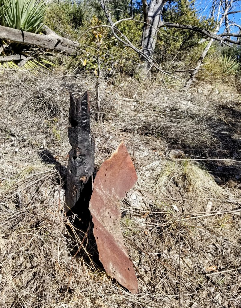
When we reach the Shaw Peak Trail it is difficult to discern that a trail ever existed here, yet we find an old, burned post with an old rusted sign to confirm we are where we want to be. When you see a sign like this, you know you have your work cut out for you.
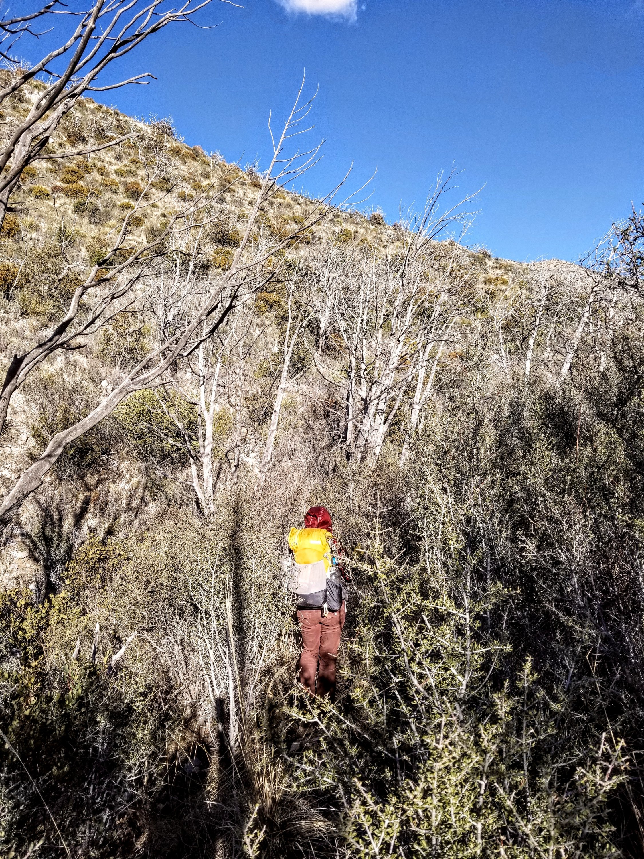
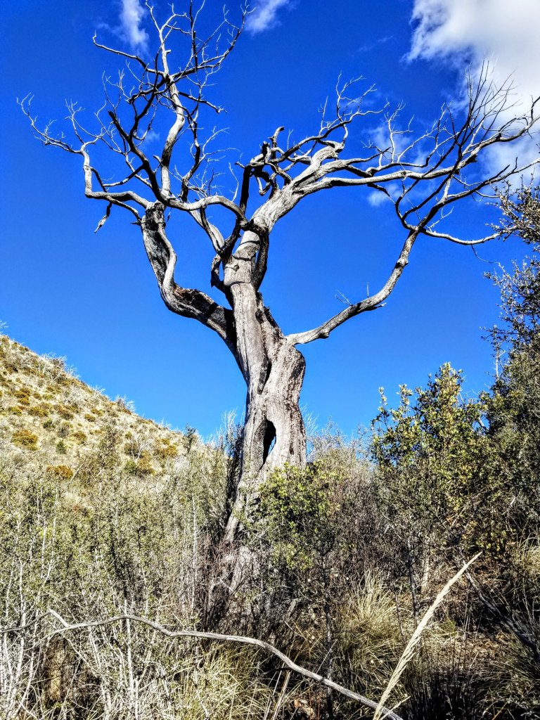
It looks like the burn was bad here, everything is super brittle, dry and very overgrown. We push through some heavy vegetation and crawl over downed burned trees right from the start thinking it is going to open up and perhaps get better. It does not, yet we keep choosing to continue. My instincts are giving me an inkling to call it quits here, turn around. I’m wondering if perhaps we should bail out on the dirt track we just left. That is what Purple Haze did here, he did not hike through this section. Knowing that, we also no longer have his trip report to reference so what lies ahead is truly a mystery.
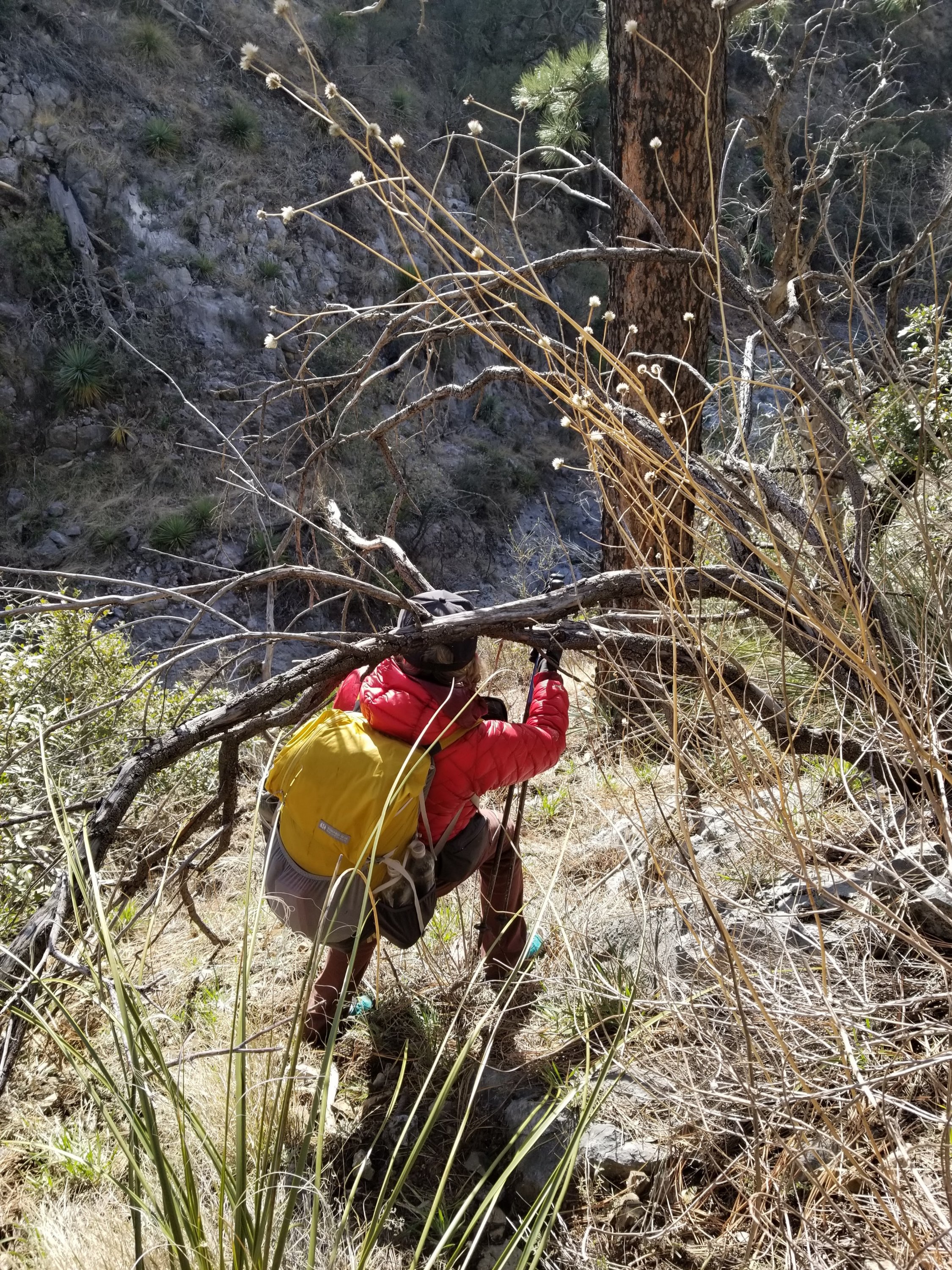
This is a long forgotten trail and we are now seriously bushwhacking, to the most high level. It is intense. Every once in a while there is a section of faint trail that we can walk at a normal pace for maybe 1-2 minutes and then it disappears again. Advise: don’t hike the Shaw Peak Trail unless you are super into bushwacking, which apparently we are.
This goes on until we finally reach a saddle and now we have to make another good choice. It is 5:30pm and we can camp here or we can continue and try to make it to the next saddle. We both think we see a faint trail that wraps around, hugging a contour under the ridge to what we believe is another saddle where we might be able to camp. It’s tough to tell, it is all in dead burned trees, but this route seems to make the most sense, thus we continue, all the while saying if it gets bad we can just turn back.
We quickly realize what we thought was a trail is not a trail at all and we are much too high anyway. After a bit of backtracking and losing elevation we are on some semblance of a path, yet still making very slow, tedious, forward progress. At least now we have shorter vegetation so we can see better, but it is some of the hardest going of all.
We walk on a steep ass slope with sliding rocks, sharp vegetation and gullies to cross along with hanging branches to crawl under. It is a veritable obstacle course and for some reason we keep moving forward having not lost hope. I start to feel the beginnings of mental and emotional fatigued but there is no turning back. It reminds me of the line from the song I am California: “you don’t know how deep you are ’till you get pulled back up” by John Craigie. We are in the thick of it and we have to keep going. The only way out is thru.
It’s been three hours since we left our last break spot and we have barely progressed a couple miles. As the evening draws on, the wind picks up considerably and begins whipping at a constant. Daylight is quickly dimishing yet the promise of a place to camp isn’t anywhere to be found. We are not on trajectory at all to reach that saddle like we thought so we are moving from plan B to plan C and beyond as we telepathically continue to pick our way along without words.
I start to feel a little nervous because of how slow we are moving, wondering how we will continue with this sidehilling in this bushwhacky schwacky sketch in the dark. Will we ever get anywhere? Just in this moment, I look up to see the sun dip below the horizon and instinctively stop moving, taking it all in. I need to witness the conclusion of the day and remind myself to trust. Just trust.

In the moment of stillness I gaze up above at the ridge and wonder if there might be some flat places in the vegetation and rocks. It won’t be easy to get up there but I feel compelled to try. I verbalize this idea to Rockin’ and we waste no time. We start bushwhacking straight up the slope, now immersed in super thick bitter brush, forging our way through until we reach the top of the ridge.
In one last forceful burst, we pop through the bitter brush on the crest of the ridge, landing in a small opening like entering a building and everything suddenly goes still. The wind has totally disappeared yet we can still hear it all around us. We are encapsulated, it’s like we popped through a portal to another dimension and it is such a relief. It ain’t much but after a few minutes of scouting around and re-arranging some dead fallen snags, we feel we can make this work for two tents.
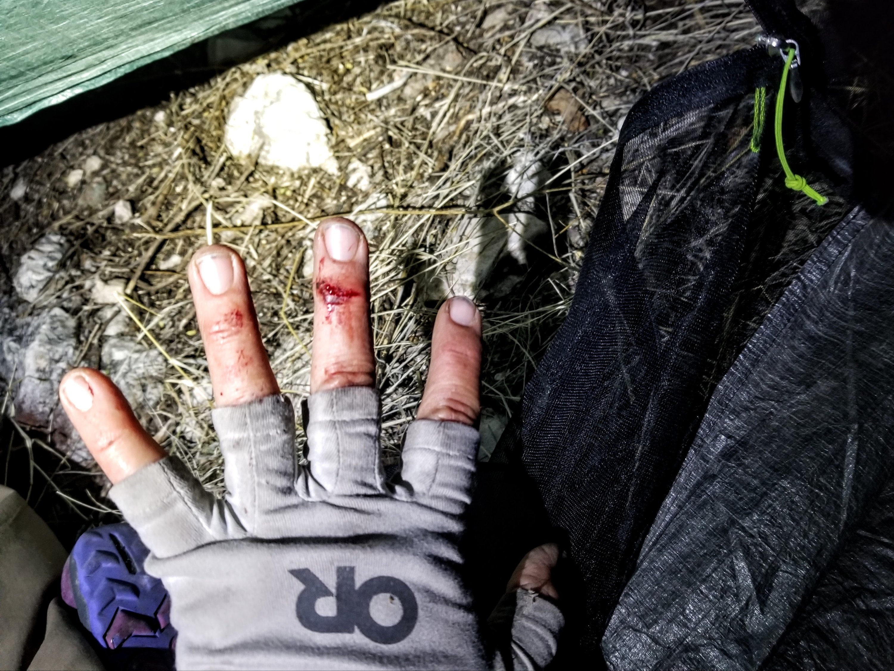
8:58pm. Okay, we are nestled in. Finally we are tucked away from the wind. Out there, it sounds like a jet liner is about to land right next to us. We are warm, fed and taking care of wounds. I cut my hand somehow when setting up my tent and it was bleeding. Rockin says she had blood on her face, probably scratched it on a tree branch. Our tents are super close together but separated by a thick swatch of bitter brush and so we have to yell to hear each other through the howling wind. It’s comical actually. We are in a good place; boy did the trail gods help us out with this one.
Rockin’ said that the conditions we hiked thru yesterday were “melt down” conditions, yet I felt more hopeless toward the end of the day today compared to yesterday, but in retrospect I say it was really just the last two hours. I could definitely have used another snack but skipped it given the nature of what we were doing. I know better than to skip snacks and still, I ignored it. When morale starts to fade, you need to eat snacks, super important.
But it wasn’t only that. It was a combination of the day getting late, not having any real hope of the trail getting better, no prospects of a place to camp, then the wind picking up. With loosing daylight and being hungry as well, I started feeling like I’d rather turn back as moving forward seemed like an exercise in futility.
In my mind, I momentarily flirted with type 2 fun territory, not because I felt in danger, but because I just wanted to find camp, get out of the wind and get food into my system. I’m positive that had I stayed on top of my snacks it wouldn’t have felt so dire. Thus, my dinner really hit the spot and I feel loads better now. Truly all my needs are met and I love the feel of being in my tent, as you know. I am actually super comfortable and happy in the present moment.
Tomorrow, we have more to do in the way of challenging terrain and all of our water sources are off route. I am looking at my maps for the course ahead and wondering about bail outs, but there ain’t much. I am not sure we can make the rest of the trip in the time we have, given the nature of the present terrain. We are due to climb up to snow level tomorrow and if that is also in a burn area, we sure are in for it.
Not to mention, my fuel is running low, so is my battery pack, and my food will last me only two more days. I can do two more days but truly no more. I really don’t think that’s enough to get us to the end of this route, especially if conditions continue like this, or become more challenging due to the snow. We are both hauling around microspikes however, so there’s that. Welp, I suppose we will find out soon enough. For now, it’s time to shut the eyes and quiet the brain, I am ready to tuck into slumber. Year number forty six sure has started out with bang!
Click the link here to watch Rockin’s Reel of Day Six: “Happy Birthday Mary Poppins and the bushshwhack from Hell”

I discovered this blog via Jaunting Jan’s, and I really like it, so I’m a bit wary of making my first comment with what’s really a nitpick, but here it is. You mention turning 46, but also mention starting your 46th year, but it can’t be both. When you turn 46 you finish your 46th year and start your 47th year.
Thanks for more rich content and beautiful images.
Thank you so much, glad you enjoyed following along 🙂
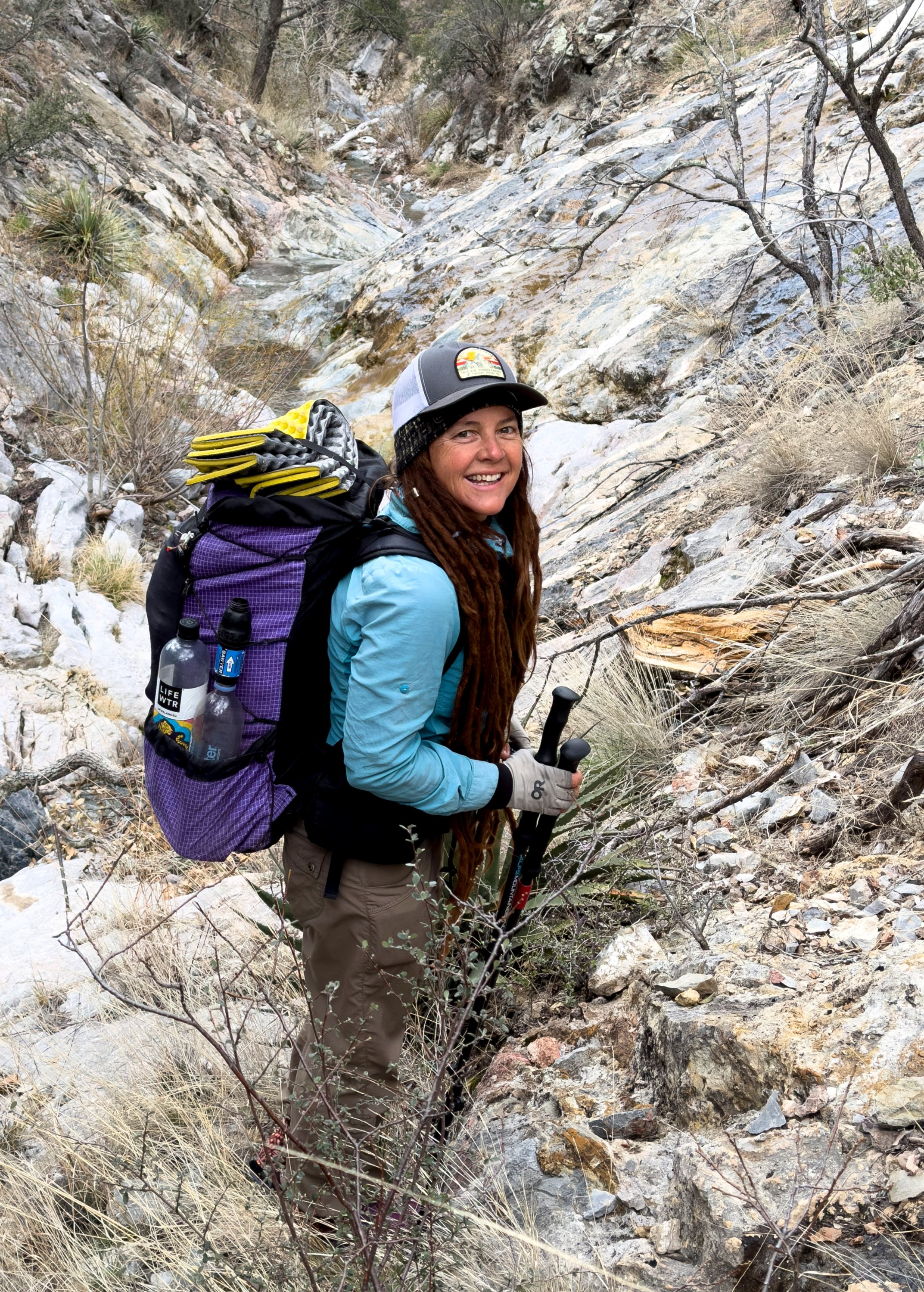
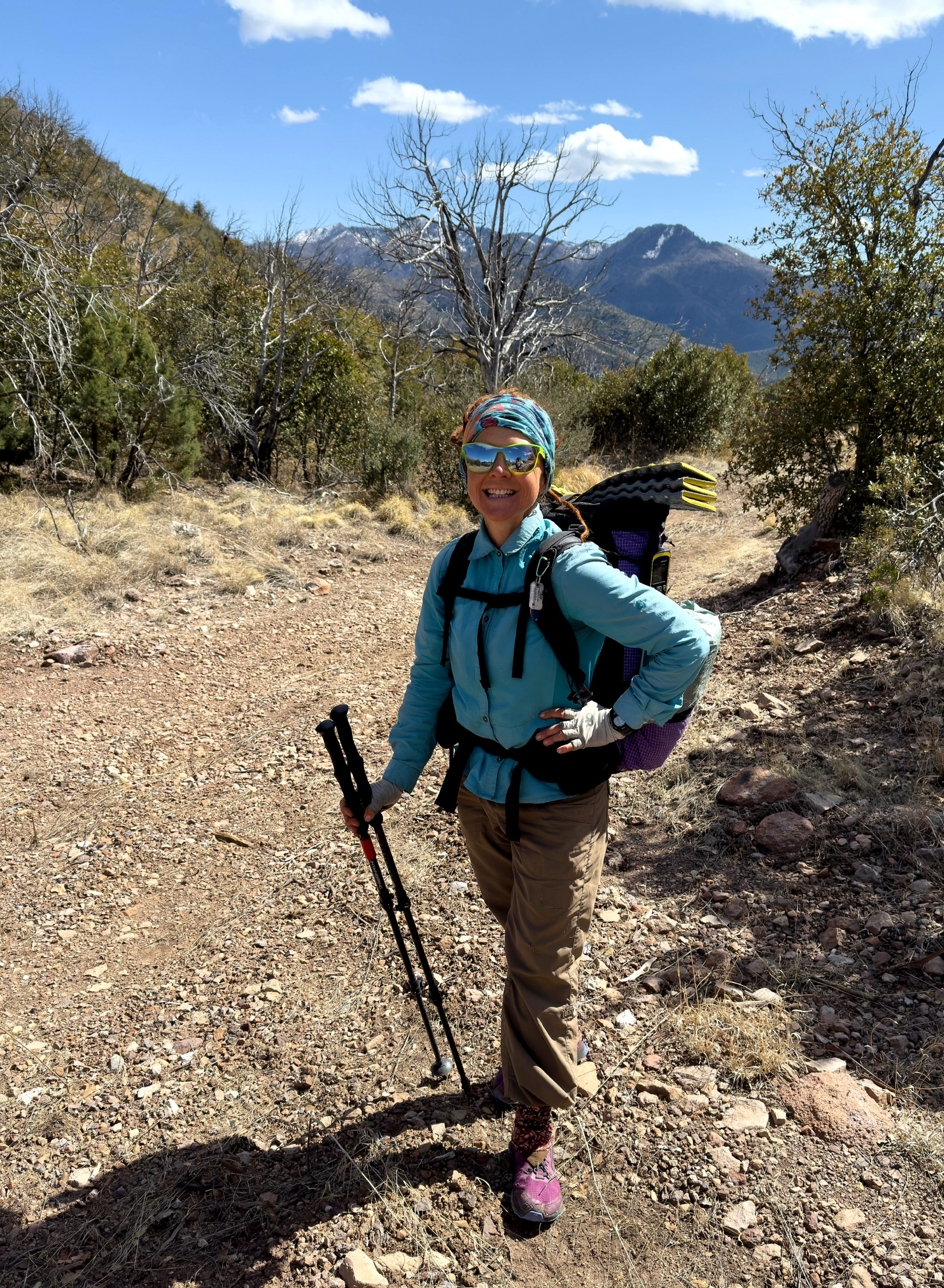
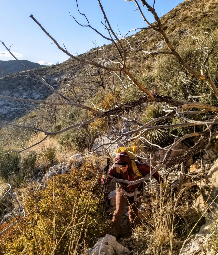
Hey Mary Poppins. Nice picture of you in Indian creek gorge heading into the thorny unknown. Your great colors, purple pack, blue windbreaker and nice red hair along with your ( I’m having a blast lets do this hike ) birthday smile, brings to mind music lyrics from Graeme Edge. ” Blasting, billowing, bursting forth with the power of ten billion butterfly sneezes, man with his flaming pyre has conquered the wayward breezes, climbing to tranquility far above the cloud, conquering the heavens clear of misty shroud.” Oh and the John Craigie song, ” I am California “. Wow! Really nice, thanks bunches for that one. Ed
Hi Ed! Somehow this comment dlipped through the cracks, sorry I missed it but glad I found it now. Thst’s a great reference, lol, which song was that? Oh, and “I am California” is one of my favorites too 🙂
What a memorable birthday. Happy belated my friend. This is terrain few experience or imagine. Sharing opens possibilities but mostly earns respect. Looking forward to the next installment.
Hi Jan!! So sorry I had not responded to this comment! Thank you and definitely chipping away at the ‘ol blog little by little in between other adventures 🙂
No worries you’ve been doing important work during the short hiking season.
Hi M
This epic day seems so emblematic of the partnership with Rockin’ you’ve built. The journey you share is a series of here it is, now here it isn’t. Success and challenge, holding accomplishment in your hands and then feeling it simply dissolve as another obstacle rears up. Too hot, too cold. Plenty of water, no water, nice trail, tangled bushwhacking. You hold each of these in your experience only to have them slip away, like the ephemeral emotions they trigger. And as with all journeys you must continue by trusting in yourself and in the choices you make. And that is so much easier with a true partner.
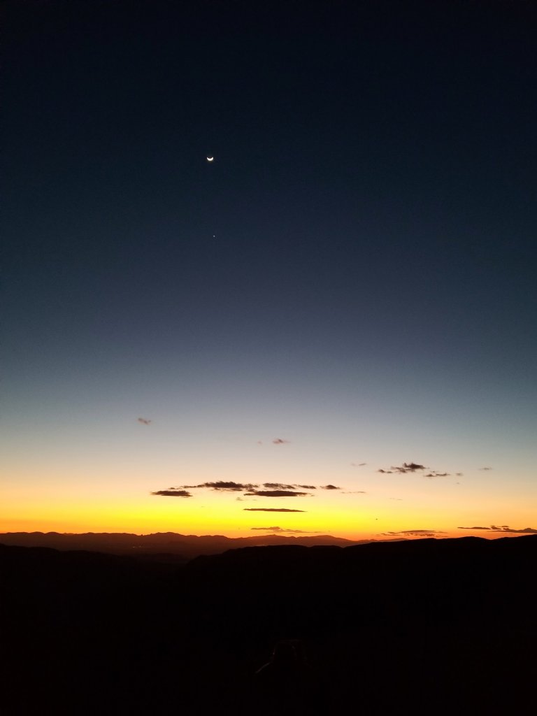
I’ve found myself in challenging situations both alone and with a friend. The indefatigable reserve inside you that is stoked by a partner manifests beyond words and is infinite in its’ capacity to engender perseverance. I don’t know if this was an intended theme for this post, but that’s the message I’m getting. Trust, persevere, walk on, and you’ll be rewarded with delights sublime, as characterized so beautifully in your image of the crescent moon above a pastel of oncoming night.
Sometimes the best times in the backcountry are the hardest, gnarliest, bloodiest, dehydrated ordeals. Thanks for reminding me of just how awesome the payoff can be when you strive to continue in the face of hardship.
Happy Birthday, M!
Tom!! Sorry for the delayed response! I love everything you said and agree. Thank you for your reflections and insights. I am very blessed to have Rockin’ as a partner and yes, we have created that very bond along the way.