
March 23rd 2023
11.7 miles + 3,616ft
Campsite Elevation 7,097 ft
“Today was that day, critical to evaluate every decision we made, the concequences could be high. It is why we are here.” ~Rockin’
I was dreaming. It had something to do with bulldozers coming into my house and destroying my things and I was mad and yelling. The alarm chiming at 5:15am saves me. It is still dark out, I sit up straight, taking in a few deep breaths. As I sip my coffee I look over the maps for today waking my brain. Things were not lining up yesterday and now I realize we are still two miles from the TH at Emigrant and we still have to pass by Mulkins Ranch. It ain’t over yet.
It is light out by 6:00am and the birds are certainly letting us know it’s a brand new day. I hear at least six different kinds. There is a thicker cloud hovereing over the mountain here, then other low thin clouds that spread like webbing.
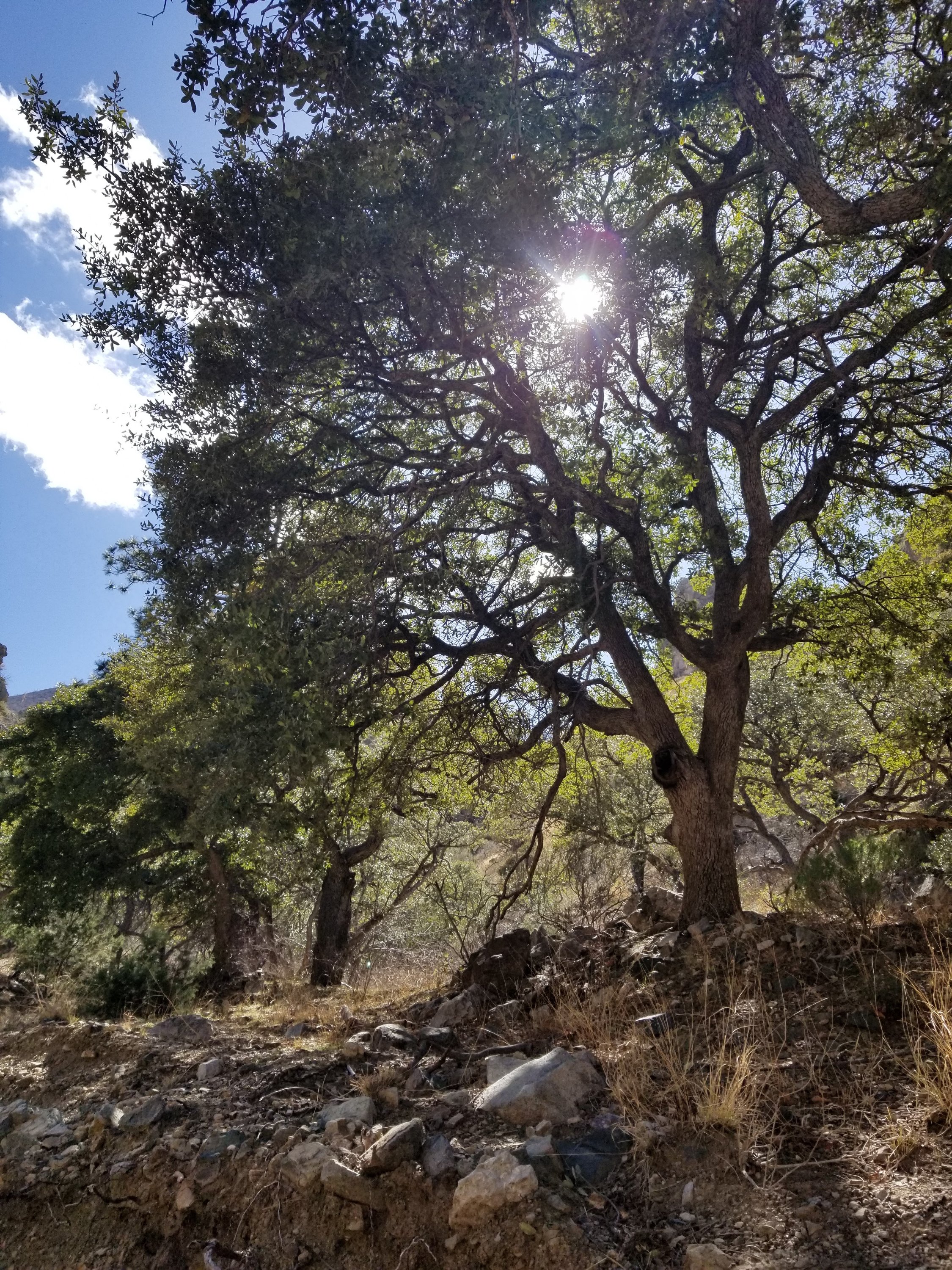
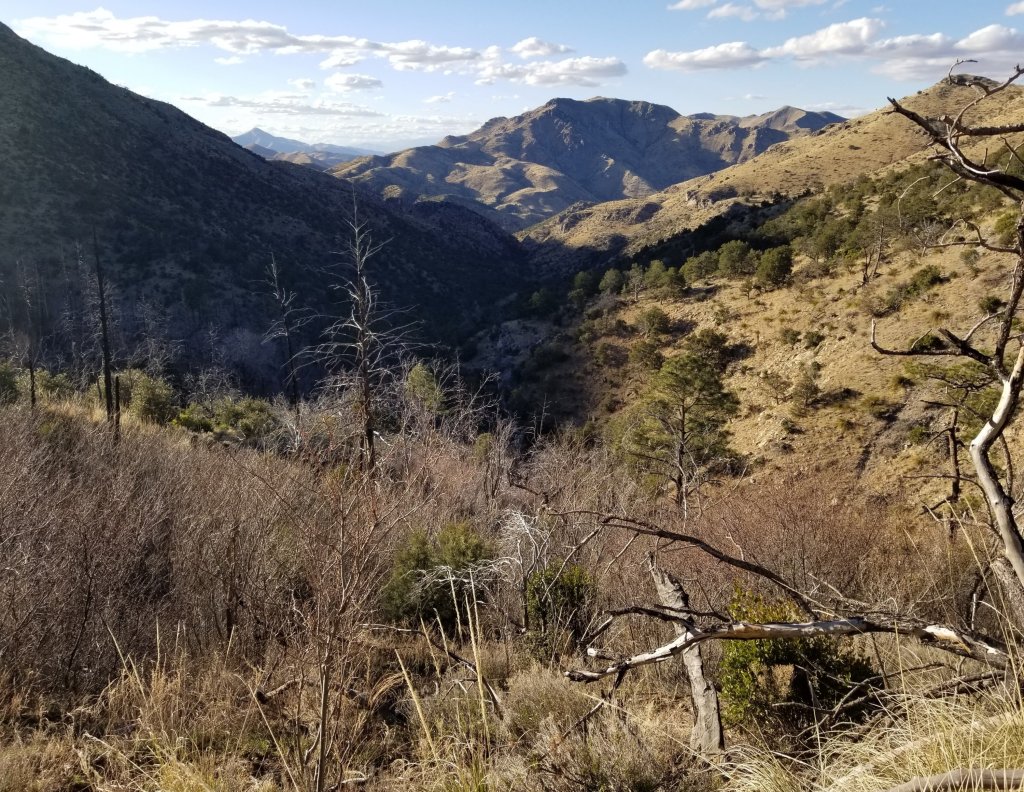
When we start walking it’s shortly after 6:30am and there is a chill in the air. The moisture adds to the effect and I make a joke that it’s like hiking in the Pyrenees with all the billowing clouds, it’s almost misty. We have a couple miles until we reach the Emigrant Canyon TH and we are still walking on a dirt track so we are able to move fairly fast. There are washes along the way with water flowing and there are huge Sycamore trees that dot the land, adding tremendous beauty.
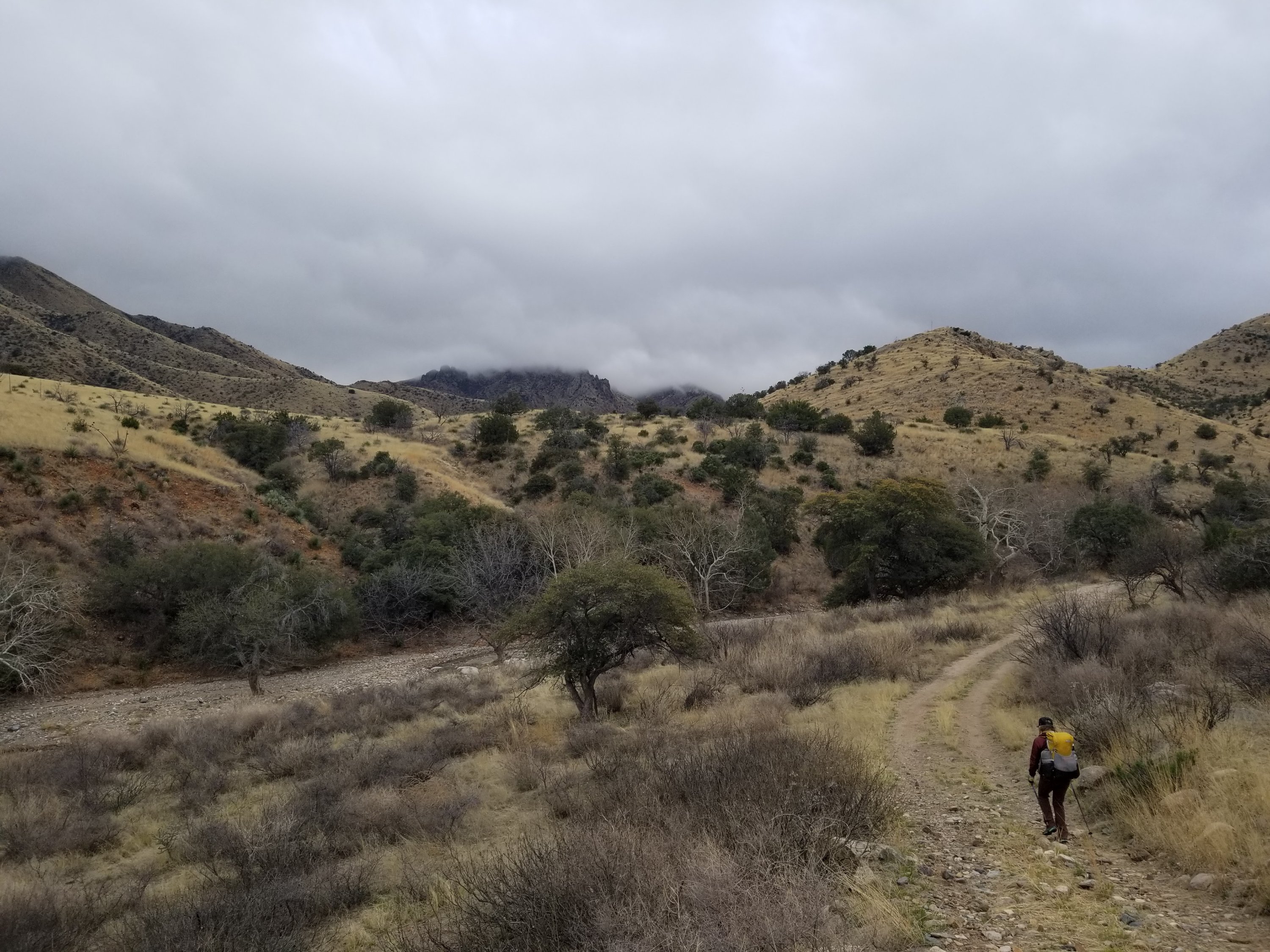
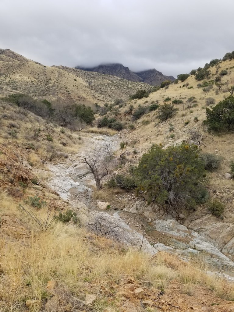
We pass by Mulkins Ranch expecting a much bigger operation than it is, and we are relieved when we don’t run into any people asking us about what we are doing. The only thing that happens is a few dogs barking at us. We can handle that. We walk by unscathed and then pass a cattle trough that would most likely have been a water source had we hiked this route last year. This is a very unique year to do this with such an abundance of water. Finally, we reach the site that indicates we are heading up to Emigrant Canyon and are super relieved. Then we see the National Forest boundary and we know we are in the clear, whoo hoo!

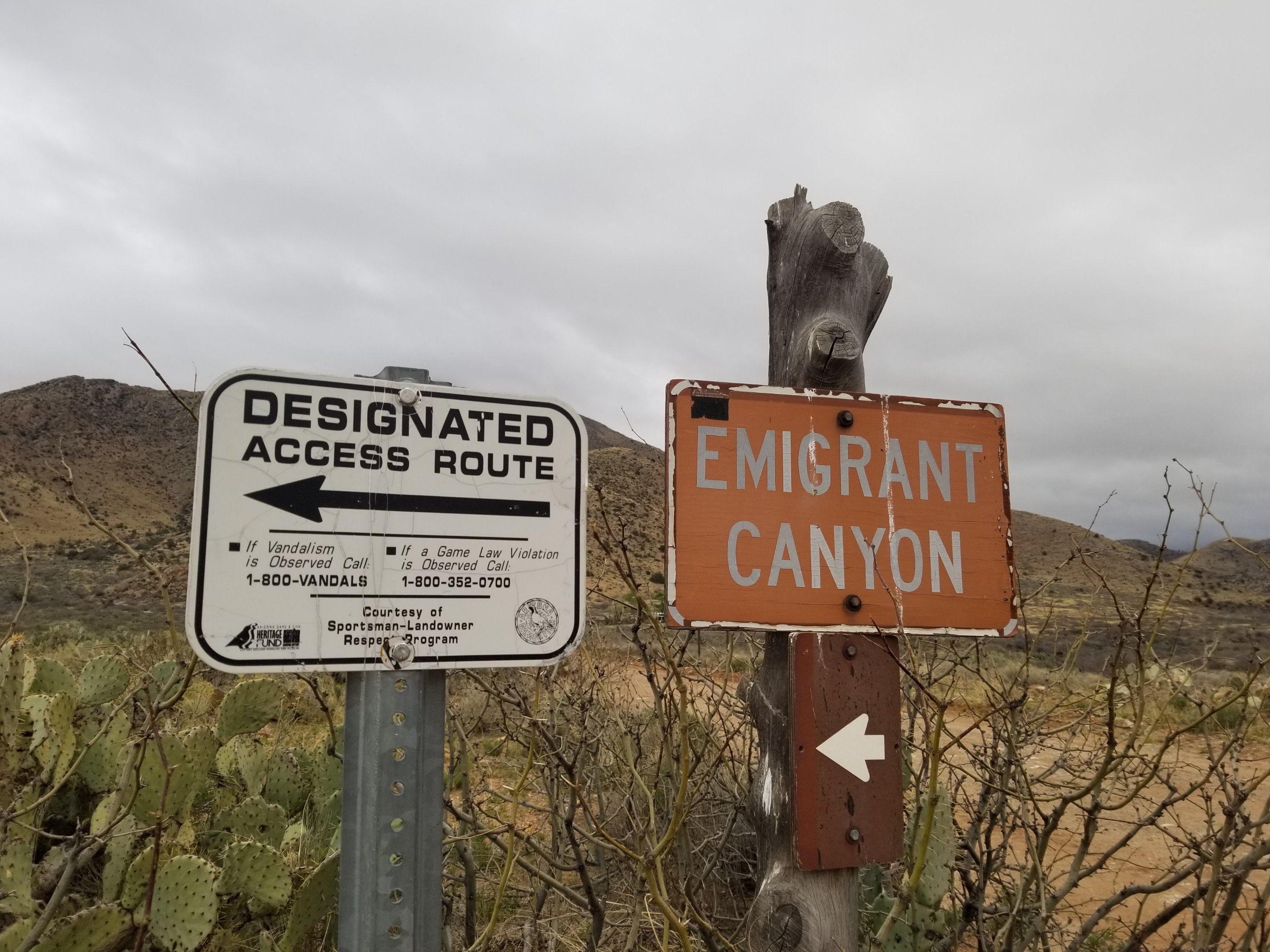
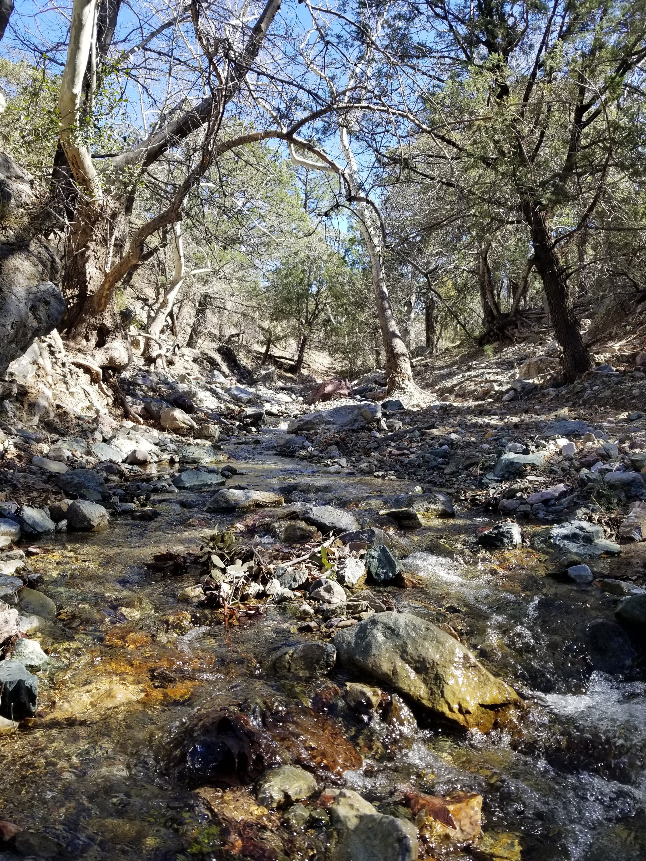
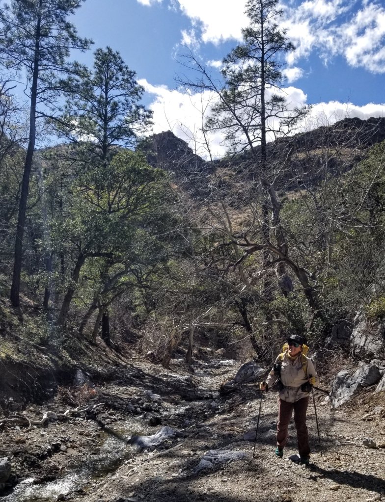
We start making our way up the creek that is the main drainage for Emigrant Canyon knowing that eventually we are aiming for Emigrant Pass. It is a little unclear how far that will be and of course how long that will take us. Much of this next section of the Sky Islands Traverse uses old trails, so while our map shows a trail, we expect it to be overgrown and underused. The Trailhead is nothing really, the only reason we know it’s a trailhead at all is because the two track dirt road turns into a single track and then we lose it within five minutes. We are now just following the creek and weaving in and out, jumping over the water and occasionally walking a semblance of a path.
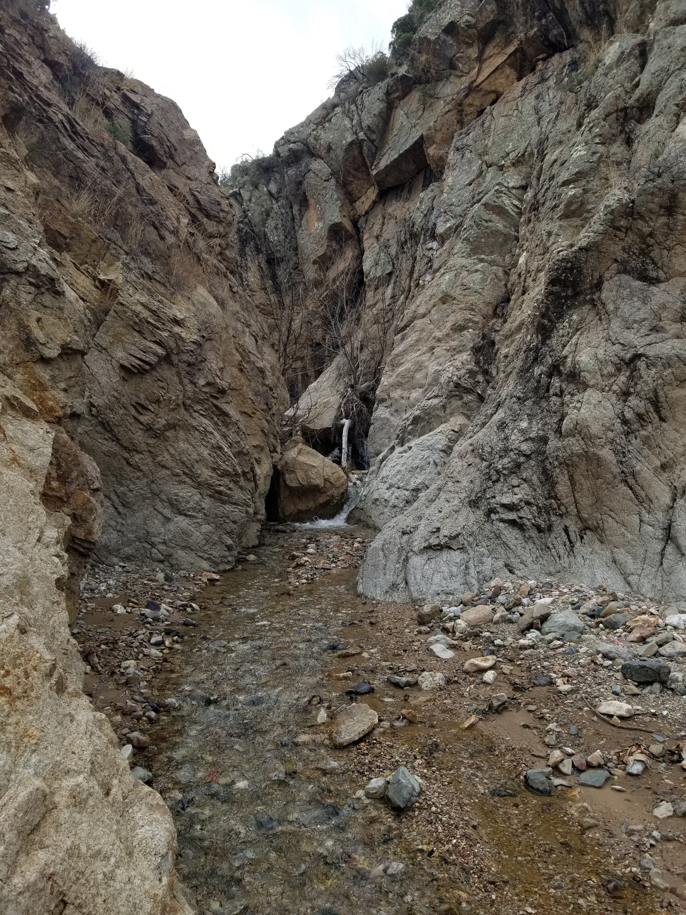
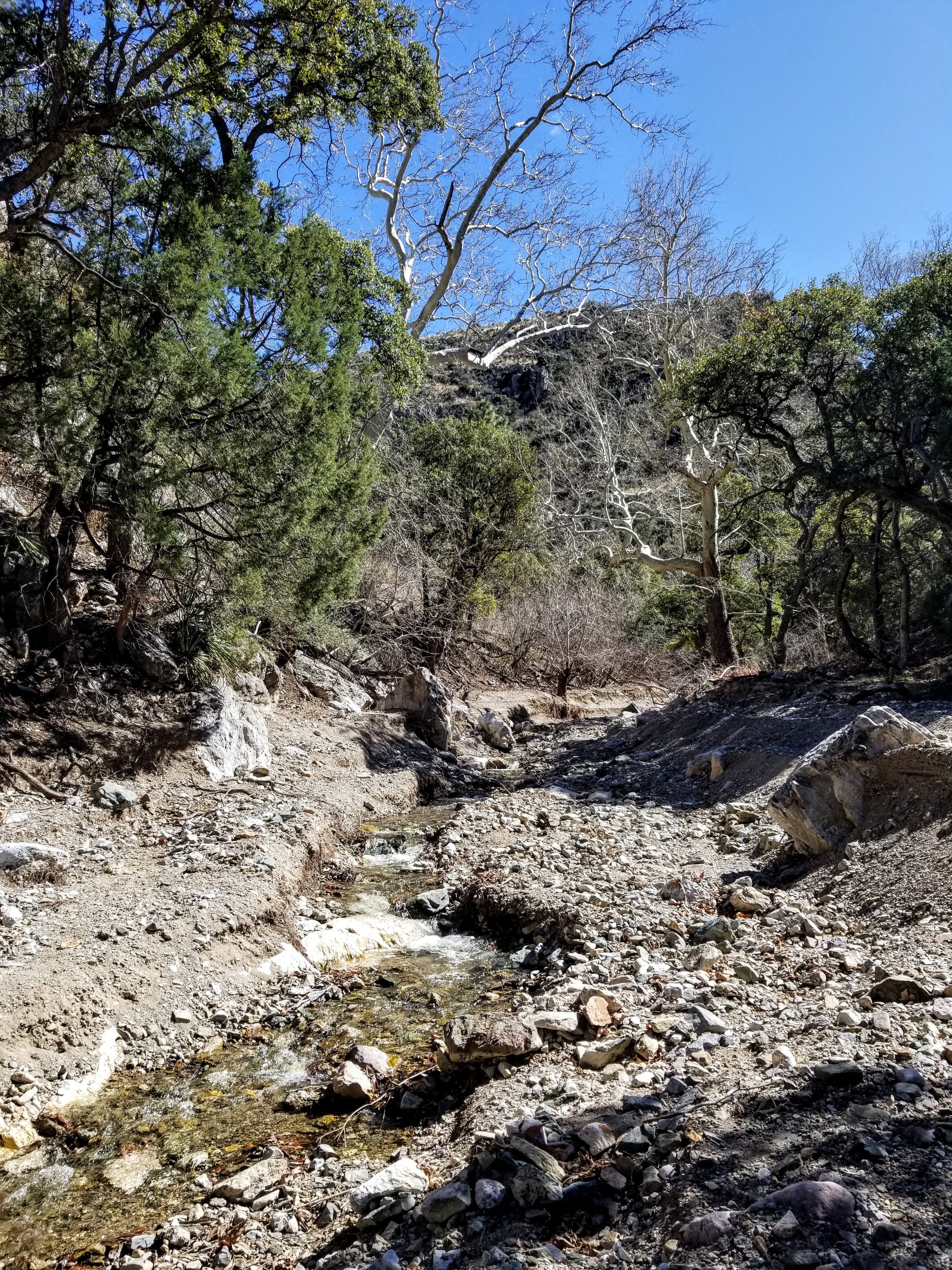
We have to pay attention to a couple of pour offs that are impassable so heed the proposed route and find ways above the water course in those sections. One of the side trails takes us super high above. After a couple hours we notice the water is disappearing and we are about to start climbing. Along the way we pass through a place noted on the map as Hells Half Acre. What a name.
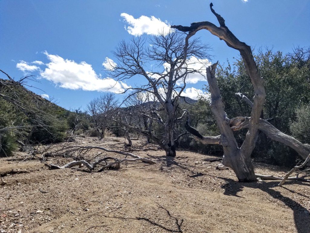
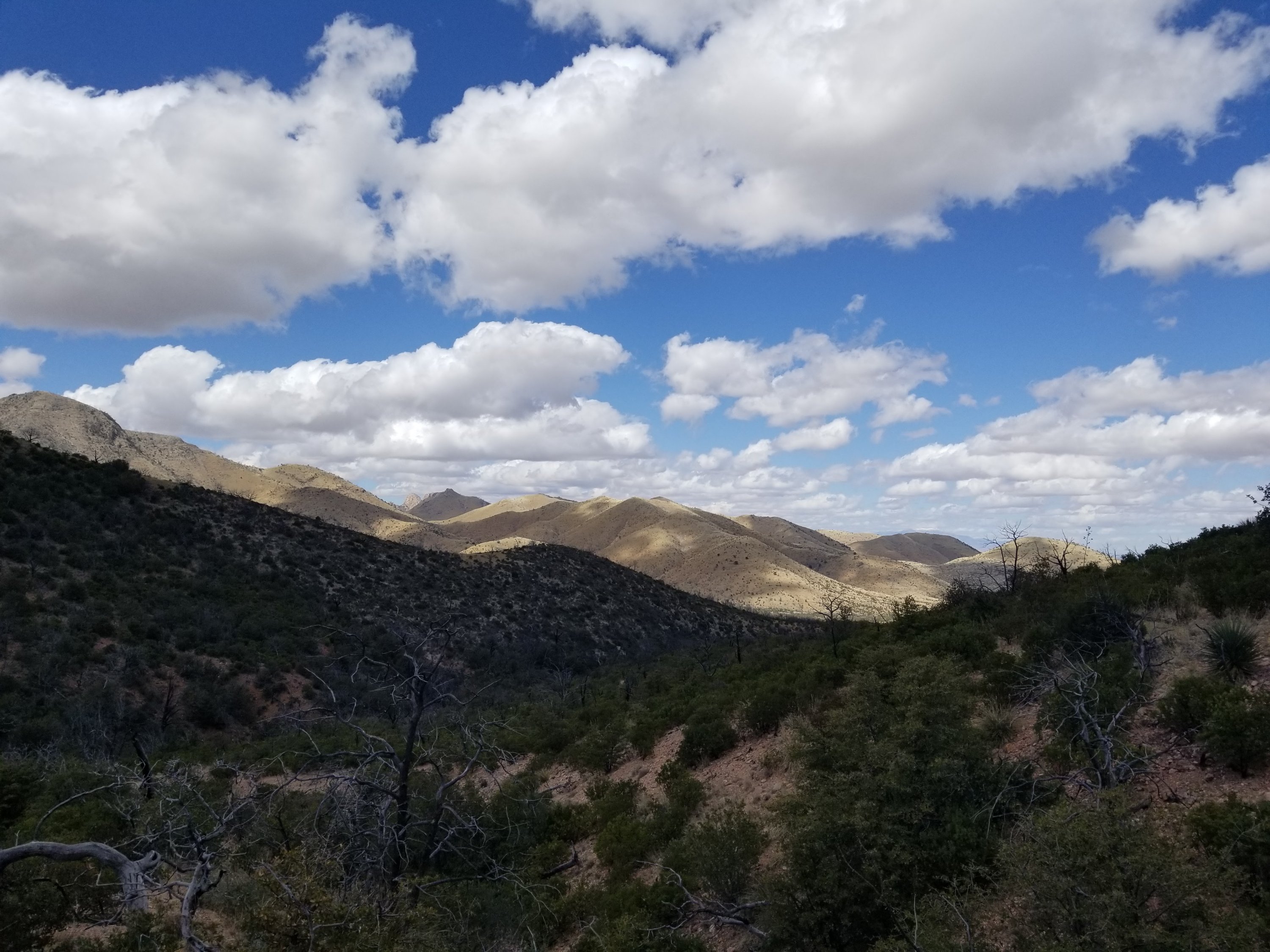
We collect enough water to make it up and over the pass not knowng how long that could wind up taking. Nor do we know how reliable the water on the other side might be. Shortly we are walking up a dry wash with old burned trees and no more water. This entire area on the hillsides above got burned a while back, you can see the mixture of devastation and re-growth. We are now negotiating a dry trailless trail as we start the steep climb up to the pass. Along the way we see some bear scat, good to know they are alive and well out here. Pretty cool.
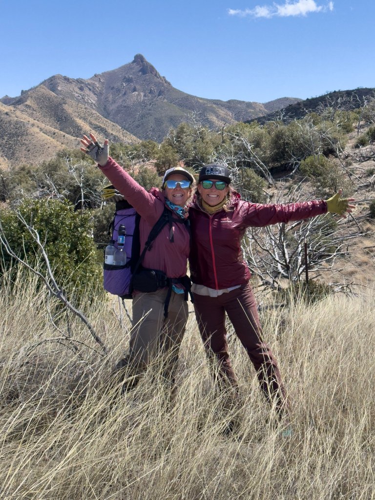
Making our way up to the pass we have to stop and navigate with map and compass to ensure we go to the correct place. I tell you what, that is just the most basic and simple skill that will never fail. Looking at a GPS is super helpful for micronavigation and terrain analysis but good ol’ map and compass just really helps you see the big picture. We aim our trajectory to the pass and soon figure out we have a lot of lumpy terrain to cover along the way. When we finally get there we feel like we have achieved a small victory and thus take a celebratory photo at Emigrant Pass.
It is getting on in the day already and we are hungry and want water so we start our way down the next canyon towards Bitter creek where our next water source will be. It is steep and we find several pieces of evidence that people have been here. We see cut logs, old fencing, and we even pass by a dead horse. At least that is what we think it was, could have been a cow, but could have been a horse. It is gruesome and we can’t allow ourselves to get too close, it has not been there all that long.

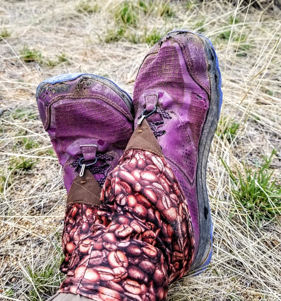
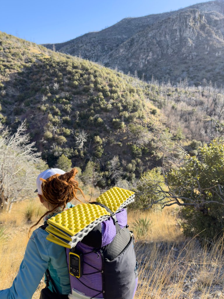
We stop for lunch at Bitter Creek and the water is plentiful. We eat a lot, and make coffee and I eat so many of my potato chips I have to be careful and ration them from here on out. I decide to tape up my left ankle as it has been really sore, all this side angling on slopes and very steep, uneven terrain is really aggravating it, plus my shoes don’t help or give much support. I’m wishing I wore my TX4’s and am kinda jealous of Rockin’s. I’m having shoe envy.
The crux of our day really comes afer lunch as the terrain becomes extremely rugged as we move into Wood Canyon Park. The burns in this area really did a lot of damage and then flooding came after that so a lot of the creek and ravines are totally wiped out, divided, and the trail that once was here is gone as well. We are super thankful for all the cow trails we are able to follow as they give us little bits of a clearing in the otheriwse really overgrown and steep terrain. There is a lot of route finding and detours, ups and downs, crossing water back and forth, one side of the ravine to the other and such. We are picking a lot, this whole afternoon is a lot of slow, slow picking, we are lucky if we are even making 1 mph.
Our minds are set on a saddle that is only 0.8 mi away as the crow flies. When we take our last break of the day it is 4pm and that will be the final push to camp. I am brain tired, with the intensity of navigation on both a micro and macro scale, my brain is just exhausted from the hyperfocus of the day. I really need snacks.
At Wood Canyon Park, we pour over our maps and look at the GPS again and again, and then look at the terrain that we are walking on. In our data book here it reads “trail x pass/crazy vague since Wood Canyon Park”. Okay, that’s what we have to work with. If it was crazy vague in 2010, you can imagine what it’s like 13 years later after fires, floods and re-growth. We think it is a totally different world.
We pick our way down to the ravine, only to then climb up a super steep, loose slope. And I mean steep, I am wondering if it is like 60 degrees, probably more like 40 but it feels like 60. I am digging in and slipping at the same time. Eventually we look at our location and see that we still have another couple ravines to cross before we reach that saddle. The ravines are super deep, narrow, steep AF and full of downed burned trees and rocks and water and who knows what else. Not great hiking. It is not getting any earlier either.
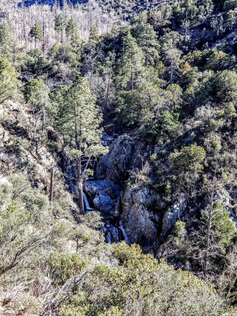
We continue climbing the path of least resistance, along the way we see more bear scat and a couple of the white tail deer, they have really large fluffy white butts. They are like ghosts, they move so quickly and then disapear into the brush. The next ravine we approach is the steepest and deepest yet and there is a huge waterfall in there, along a gorge with a ton of water. There is no way we can cross it. Supposedly if we could get to the other side, we would pick up an old trail, linking to the ridge and finally the saddle. Not going to happen. We have to make good choices here. We decide to go to Plan B.
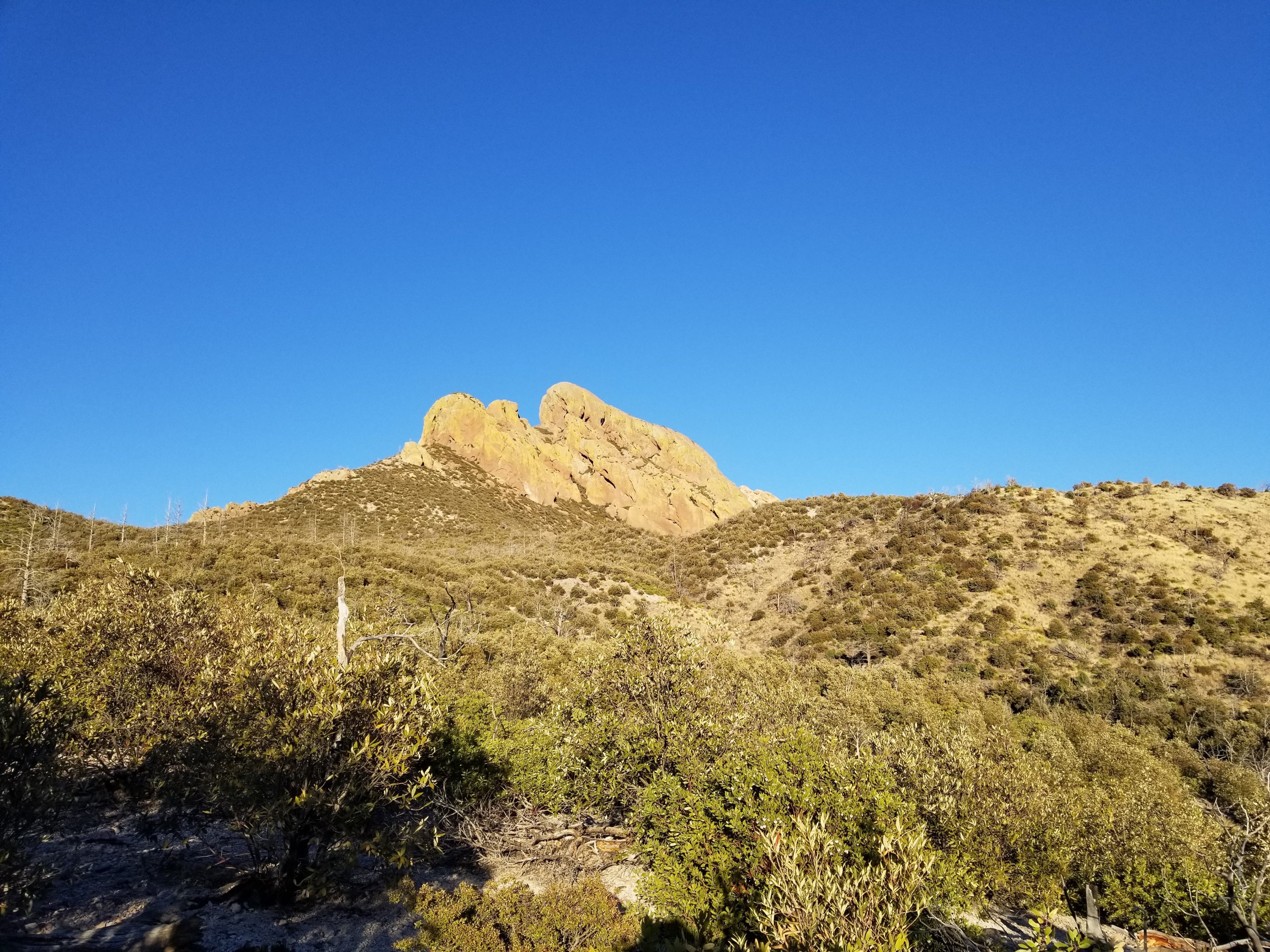
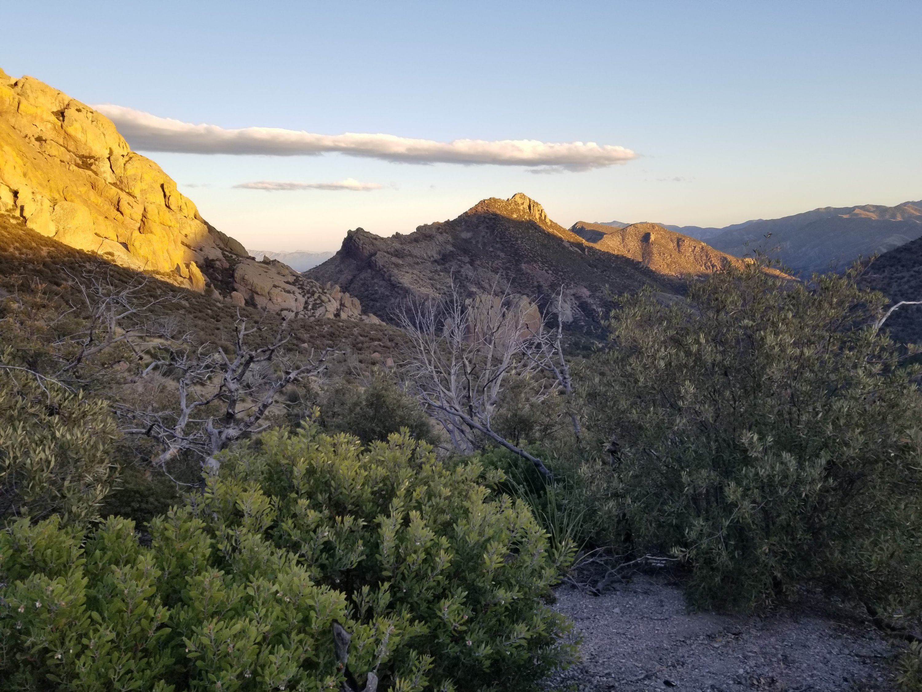
We once again look over the maps and GPS noting that we are making our way super close to the prominent rock feature called Cochise Head. It dawns on me that perhaps we could hike up to that ridge and then cut over to our saddle. When we look at CalTopo again we see there is a “trail” up there along that ridge that would go to the base of Cochise Head. Perhaps people hike in on that trail to get to the massive rock. We are thinking if we go up to it and contour over, we should be able to pick up that old trail and cut over to our saddle and be back on our route.
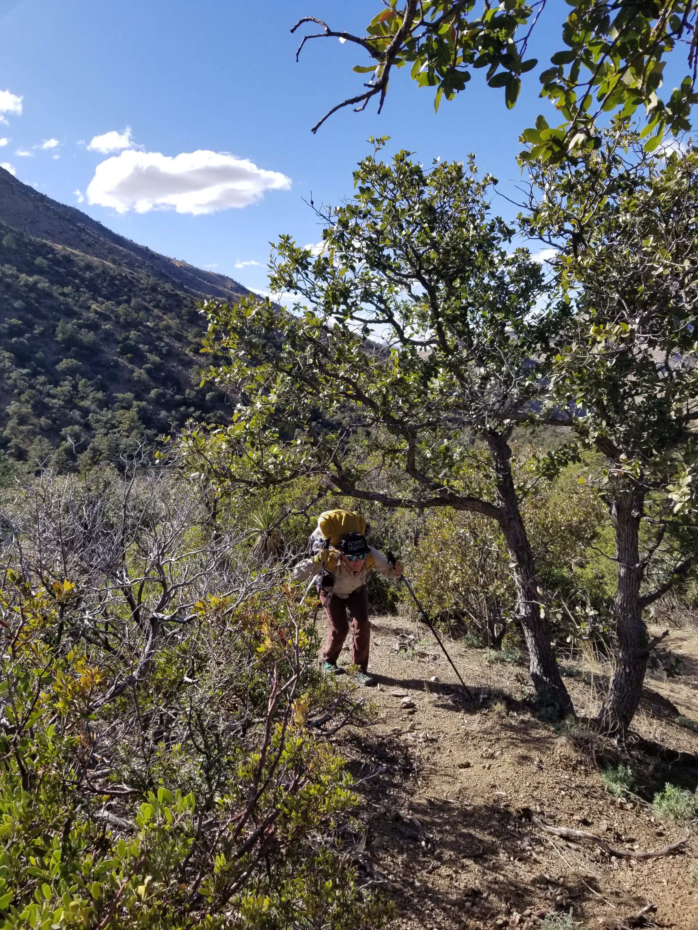
It is definitely circuitous but a lot safer than the ravines. Great, we have a plan! Thus, we start making our way straight up through thick Manzanita on a sandy slope with old burned tree skeletons. We are very fortunate here as while it is still super steep climbing, and we are carrying heavy loads of water, it is better than what we would be doing in those ravines. Shortly, we find an old barbed wire fenceline that has fallen over which we repeatedly almost step on but it provides a line of definition.
As we push the last segment to the ridge it is getting super windy. We are so sweaty from the climb we have to stop to layer up. We take a moment here to search for the trail that leads up to Cochise Head. When we find it we are ecstatic, even if it’s only a faint trail. Like everything else, it is super overgrown and there are lots of old burned trees, sharp poky vegetation and the like. Alas, the cows save us again. As we follow their tracks, they lead us through the thick brush.
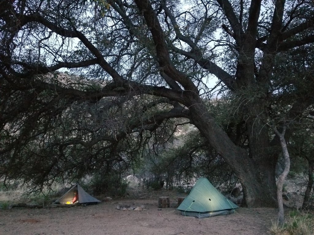
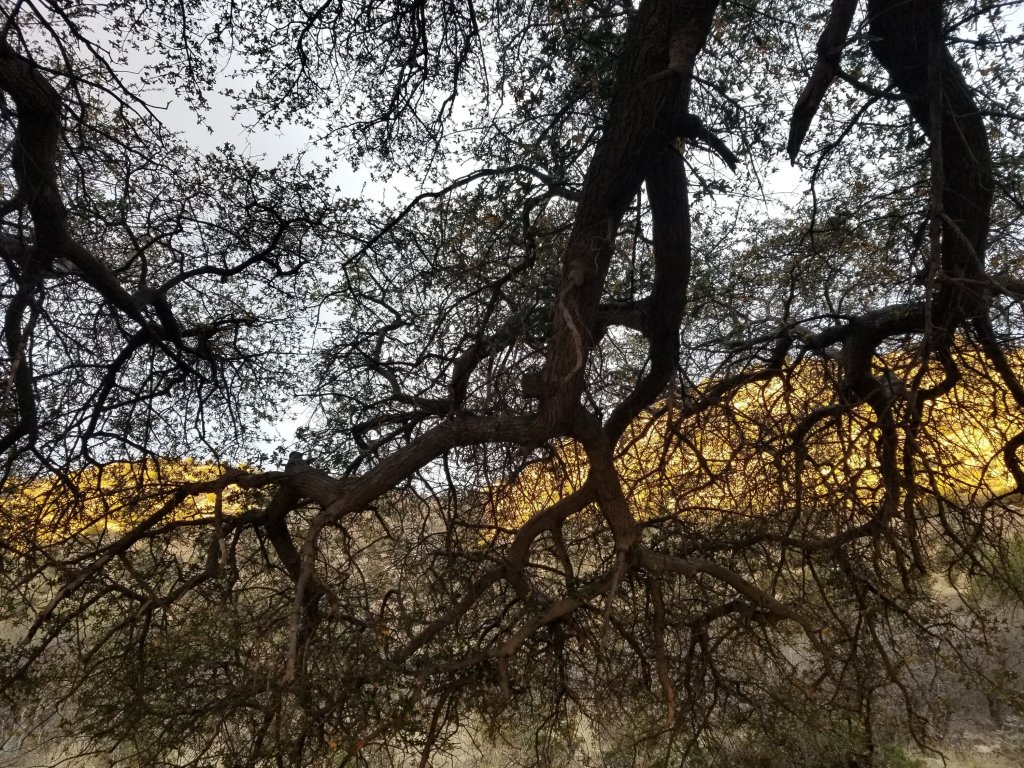
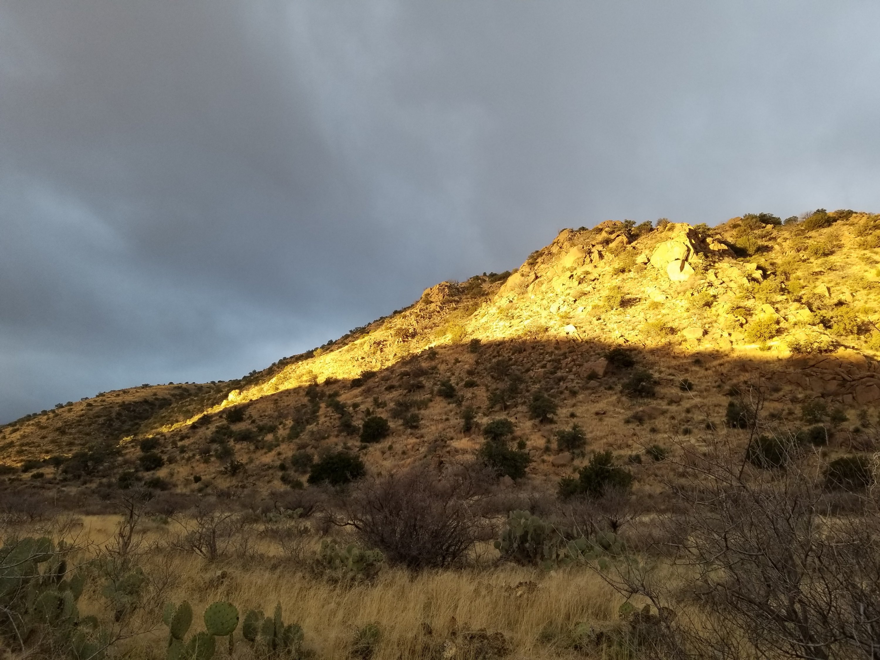
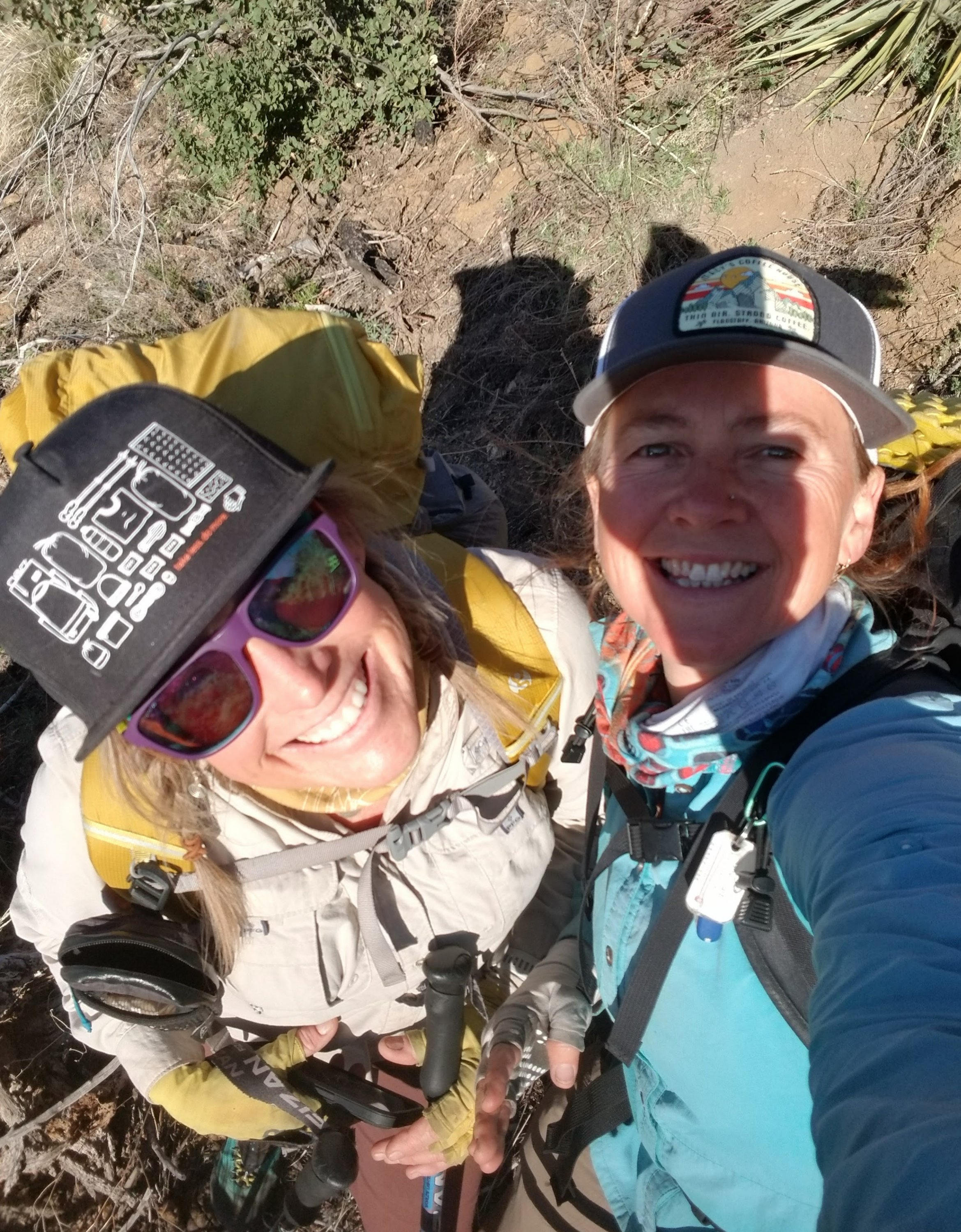
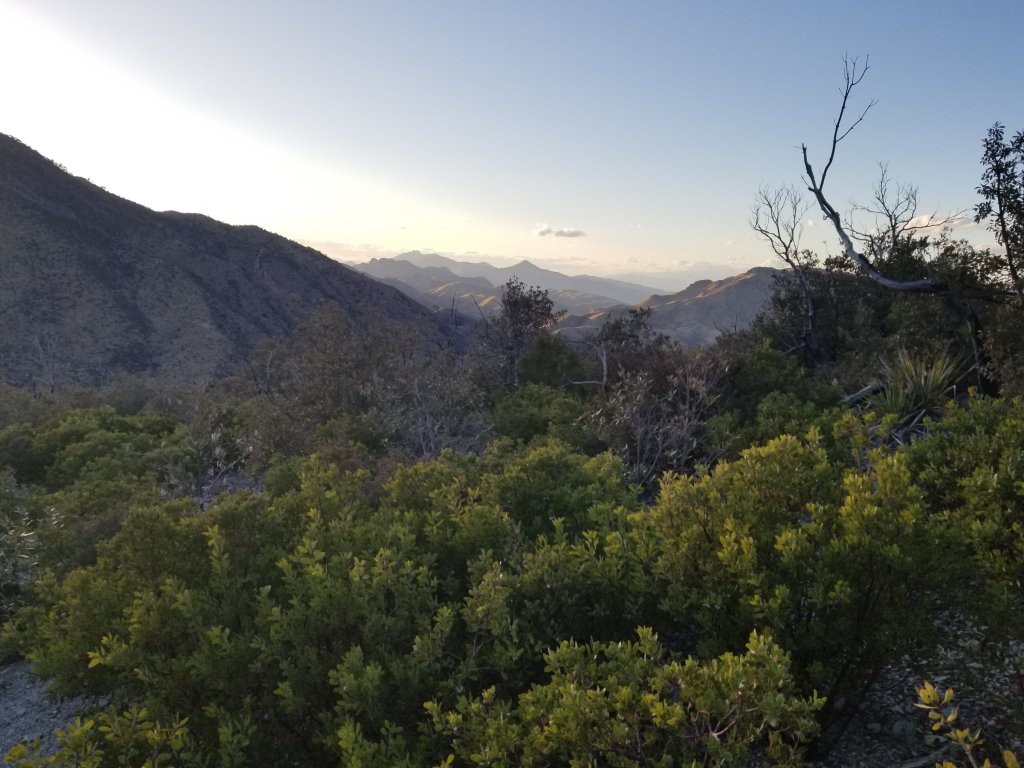
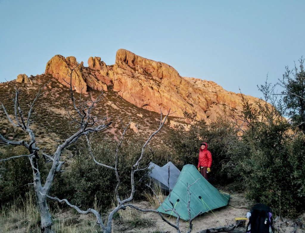
It is 6:00pm by the time we crest the ridge and the sun is just setting along the opposite side. We find a little saddle on the East side of the ridge that’s somewhat protected from the wind. Here we scout out a couple places to pitch our tents after removing large fresh piles of cow dung. But we are thankful for the cows, really we are. We are afforded wonderful views from up here both to the North from where we came and of the Cochise Head which now has golden sunset light clinging to it’s lichen covered face. It is a super cool rock formation indeed and I am excited we are actually going to get to camp under it.
We finished the day strong and happy with our achievements, it was definitely one of the toughest days of hiking I have done in a while. There were elements of the ruggedness and steepness that I found more effortful than a lot of other things I have done, involving new body contortions and the constant effort to avoid getting snagged or dragged. Yet the mental concentration and use of my brain was probably tougher than anything, as I found myself getting brain fatigue. That last snack was so needed and really helped pull me through this final segment.
It is hard to imagine all that we saw and did when I look back on it. Pretty amazing, and pretty crazy that this is what I choose to do for fun. I’m so thankful I have a friend who wants to do these crazy adventures with me and who also thrives in these situations, willing to work through the challenges with an active mind and open heart, smiling and laughing the entire way.
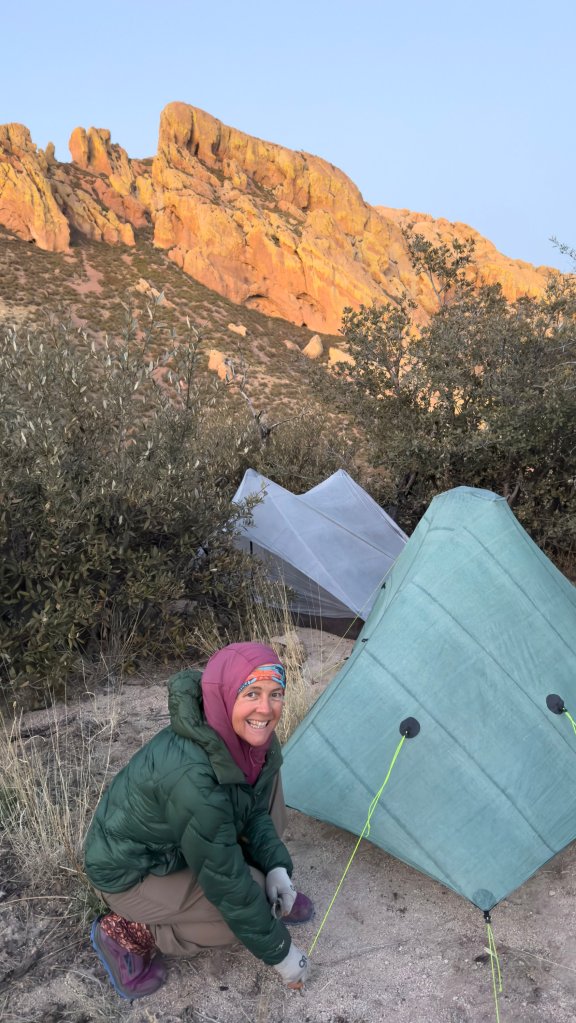
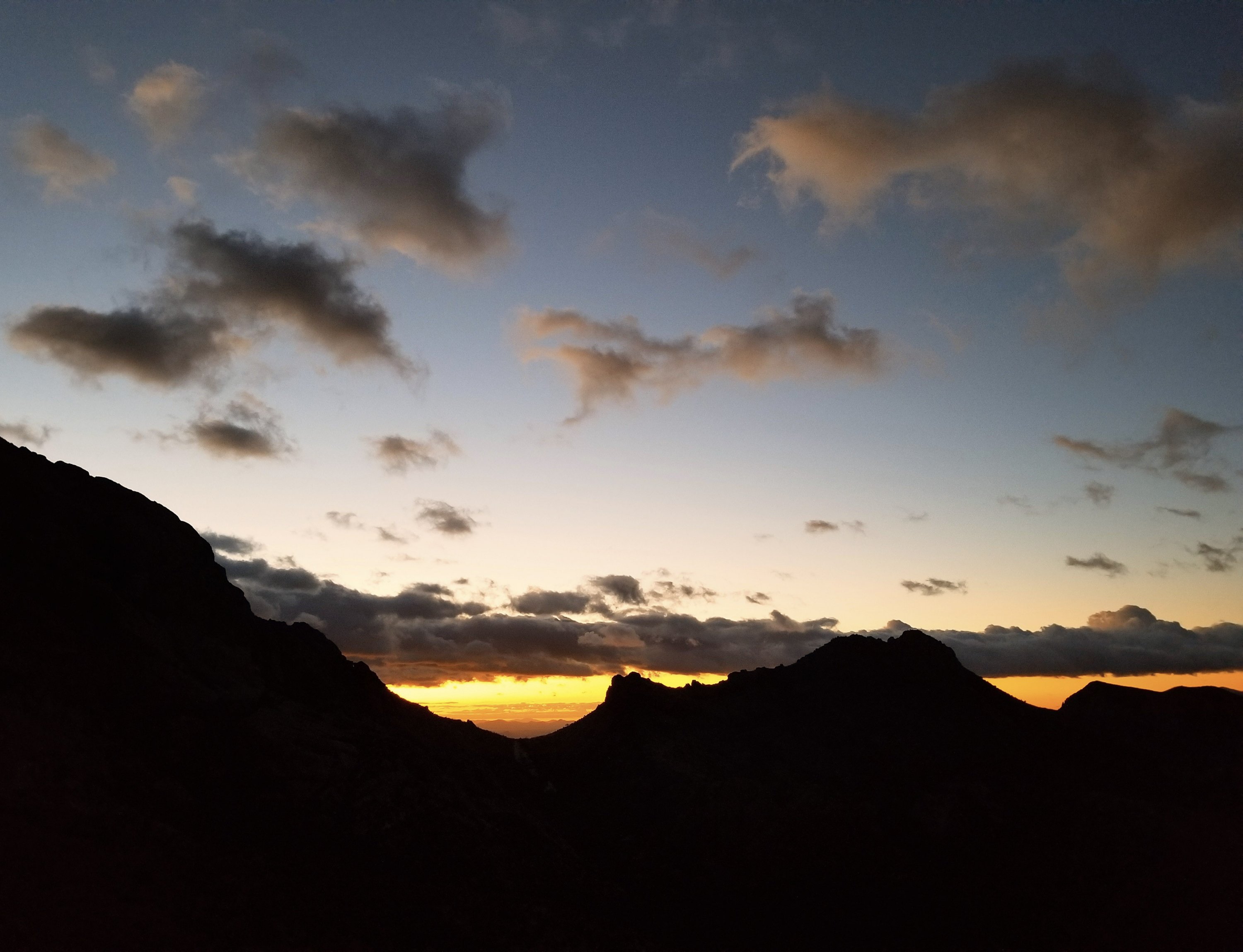
Its 9:20pm now and I’m all tucked in after massaging my feet and calves. It is 35F out and the wind is even chillier. It was worth it to go outside one more time to pee so I don’t have to wake in the night. And those stars tonight are some of the best I’ve seen in a long while. On the tail end of the new moon the darkness is thick. The wind is intermittent now and besides it’s occasional gusts that flap my tent doors or the background swirling in the Manzanitas, it is pretty silent up here.
Tomorrow is my 46th birthday and I’m very glad to spend it doing what I love. We have perhaps the most rugged and challenging section to tackle right off the bat tomorrow, so tonight’s sleep is just a reprieve. It’s difficult to say how the rest of the trip will go, we are truly in a super remote area, there are old trails that link up which we will string together, but no real bail outs. It feels like we are truly out in the wild. It’s rugged country in these here hills and I love it.
Watch Rockin’s Reel for Day Five on Instagram!

Wow…sounds and looks like amazing terrain! You are both rock stars for traversing it so gracefully!!
Thank you Ray! It was a great adventure indeed, the challenges made it even more rich! More to come soon 🙂
Wow number two…
Skilled you two impressive images and narrative.
And Happy Birthday Moving Mountains…
Thanks William! Day 6 gets even better…lol…coming soon 🙂
Happy Birthday Moving Mountains…
Thank you!! Best way to celebrate another revolution around the Sun 🙂
What a fab team. Rare to find that kind of compatibility. Great descriptions. I felt like I was there with you.
We have found we are quite compatible, I am so thankful for that, I have hiked solo so much as you know, it is a great new aventure to share these experiences with a fellow female who is so full of grit, so passionate about being out, and who keeps me laughing the whole way 🙂
And boy do you ever need laughter to get through some of that grit.