
Nov. 28th, 2022
27.8 mi
It was chilly again last night, I could feel the drafts, that’s what you get with such a light set up. I don’t have a thermometer but IDK I’d guess it’s around 39F. No condensation though so that’s great. I stop my alarm when it chimes at 4:00am and duck my head in for just a few minutes. I lay there thinking I could really keep sleeping (story of my life) but then imagine that I can do this, Yes, it’s going to be a push, but this is my chance to try and reach my goal as today I get out and do this, tomorrow I can sleep in. As I fell asleep last night I said to myself, I just have a marathon to go, that’s all. If I were truly running this, I would be done in say 5 hours right? I should make it at a fast walk in just 9 hours and that will get me there awful close to my goal time. All I would’ve had to do is get up an hour earlier and I would definitely make it. This is where I just don’t have that edge. At least not on this one.
I light the fire for coffee and mix up a weak cuppa Joe saving the one spoonfull I have left of the dark elixer for this afternoon. Im hoping the same magic with that cocktail of maple syrup, coffee and ibuprofen will happen again today. This morning that knot in my back is insane. How can it hurt so much? I thought all this movement might help work the knot out. Apparently not. No pun intended. Okay it’s time to focus. I’m excited to get to see this section of trail, I wish I would have seen more of it last night, the vegetation around here is quite remarkable, it’s a little ironic I am hiking through it in the dark. Welp, that just means I will have to come back!
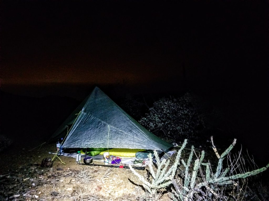
When I start walking it’s 5:00am on the dot, don’t ask me how I did that. The dark sky is peaceful with several patches of glowing stars and a few wisps of cloud cover that rolled in during the night. Within about 15 minutes of walking, I notice my headlamp seems super dull and it shouldn’t since I put fresh batteries in just the other day. I mess with the settings and it’s no use, I can hardly see and this is slowing me down. However, I just happened to bring a second headlamp because I was planning to try out using both of them together, one on my head and one on my torso and haven’t tried it yet, so here we go. No better reason than now to give that a try. I have to stop and take off my pack to retrieve the second headlamp and do this as quickly as possile, slipping it up around my waist and clicking it on. This light is so much brighter! Wow, good decision!
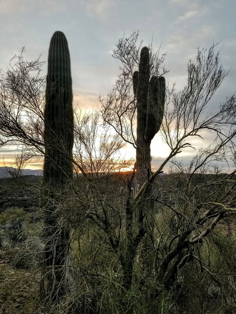
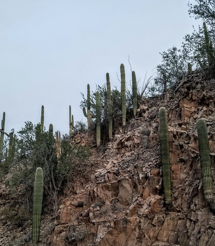
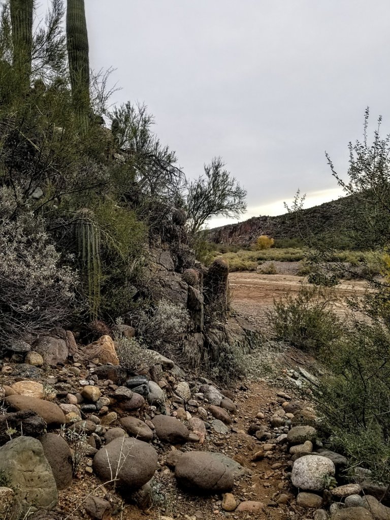
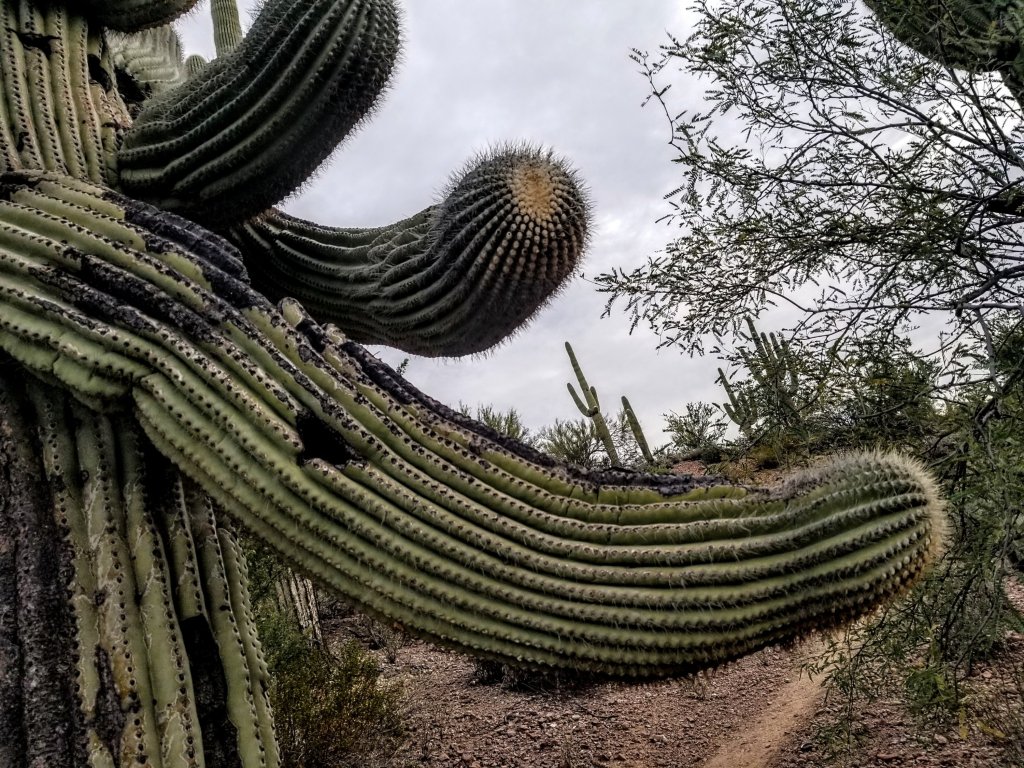
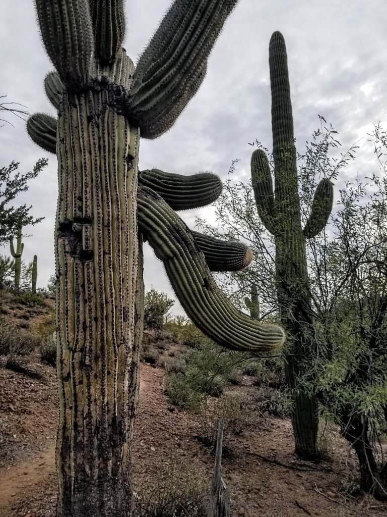
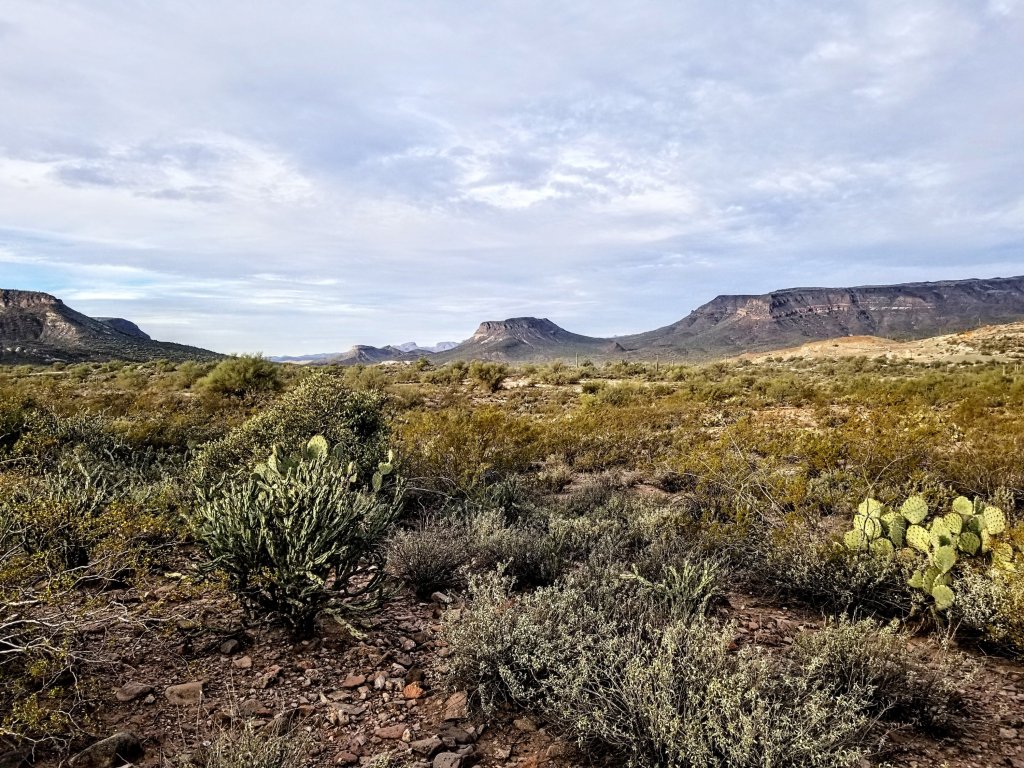
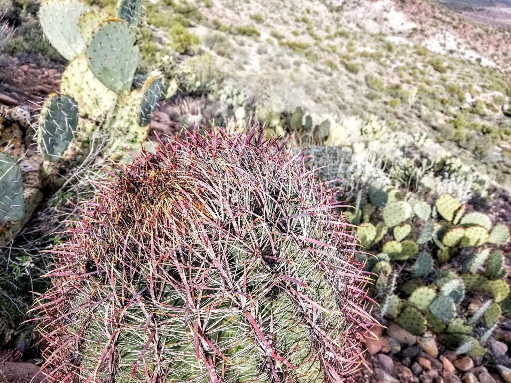
It remains cold as I walk and I keep all my layers on for quite a while. Apparently I did all the climbing there was to do last night as the trail now just winds through the Saguaros on a steady contour. There are now barrel cacti, ocotillo and mesquite trees and it seems as if this section would be really beautiful in the daylight, though walking along now in the dark of early morning there is a sense of great expansiveness that is unique to the wide open desert. The sky above me looms so large and I feel like a teeny tiny speck on this great Earth.
It seems like forever and a day and it is still not getting any lighter out. I keep glancing at the horizon to see any signs of daylight to no avail. Strange. I start having thoughts like what if today is the first day in the history of the Earth that the Sun doesn’t rise? Creepy thoughts like that infiltrate my mind and I have to push them away. I console myself with the reminder that at least I haven’t been hiking or running through the entire night like many folks do in long races. I’m not sure how I would handle that. That seems really mean. I could maybe do it in a place I am already familiar with since that way I would have some idea of what to expect and track my progress. Otherwise I don’t know. I guess I’m just not there yet. When I stop to pee there is steam coming off the Earth where my pee hits the dirt, the light of my headlamp shines on the vapors like it’s a hot cuppa coffee which I wish I had more of. Haha!
At 6:50am I begin to see some pink on the clouds to the East. Yay! The sun shall rise!
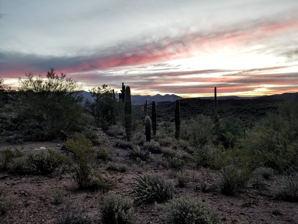

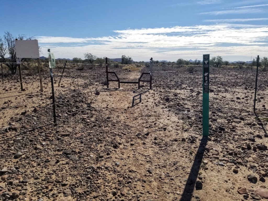
It is finally warm enough to layer down to just my t-shirt and long sleeve merino that I slept in and finally light enough out that I can eat my cold soaked granola while I walk. The landscape flattens out and widens here as I approach the first of two loop options on the BCT. Honestly, I never looked at my paper map this morning and basically checked the GPS track on my Cal Topo to be sure I was on the correct track. I never saw a trail split here, but in retrospect, I can say I wound up taking the Williams Mesa Segment of the loop split. I believe the East side of this would be the Little Pan Technical Loop, of which it begins on a dirt two track road and then does a lot of twists and turns around the hills like a knotted loop. That would probably be fun for the bicyclists. I’m glad my route today is more straight forward.
When I near the Agua Fria River third crossing I am in familiar territory as once again, I’d scouted this section as a trail run before. I know now I am getting super close to my next water cache at Table Mesa, like only three more miles. I try to start guzzling my water as I only carried two liters from Rock Springs last night, did all that climbing, used my water for overnight and still have water left this morning somehow. I tell ya, this desert hiking in the Winter is way less water consuming than other seasons. I hope I am drinking enough of it, I peed twice this morning so I can’t be all that dehydrated right?
My goal this morning was to get to the Table Mesa Water Cache in three hours from where I camped. It was a 13.5 mile segment from Rock Springs to Table Mesa, I hiked about 4.5 miles of that last night, leaving me 9 miles this morning. After this quick calculation and checking my watch, I realize I’m a little behind pace.
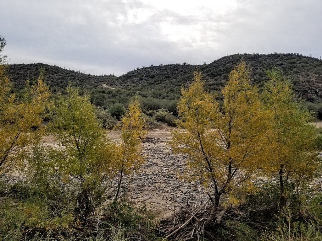
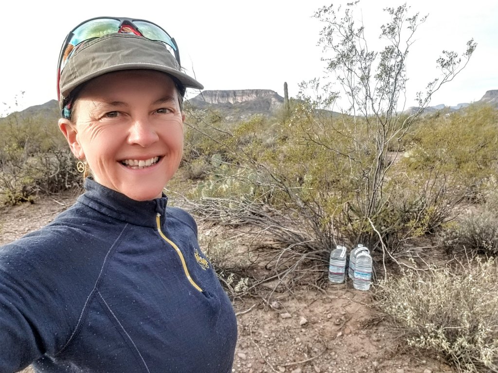
When I reach the Agua Fria River (which is totally dry here by the way) it’s almost 8:00am already so I push as fast as I can up the little climb from there to the flats where I can finally jog a little. I cruise around the windy trail where several RV’s are camped out, folks are still sleeping so I pad along trying to be stealth lest I get barked at by another dog. I find my water cache undisturbed and right where I left it under a tree, at 8:25am. I am relieved as I take note there isn’t any shooting. Yet.
I drop my pack with a plunk in the dirt and start refilling my water bottles, mixing up Tail Wind and grab some snacks. Apparently I am hungry because I eat almost all of the remaining plantain chips I have and top it off with a handful of Almond M & M’s. It’s a little early for my 2nd coffee but I figure in the final 17 miles I don’t really want to have to stop and take off my pack so I go ahead and mix the last spoon of instant dark roast and add the packet of pure maple syrup. Oh my goodness, this was an accidental discovery but hell yeah it is amazing!
I decide to make a quick video of my pack set up too. A couple Winter’s ago I got a Christmas gift from my Mom which was a customized Nashville Pack. They agreed to try making an extra small pack for me since my torso length is child size. They argued that it would make the overall pack volume smaller, which it definitely did, and what I’ve discovered is I can basically use it either as a day pack or a 3 day overnight set up with very little gear. Think desert hiking in early Fall and late Spring when there is no precip and temps are mild. I used it successfully in the Grand Canyon on a 3 day trip on the Escalante Route, with food and 2 L of water it came in at 20 lbs. My base weight for this hike is 10 lbs, so nothing extreme in the UL world but a lot lighter than my usual set up which is closer to 13-14 lbs, say for hiking in the Sierras.
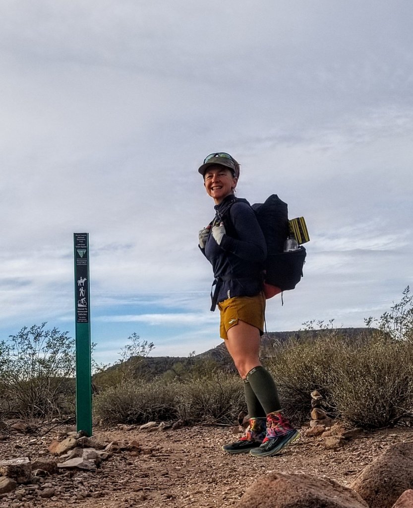
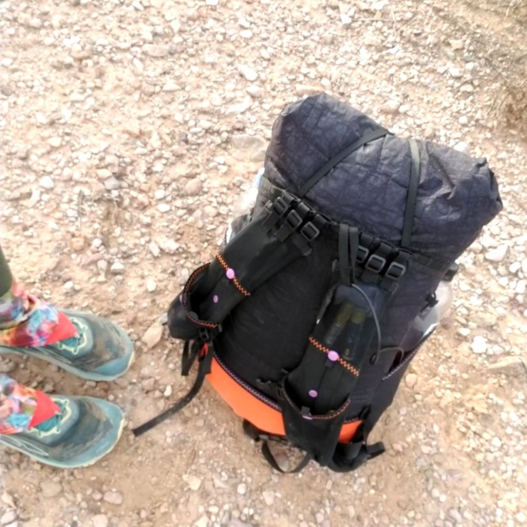

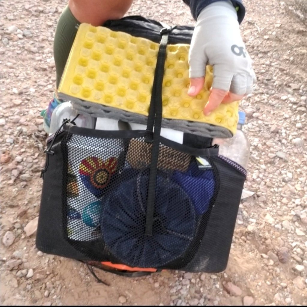
So for anyone who is interested, the things that made my kit UL here for this hike are: 1.) Nashville Pack at ~3.5 oz 2.) Z Packs sleeping bag at 15oz (rated to 35F I think, it’s not the warmest) 3.) Z Packs Pocket Tarp at 3.5 oz along with a Tyvek ground sheet (not the most UL ground sheet, but that’s what I have). I carried just enough tent stakes to set up the pocket tarp. I could have easily gone without a shelter, but at 3.5 oz the comfort level it provides me is 100% worth it.
I hate going stoveless. I did it for 500 miles on the AZT in 2019 and hated it. Thus, for this hike, I used my cat food can alcohol stove so I could measure exactly the amount of fuel I would need and still be able to eat a hot healthy dinner, have hot coffee in the morning and hot tea before bed. I know that all sounds so luxury but I am not in this to see how well I can tolerate suffering. That, to me, is not why I am out here at all.
I will never forget how on my AZT thru-hike I happened to hike with Flyby (Mikela Osler) for a few days and she was shakin’ out her UL gear set up. It was so funny how when she told me one night “basically you take away every single thing that brings you comfort and joy and that’s your UL set up”. I also recall that she was eating a lot of tortillas with powdered hummus to which she added water and olive oil. That was a staple in her diet. So no hot meals for her.
She also went on to set notable FKT’s on the Colorado Trail and the Long Trail and clearly her baddassery extends beyond her UL set up. Her strength and determination is above and beyond what got her there and the ower of the mind surpasses any UL kit no matter how light. I would like for that to also me by reasons for success without having to sacrifice to the point of suffering.
I’ve come a really long way since my 2016 PCT thru-hike when there were days in the Sierra when my pack weighed upwards of 50 lbs, days in the desert I started hiking at 11:00am and I never once on that entire 2,650 mile hike reached a 30 mile day. Today by 11:00am I have already put down 18 miles by starting at 5:00am, who would have thought!
I leave Table Mesa after a 25 minute break feeling refreshed and energized for the final 17 miles. The only negative right now is that the target shooting has begun. Crossing the dirt road into unknown territory now I can’t quite tell how close I am getting to the shooters. But it feels too close. I try to keep my cool and trust that I am safe but it’s hard. The trail seems to wind around and meander back toward the shooters and I can actually see them from above yet ther have no idea I am here. I move very quickly through this segment and press on up the hill hoping to get through uncsathed!

As I approach the final few miles into Emery Henderson none of it looks familar. I had done a trail run out here a couple years ago, it was what I recall as being a “long run” of say 16 miles when I was training for an ultra. I thought for sure I would recognize this section of trail, but I don’t. That day was my first encounter with the Black Canyon Trail and thus planted the seed for a thru hike or run someday. It only took me moving to AZ in 2020 and a couple more years to finally get it done!

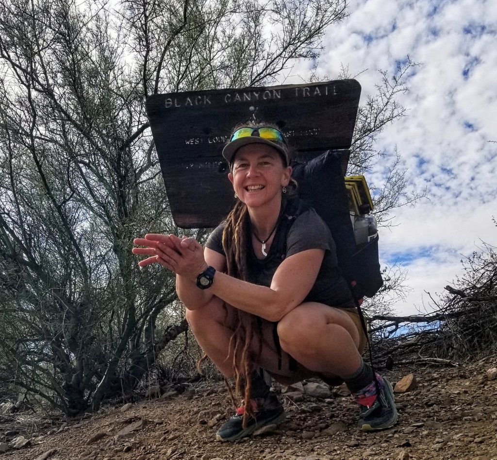
When I reach the Emery Henderson Trailhead it’s 12:20pm and now I’m at mile 20. I’d hoped to be here by noon so that stop for snacks etc at Table Mesa put me a little behind schedule. Still, I am moving, and have been moving this entire hike at the pace I projected for myself. The little stop was well worth it as it gave me the re-set I needed to feel better and will help me to keep that pace for the final several miles.
I had thought all along how easy it would be to stop here at Emery H. and call it good. It is a much easier trailhead for my Mom to pick me up at, and I happen to know the last seven miles to the South are not scenic at all. In fact, they are totally flat and boring and I read on another trip report that it goes right by a Federal Prison. Okay? And alas, it finishes on the side of the very busy Hwy 74. Nothing about this last seven miles is appealing. Nevertheless, I’ve made it this far, and while it looks like I won’t quite make my sub 48 hr goal I am going to be very close. No matter what my final time ends up being, I have to finish the entire thing or I will regret it. I am going to try to push it as fast as my body can handle.
I make this water fill up as efficiently as I can, treating this like an aid station in a race. I sign the trail register before I set off and that feels good, sending a fluttering of energy through my system that can only help propel me forward.
I cross New River Road and enter the Bisquit Flat Segment recalling the email convo I had with Bob from the BCNRT Coalition. I had inquired as to why this last segment even exists and why the terminus at the South end is where it is. He replied that it has Historical significance and that there was a group of equestrians who fought to designate and protect this segment of the trail. I wonder what it used to be like before the Prison was built back here?


I get a text message on my InReach from my Mom that they are en route to pick me up which causes me some anxiety. I had not told her that the trail finishes on a busy highway and asked her to park at the Fish and Wildlife parking lot off of HW 74, figuring I’d just call her when I finished and they could drive up to find me. She always worries about my safety and it is such a random place to finish I can’t even describe how to find it. I do a quick calculation in my head and estimate I should arrive by 2:30pm.
At this point I am able to somehow keep a steady jog and cruise along. The trail would be difficult to follow here without a GPX track, I’ll say that. The carbonite markers here are all blown down by the wind and I stop four times to set them upright, burying them in their rock piles. I’m sure they will just fall down again, but it seems like the right thing to do.
On the home stretch I run into a bunch of construction. It seems the workers are preparing to lay down some pipes underground, and one of them approaches me and very politely asks me “excuse me m’am but would it bepossible to ask you to use that other dirt road just over there so you don’t have to go by the machinery?” I smile and say “sure absolutely, thank you” as I don’t even stop moving and re-direct my trajectory.
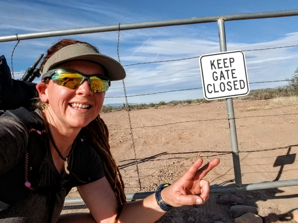
Not much further along this dirt road I realize I really need to pee. There is absolutely zero privacy out here, but I make it work, ducking off to the side of a cabling ditch and a small bush. I can see cars whizzing by on Hwy 74 about a half mile ahead and envision finishing soon. When I reach the Hwy it is 2:20 ish, I take a hard right and point myself up the road on the rough shoulder. It’s .8 miles from here to a random dirt pull out just past mile marker 89 where the trail finishes at a stock gate. At least, that’s where the GPX track goes, so I have to get to that same spot.
Along the Hwy I keep up my jogging pace and when I am about .2 mi away from the finish I see a familiar big slate gray truck slowing down like someone is creeping on me. I stop to look over and it’s them! My family! I wave at them trying to figure out how I will tell them I have to run a little further to where I am certain seems like a totally arbitrary spot to them. Remember they don’t know I am trying to set an FKT, so they seem to want me to get in the truck right now on the spot and why wouldn’t I? But I have to make it to the offical finish come hell or high water if I want to claim this. I shout across the busy Hwy to let them know I have to go up the road just a little more and that there is a dirt pull out they can use in a quarter mile.
They nod their heads and drive away to go turn around as I push the final several hundred yards. When I get there they have already arrived and await me. I snap a super quick selfie, stop my tracking, take a photo of my watch to note the time and jump in the truck. Inside, my Mom has a little cooler with ice cold beverages, a home made turkey sanwich with avocado and cranberry sauce and a piece of pumpkin pie. Awww, thanks Mom!! I comment how this is the least glamorous finish to a trail I have ever eperienced. They said they had driven all around looking for me and even had gone up to Emery Henderson, so I totally could have stopped there! Ha! But then, no record.
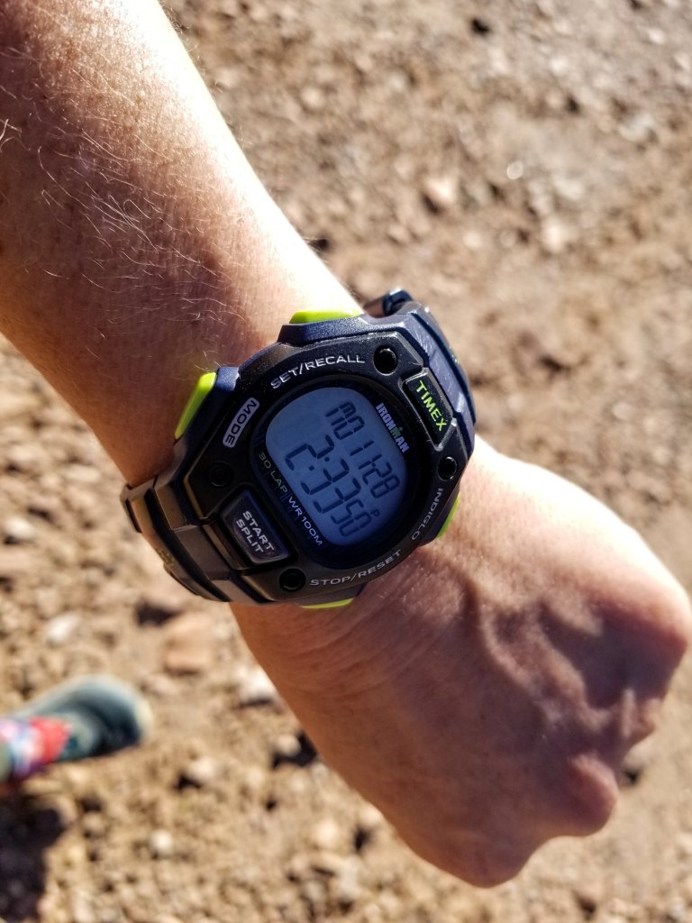
As we head North back toward my car at the Big Bug Trailhead we get to chatting about my experience and the trail, and my Mom says “wow, so you did it in like two days” so perhaps she knows me better than I think. I just say “yeah, I kind of did” as I take another bite of my sandwich. My official time ended up being 2d 0h 48 m 36 s. I didn’t beat the men’s time but I did put down the first women’s time, and that was ultimately my goal. So many routes have a men’s time and no women’s time, so this is a little niche in the FKT community where I can fit in. I’m certain someone will come along and surpass my record (maybe all of them) soon and when they do I will love to hear about it!
At the Trailhead my car is thankfully right where I left it, waiting for me to jump in and drive home. It’s windy when I leap out from the big truck so I yard sale my gear in the dirt lot looking for warm layers to put on my sweaty, salty, tired body. I’ve finished my pumpkin pie and my bubbly drink so there’s that wonderful sensation of everything equalizing in my cells after putting so many valuable calories into my system. My Mom and Todd need to get home before dark, so they give me big hugs and congratulate me on a successful endeavor and hit the road.
As has become my own personal tradition after spending time in any landscape I like to give an offering of thanks. I walk over to the Big Bug trailhead sign and ducking down out of the wind I kneel to the ground. I place a small bit of Sage on the Earth and sit with a sincere feeling of gratitude in my heart. As in the tradition of surfers, you never turn your back and walk away from the ocean. I always feel the same about the trail. I bring my hands together at my heart and say Thank You, allowing the feeling of deep peace and stillness to takeover, acknowledging the wisdom of the land, the presence of the Ancestors and those that came before me. And with this I water the seed of a dream that I am able to continue walking and running in beauty for years to come.
The Black Canyon National Recreation Trail exists on Ancestral Lands of Akimel O’odham (Upper Pima), Hohokam & Yavapai Apache. To learn more visit Native-Land.ca
Planning and Resources: Black Canyon National Recreation Trail Coalition: visit www.BCTAZ.org or email them at BCTAZ@gmail.com, they have a fantastic website, and now an official waterproof, tearproof beautiful trail map. Digital maps are available at AVENZAMAPS.COM/MAPS/482815 and there is a GPX track from the FKT website which you can download to whatever mapping app you prefer to use. Also, Aravaipa Running holds a Black Canyon Trail Ultra event every year in the early Spring, if you are interested in running a 60K or 100K on this trail as a racing event, visit their page here. They will hold the 2023 event on February 18th & 19th. It is a qualifying race for Western States 100. Just sayin’.

Lovely story and finish. Congratulations. Like your closing ceremony
Thanks so much 😉 😉
M
Your mindful communion with the land, the trail and the history is beautiful and inspiring. I’d say your dream became much more than a seed long ago. Congrats on fulfilling this particular goal.
Aww, well thank you Tom, much appreciated…and the journey continues 🙂
Interesting personal narrative and images. Congratulations with the Women’s FKT for the Black Canyon Trail. As a Hiker Athlete your efficient observations/images reflect the journey of a trail and as Tom writes “Your mindful communion with the land…”.
Thank you so much, I really appreciate hearing from folks who enjoy following along on the journey(s)…. 🙂
“May you walk gently through the world and know its beauty all the days of your life.” Indeed. Enjoying all your adventures, so wonderfully illustrated and reported, pulls at the threads of my history, past and future both.
Wow Greg, thank you for such a beautiful reflection. Ver much appreciated 🙂
Well, Mary poppins. I was looking for food ideas and guess what I stumbled upon. Your ” trail food is love” site. What a treasure trove of information. Milissa, your thoughtful, sincere, caring, healthful, detailed and thorough presentation is invaluable. Sorry for all of the accolades but a lot of work went into tnis and it should be required reading. One thing, if you leave those cookies in your dad’s freezer, he might eat them all. I would not blame him one bit ! P.S. have you ever had aged Chinese PU-Erh tea?
Hi Ed! Well how cool is that! I am so glad ou liked that article, and you know what, ever since then I actually have kept a steady supply of hiker trash cookies in my Dad’s freezer just for him, so going on 7 years now! To answer your question, yes I have tried lots of Chinese teas, Pu-ehr is one of them though I can’t say I am a connoisseur. Is that one of your favorites?
Congratulations on the FKT by a woman!
The trails you hike in Arizona have been beautiful and I’m very intrigued by what I’m seeing. Thanks for capturing it all in your pictures. I need to start planning some hikes there for myself now.
Regarding your comments “I start having thoughts like what if today is the first day in the history of the Earth that the Sun doesn’t rise?” and how creepy it was. To give you another perspective, I like what God promises to us in the Bible about the Earth He created:
“While the earth remains, seedtime and harvest, cold and heat, summer and winter, day and night, shall not cease.” (Genesis 8:20)
It’s comforting to know that “day and night” refers to sunrise and sunset, that they’ll never cease while the Earth remains.
Whenever I’m out in nature I always praise God for His marvelous creation and for allowing me the privilege to enjoy it, never forgetting that He’s the one creation points to.
Looking forward to your next adventure.
Thank you for sharing this perspective, indeed it reminds me of the balance of yin and yang as a dynamically integrated and forever changing flow of day and night, cold and heat, the changing of the seasons, that is the wisdom of the ancient Chinese symbol of the Tai Ji which is something I always carry deep in my heart…I hope you are ale to get out to AZ for some hiking soon, Spring is a fantastic time for it, so many places to hike out here!
Hello M.P. Yes pu-erh tea is my favorite. I have a good friend from Taiwan who used to own a tea shop here in Mt. view. I have some 1949, 1960 and 1977 tea that gets better with age. A lot of chi, very special, hard to find now. I was looking at your photo of Breche du Roland in the Pyrenees, it reminds me of Petit Griffon between mt. Abbott and mt. Mills. Same gap but with a 1,3046′ spire. Check it out, you need to key up petit griffon sierra or you will get pictures of little dogs!
Hi Ed! Wow, that Taiwanese Tea sounds amazing, I do have an appreciation for things of that nature. Great! I will definitely look up Petir Griffonin the Sierras, that sounds interesting, I hope to someday return to Gavarnie and walk up to the Breche! Cheers!
Congratulations on your FKT! I’m the person who first added the BCT to the FKT site in 2015. On the ending, the GPX shown doesn’t match my route. A mile north of the highway, the trail angled towards the finish. Some time after I set the first FKT, the BCTC changed the end of the trail due to some land management issues. Great write up and I’m happy you enjoyed the trail!
Hi Russell! That is so cool to hear from you, thanks for reaching out and reading the trip report. Anyway, it was a super fun project, one I would repeat. I have been scouting the Northern section of the trail and have almost connected it all the way to Hwy 67. I have been using the BCNRT official map for that and will most likely get back out there in the Spring. Thank you for contributing this trail to the FKT site, cheers!
I’ve been on the trail from Orme Rd south last year. I was surprised to see it, as it is new from the last time I was there. I was planning on hiking the BCT again but ended up bailing at Big Bug with covid. Do you mean Hwy 169? Hwy 67 is the road to Grand Canyon north rim. Oh, here’s the link to my GPX track from my BCT FKT, so you can see the southern end. https://hikearizona.com/map.php?GPS=35585
Hi Russell, sorry for any confusion, so it is South Old Cherry Road off Hwy 169, from that point South to Hwy 69 at Big Bug, that’s the segment I am referring to. I did not explore North of the GPX track which had a marked waypoint for the North Terminus of the trail, though I did go back and explore South from S. Old Cherry Road, about 5-6 miles to just a few miles shy of Russian Well. That section of trail seems pretty new, I would definitely argue that the Northern Terminus shouldat least be at S. Old Cherry road for future attempts perhaps and I would be happy to go back and do it again. Also, Bob from the BCNRT association reports the official trail connects North of there with the General Crook Trail immediately West of the Grey Wolf Landfill on Hwy 169, I have yet to explore that section and not sure if it is official BCNRT yet and I don’t believe there are trail markers up there. Thank you for the link to your GPX track on hikearizona, I am comparing that to the official BCNRT map and the GPX track from the FKT site and each looks a little different in the Southernmost segment. Is the track provided on the FKT site yours? That is what I used for navigation and that one goes straight to the Bob Bently TH (as shown on the BCNRT map, never saw any signage) at Hwy 74 then turns W for .8 to the finish, which seemed so random to me, but that is what I followed. I think the area has changed some since your FKT in 2017. We should team up and do a mixed genter FKT of the entire route from Hwy 169 sometime, that would be super fun!