
Nov. 26th, 2022
28 miles
I am all settled into my tent, pocket tarp actually, which I am so glad I decided to bring. It really keeps me warmer than cowboy camping as it blocks the breezes just enough. I almost suffocated myself though because I was boiling water for dinner using my alcohol stove inside my vestibule. Not a good idea. I momentarily felt a wave of panick as my eyes began to burn. Fortunately I was able to finagle a reach around the flame to open one of the storm flaps. My dinner is soaking now and I really am looking forward to eating it. It’s one of my home made chili dinners to which I added brown rice, dropped in some sweet peppers and a packet of coconut oil and sriracha. I am living the luxury hiker trash life out here and lovin’ it.
I hiked only until 7pm tonight, I was going to go another two miles to make it to my water cache and an even 30 miles for the day, but honestly I was feeling quite done. I kept stubbing my toes on rocks after it got dark and my body was really really sore because I actually did a fair bit of running earlier today. I was able to cover around 28 miles from 11am to 7pm. So not bad. It’s just that the first 22 miles from the Big Bug Trailhead up to tag the Forest Boundary and back were longer than expected.
The northern end of the Black Canyon National Recreation Trail is supposed to be at the Prescott National Forest boundary roughly eight miles up the trail from the Big Bug TH. I had downloaded a GPX track from the FKT website to follow, but the distance turned out to be three miles futher than I expected, which meant six extra miles in total out and back.
My plan all along was to try to get a sub 48 hour total time from end-to end of the BCNRT (officially an 80 mile trail) and submit the first solo self supported women’s time to the peeps at Fastest Known Time. So I was bound for that forest service boundary no matter how far it was, as my predecessors had established this official point as the Northern “terminus” of the route. I have since learned that the official trail actually goes quite a lot further to the North, another point I will expand upon later, but for the purposes of doing an official end-to-end thru-hike, and for the record, the forest service boundary is where I needed to start.
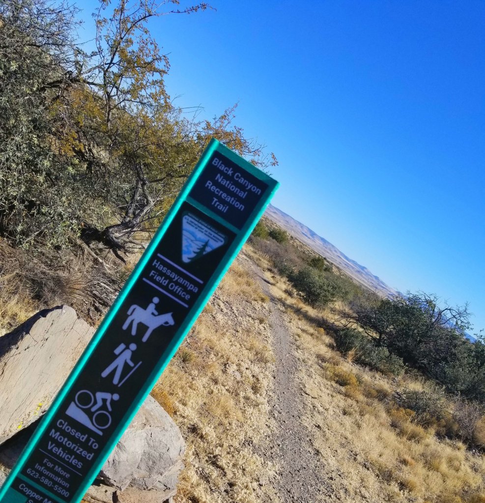
So what is the Black Canyon National Recreation Trail? It is an 80 mile mostly single-track trail designated for non-motorized use covering terrain through the Northern Sonoran Desert up to the high desert at the Prescott National Forest and passing close to the small town of Black Canyon City, AZ. The elevation ranges from 1,600 ft in the South to 4,400 ft in the North. The recorded total elevation change from the GPX track I used and going in the Sobo direction is a vertical gain of +7,523 ft and descent of -10,303 ft over a distance of 72.42 miles, so I am not exactly sure where those other 7.6 miles went, but that is what shoes on the FKT site. The trail is wedged between the east side of the Bradshaw mountains and to the West of Highway 17, which runs N-S up from Northern Phoenix to Flagstaff.
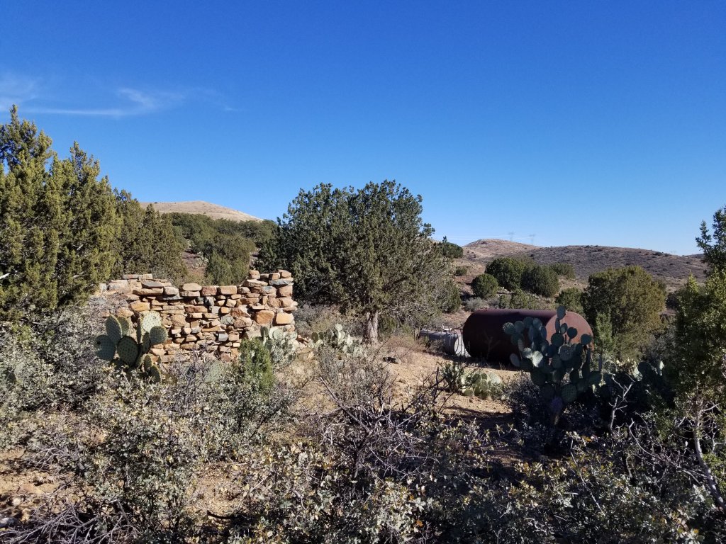
It became a National Recreation Trail in 2008 although clearly it’s history of use extends to prehistoric times where it began as a trading route for the local indigenous peoples. Later, it turned into to a sheep herding route perhaps bringing the animals down from the Bradshaw mountains to lower elevations and eventually evolved into a stage coach route. Finally the Southernmost section became a livestock driveway where local equestrians petitioned to designate and protect the area from development, both for historical reasons as well as future use. The aim of any National Recreation Trail is to enhance the lives of it’s users with access to Federal, State and Tribal lands for purposes of recreation and economic development through tourism. There are over 1,300 NRT’s with one in each of the 50 US states as well as British Columbia and Puerto Rico.
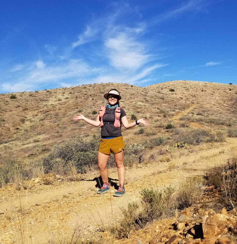
I discovered this trail as I have driven the section of Highway 17 between Phoenix and Flagstaff so many times when visiting my Mom. I always found myself gazing off toward the Bradshaws wondering “what’s out there?” Largely the trail winds through stunning Saguaro forests which you can see from the highway and that has always been a big draw for me since I make my home up in the Ponderosas of Flagstaff. The Saguaros have always had this mysterious pull.
There are four official trailheads for the BCNRT and several other dirt road access points which I have visited over the years. Along my drives, I would pull off the highway and set out for little trail runs as a break from the commute to stretch my legs. It was this process of running the segments that got me hooked with curiousity, as I always felt myself wanting to go further and see what’s around the next bend. I decided I would see the entire trail end-to-end one of these days, and so here I am.
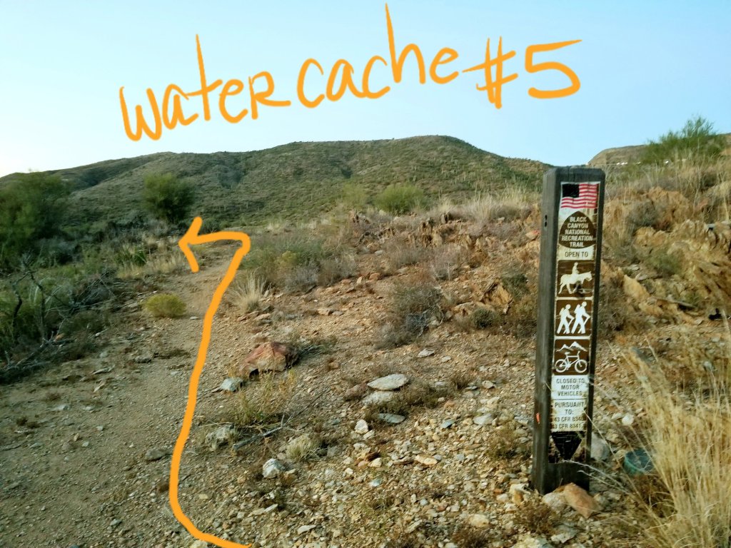
In the process of planning this thru hike I placed water caches for myself in six different locations along the route, marking them with my GPS and notating the distances between each water cache. All in all, I never had to carry more than two liters of water, with the longest distance between caches at 16.5 miles, between Antelope and Bumble Bee/Gloriana.
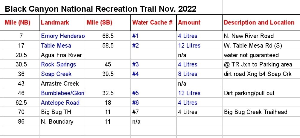
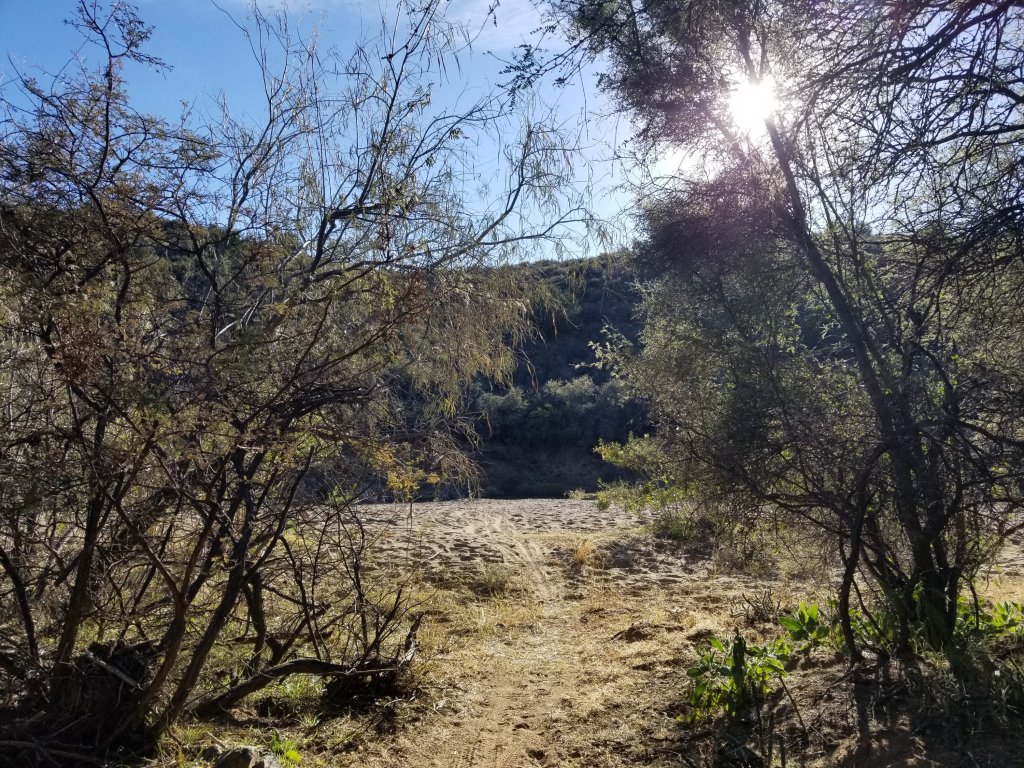
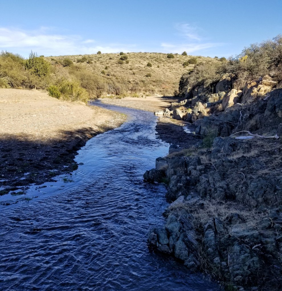
The route does cross several creeks and the Agua Fria River a few times, however doing this hike in the late Fall I knew I could not rely on any natural water sources and driving out to plant the caches was a fun way to get to know the area. Also, it should be noted that there are several wildlife tanks along the route and the BCT Coalition and other land users ask that trail users refrain from going near the tanks, so it’s not like the Arizona Trail where you rely on those all the time. So please plan ahead.
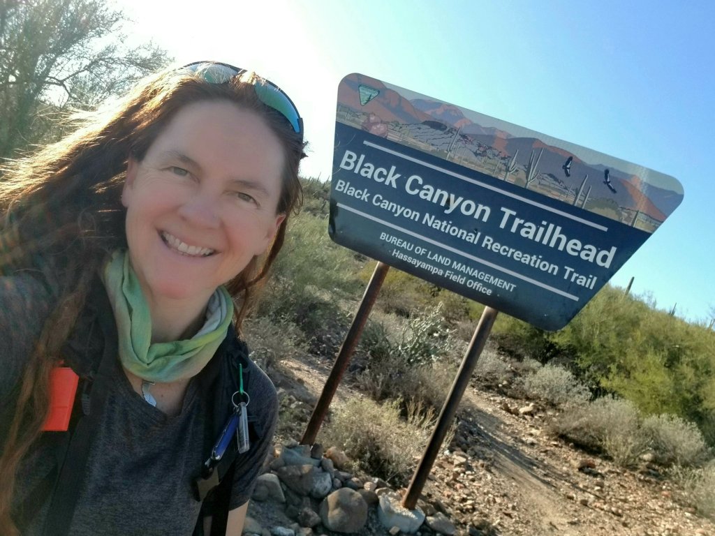
Two days after Thanksgiving, I left from the Big Bug Trailhead just before 11am, hoping to go out to the Northern Terminus and back by around 3-3:30pm but didn’t return until 4:45pm. I made good time given the six extra miles I hadn’t planned on, as I was able to keep the pace I’d set out to do, so there’s that. However, I’m not so sure why I thought it was a good idea to start this total 90 mile journey with a 22 mile run?
On the way up to the Northern terminus I saw a group of 10 hikers, two women on horseback and one dude on a bike. Mostly though I had the trail to myself. The trail is very runable up there and I kept up a solid jog for a lot of it, and had to walk a lot too as my hamstrings just felt super crampy as they tend to do on flatter terrain.
When I reached Russian Well I knew I was close and continued to follow the GPX track until I reached the waypoint marking the forest boundary except there was no sign of it in real life. I could have kept going up the dirt road, but there was no reason to. I really don’t know if this is the true North boundary of the trail or not?
At any rate, for the purposes of this FKT attempt, I started where the waypoint was marked from the GPX track I downloaded. I would offer however that this route needs to be updated on the FKT website and I am in the process of scouting the northern miles for that purpose. Perhaps in the future, I will provide a new track of the Northern section. I believe it actually extends all the way to Orme Road, though it’s possibly not marked throughout that uppermost section, so TBD. A classic example of a trail still in progress.
I started South officially at 1:45pm with the intention of making it 80 miles down the trail in under 48 hours. Along the 11 miles back to Big Bug TH, I went through a lot of challenges in my body and mind. Right about mile 16 I was already thinking of excuses for quitting the FKT attempt due to how I was feeling from all the running and the extra miles. With those extra miles, I was feeling like I had a very early setback right from the get go and was not mentally prepared for that. Nevertheless, I focused on embracing the beauty of the trail and knew when I returned to the Big Bug TH that I could get some needed calories in my system and do a little re-set before continuing.
Those last five miles I had to shut down thoughts of returning to my Mom’s house or just sleeping in my car or even going home with the satisfaction that I ran 22 miles today etc. My body was in so much pain all afternoon and it would come in waves along with these doubtful thoughts. My head space seemed to shift to and fro between a more negative outlook and a more optimistic one based on calories. I hadn’t brought enough calories with me for a 22 mile run, and I know myself well enough that when I need to eat, my head space really spirals down into self doubt.
The thoughts would go like this “you know, nobody is making me try for an FKT, I am doing that to myself, and all I have to do is change my mind if I am not loving it. I can choose to finish anywhere short of the South Terminus that I want and just take my time”. But I knew that was not going to happen. I knew I just needed food and deep down I wanted to do this, I chose this level of intensity. I set myself up for an opportunity for growth and expansion and that naturally is going to take me out of my comfort zone, otherwise, it wouldn’t work.

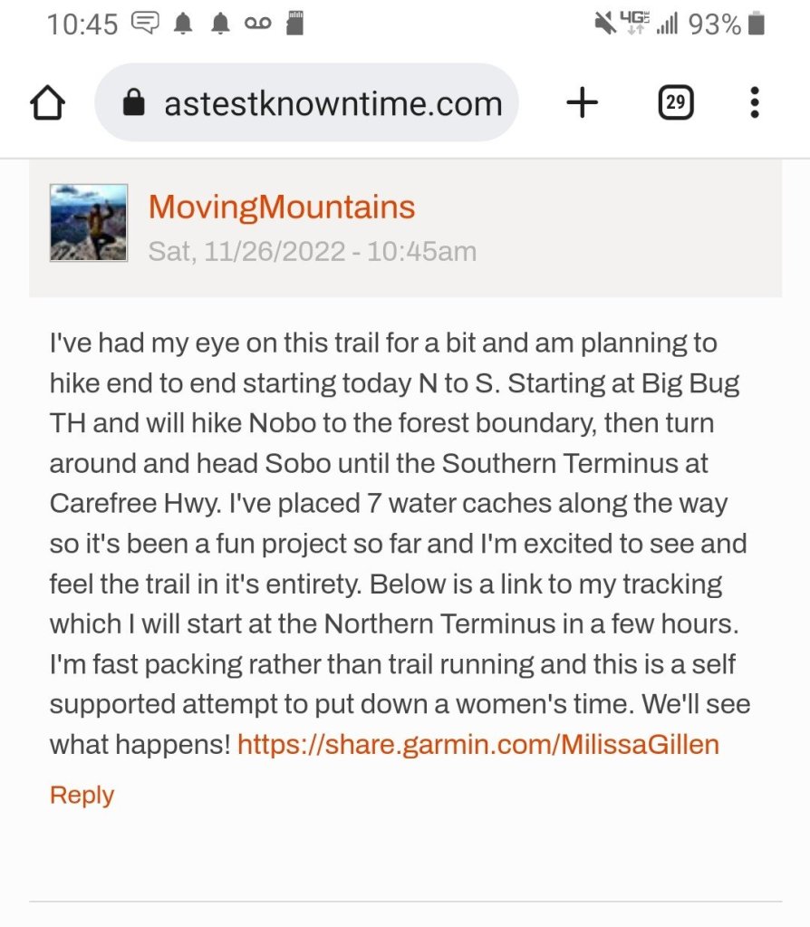
I had to remind myself this is an attempt and I am imposing the 48 hour time on myself. I am not a natural FKT’er at all, but for some reason I’ve gotten into this sport and quite often dream of FKT’s I want to do, albeit in my own style. I have one other FKT on record and that is the Tonto Trail in the Grand Canyon (click link to read trip report). I was the first person to put down a time, and that was a self-imposed 2d 14 hrs. Also a self supported effort where it took me a hitch across GCNP and then hiking for two days just to get to the start of the trail. I had also placed several water caches in advance for myself and spent over three months planning and preparing for that one, so it was really a big logistical project and a very unique experience. I absolutely loved it. And as things go, I want to do it again and try to better my time.
That was back in the Spring of 2021 and later that year, Rob Krar and Buck Blankenship went in and smashed my time in half. Although they had a support crew and they are like professional runners, the two of them put down a time of 1d 02h 23m. They reached out to me and interviewed me during their planning which was so much fun and really validated my own effort. In reading Rob’s recap from their run on the FKT site he writes “This was the most physically and mentally challenging effort I’ve ever done. It’s hard to describe, compare, or put into perspective how challenging I feel the Tonto trail is.” It made me feel a lot better about my own time reading this, as I am not anywhere near as well adapted to be putting such miles in at a running pace as people like them. Yet I believe my stoke factor is just as high and that’s truly what matters to me.
This particular effort on the Black Canyon Trail was nowhere near the level of planning and prep as the Tonto yet I felt really excited to do this. My plan was to mostly hike fast or perhaps jog a little since the terrain would be pretty smoothe single track most of the way. It’s what folks call fast-packing, but not true running. I did not do any specific training for this either, so I was purely relying on baseline fitness, which comes from all the backpacking I did earlier this year and my weekend trail runs that are usually in the 6-10 mile range so this was sort of a big ask of my body right now to suddenly crank out 90 miles. I have promised my body I will take very good care of her when this is all said and done.
When I finally made it back to the Big Bug Trailhead it was 4:45pm, the sun had set, the winds had picked up and I was feeling really cold, tired, hungry and still questioning my motivation to continue. I treated my car as a little aid station where I guzzled a bunch of water, put on warm layers and ate a bunch of calories. Game changer. Without any further thought of quiting, like the thoughts simply vanished, I set off again just 15 minutes later, ready to hike into the night and all the way to the Southern Terminus.

With my fully loaded pack, enough water to get me through the night and trekking poles in hand, I headed South with a newfound sense of pure joy. It’s so interesting how much better I felt after the little break. I did not even sit down. I also recognized that I felt better just walking with my pack rather than trying to run and feeling like I was finally “starting” the hike. Everything about those first 22 miles just felt like something I had to do to get to the start, which is sort of true, but leaving South from Big Bug felt like my adventure was finally underway and this wonderful sense of freedom moved through my entire being. Yes! This is why I’m here.
I also want to mention the FKT is not really that important to me, it’s just more of a layer of intensity I wanted to build into the experience. Yet, I always realize once I get myself into these situations, that I am not good at sticking it out for long hours in the night, nor am I good at suffering by denying myself certain comforts. Truly my MO in life is to operate from a place of Joy. Perhaps someday I will find a way to experience Joy in the face of suffering, but I am not there just yet and not sure if I want to be?
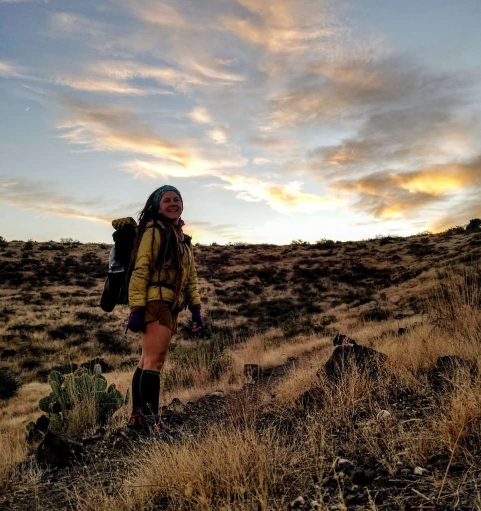
I know from experience that one way to prevent suffering and promote joy on these trail adventures is to find that perfect balance between keeping your pack weight super light yet having a few comforts with you for the low moments. With a few luxury items I was able to get my base weight for my pack down to 9-10lbs and with less than three days of food and no more than two liters of water at any given time, my max weight is probably in the 17-18lb range. I am hoping to load up on calories tomorrow as I go and lighten the load even more. I want to see if I can make it all the way to Table Mesa tomorrow, so somwhere around 40 ish miles or so, a big day indeed, it will be my toughest day, but will set me up for only 17 on Monday which means I could feasibly finish within that 48 hour window. We’ll see, that could all be a pipe dream. Haha!
But enough of all the gear and logistic talk, hopefully I have provided enough background information to satisfy the curious minds of my readers. What is truly most important now is that I am enjoying the feeling of being on a trail for a few more days before Winter sets in. I love the sounds of the numerous insects, I think they are some kind of desert cicada? Then there are the birds that flit from the brush suddenly as I round a bend sending a jolt of wild adrenaline through my veins. In the distance there are faint sounds of motor cycles, and now I can hear the crickets rhythmically chirping, aiming their songs up to the stars and there’s a pack of coyotes yipping, their high pitched calls rolling like waves over the curves of the distant hills.
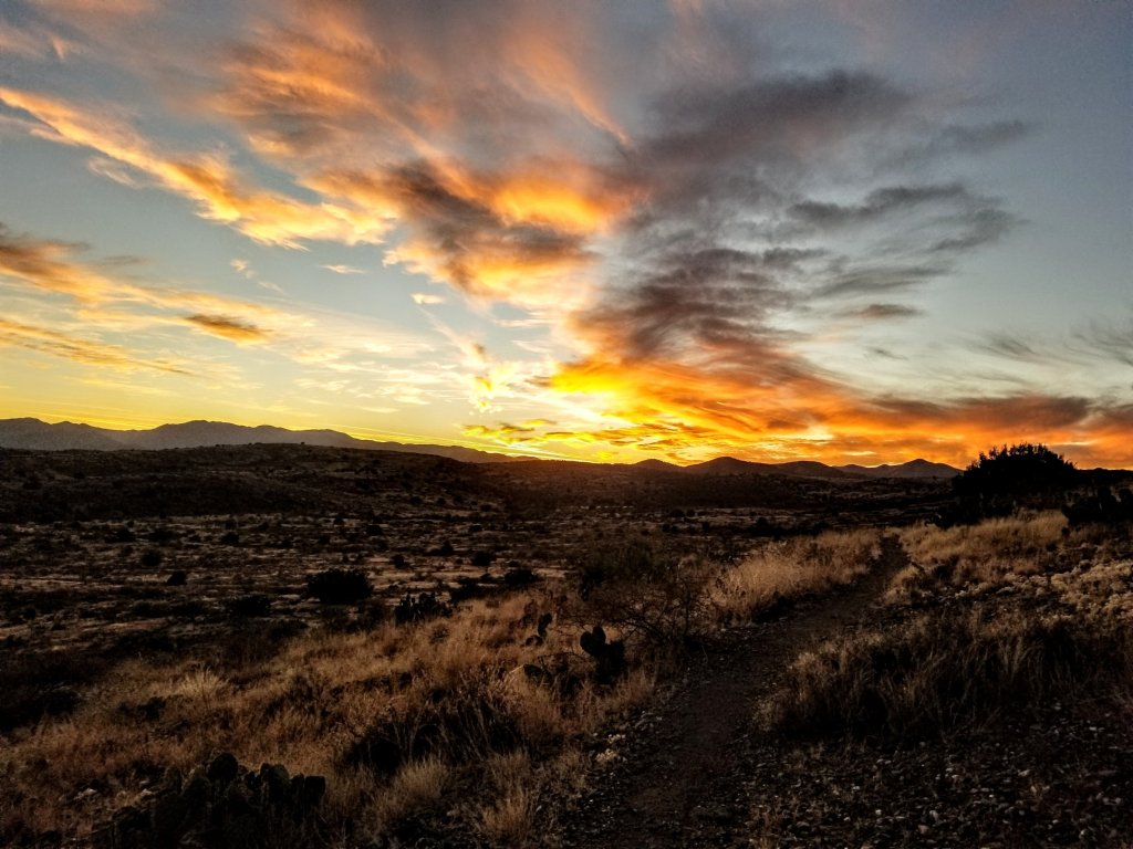
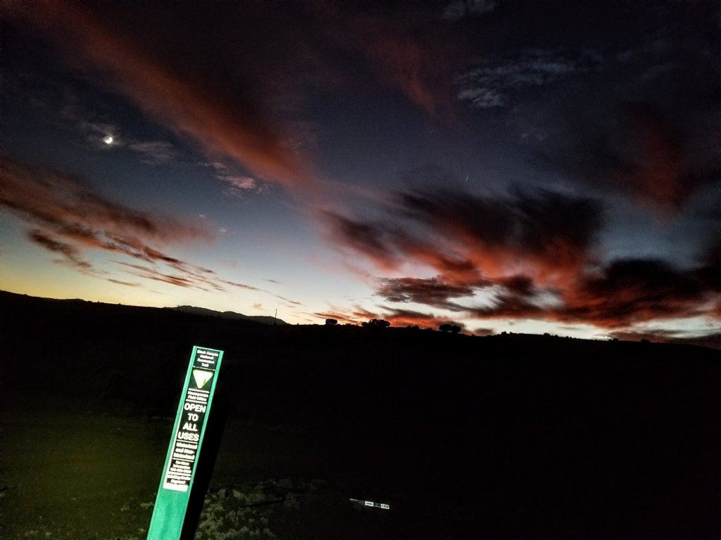
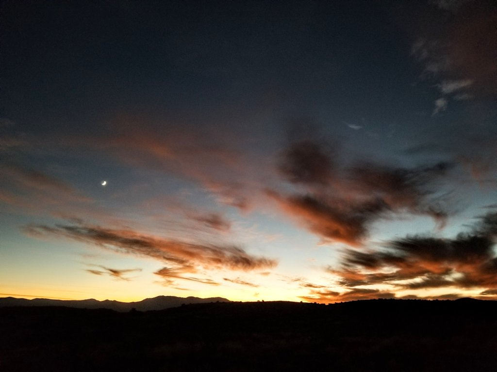
This evening’s sunset was stunning, it kept changing color and evolving. The cheshire cat moon was hanging in the sky nestled among a thin layer of clouds making it look more mysterious and elegent. I didn’t mind the night hiking at all this evening, I had forgotten how peaceful night hiking in the desert open space is. You get a sense of expansiveness that is incomparable and it brought me many wonderful memories of night hiking on my PCT Sobo hike in 2017. We night hiked for hours each day towards the end there. By 7pm tonight I had reached a perfectly flat spot that beckoned me to call home for the night as my stomach growled for dinner. I decided to stop there at 28 miles for the day and promised myself to get a very pre-dawn start tomorrow. We’ll see what happens!
The Black Canyon National Recreation Trail exists on Ancestral Lands of Akimel O’odham (Upper Pima), Hohokam & Yavapai Apache. To learn more visit Native-Land.ca
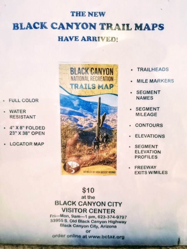
Planning and Resources: Black Canyon National Recreation Trail Coalition: visit www.BCTAZ.org or email them at BCTAZ@gmail.com, they have a fantastic website, and now an official waterproof, tearproof beautiful trail map. Digital maps are available at AVENZAMAPS.COM/MAPS/482815 and there is a GPX track from the FKT website which you can download to whatever mapping app you prefer to use. Also, Aravaipa Running holds a Black Canyon Trail Ultra event every year in the early Spring, if you are interested in running a 60K or 100K on this trail as a racing event, visit their page here. They will hold the 2023 event on February 18th & 19th. It is a qualifying race for Western States 100. Just sayin’.

Fantastic motto, “Truly my MO in life is to operate from a place of Joy.”
It is true!! Thanks for noticing that 🙂
Hi there! I am starting to think about doing this trail as a fastpacking trip in 4-5 days between Christmas and New Years this year. There doesn’t seem to be a lot of information out there for backpackers/trail runners as opposed to mountain bikers. I would love to pick your brain a little bit about your experience, or could you point me towards some resources that you found helpful in planning your trip? Like you, my goal for my outdoor adventures is to experience joy and put myself in the path of sublime moments, not to suffer or deprive myself.
Hi Lisa! Sorry for the delayed response. Yes, absolutely I can help you 🙂 please send me an email and we can communicate that way. Makiawellness@gmail.com
Hi Lisa! Sorry for the delayed response. Yes, absolutely I can help you 🙂 please send me an email and we can communicate that Makiawellness@gmail.com