
July 21st, 2022
Tarn below White Fork Pass –> S. Fork Kings River –> Cartridge Pass Trail –>Cartridge Pass –> Lakes Basin –> Base of Dumbell Pass
In the morning when I wake it is just barely light out. I don’t hear the others stirring yet but I need to pee. I crawl out of my tent and hobble over to squat beind a rock. Behold I’ve started my period, a week early. Wow. I didn’t bring any supplies with me, they are in my re-supply box at North Lake, so I guess I just have to wing it.
When I am crawling back into my tent, my phone alarm is beeping. I thought maybe I could dive back into my sleeping bag, but no, it’s is time to start day four of our High Sierra Tramp. As the last two days were pretty intense, I wonder what today will bring? I have a feeling today is going to be mellower and really beautiful. Well, beauty is guaranteed, but mellow, we shall see.
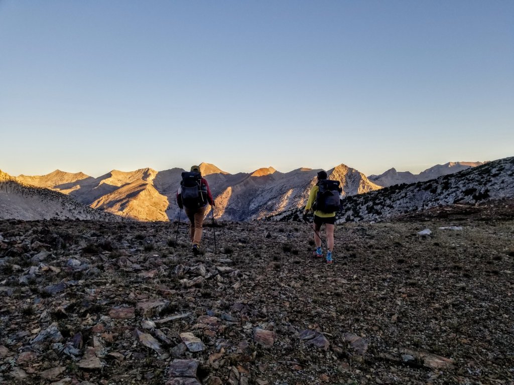
We will first drop to the South Fork of the Kings River and ford it. Typically this river has a deadly potential in July, but with the low snow pack from last Winter, we know it’s not going to present a big challenge. At least, we hope so. You never can tell. From there we will head up the old Cartridge Pass Trail. This was the original JMT way back when and the trail is super steep, overgrown and generally crappy and hard to follow. Sounds like fun. The reward will be hiking over Cartridge Pass and down into Lake Basin. Lake Basin is one of my favorite places from the Sierra High Route. Lake Basin is also the backdrop to the story about Randy Morgenson, the back country Ranger who mysteriously went missing in the Sierras. If you haven’t already read the book, I highly recommend it, it’s titled The Last Season, by Eric Blehm.
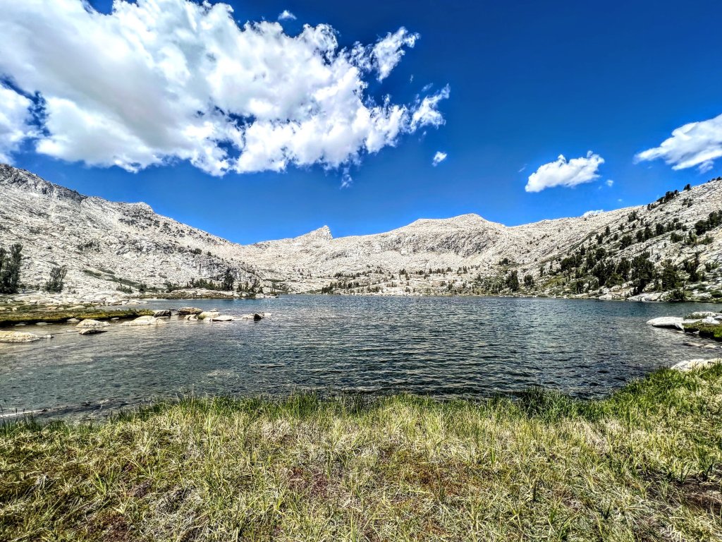
We have some pleasant, easy walking along the outlet stream the little tarns we camped near and the morning light has not yet hit our valley so everything feels calm and quiet like a morning should. Shortly, we wind our way around toward Bench Lake, but don’t go all the way there. The Cartridge Pass Trail is almost directly across from Bench Lake, however one must drop from 10,600 ft to 9,400 ft over only a half mile first, cross the South Fork, then start an equally steep climb back up the other side of the massive drainage. There is a lot to negotiate for the first part of the day but it’s never anything crazy. It’s not crazy pants.
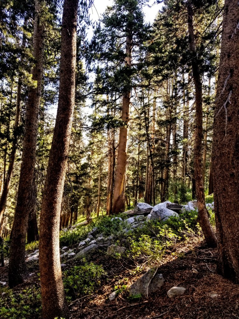
Looking at our maps, all we see are really tight contour lines yet we are in the trees and the description we have reads “slabs and lodgepole”. It is different navigating in the forest compared to an open rocky slope or cirque. In the forest we have the pleasant shade, less rock hopping, althoug it does exist, but here there is a lot of vegetation, especially around the creeks. It’s easy to slip on grass or step into a hole, and we wind up crossing the creek a few times, always thinking the walking will be easier on the other side. It never is easier, but keeps things interesting.
For a minute we think maybe we can do like yesterday and just go straight down the drainage, but this one is super steep and there are too many places where things could happen. We stick it out and continue with the bushwhack through the thick vegetation. It is all lovely and like a puzzle to work our way down. There really is no efficient route or perfect landing. We zig and zag following the path of least resistance.

I feel today like I am starting to get adjusted to our daily rhythms, as we set off generally at 6am and we take several breaks before we stop for lunch. Since I was hiking solo for 10 days prior to this adventure, I could afford to sleep in and get later starts since I was just walking on trails. On a trail you can always count on moving faster if you need to and make up any lost time. On a cross country route, you have to let go of time and even certain expectations, you must flow with the shape of the landscape and accept the obstacles in your way that are a near constant. Thus, we need to set ourselves up for success by starting early, and today feels like the first day I didn’t resist this. I feel like I’m adjusted, even if I did start my period a week early.
We have planned a semi-conservative schedule for our daily mileage and vertical gain this week, so we are not on a tight schedule, yet each day we have some big objectives to meet, we have our work cut out for us. The terrain dictates everything. When I’m hiking on a trail, I always enjoy pouring over my maps at night, studying the route ahead, but I rarely need to reference them in the daytime. Now, we are constantly studying the contour lines and comparing what we see on paper to what we see in the field. I am loving this process. It feels good in my brain.
We stop along a creek to collect water and have our first morning snack. The sunlight is cresting the ridge, starting to filter through the forest. It seems like the trees and water sparkle with magical faery energy here. This little spot has all the elements, including views of what we are able to identify as Arrow Peak and Arrow Pass. We study the pass intentlly as that would have been the way we came through yesterday had we taken the primary route for the KCHBR. I stand there chewing on my Honey Stinger waffle, sipping the delightfully refreshing water and say to Christy “that pass looks fairly friendly” which generates a big laugh from her and she says “well I can see you’ve adjusted your standards already”. Sure, after the past two days, most everything else is going to seem real friendly!
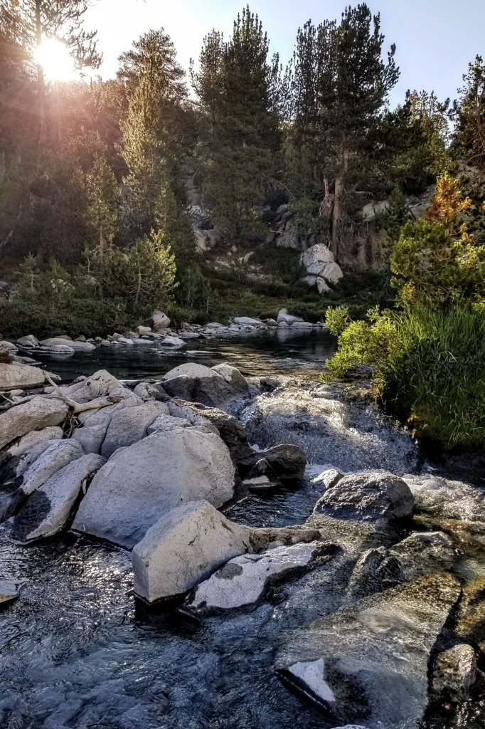
When we reach the S. Fork we cross several braids of river that are no more than shin deep so crossing is not an issue at all, and we are glad to wet our feet since it is getting hot already. It’s interesting how it seems like the river is flowing through the forest here. We are in thick trees, the river spreads out and isn’t clearly defined with a singular bank like I am used to. It looks really different compared to where the JMT/PCT crosses it further upstream. It’s cool to see a different crossing and also try to imagine what it would be like down here had the water levels been anywhere close to normal.
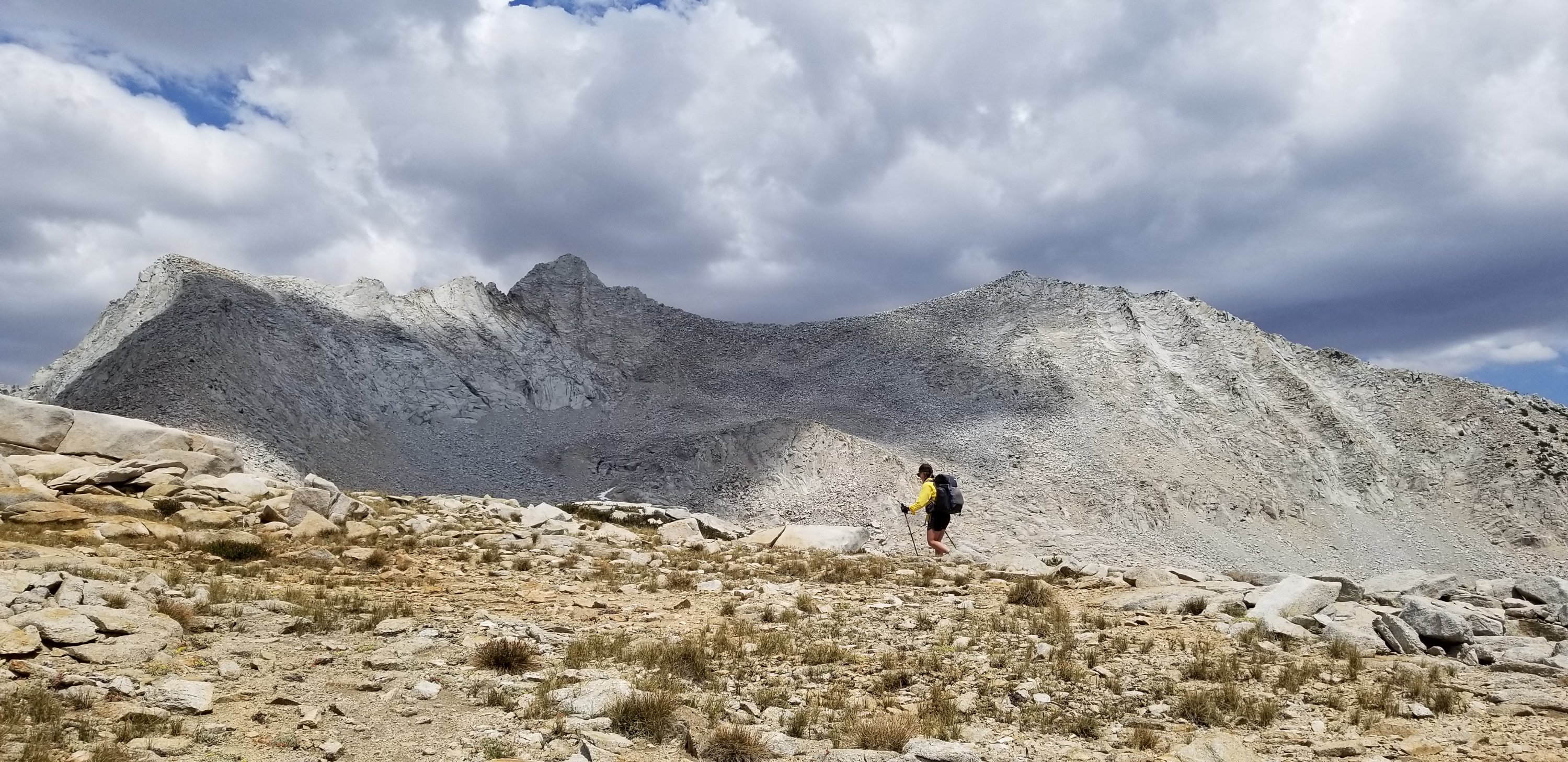
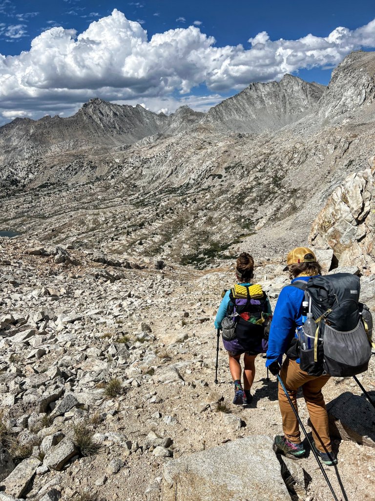
After we cross the S. Fork we scout for the Cartridge Pass trail, which is really faint, overgorwn, an underused. We start climbing and it is steep! I am talking 64% grade and there is quite a bit of sun, oof. As is the case with these underused old trails, we loose it a few times and have to travel over steep, loose terrain around chunks of boulders and along slopes blanketed with manzanita as we kick up the dust. The sun is beating down on us now and every chance to stop in the shade is welcome.

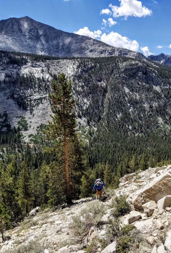
We stop for a shade break under a cluster of pine trees and I am groaning and bending over from a moment of menstrual cramps. The girls comment how very impressed they are that I am managing my period without any supplies. I was hoping to impress them with my mad rock scrambling skills but hey, I’ll take the compliment. The same thing happened to me a couple years ago when I was backpacking in Peru. Which reminds me I never finished writing about that trip.
Part of my strategy is to time peeing just right so I can free-bleed onto the Earth. In many cultures this is what women do anyway, except they have bleeding nests and the entire experience becomes a sacred honoring of the devine feminine. But I won’t get too much into that here. When I’m not free bleeding I use my small piece of cut up pack towel, I happen to have three of them and I rotate them, washing them in the water every chance I get. You’d be amazed at how well this actually works. Sorry to any of you male readers out there if this is TMI but I think the women reading will understand and appreciate. It happens.
Our break in the shade is over now and we commence the hot slog up the sandy slope once again. It is so steep we gain elevation quite quickly and when we are almost at the top Michelle points out we can see Bench Lake on the other side. That’s so cool! Right here we are a little higher than it at 10,600 ft, but there is a huge chasm between us and the lake that you almost wouldn’t know is there. It looks like a fairly large body of water, larger than I’d expected and now I want to go there. Yep, Arrow Pass has my name on it and now so does Bench Lake. Welp, I’m just gonna have to come back!
The final steps to the top of the climb are a push and we are aiming for a large lake that we plan to definitely swim in. Of course when we get there and drop our packs, the breeze picks up and I am now feeling slightly chilled. It’s probably hormones as I tend to get cold very easily when I’m on my moon cycle. I decide to only go in up to my thighs, but Michelle and Christy are going fully in with clothes on! We then set up for eating and proper lounging. If you’re going to call yourselves Team Lounge, you have to hone those skills on a fairly regular basis, thus we put some time in now so we don’t loose those hard won skills.

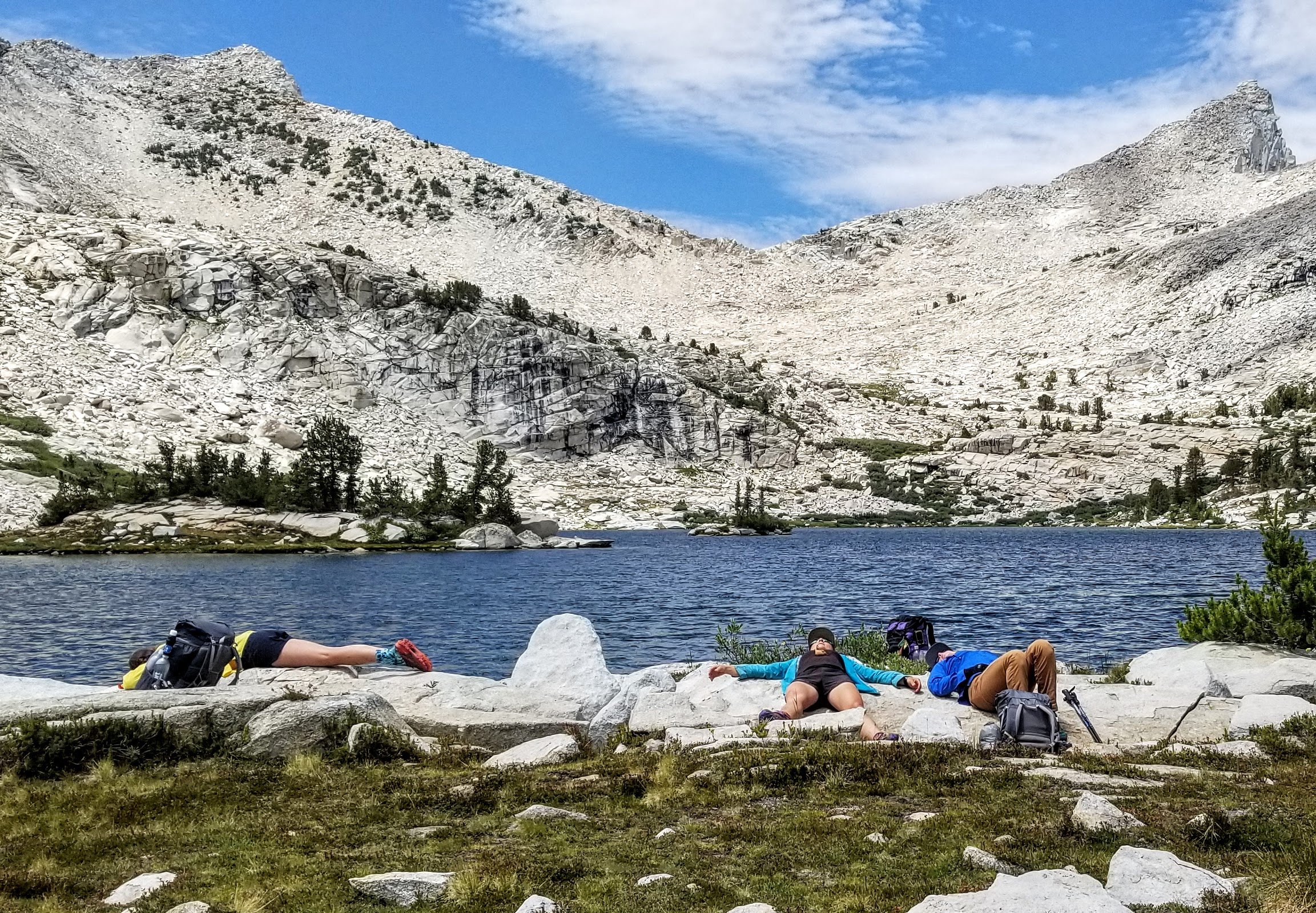
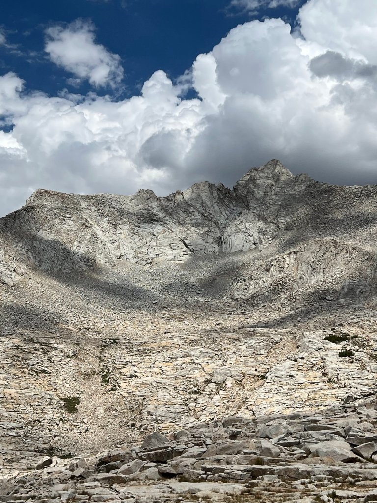
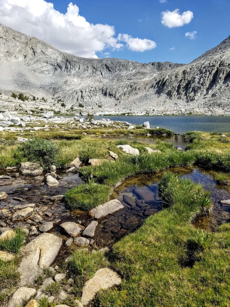
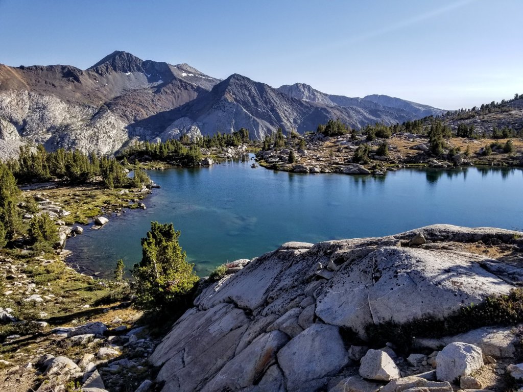
We lay like snakes on rocks in the sun, basking and sinking deeper into heaviness. The force of gravity feels quite dense here, like a vortex and I could easily fall asleep. But I don’t. Of course we still have quite a bit of climbing to do this afternoon over Cartridge Pass. I’m sure this time spent lounging will set us up for success though. This little lake we’re at has no name but the area is absolutely gorgeous. There are wildflowers lining the lake, brilliant green grasses covering the slopes, giant slabs of granite that form into bowls which invite one’s curiousity. This is all against a backdrop of steep gray walls and grassy ramps that lead up to Cartridge Pass. I can definitely see why the JMT originally passed through here, as it certainly highlights the beauty of the range.
Finally we rally to get going as clouds roll in and now it seems like the threat of rain could be possible but it’s not in the forecast. We pick up the trail as it continues around the Northeast side of the lake, and in a similar fashion as before we loose and re-gain the path, although it is a little easier to stay on track here. It is quite steep in some sections yet that’s when yo get the reward of the views. This is a truly rewarding section of trail and the stoke level is getting higher as we grind out the climb.
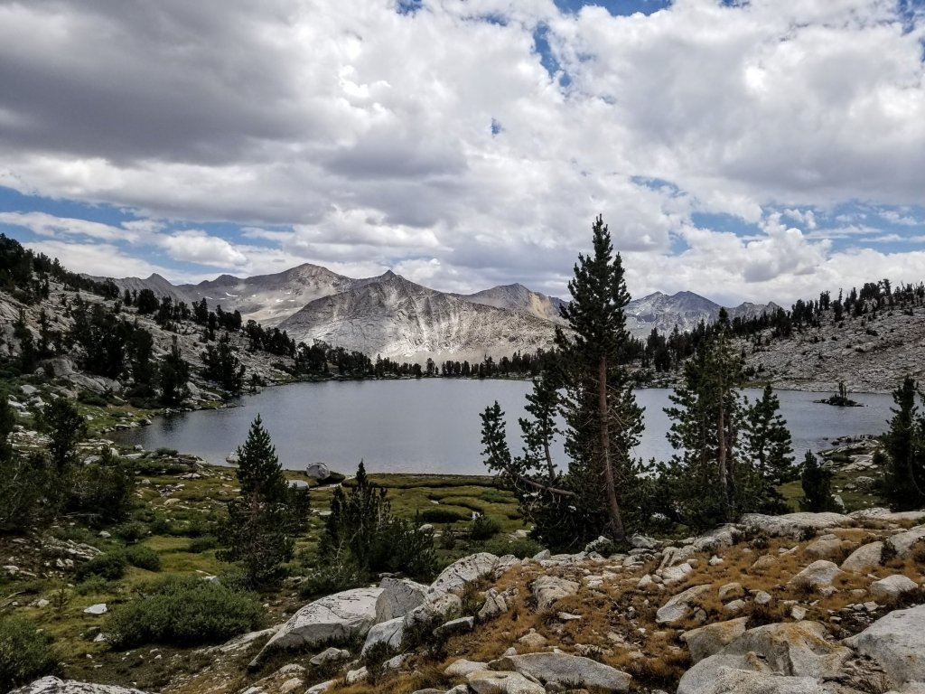
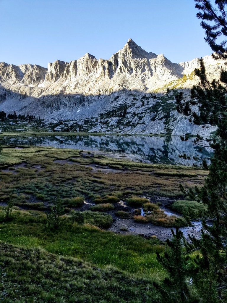
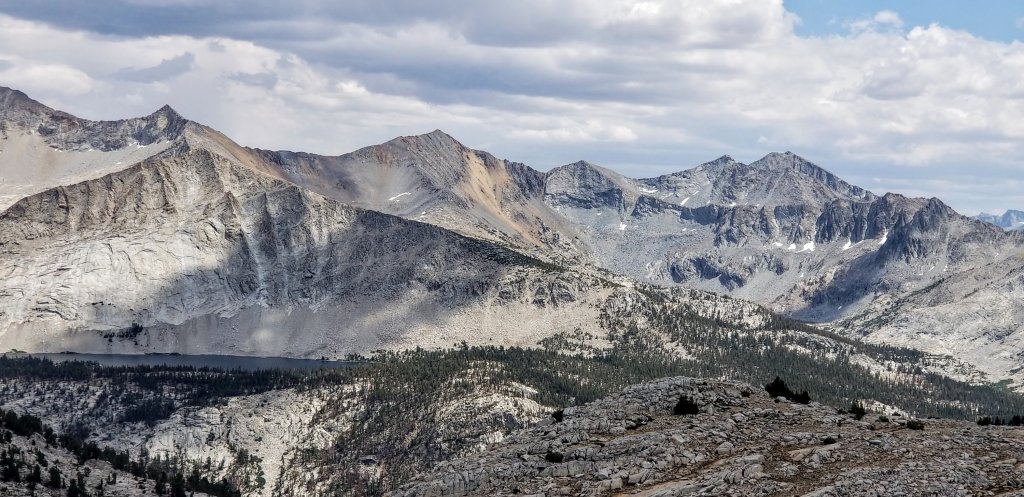
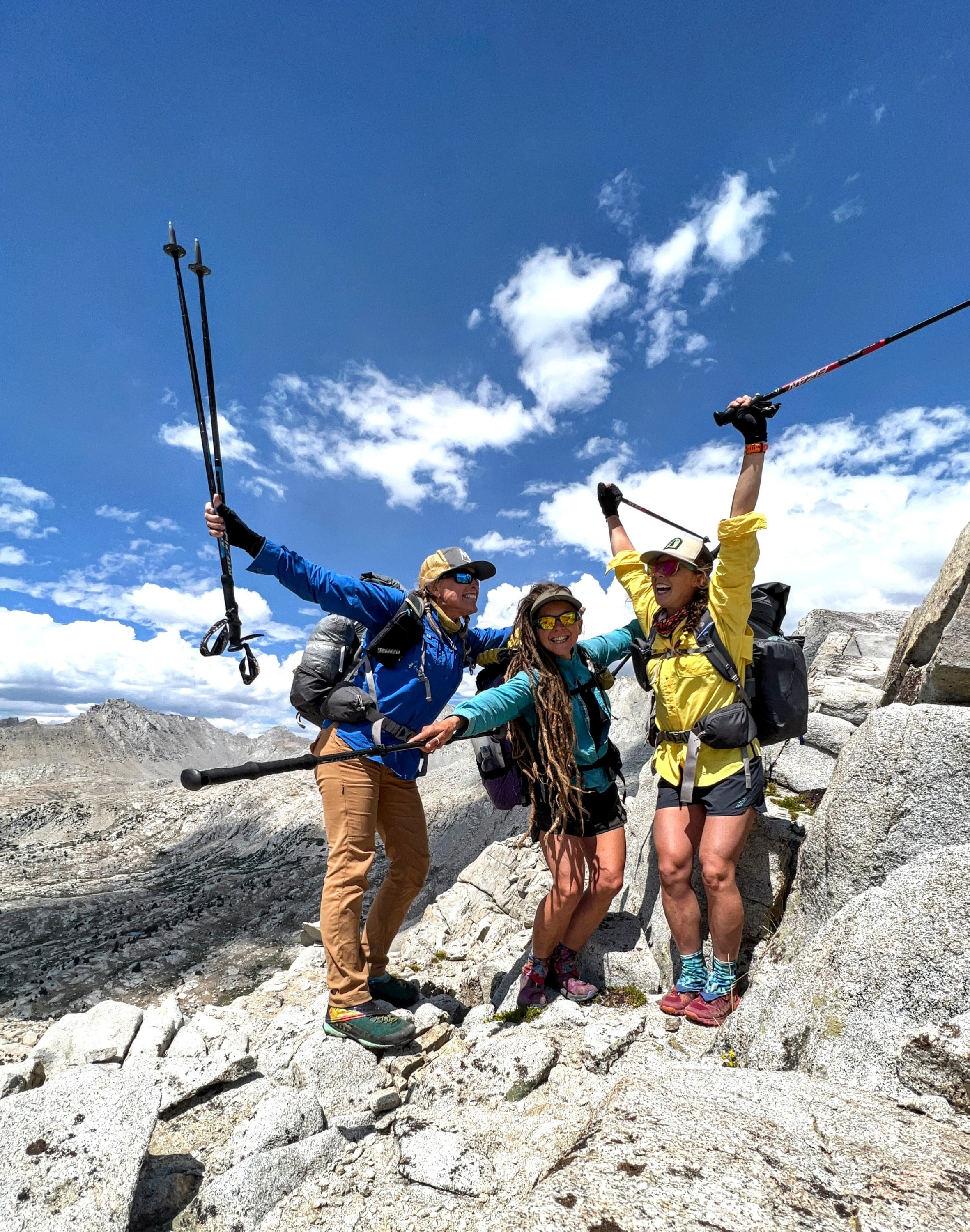
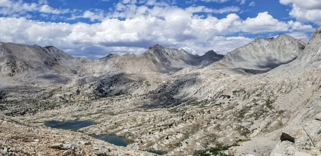
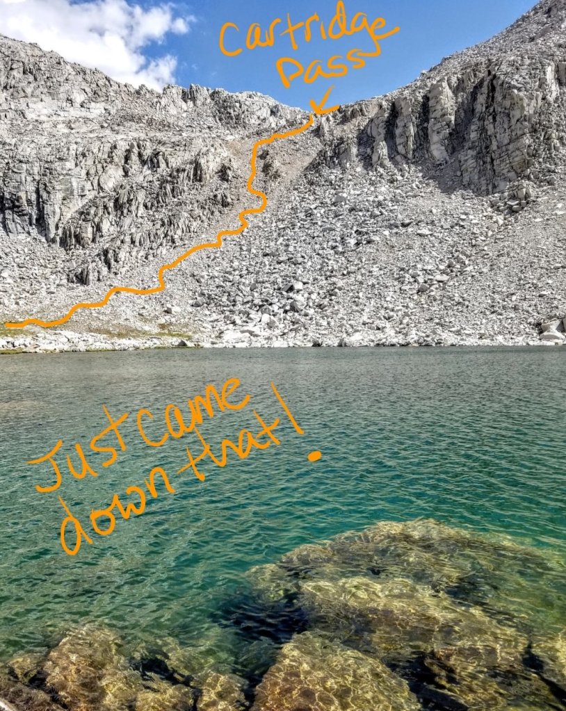
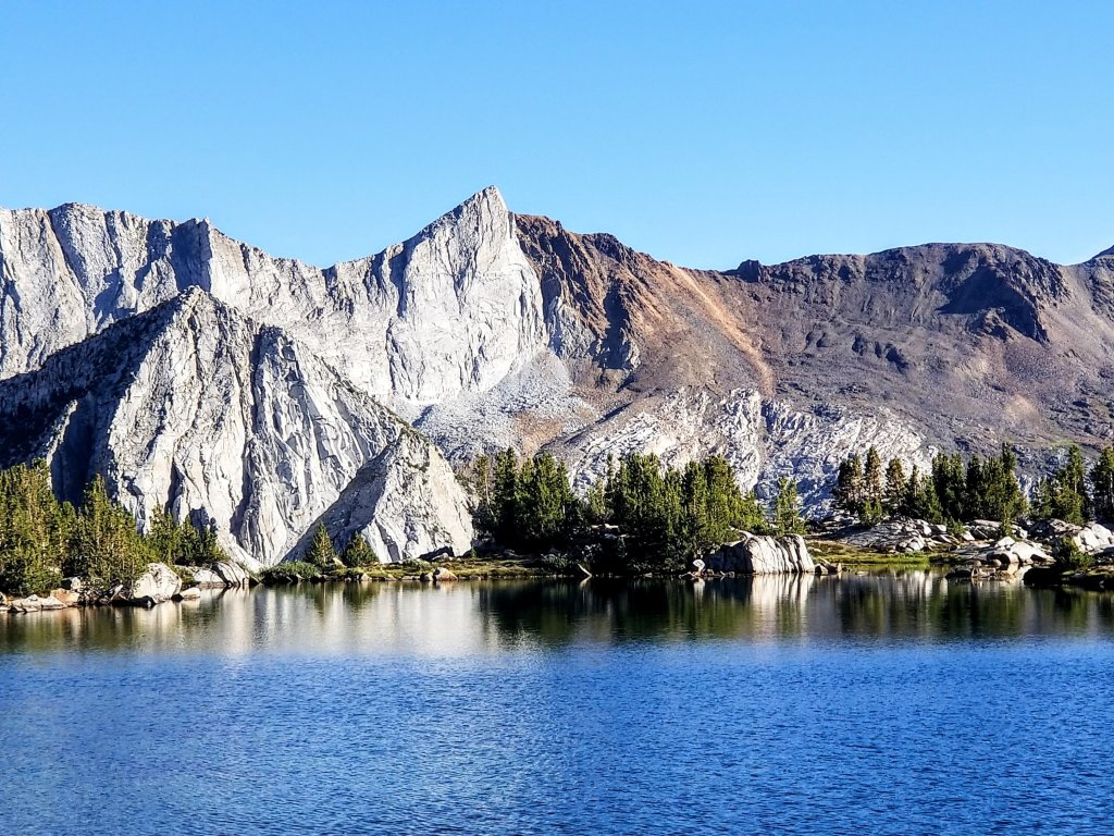
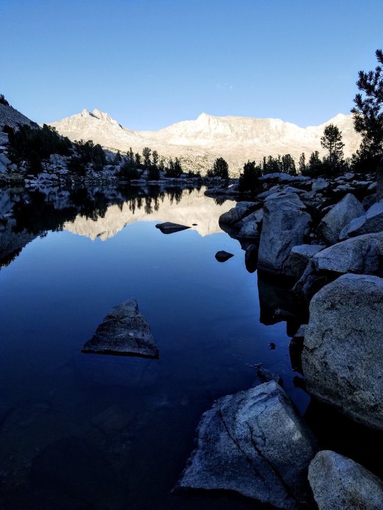
We top out at 11,800 ft and marvel at what lies beneath us. Lake Basin is definitely one of the most beautifull quintessential alpine basins in the Sierra. We get right down to business consuming much needed calories and hydration as we examine our route across the basin to Dumbell Pass, our next objective. It’s always great to see your route from a higher, more distant vantage point, like an Eagle’s perch.

My eyes pour over the contours of the valley below trying to identify Frozen Lake Pass acoss the way and a little to the Northeast. It is notorious for being one of the scariest of all the 33 passes on the Sierra High Route. I think I can see it from here. I spend a few moments refelcting on that experience, which I would not intentionally repeat, at least I say that now. Everyone talks about that pass with disdain, and I was not in a good headspace when I did it four years ago. If you’re interested, here’s a link to my post from that day: How to Fry Your Nerves. In retrospect, and after the Baxter Peak experience, I wonder how Frozen Lake Pass would compare? I bet it would be so much nicer with a good snow pack and the right equipment. I wonder if I will do that one again. Maybe the other direction? Crazy.
We go bombing down from Cartridge Pass on a little trail that is easy and fun. We lose 800 ft in elevation in only 20 minutes and we are chatting and laughing the whole way. At the bottom, we look back up in awe what we just came down. You can’t even see the trail from here as it’s been absorbed by the chunky boulders. Amazing, how wonderfully fast a trail is!
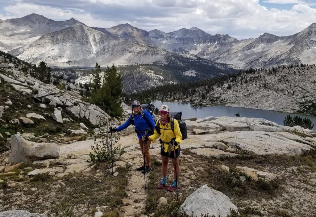
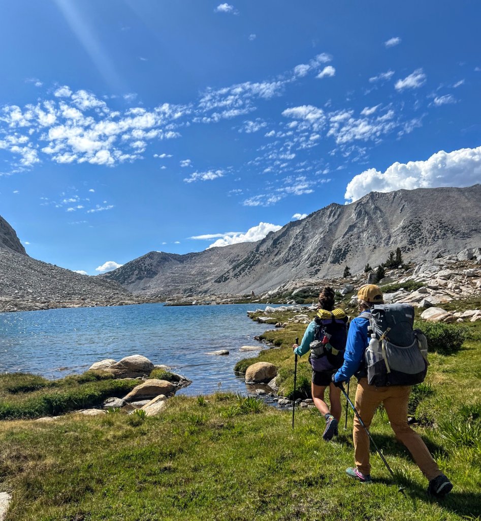
We spend the afternoon meandering along a circuitous route next to the shores of the sparkling lakes. We are loosely making our way over to the area at the base of Dumbell Pass yet we are not making a beeline for it. Michelle comments through laughter how differently we all navigate. I’ve been in the lead for this little section and apparently I am the one who takes the “pretty” route, which can definitely be circuitous. Michelle navigates like a straight arrow, aiming direct for the next objective. No obstacle is too much to scramble right over or across. Christy likes grassy ramps and nice angles. She will quietly study the route to identify the path of least resistance. This woman has the remarkale ability to take what looks like a gnarly climb and turn it into an easy walk up. I suppose that’s what 25+ years of walking in the mountains brings you. She sure has it dialed.
We haven’t determined if we are going over Dumbell Pass this evening or not. Christy has done it before and while the contour lines on the map make it look super easy peasy lemon squeezy, her trusted beta is that the North side of the pass has a shit ton of large boulders, so it’s slower than you would think.
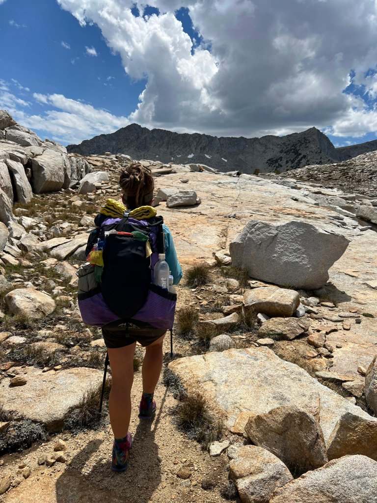
We take our time making our way across this lovely basin and decide to just see how it goes this afternoon. I think we are all a bit tired to be honest. Christy is having some breathing challenges still from the remnants of Covid, Michelle has been dealing with some of her own health concerns although she does not show it, and you know what I am dealing with. I am feeling wiped out just from that situation alone. While I don’t say so, I am hoping that we camp before Dumbell Pass. I would much rather stop at a decent hour tonight and get some rest, hitting the pass at first light tomorrow. But if the girls want to do the pass tonight, I will certainly rally. Rallying is what we do.
About a half mile before the pass, there is a little tarn shown on our map. We decide to get to the tarn and evaluate from there what to do. We aren’t sure if that tarn will even have good water, so we stop at a little spring along the way and tank up for the night just in case we need it. We sit at the spring and the chatter organically unfolds. This is where we all start to admit to our fatigues and health concerns. Michelle shares that she would prefer to stop and camp before the pass too, and this is to my great relief. Even though we are all willing to go the distance and show our grit, I think we are all on the same page with wanting to get to camp at a “normal” hour tonight. If we go over the pass, surely it will be an 8pm finish. No thank you, not a third night in a row!
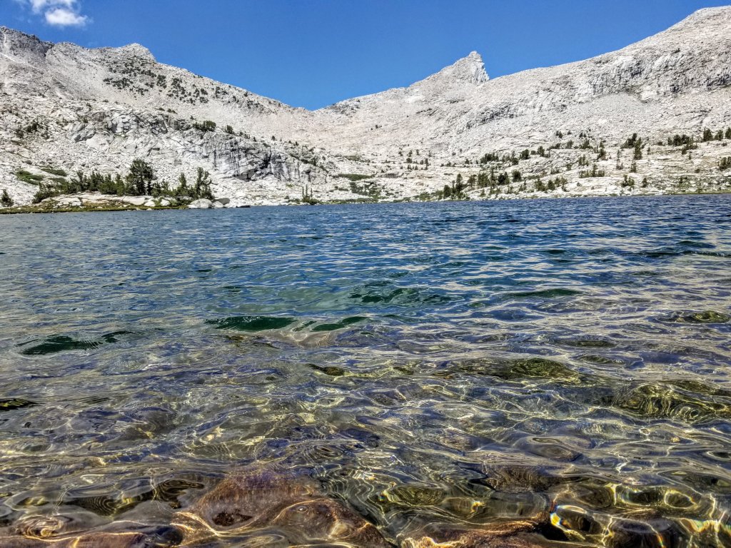
There’s always potential for the landscape to be deceptively easy or deceptively difficult based on what you see on your map and what is actually there. Turns out that little tarn is a full-on lake! It is so beautiful and the shoreline looks incredibly inviting with plenty of good camping opportunities. From this vantage point we are well above the lake still, so we have to drop precipitously to the shore over a few tricky rocks and little chutes. I’m thinking a ladder would sure come in handy here as I follow Michelle’s direct approach. Meanwhile, Christy finds herself a grassy ramp to walk down. Jealous!

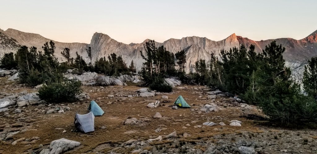
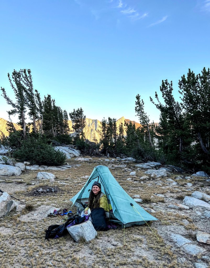
As we pick our way down very fews words are spoken, we are intent on getting over to that inviting lakeshore. When we arrive we are not disappointed. We’ve struck hiker gold! This is the most beautiful campsite and it has all the elements: a flat grassy platform to pitch, trees for ambiance and privacy, stellar views, pristine and plentiful water. Looking out toward Red and White Pass above Marion Lake there is some jaw dropping gorgeous geology (reference Sierra High Route again). You can see the long dividing line between the granite and red rock that I think is some kind of shale. The line goes all the way down to the dirt. How did that become? So fascinating and beautiful, a truly remarkable feature. As the evening settles in with golden light, the play between the contrasting rocks unfolds even more. Yep, five star camping tonight! As we get to work pitching tents we are all in high spirits and we are prefectly set up for a sunrise hike up to Dumbell Pass tomorrow.

Hi M.
I am so jealous! Lake Basin is a true destination spot in the Sierra. I’ve managed some pieces of Roper’s route, but never any part of the first section – probably because of Frozen Lake Pass and my stubbornness in considering Cartridge Pass as a “cheat” in doing Roper. Your images reinforce the loveliness of the area and were a great help in plotting your route on Google Earth. I love tracing different routes on maps and your thorough storytelling makes it possible to pick out your route and “armchair” my way along with you guys.
Glad to see you have an earlier evening on this day. I can only guess at the laughter and camaraderie you all shared as you had time and daylight at the end of your hiking day.
I am really enjoying following you on this trek and am looking forward to the rest of your story.
Hi Tom! Awww, well that is such a great commentary, I am happy to know there is enough information for someone to really follow along if they so choose. I would definitely say to go for Cartridge or Ampitheater Pass on the SHR as an alternate to Frozen Lake, it’s not “cheating” at all though I get what you are saying. Thanks for your thoughtfulness and I am so glad you’re enjoying!