
July 19th, 2022
60 Lakes Basin –> Baxter Pass Trail –> Baxter Peak –> Stocking Lake
~8.5 miles +3,300ft / -2,000 ft
It’s always hard for me to switch to an early start schedule. My alarm sounds the first time at 4:25. No way. Not gonna do it. I fall back to sleep. Then my other alarm, 4:45am. Ok, I have to pee. I switch on my head lamp and feel the outside of my sleeping bag, it is so wet. Everything is wet. There is a pool of water coming into the floor from the seam of my tent screen. Oof, this is going to be interesting. Hopefully we get enough sun to dry our gear out at some point today.
Coffee, of course, is a Godsend and I sip the wonderful hot brew as I take inventory of my snacks for the morning. I am pretty sure I rationed everything well, yet, I am already feeling like the hiker hunger has kicked after last week’s jaunt. Plus, when we hike cross country we use a lot more energy. I really hope what I have is enough. I am learning, learning learning. I know there is going to be so much learning on this hike. I feel like today is really our first day, as yesterday’s cross country travel was straight forward and easy. We do have a weather forecast for rain/thunder showers today at 40% before 11am. We’ll see what happens.

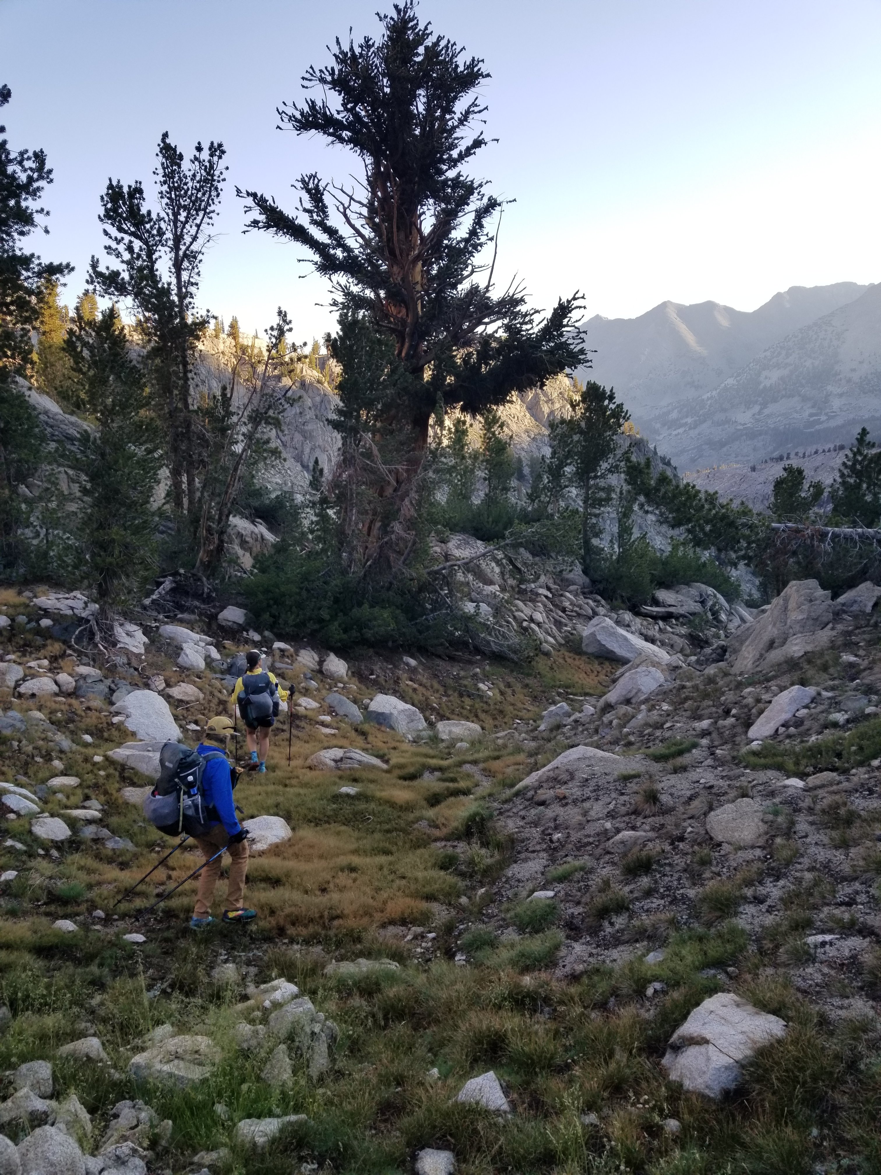
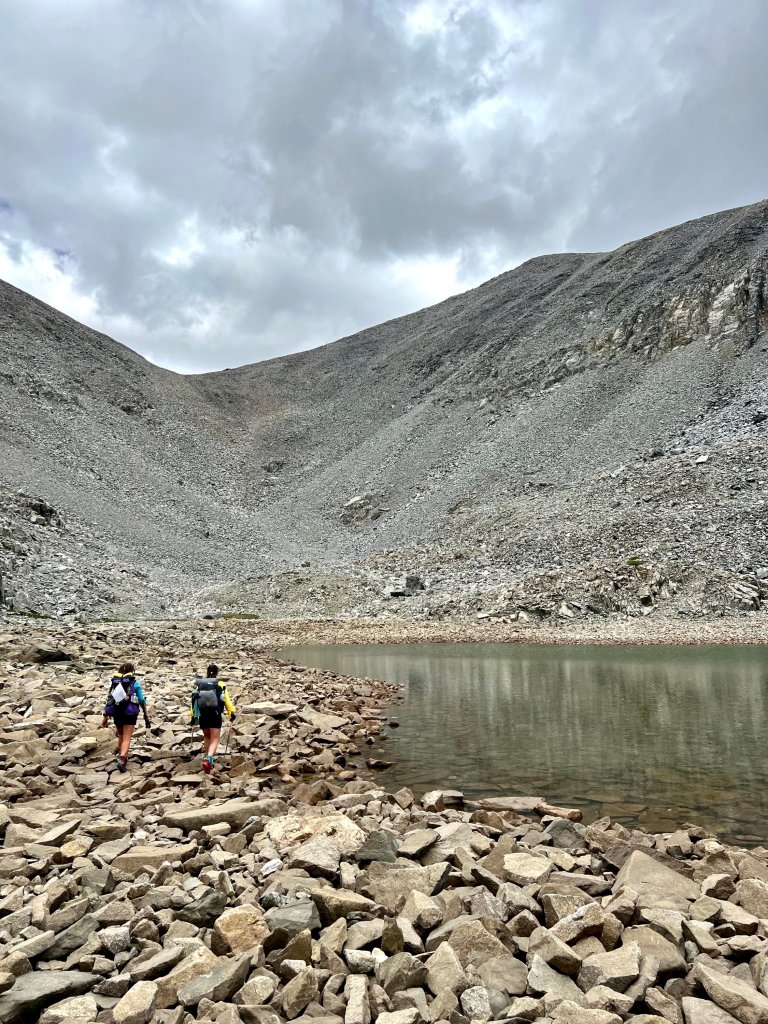
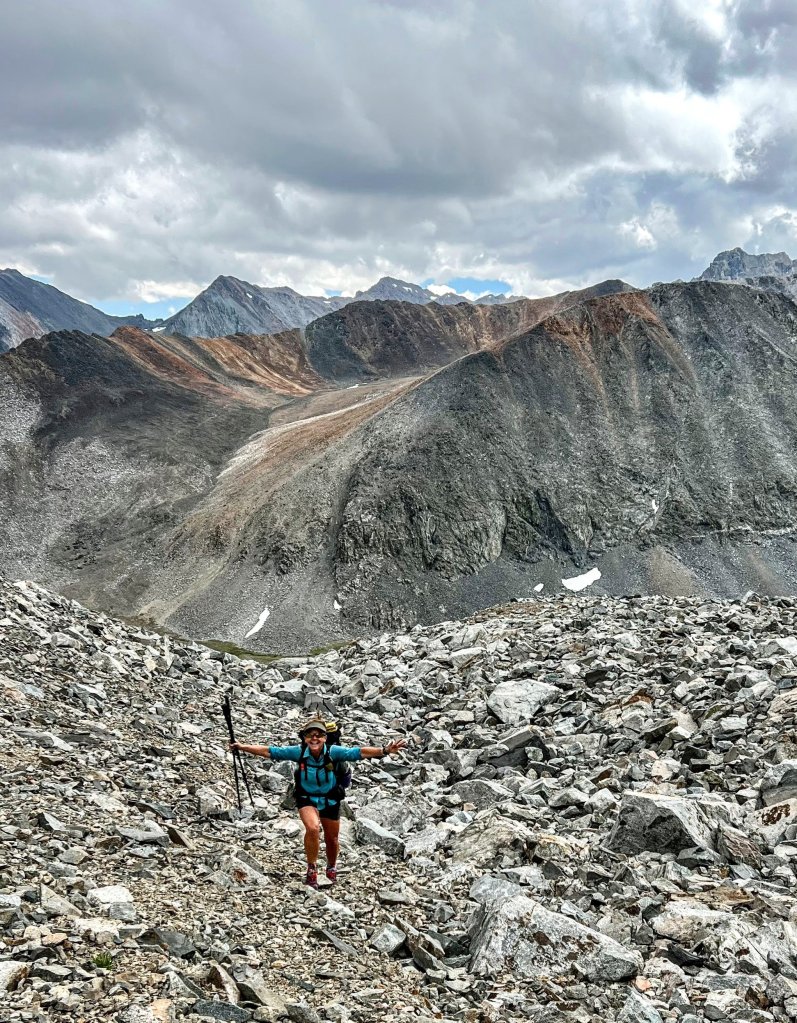
We start out the day with super lovely walking, first down a little use trail and then we climb through a feature called Basin Notch, which drops us shortly onto the JMT after a little scrambling down a ravine lined with vibrant vegetation, wildflowers and trees. We are only on the JMPT/PCT for a minute, then we connect with the Baxter Pass trail at Dollar Lake. We follow and lose this trail several times as it will be goin’ just fine and then suddenly disappear. Eventually we make it into the canyon that leads us to the approach for Mount Baxter.
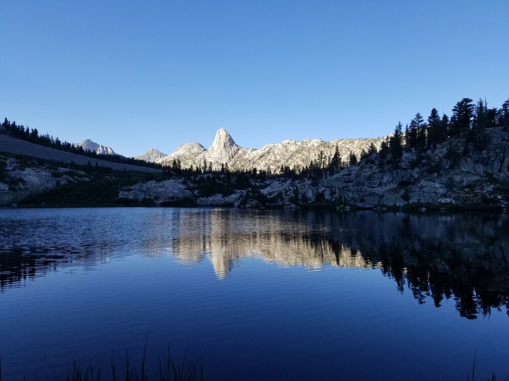
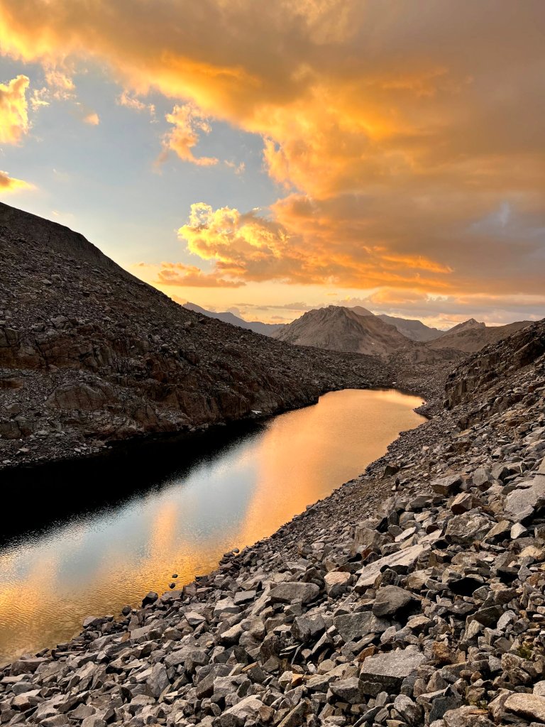
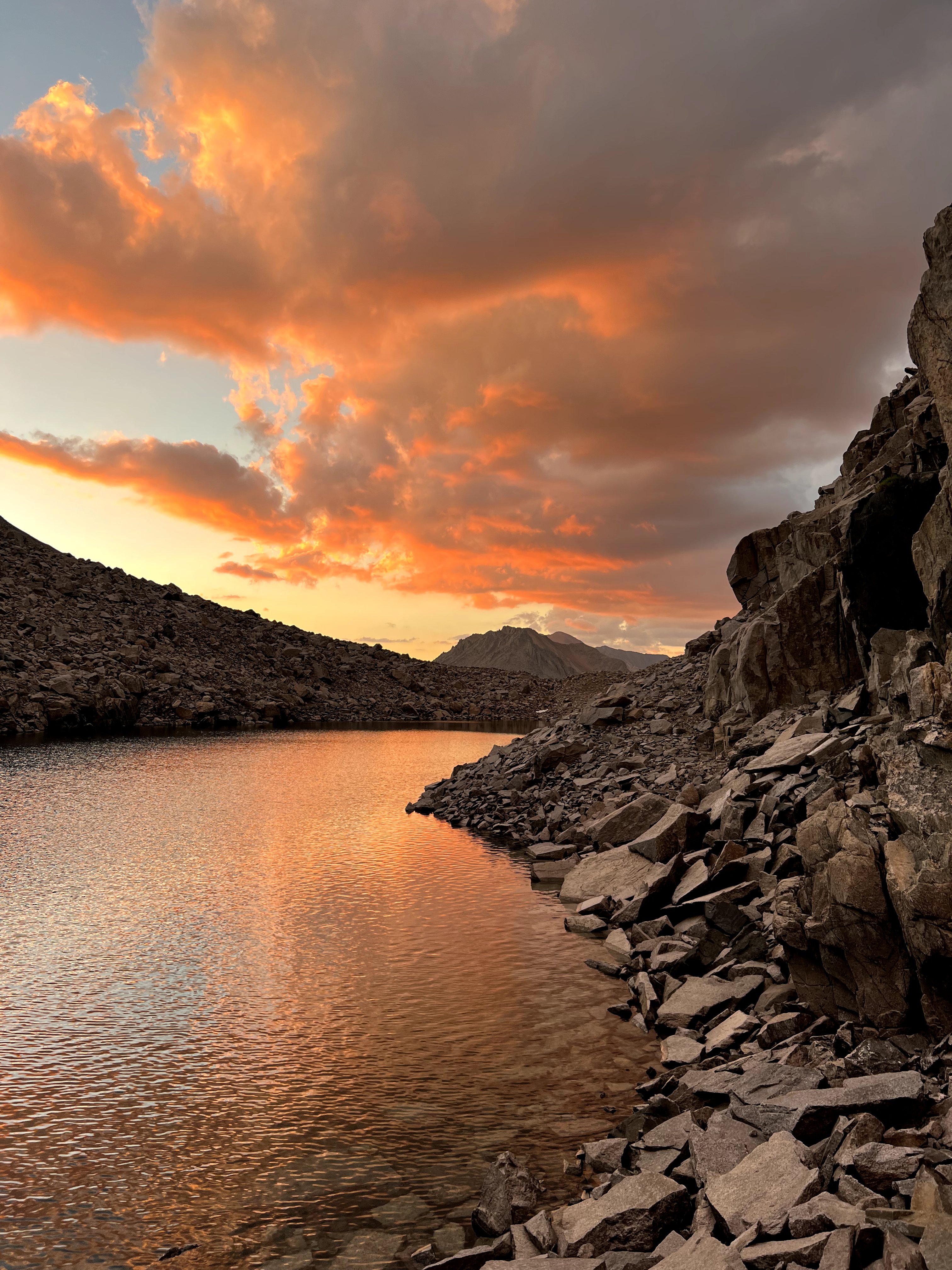
Around 10am we are already so hot, we want water, and not just a drink of it, we want to get into it. At 11,000 ft there appears a lovely little pool of small lakes coming from the outlet stream of a larger lake that lies ahead. We stop here and dunk in the water while our tents and sleeping bags dry out in the sun.
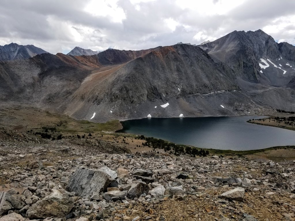
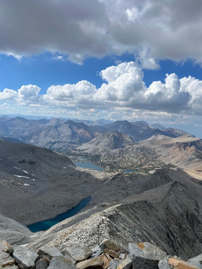
The views up here are quintessential Sierra Nevada with that cobalt blue sky accented by cloud formations that morph every few minutes, casting shadows on the pointed granite features in the distance. The water is clear, pristine, inviting us in. One of the Sierra’s greatest gifts to us, plentiful water. Even now in a year of severe drought, water pools and flows relentlessly. I sudenly have the realization that I’ve made it here. I am so thrilled to be exploring uncharted territory in my favorite mountain range in the world. The places we will explore together over the next 13 days I’ve been dreaming of for years. I am so grateful I get to be here, so grateful for these friends who want this as much as I do.
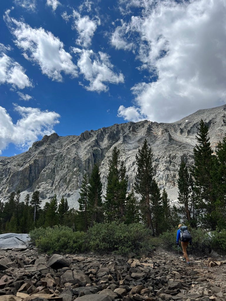
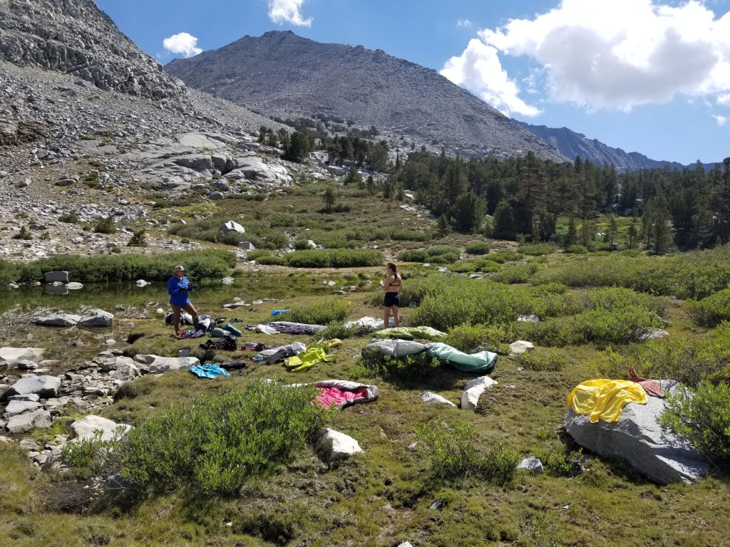
We take a pretty long break, but when we start off again everything is dry, success! I’m feeling comfortable in the group as while we are tackling some massive terrain, the vibe is never rushed, I never feel any pressure by the girls to keep moving or stay on any schedule. This is wonderful. We take a lot of breaks and we laugh a lot. I mean, how could we call ourselves Team Lounge otherwise right? We continue up the canyon meandering through trees and meadows again losing the trail often but eventually the views open up and we can see Mount Baxter for the first time.
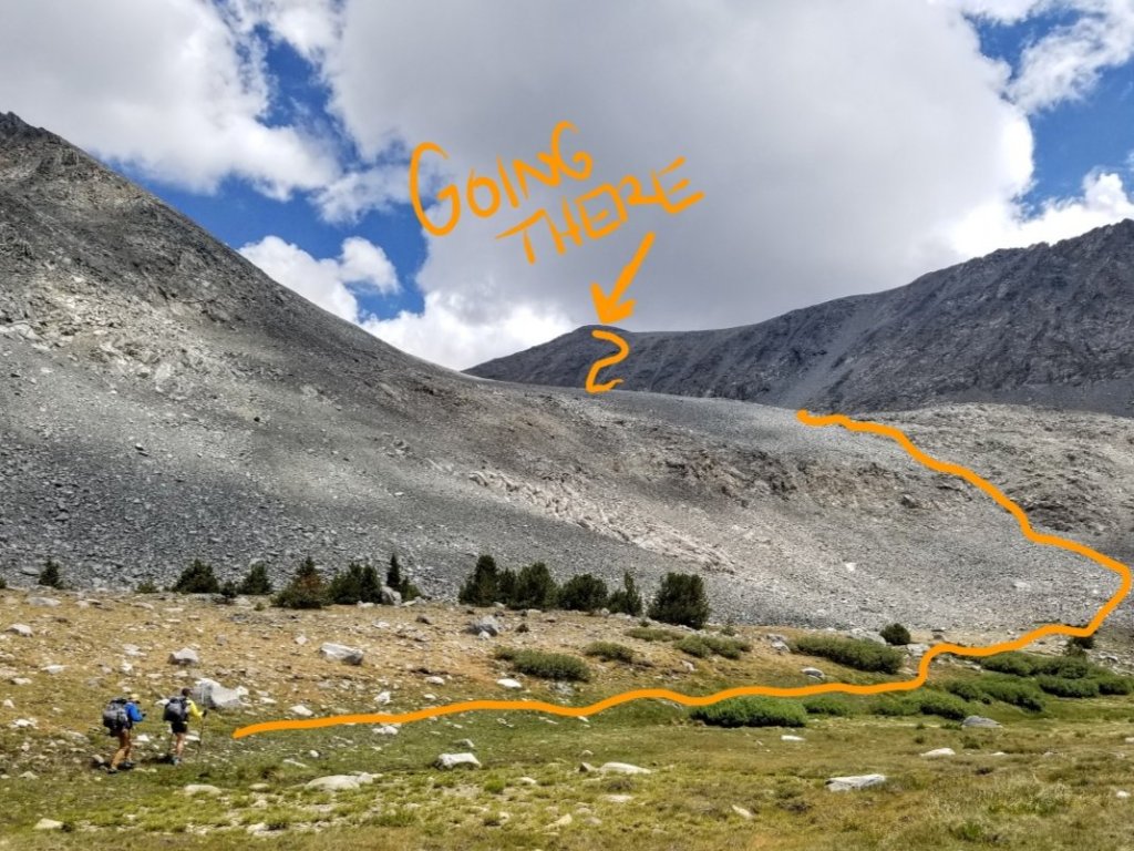
Christy’s first expression is to the effect of “wow, that looks quite intimidating” which is not encouraging. This gives me permission to admit I’ve had anxiety about this mountain for weeks. Nevertheless we decide the only way to find out what it’s like is to get closer and go into the belly of the beast. And, the only way to get to Woods Lake without backtracking, is to climb the mountain and drop to it’s Northern side.
The first scramble is just an appetizer of what’s to come. It involves a little slope of boulders and talus that pops us up to a small tarn which sits at the base of the gully we are to climb next. That pitch to the summit is at least 1,200 ft of vert in a .25 mile distance, fun stuff! We eat lunch at the tarn and fend off raindrops and hail intermittently but it does’t rain all that much, nothing like yesterday, so we are happy. We sit looking up at the task before us. It looks way less intimidating now at close range, than it did before.
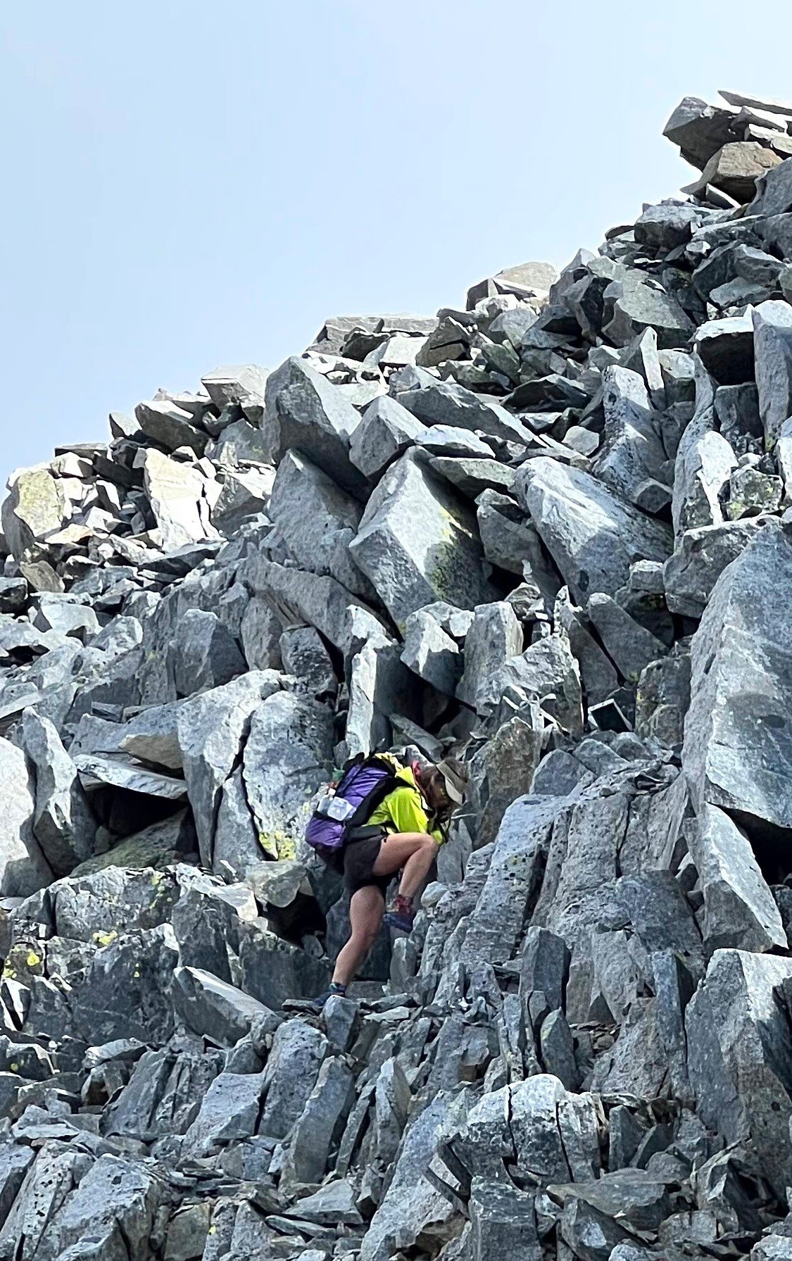
I’m feeling good that I got a complete lunch in as I know I’m gonna need it. With full bellies, we set off to climb that long ass, steep ass gully to the Summit. Let’s do this thing! We put away our trekking poles so we have free use of our hands. The climbing is work for sure but the fun kind and whenever I stop to look back at the views from where we came my jaw drops, we are making good progress. This is some stunning country! How many people get to see this and to this?
As I make my way over the chunky rocks I fall into a meditative state where all I can hear is the rhythm of my own breath and the occasional clanking of rock on rock. It takes a lot of time to pick our way along, constantly scouting solid footing as the further up we go the looser the rock is getting. So much so, that at a point it is so loose Christy calls it “Crazy Pants”. It seems fitting, as the instability of the rock does become a little bit of a factor in both our speed and level of comfort. Eventually there is a good chunk of stable blocky rock lining the upper gully so we use that as a handrail and this turns out to be super helpful.


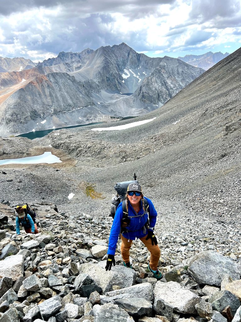
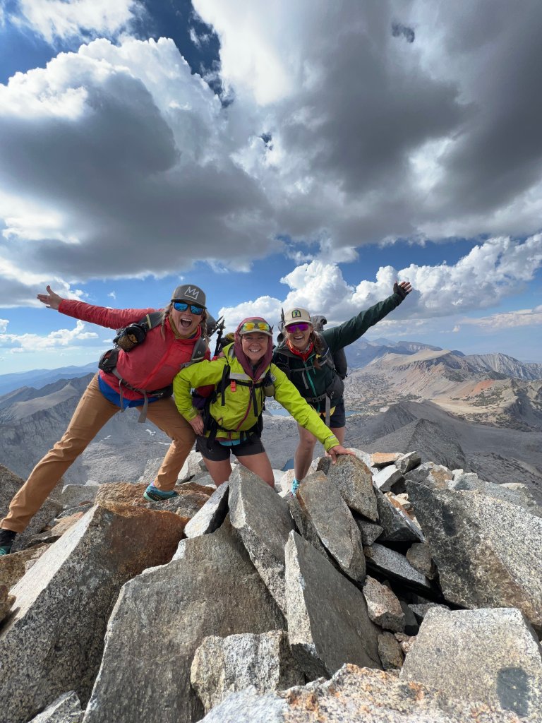
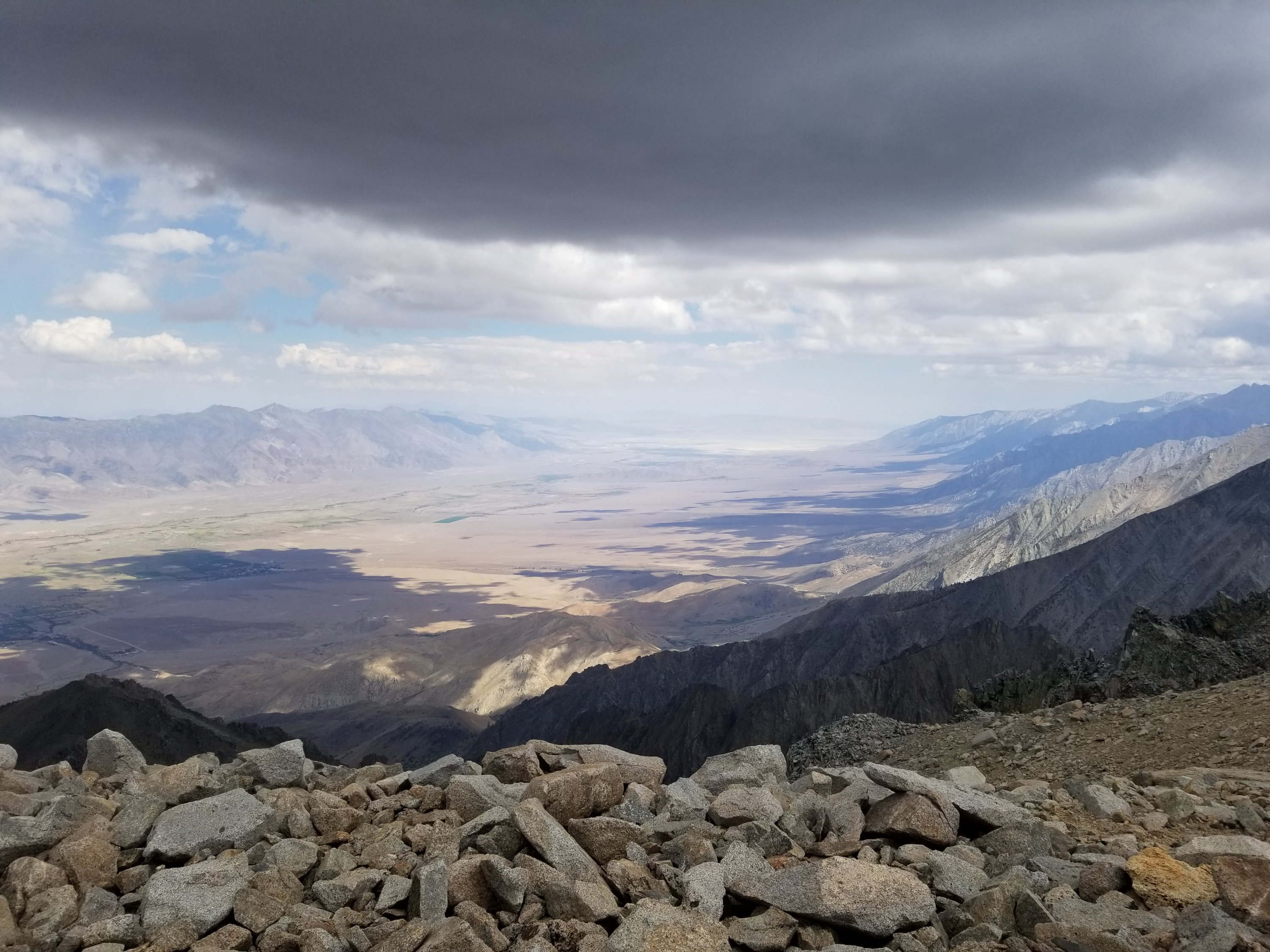
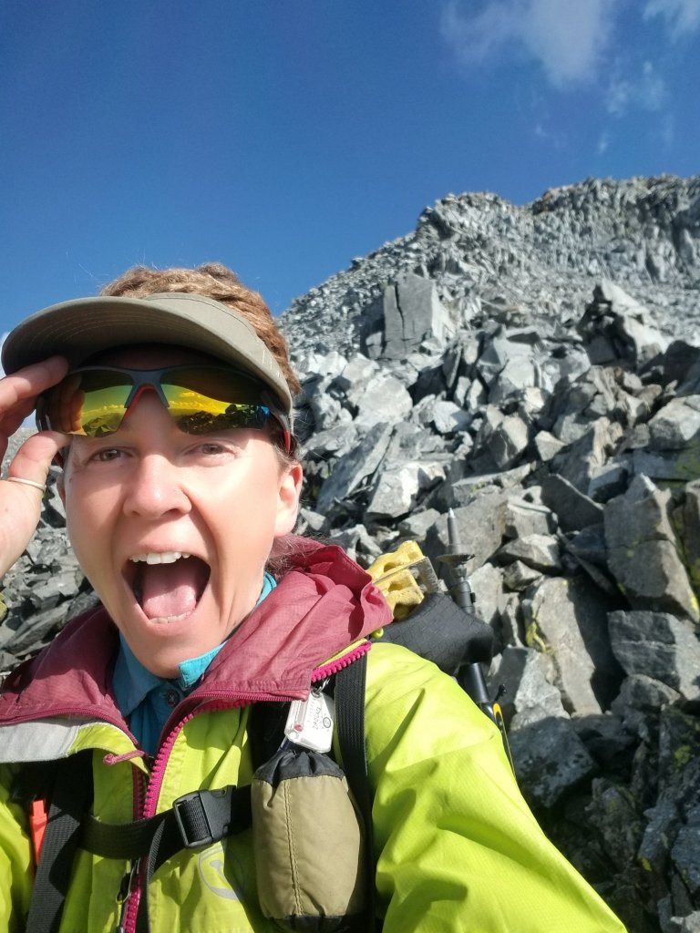
After 1 hr + 40 min of steady climbing, we reach the broad surface on the summit of Mount Baxter at 13,125 ft and what views!!The summit spreads out fairly flat on top and we walk around looking for the summit register. Don’t always trust your GPS, as our GAIA apps led us to the incorrect summit. We walk well out of our way to the marked location but it does not feel right, there is a higher knob to the NW that seems intuitively like a proper summit and it is there that we locate the summit register. Whoo hoo!! We take a bunch of photos of the truly stellar views and our 2nd Team Lounge photo on the summit of Baxter, IMO it’s best photo yet (photo courtesy of C. Rosander).
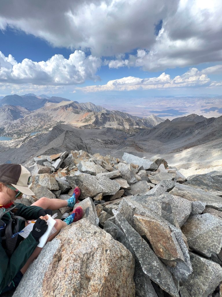
Alright, it is snack time and time to figure out how to get down. The wind is picking up a bit, there are little drops of rain tapping on our heads, we layer up and start scouting for a good place to drop in. There are two possibilities we find and neither looks great but we decide on one and start to make our way down onto the ridge. Michelle and Christy go on ahead telling me to wait just in case it doesn’t go.
For what seems like an eternity I am poised on top of a chunk of talus, feeling the full gravity of the Earth holding me down. I can’t see them but I can hear their voices echoing below. I know this is going to take me out of my comfort zone, and in this moment of realization, I settle into stillness out of necessity. We have a lot of work cut out for us and it is very exposed. The definition of exposure. I am so thankful for Christy and Michelle for their patience and guidance, I know I got this, but I am going to be the slowest one. Someone has to be, right?
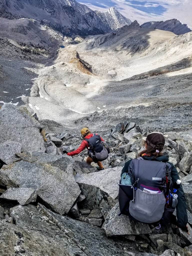
We need to drop to Stocking Lake and beyond to get off this mountain, and once again we are dealing with a significant descent over a miniscule distance. We are talking in the ballpark of a 1,400 ft drop over aout .3 mile straight down to the lake, but we really want to aim for the head of the lake at it’s Northern tip. All I can say is the next mile takes us four hours. This is truly the definition of “Crazy Pants”. Apparently there is what Christy calls “Crazy Spaghetti” and that is encountered on a farily regular basis while traveling cross country over mountainous terrain, but when I ask her what the difference is between crazy spaghetti and crazy pants she says “well, crazy pants is next level”. I think she just invented this today. It seems very appropriate.
We are slowly making our way down to the ridge when she turns back to me and says “you know, I would never do this on purpose”, which does provide me with a wash of relief because I’ve planned 12 more days of hiking up here with these two. Then she jokes that there would be no trip report for this one, which breaks the ice of tension I’ve formed around myself. In between moments of intense focus, we laugh “hahaha, yeah, come hike with us! Isn’t this great?” I love this about Christy, she is able to provide levity to a situation that to me is ladden with gravity. Her level of comfort in the mountains, which comes from a vast well of experience shines through in this situation.
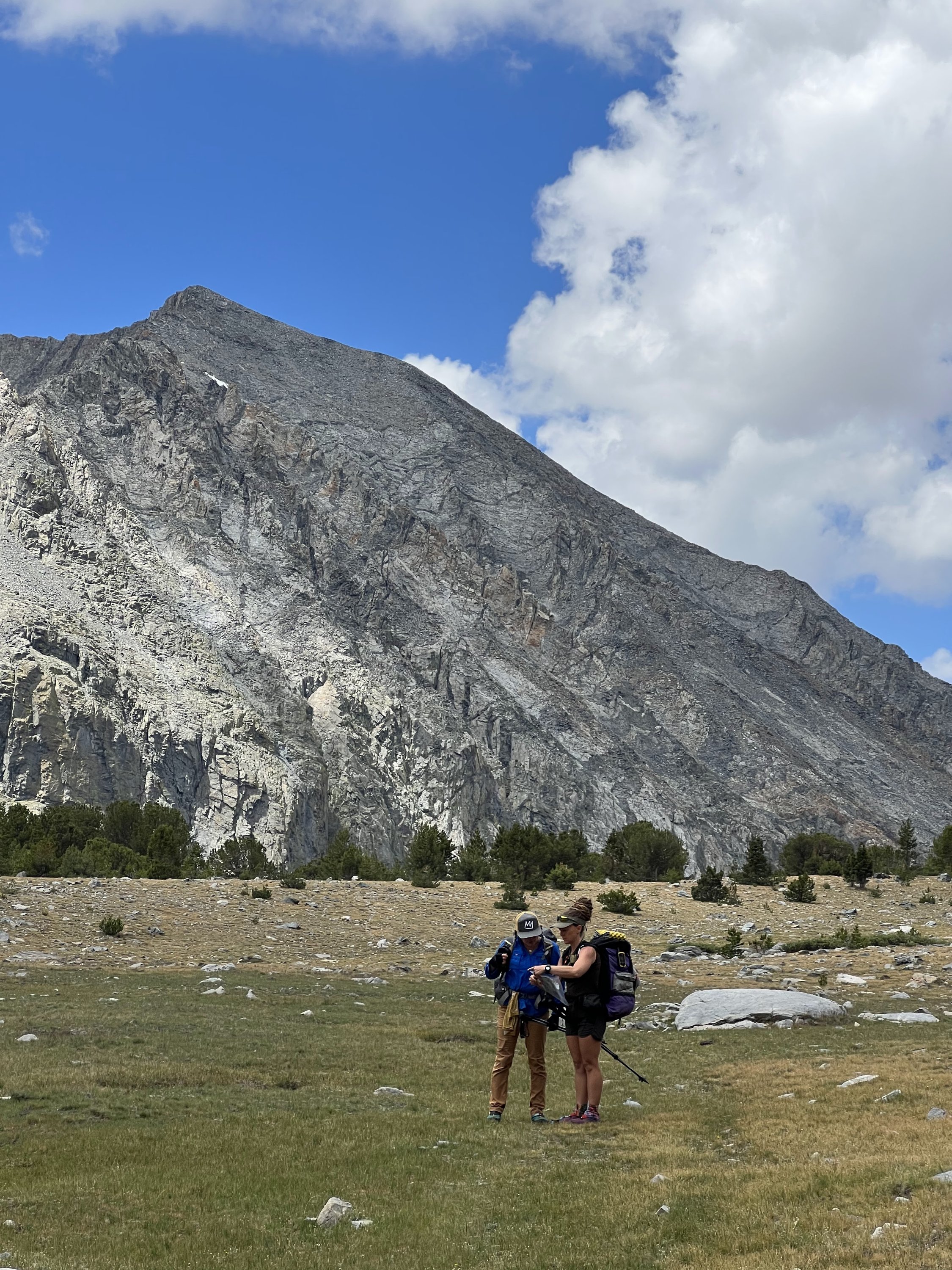
We follow a trusted GPS track over to the Northwest side of the ridge looking for the drop in spot in a little gully. Christy and Michelle take one look at it and turn around. I never even see it. I think this is a spot that people tend to climb up rather than down, and if the girls aren’t comfortable going down it, I know for sure I won’t be. So we have to re-group and come up with a new plan. Following said GPS track, fail. And that’s okay, that’s what maps are for.
Stopping to re-group means we eat more snacks. The amount of focus and attention it takes to navigate this terrain is definitelyl next level and requires much more fueling that I am accustomed to on just a straight forward trail. I know I am digging into my snack rations for tomorrow when I shouldn’t be, but in this moment I don’t care. I will deal with that later.
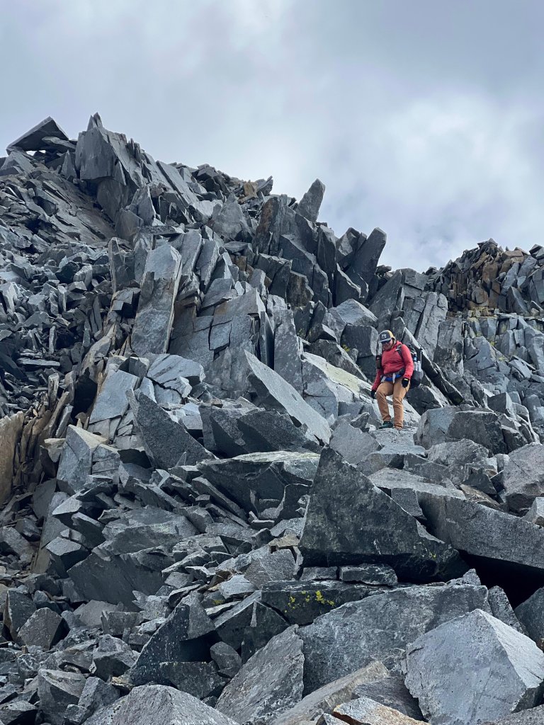
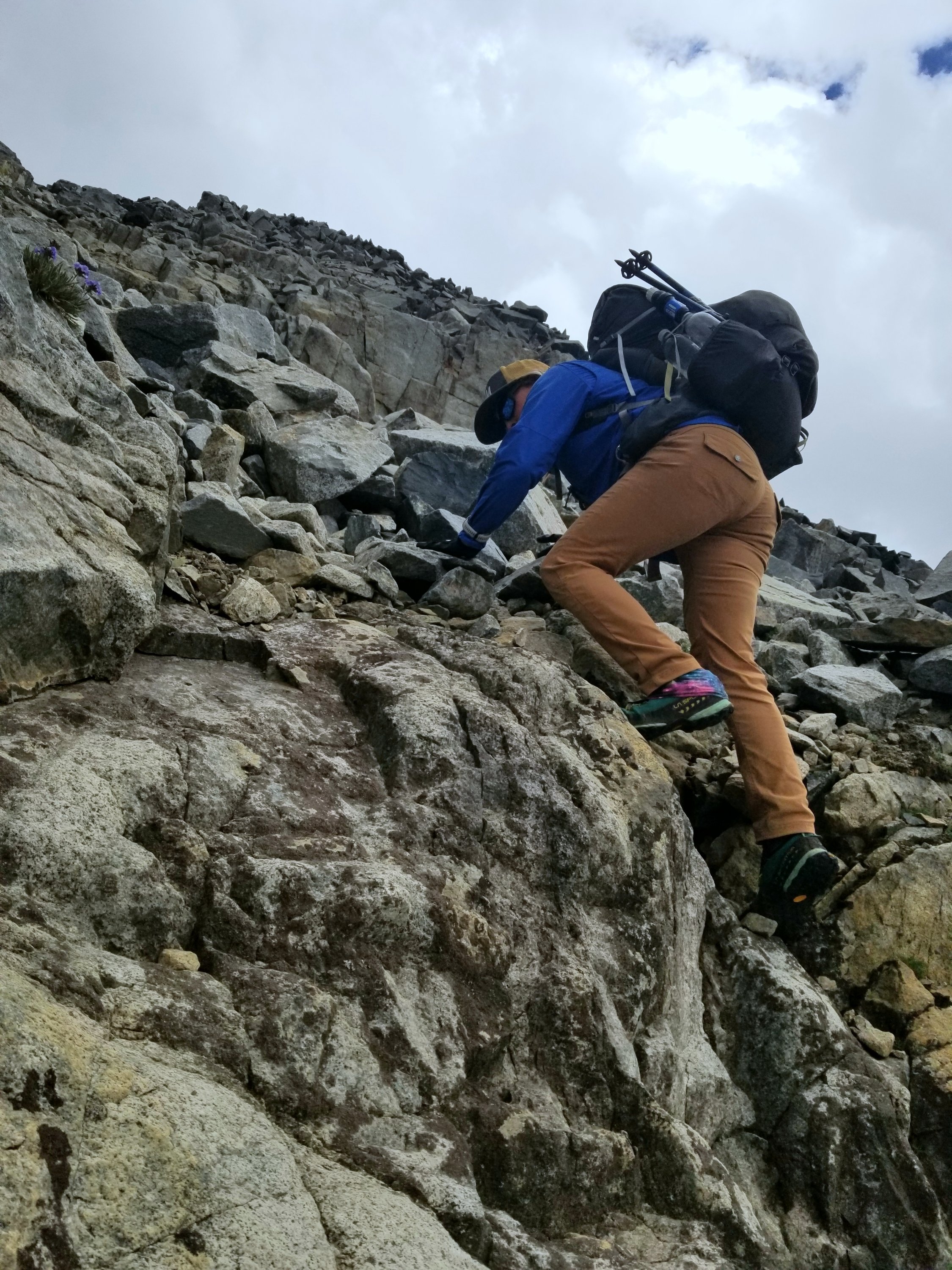
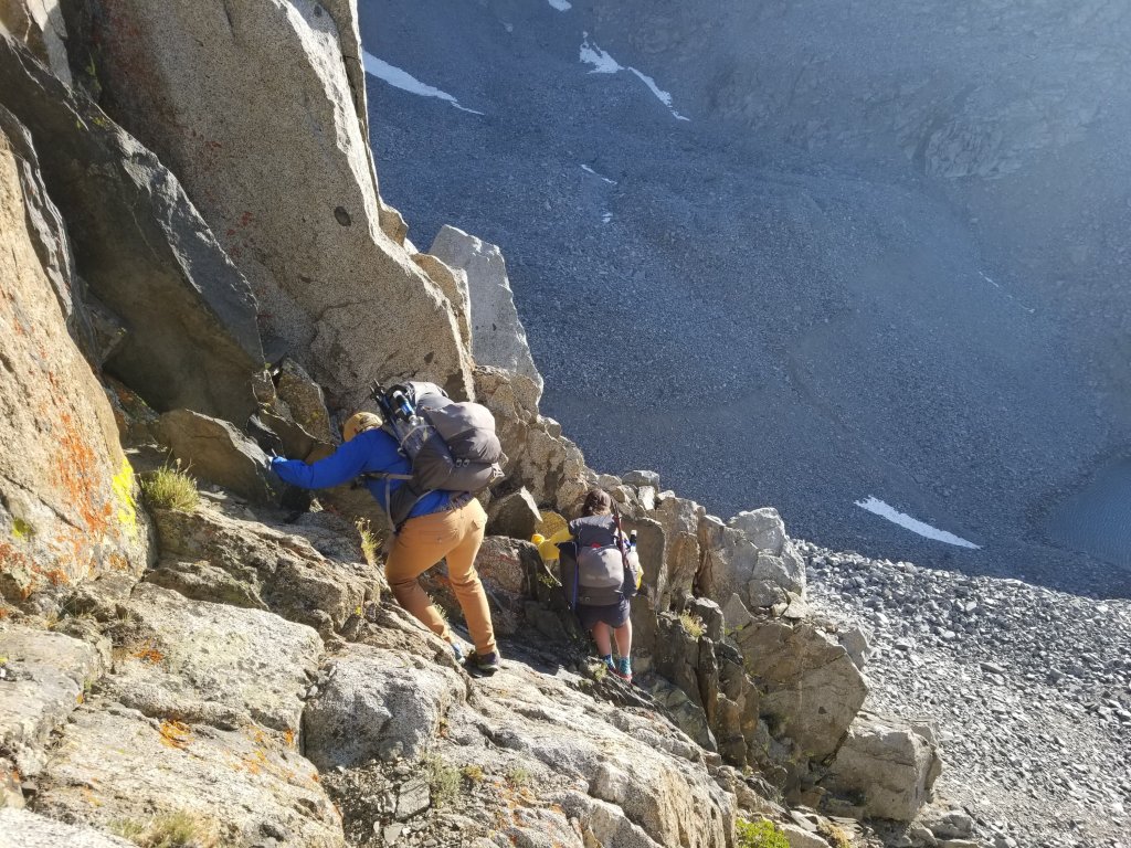
If you read the description of Baxter Peak in R.J. Secor’s book, you will see there are routes anywhere from class 2 to class 5. We definitely manage to avoid the class 5 stuff, but the level of exposure and loose rock, combined with some moves we have to finagle, qualify as bordering on class 4, except we do not have any ropes. My prediction proves accurate, as I am now for sure pushing my own boundary not only of what feels comfortable but what feels safe. We get into some pretty intense stuff. A lot of this does not feel safe due to the exposure and very loose rock. So, disclaimer, we are not recommending that people go hike this peak and drop down this NW side like we did so please don’t follow us here. This is not yer class 2 playground.
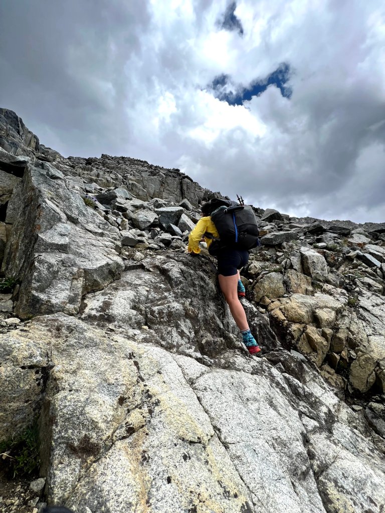
We decide to drop into a little gully because it looks like it might “go”. Yet, we can’t see past the next corner, or the next gully, or the next drop off and just like that this goes on and on for the next few hours. Michelle is uber brave and leads the route for us, she is truly the testee of the group. She tries out section after section to see if it goes, and she has a remarkable ability to make anything work. They both guide me along a few times when I have to down climb, helping me with my foot placement cuz I can’t see. Michelle is helpful with encouraging words for me saying “use your abs” or “use your legs, your legs are really strong” and my personal fave “you have to be willing to extend”. We will laugh about that one later. She may not realise how big of a help her words are.
We are causing rockfall left and right, things are slipping out from under us. To me, it feels like the overall energy of this side of the mountain is teetering on the edge of collapse. I don’t feel any energetic integrity in these rocks. This is unquestionably the definition of type two fun (not fun to do but fun to talk about later), bordering on type three fun (not fun to do and not fun to talk about later) at times. We’re not sure where the class 2 section went and now I’m not sure where we lost the type two fun, but I know I must stay relaxed and try to smile.
5:30pm. We have a long-ass way to go. Or as Chirsty says “a fair bit”. I am learning that when Christy says “a fair bit” it is not a small measurement. We have abandoned any hope of finding a class 2 route down, yet even class 2 can be downright scary when all the rocks are moving from under your feet with every single step so I don’t even know what this is now. I’ts crazy pants is what.
We keep having to cross gullies to get to terrain that we can manage to squeak around. The exposure is nearly constant and the drop-offs are straight down. A fall would be consequential. Time stretches out into infinity as we teeter on the loose rocks with our 35 pound backpacks. I am feeling the weight from my pack and the down climbing, squatting and sitting on my butt with every move. My knees are taking the brunt of that pressure. I am finding I need to use my hands and arms a lot to balance all the weight and also to hang on to something at all times.
None of us are saying much, we are intently focused, the air is totally still, the afternoon light is fading by the minute, the only sounds I hear are that of rock clanks as they get dislodged and crumble down the mountain and my own breathing. I am getting real bad dry mouth now. I try to keep drinking water, yet it does not quench my thirst. We each have a close call of some kind with these rocks, the adrenaline is sure running high. I find I need to really focus on breathing to keep my hands from shaking. My sense of time and space is completely distorted.
The further we make our way down, the more confirmation we get that this entire side of the mountain is a loose mess. We are probably all thinking the rock will improve as we make our way closer to the bottom, yet it never gets any better. Things look like they should be stable, but nothing is, it is quite remarkable actually. Everything has to be tested before making a move. At this point we have lost trust in the rock.
There are finally a couple of crux moves we have to make to get past the last drop and last gully. Beyond this point the terrain becomes a little more manageable and maybe slightly lower consequence. Not gonna lie, I said my prayers for assistance back there as nothing seemed like it was going to turn out good. Yes, I called in for reinforcements for sure!
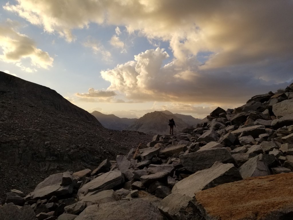
By 8:15pm we finally get ourselves down to the shore of Stocking Lake and I can’t tell you what a wash of relief it is. To be talus hopping on large boulders that even though they move and even if you fell from one, you would only end up in the water, is a welcome that fate! It’s not until this moment that I have any sense of control. I pause at the water’s edge and say my thank you’s to the powers that be who assited us on today’s quest for adventure. It appears we are being rewarded with a stellar sunset for what we just endured. Thanks for that! And thanks for keeping us safe!
When I reach the water I see Christy at the head of the lake stopping to dunk her bottles in and MIchelle is up ahead scouting a place to camp. I have the worst cotton mouth ever so I stop right where I am, teetering on a boulder to dunk my own bottles and then start swigging. The swarm of little gnats is insane next to the water and I’m nearly sucking them into my mouth as I drink but I simply don’t care. I am so thankful for everything in this moment, even the gnats!
From the head of the lake we still have a lot of talus and boulders to traverse and it’s getting dark. We need to find a place to camp soon, it’s 8:45pm and we are NOT night hiking here! We get out our headlamps and squint our eyes looking across the horizon into a field of boulders that stretches to the ends of the Earth. We spot what looks like it might be a flat spot with fewer rocks, maybe even dirt, but it might also be a mirage. We might be hallucinating. Like everything else we’ve done today, we just have to get closer to it and see what’s there.
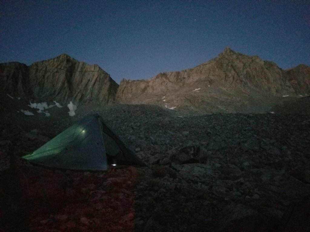
It feels amazing to have my feet on something that resembles dirt again and I bend down to kiss the ground. This is by no means an ideal campsite in terms of surface area, but there is literally nothing else. We scout around and decide we will make this work.We remark at the good fortune we have to get any place at all. And thank goodness we all sleep on air mattresses! We make quick work of pitching our tents in quite creative ways on top of so many rocks.
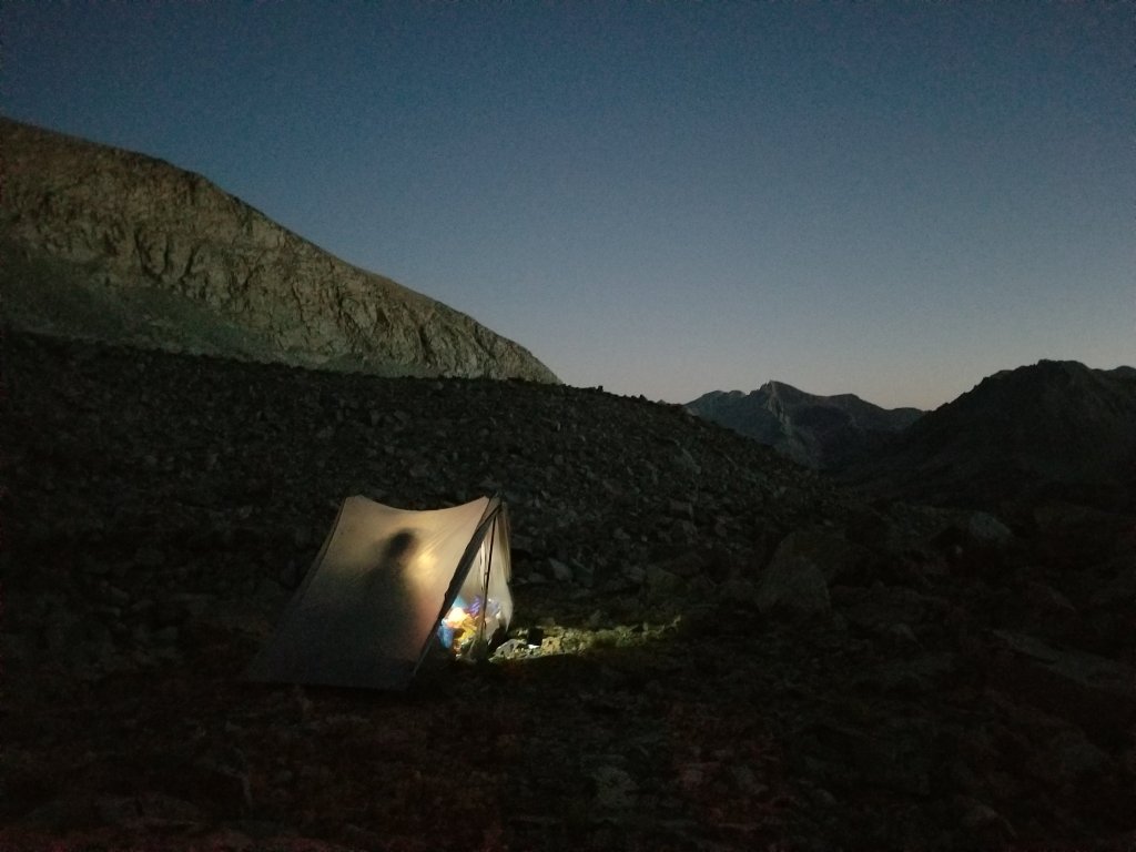
In the midst of our camp chores, we pause to look around us, and look back from where we came. It looks impossible. How did we do that? And look at where we are now, it’s like we’re on the moon! The silhouettes of the peaks and ridgelines encircle us, the sky is midnight blue and the stars are popping out like costume glitter. Aside from the rocky surface and the exposure this is truly a five star campsite! And it’s not raining!
We each retreat to our tents in silence prioritizing self care and eating dinner. I look down at my legs, they are covered in bloody scrapes and so many new bruises. My right hand is bashed up from a rock that fell and hit it. Christy offers me some of her essential oils to help the wound heal faster and it is truly so soothing. Thank you Christy!
I tuck into my sleeping bag, so happy to be inside my tent and eating my dinner. Annies Mac N’ Cheese with broccoli, such a gratifying meal after a tough day. In this moment my understanding sinks in, I am amazed at what we just did, we made it, we actually made it! By 10:49pm I am still awake, you would think I would collapse from sheer exhaustion, but I still need to come down from the adrenaline of the last 5 hours. I sip my tea and settle into my bed finally laying flat on my back, finally etting all the tension of the da. This …. feels ….amazing.

That was a hair raising amazing accomplishment! I’ll stick to reading about it, I don’t see myself tackling a route like that ant time soon, lol!
Haha, it was hair raising to do, glad you enjoyed the read!
I have been wondering about this route for years. And you did it. Anything to keep out of the woods creek hole! The big question was always, to do mt. Baxter or go over grasshopper col. The north side was said to be steeper. So going north to south would be easier. Congrats Mary Poppins on going cross country. Bunches of good stuff ahead!! The Sierra just keeps delivering. Igor say ” paper map gooood “. Take care Ed
Hey Ed! Oh yeah, this was certainly a cool route however I would only do it again in the opposite direction! Grasshopper Col looked downright lethal to e honest, it still had a very steep snow field (more like ice) on it’s N Face, Christy mentioned ppl get stuck up there all the time!
Hi M
Great photo on Baxter. Was Team Lounge happy to be there? 😉
This is such a great illustration of the priceless joy camaraderie can bring to a challenge. You do a wonderful job exemplifying the assistance of your teammates and recognizing the value even a seemingly simple gesture can have. All while being brave enough to admit to the “grips” that are often unavoidable.
Congratulations on conquering that beast. Looking forward to a piece about strolling through a meadow. 🙂
Hang in there Tom! We will get to the grassy ramps as we call them soon! Thank you for following along and your commentary which makes me smile 🙂
Looks like a great journey! I know I am going to remember that “crazy pants” phrase when I am doing something sketchy (and for me that will be something much less risky than what you all did!). Thanks for writing about your travels.
hahah, cool! I think that phrase has a lot of versatility! Thanks for commenting and following along 🙂
Amazing pictures. Thanks for sharing your adventures
Thank you Rex, more coming soon!
I’ve had this post saved for a time that I can really sit down to saver it. So glad that I did. What an adventure! And bordering on misadventure :).
You three traveled through some amazing landscapes! Happy that all turned out well. I’ll stay tuned!
Always great to hear from you my friend 🙂 hugs xxoo
Those photos are ah wonderful but that work to experience gave me major anxiety. I love that there are 3 bad ass women taking chances and being resourceful to make things happen!
Hey there! Yes, it is a lot of work but so rewarding, and really great to have some solid hiking companions to share the experience with!
I would absolutely be there with you if I was a few years younger although Christy proves age doesn’t matter.
Indeed she does, she is a superwoman! And, YOU are amazing! 🙂