
October 13, 2018
Fantail & Shell Lake area, Elevation 9,819 ft
Last night was colder than we predicted. It was not crazy cold, but one of those nights where when you roll over you feel the cold spot on your air mattress where it wasn’t warmed by your body. I checked the temperature when I got up around 7:20 am and it read 25 F. So, coffee and breakfast this morning also involved the sleeping bag at the “breakfast table.”
It’s now 6:13 pm and I am already tucked into my sleeping bag with a nice hot cup of Chamomile tea. I am tired, I’ve been tired all day and it’s been a cold day. I almost feel like my body is trying to fight something off, as I’ve had the slightest sore throat for the past couple days. I’ve been taking my Chinese Herbs for this, and they do help, but since today was punctuated by a nearly all day icy cold breeze, it just didn’t help me feel any better. I’m glad we stopped a little early today and I am here in the tent, staying warm and resting.
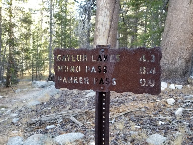
We did make 10 miles today, we were lucky because we had about 4 trail miles right off the bat from Tioga road at Tuolomne Meadows. After splitting off the JMT/PCT we took the Gaylor Lakes Trail which first parallels the creek, which parallels Tioga road for about two miles, then crosses the road and begins an 1,800 foot ascent up to Sierra Mines and Mine Shaft Pass at 10,800 ft.
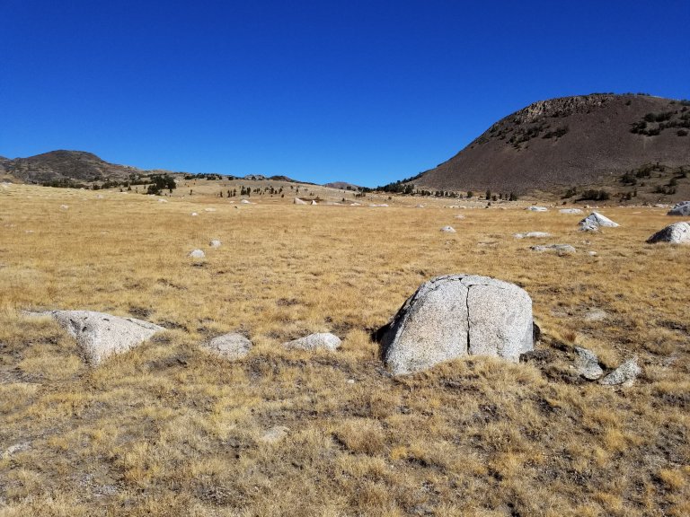
The trail climbed through lodgepole forest and I pushed to make a 2 mph pace. After about 800 feet or so of climbing, the terrain flattened out and opened up into a meadow dotted with large granite boulders sunken half way into the earth, and then Lower Gaylor Lake. The wind picked up across the meadow and while I was happy to be walking on flat ground, I was chilled. I tried to be tough and get through it, but wound up just stopping to put my jacket back on. It’s just going to be one of those days, I kept thinking.
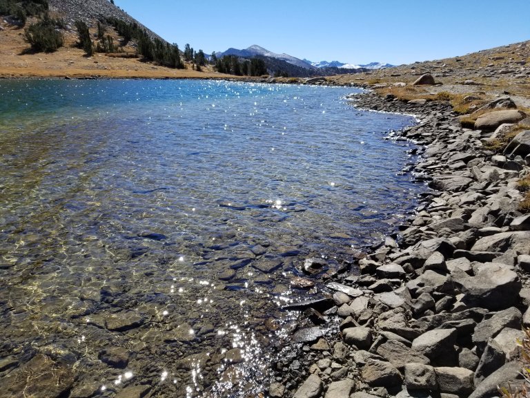
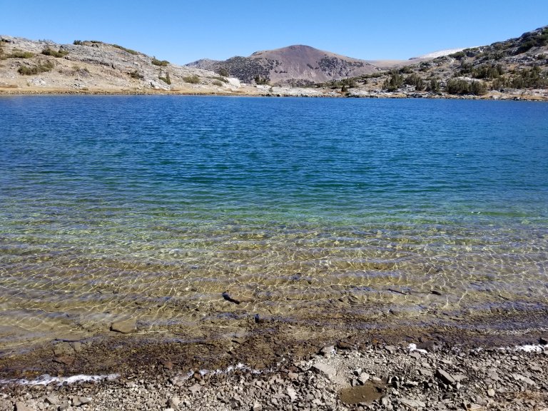
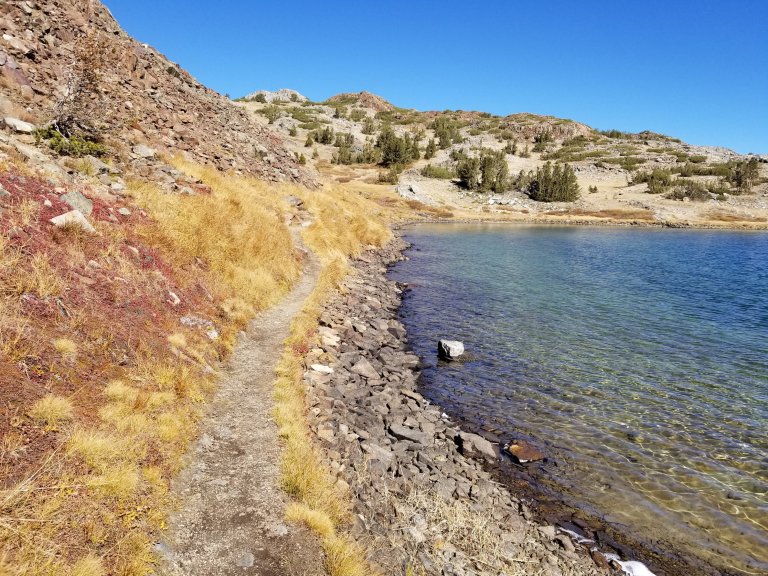
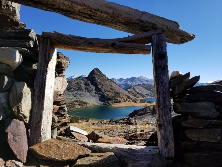
After Lower Gaylor Lake the SHR splits off for about a mile of cross country travel towards Middle Gaylor Lake. We could see on the far side of Middle Gaylor there were a few other people out there, fishing. We didn’t get too close to Middle Gaylor though, instead we hooked on to another light trail which follows the inlet to Middle Gaylor, then up to the Upper Gaylor Lake shortly thereafter. The High Route takes you right next to the Upper Lake, which at the shores has blackened exposed rocks which lead to some of the clearest and prettiest water I’ve ever seen. This water was like the Caribbean and there were various shades of turquoise and cobalt swirling around as the sand and rock bottom curved underneath. I want to drink this liquid turquoise. The sunlight did it’s glittery thing on the surface of the water and in the distance were snow covered peaks. It was definitely an idyllic setting to stop and take a lunch break. So that’s what we did.
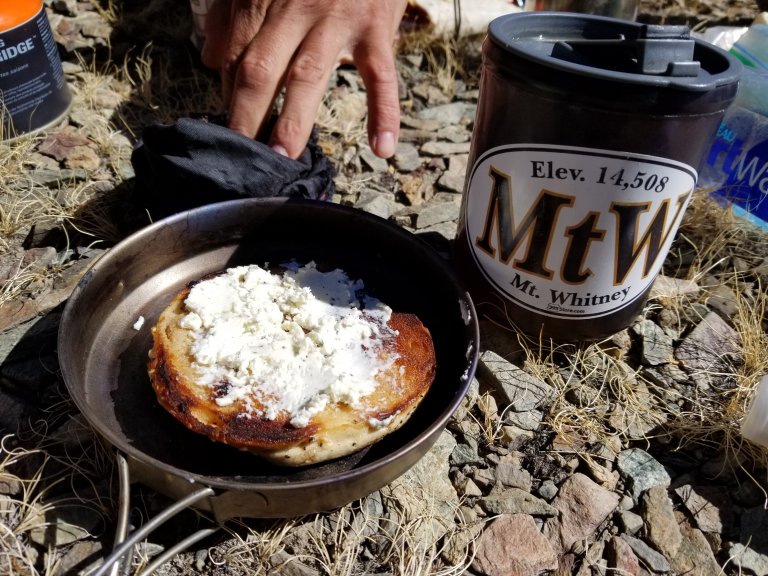
It proved to be difficult to find a spot out of the wind, or even protected from the harshly cold breeze, but we did manage to find a comfortable spot in a grassy area that was in full sun and a little less breezy. I’m excited about my food this week, since I resupplied unexpectedly in Yosemite Valley, I opted to shop for a different variety of meals and snacks, rather than the same ones I’ve been eating all Summer. So, for lunch today I had an everything bagel which I toasted with plenty of butter and then smothered with Boursain herbed goat cheese, Yum. I also strayed from my tried and true BBQ Kettle cooked potato chips and found a really good bag of Tortilla chips, restaurant style. They are medium thick, salty and oily and have a great crunch, just how I like them.
For breakfast today I got some new granola bars that are “pumpkin spice” flavored although they really don’t taste like pumpkin, but they are good. They have actual pumpkin seeds and flax seeds in them too. I smothered the chewy, light granola bar with Justin’s PB and Honey, and called it a day. Delicious. I’ve missed my nut butters. Factual statement from a thru-hiker. For dinner last night I packed out a “heavy” meal, as in weight heavy, Indian Tasty Bites. This one was lentils with chickpeas and I heated up the sauce and added pre-cooked brown rice, added a touch of sea salt and hot sauce, delicious and warming. Tonight I am planning on having Pad Thai rice noodles with the sauce it comes with already, and I will add my left over brown rice from last night and also add some PB and Sriracha. I have to say I am quite looking forward to it.
So, where were we? Ah yes, lunch at Upper Gaylor lake, food talk. So, we ended up taking a really long lunch break because we had already hiked close to 7 miles and that was our goal for each day on this last stretch, not knowing how tedious or slow the route may be. Plus, since Hurlgoat changed his plane ticket, we now have plenty of time and he really wanted to do some more fishing, which is where he is this very moment as I sit cozy in the tent and write. Ugh he must be cold out there! After we finished eating lunch and having hot tea, we glanced over Roper’s notes and Skurka’s maps and then we curled up together in the sun and let the warm rays bake us right into a little afternoon snooze.
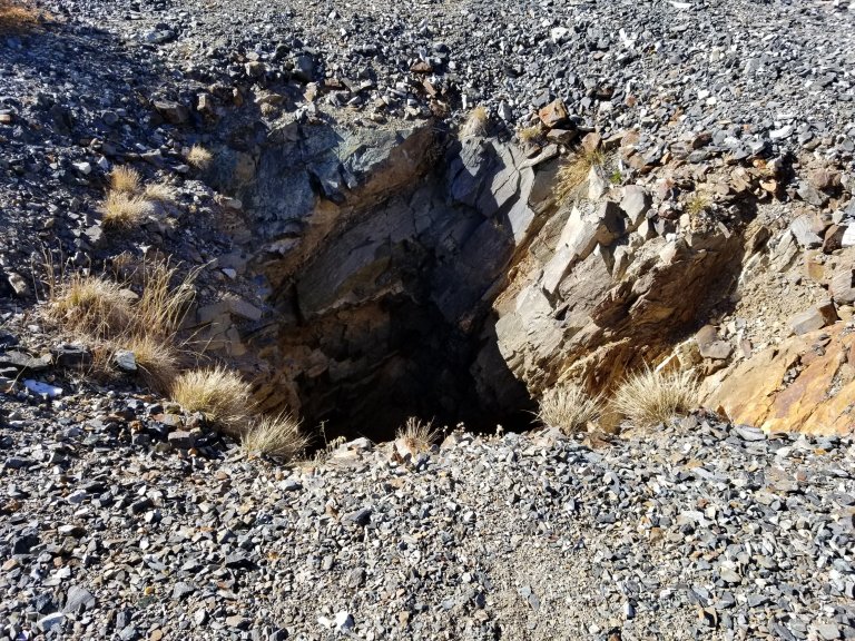
By the time we set off from that lovely spot, it was closing in on 2:45 pm. From there we had to climb Mine Shaft Pass, and descend it to where we are now, which was only about 3 miles from our lunch spot. We headed uphill first to the Sierra Mines where we inspected the old buildings made entirely out of stones stacked on top of one another, now teetering and on the brink of collapse. We stood on the edges of the massively deep holes in the earth, created by humans in desperate search for precious metals. All of this incredibly hard work, all done by hand, and often in harsh conditions, is incredible. People were so hardy then! We read in Roper’s book that these miners lived out here during the winters and built dwellings that had walls 3 feet thick. This was all in the 1800’s, it must have been such a tough life, and yet, they chose to do it at the chance of striking it rich. Now we suffer by choice through harsh conditions like that in pursuit of recreation and hanging on to a hope of being closer to the Divine. Evolution, huh….
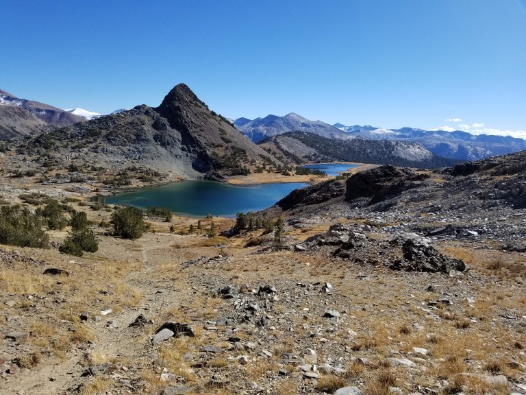
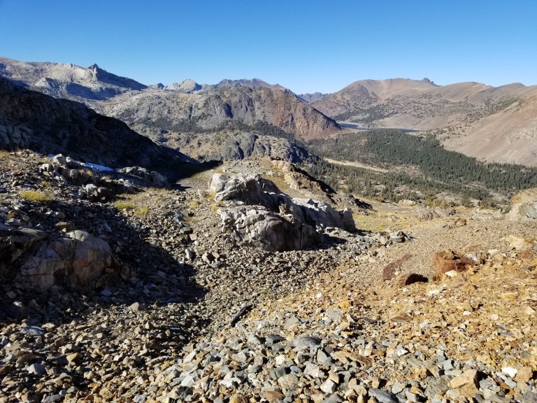
Climbing the pass was not a whole lot further, maybe another 250 feet of elevation gain, and was one of the easiest passes of the entire route. I mean, there have been “saddles” we’ve climbed through that were more intense than this one. The pass flattened out on top into a little grassy knoll, there was yet another mine dug out and tons of loose rock piled in a mound. Looking to the North from the pass, we could see that the route heading down to the lakes below would take a little more effort and time. There were several grassy and rocky ramps though, and several little cliffs as well. The whole area was quite rocky and we definitely relied on our GPS track to lead us safely down. We ended up backtracking a few times simply because we were too high or too low to make it to the next level down. It was slower going but nothing as bad as loads of talus!
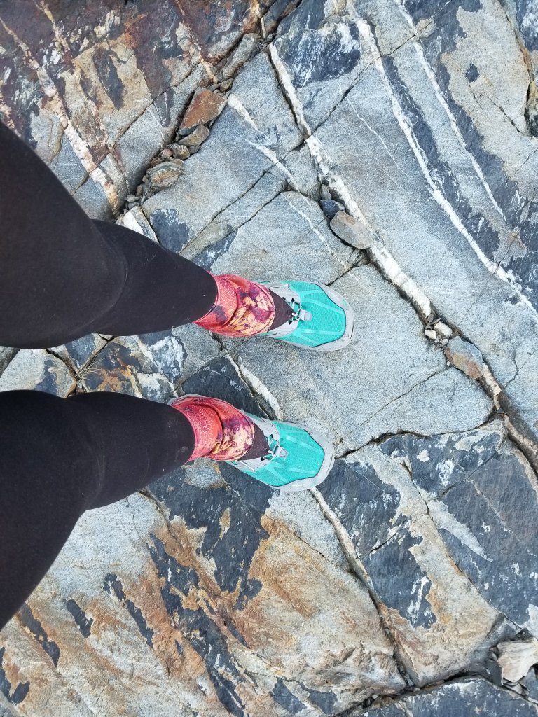
The rocks now are definitely different. We are and will be traversing the Sierra Crest from now on, until the end of this hike. From the description in Roper’s book, we are also on the transition line where the granitic rock and metamorphic rock intersect, so what we are walking on this afternoon is totally different rock. As I balanced and concentrated on my foot placement, I thought about this, how I have to get to know this rock. This rock is strange to me and I don’t know how it will behave. I don’t know how much grip I will get from it and I don’t know how loose it is.
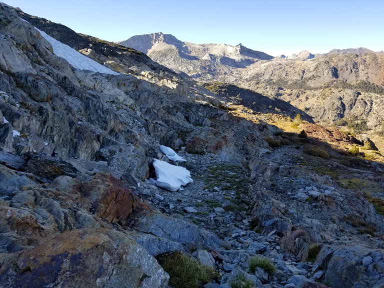
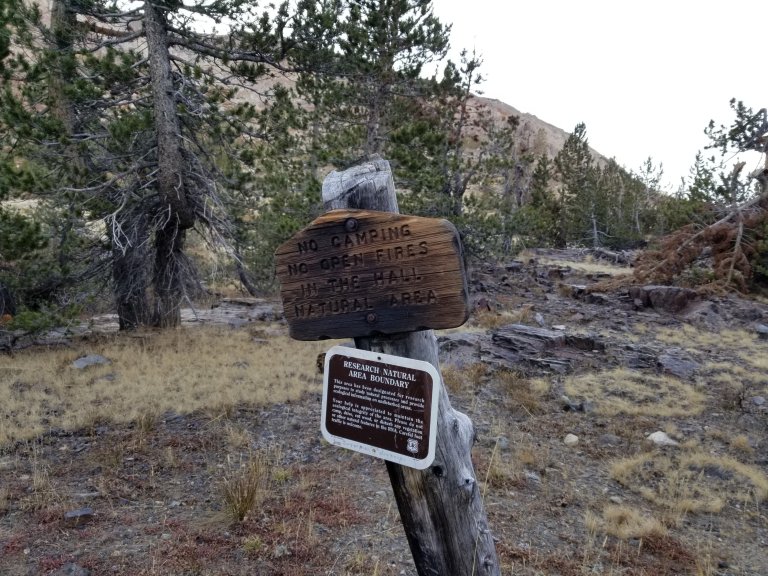
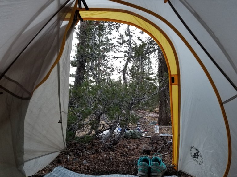
There were a few steep sections coming down from the pass, some quite loose scree-like shingles, and some sections that were still patched in shiny, black ice to be strictly avoided. Overall though it was a mellow climb down and when we reached the lake level, we realized we had already reached Fantail Lake, which was one possible destination for the day. It was only 4:45 pm, it seemed a bit early to call it a day. However, there are some strangely strict camping regulations in the area and from here, there is no camping for another 7 miles. So our options were to say “screw the rules” and be arrogant and camp anywhere we want, or to stop early and be respectful. So we stopped early and on account of the cold today, I was perfectly happy to duck inside the tent and sip hot tea.
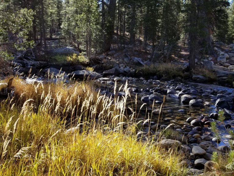
It was really a win-win because Hurlgoat wanted to fish and I am feeling pretty cold and tired. So here we are, between Fantail Lake and Shell Lake, nestled among some lodgepoles and between streams filled with hundreds of little pink bellied trout. I mean hundreds of them. It’s almost eerie how many there are, all flopping, fliting, skittering about in the shallow moving water. I scurried down to the creek tonight in the dark to fill up a bottle of water. As I shined my headlamp on the water’s surface they all went scattering, but some of them remained. Then, I went to dip my bottle in the water and the fish had stirred up so much debris that I had to go elsewhere to get clear water. Is this not odd?
I was so chilled before dinner, and while in the tent working on this blog, that I had to stop and snuggle into my sleeping bag, tucking my hands into the warmth between my two knees. I lay there for about 45 minutes trying to get warm. Hurlgoat came back from fishing, or attempting to, and said he didn’t catch a damn thing because the water in the lake was so shallow. So, no fish dinner tonight. Instead, we cooked our meals separately because we are sharing a stove. His meals take twice as long as mine to cook, so he got his started while I was in the tent, then I reluctantly emerged. Grateful, I discovered it was much more comfortable than I had imagined it to be. So I cooked my pad thai noodles sitting outside, yet bundled up in my bag. I added peanuts to the concoction, and we ate together listening to mellow music and the sound of wind in the trees.

Back in the tent, all snuggled in, we decided to take a look at what the terrain we’ll be facing tomorrow will look like. To put it into layman’s terms, it’s going to “suck ass”. We have notes from Double Tapp, Ropers Book and our maps and GPX tracks. All together we have a lot of information that all points to a very challenging day. From what I can gather, there will be a shit ton of talus, lots of loose slate, boulders the size of cars, steep snowfields, and some challenging navigation, all of which is going to be very tedious and time consuming. In our notes, it is even mentioned in one particular section that you “cannot afford to loose your concentration for even a minute” which can be absolutely exhausting. So, I am ready for bed now, we have to start early tomorrow and I am going to try my best to distract my mind from the angst of what tomorrow will bring by reading my book North and calming my mind. Ready to embrace some rest!

Damn MP another master piece where I think I’m along with the both of you. I know the frustration I get when I get skunked fishing but knowing Cornelius he probably had a big smile on his face saying shit I got skunked.
You nailed it, that’s Hurlgoat, always smiling!!