
September 20, 2018
“L” Shaped Lakes, Lake Basin
Elevation 10,800 ft
This morning I slept until close to 7:00 am and when I poked my face out of my sleeping bag, Hurlgoat was already gone fishing. I lay there, having been fighting off the need to pee for what felt like an eternity. I waited even longer because I was just that comfortable. Meanwhile Hurlgoat was down by the water’s edge, occasionally whooping and hollering, apparently having a good morning already.
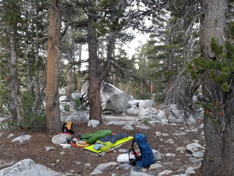
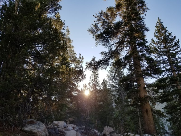
Turns out he caught nine fish this morning, before I even finished making my coffee. What a great way to start the day! He didn’t keep any of them though, because they were small and we weren’t going to eat fish for breakfast, but he sure was having some fun. I ate spirulina cookies with almond butter for my breakfast, made a strong cup of coffee and sipped it while the sun came gleaming into the woods. We got on the trail by about 9:15 am and I took the lead heading through the trees towards what I thought was the upper Horseshoe Lake.
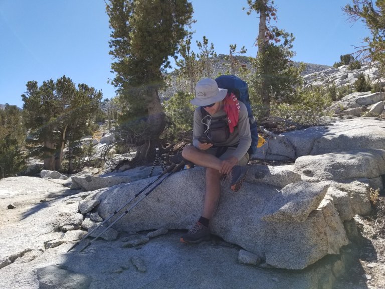
Despite having looked over the maps and Roper’s book over breakfast, I seemed to have a skewed understanding of where we were and where we needed to go. Navigation can be tricky, especially in the trees, and today was just not one of my better days. I thought I was taking us up around the second of the Horseshoe Lakes, but we should have been going pretty much due North instead of NEast where I went. It was about 30 minutes of walking before this became clear, and while it was an easy fix, it was just not the best way for me to start my day. I really want to get good at this navigation thing. Then, it got even worse.
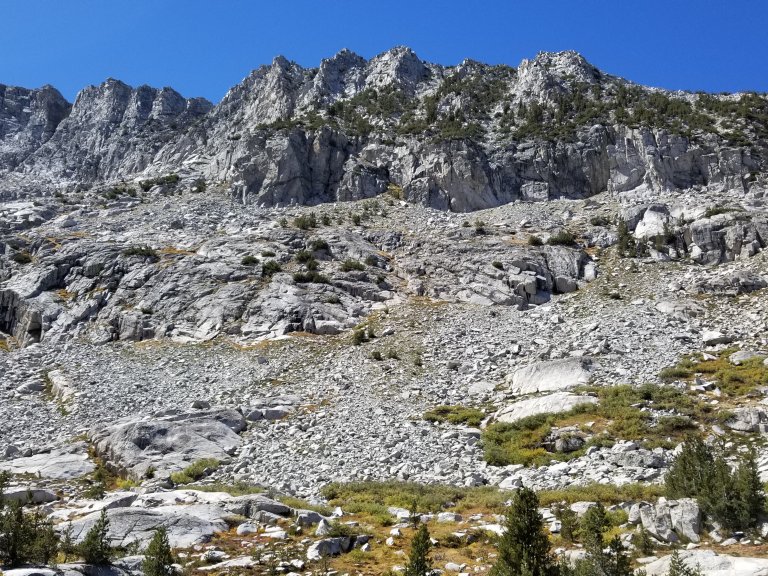
We made our way around the “correct” Horseshoe Lake and continued to head North, ascending the slope up towards Gray Pass. Climbing, climbing. My body felt tired, I felt shaky and like I had no strength for the first hour of the day and can’t explain why. Once we made the initial climb toward Gray pass, and really got the blood pumping, only then, I started to feel more normal.
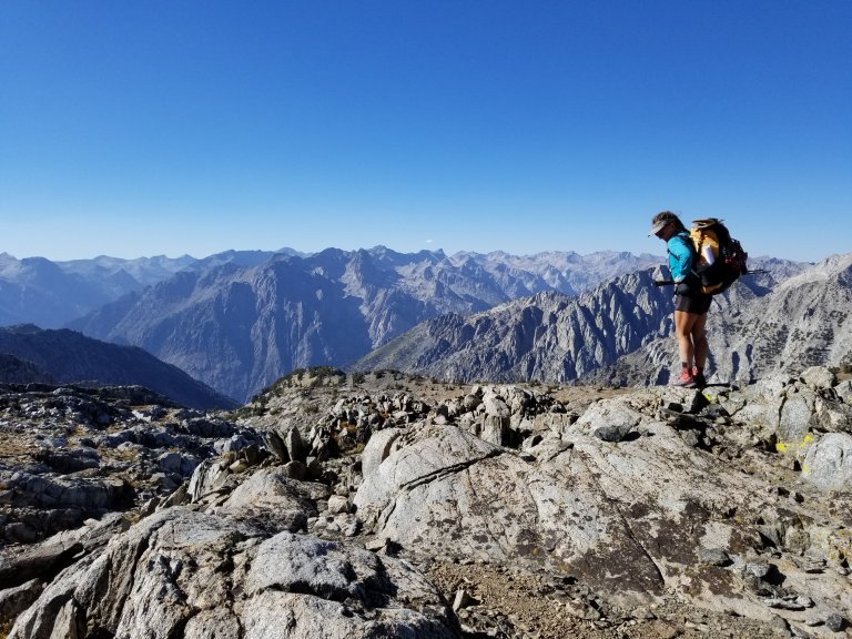
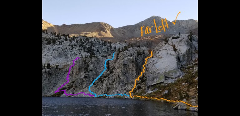
Our day began at an elevation of about 10,300 ft and topped out at about 11,700 ft and in between there were a lot of ups and downs. For one, Gray pass was confusing. We seemed to have thought a saddle we reached was it, until we crossed Windy Ridge and ended up overshooting the pass from way above. We had to scramble down big slabs to make it to the true pass and then descend another long slope of rock, grass and small willow brush to arrive at the South Fork of Cartrige Creek. Nevertheless, we were treated to some stellar views in every direction. We’re IN it now. Or so I felt.
When we arrived down at Cartridge Creek I was hungry for a snack and the fresh running water in the creek beckoned me to drink it. We found a quaint place in the shade and I took my pack off, givinng my aching shoulders a little relief. As we sat there we learned that our GPS tracks had told us that Gray Pass was White Pass, and this threw us both for a loop, since on our maps and in Roper’s book we definitely had not reached White Pass yet. This discovery somewhat alleviated the confusion I’d been having with navigation all morning, but even still, it didn’t really seem to get much better up ahead.

White Pass was a dusy, at least in my opinion. Mainly it was beacuse we had conflicting information between Roper’s book and what the GPS tracks read. We did what any good hiker would do, we navigated our own way. It was just that my way and Hurlgoat’s way don’t always match up, and he tends to just “go” in a direction and make it work, whereas I am more process oriented and want to “understand” the way on a bigger scale before attempting it.
Both of these strategies work at times and do not work at other times. So, along this journey I am learning how to also navigate having a hiking partner, and finding that balance between following his lead and taking my own path. I like to ingest the words in Roper’s book and then translate that to the map and yet again translate that to the terrain as we walk it. This is sometimes very confusing, especially with two people who may have opposing ideas about how to approach something. Nevertheless, it usually leads to beauty no matter which way you go, and how you get there. Some ways are easier, some are harder, but they are all beautiful!
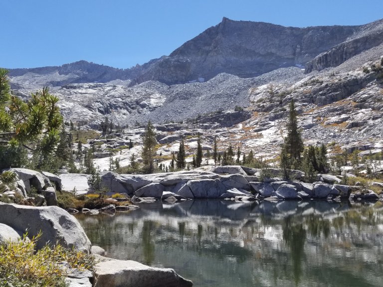
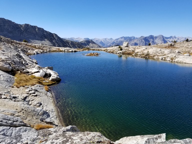
When we crossed the creek, heading in the general direction of White Pass, we still could not tell exactly where it was, as we could not see it from down below near the creek. It’s confusing when you can’t see the pass you are attempting to climb. As if an exercise in faith, you have to almost blindly trust the sources of information you have and just go. We got off the mark again after arriving at a locale labeled “unnamed lake” -which was beautiful- of course.
We ended up scrambling up a steep, rocky slope, several areas I would classify as class 3 and at a certain point we realized it was not the route our GPS suggested we take. At this point in the journey, I want to follow the GPS as much as possible, because I feel that it will lead us over the “safer” and “easier” terrain. Sometimes, though, it’s just not realistic or practical to do such. From up on that ledge, hanging onto the big rocks with both hands and climbing up, up, up I was not ready to turn around and go back, even if we were off track. It was too precarious of a climb for me to face the sketch of going back down- only to lose ground and lose time.
I am realizing that in the aftermath of the accident my friend Prince and I endured earlier this Summer, I am still facing a lot of fear around precarious and sketchy terrain. In particular, steep terrain where there are drop offs and loose rock, steep going and potential for slippage that could end in bad news. Now- I know this may sound “normal” that this type of terrain scares me, and when I describe my feelings to Hurlgoat, he simply replies with “of course it’s scary, but not everyone wants to take that risk, and that’s why we’re out here”. Okay, agreed, but what I realized today is that I am reacting emotionally to the sketch, I sometimes feel like I am fighting back tears, I swallow hard as my throat wants to close, and I start to tremble. All of this makes me even less sure footed and even less confident in the choices I am making to cross this landscape. I do know however, that this is something I must face. If I am to continue spending time in the back country, and epecially on cross country terrain, the only way for me to “heal” and get over my fear is to confront it head on. I’m thankful that I have the opportunity to do this now, here, and with a partner who is solid and reliable. So, let’s make it happen, right?
We ended up taking a lunch break by three little tarns on the way up to White Pass, since it was already closing on 2:00 pm. Geez, 2:00 pm and we still had not made it to White Pass, it seemed to be taking forever. The views were absolutely stunning as ever from up there though. The lake water was midnight blue and we watched the surface come alive with wind patterns that danced across and shimmered in the shape of ferns, then suddenly disappeared into the abyss of water.
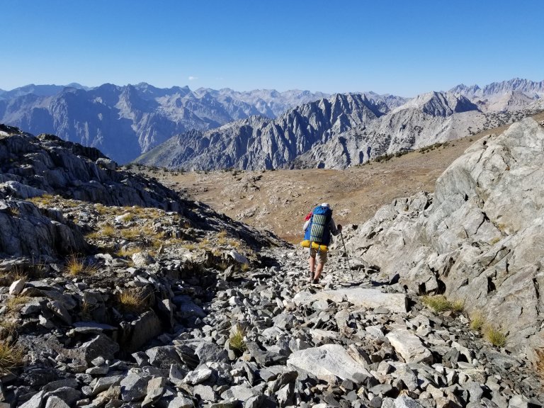
Satiated and rested, feet aired out and clothing dried, we set off by 3:00 pm to make the final ascent to White Pass. There were still two more shelf-like climbs to surmount, in order to make it to the top of the pass at 11,700 ft. Turns out the rest of the way up to White Pass was still a bit confusing, but at least it was not precarious. To the contrary, it was super non-technical and just a little over a 700 ft of elevation gain. It was easy terrain compared to what we had faced to get to the tarns where we had lunch. I am safe and I know where to go!
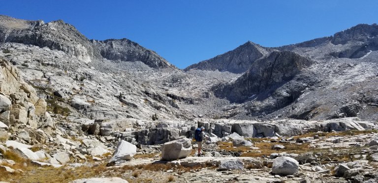
From the top of White Pass we once again consulted Roper and our GPS and made a team decision. The space between Red and White Passes is short in distance, but it is all rock/talus. Some are slabs of granite, chunks of talus or slate shingles. We scurried straight down a gully of sofball size talus to loose some elevation before contouring across to Red Pass’ saddle beneath Red Pak. It was slow going but turned out to be a rather peaceful walk once we found our line and stuck with it.
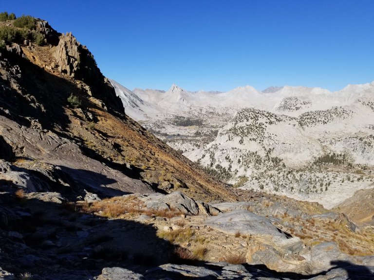
The sun was now beginning to sink and cast the golden light that I love, love, love across the range. As such, for the traverse to Red Pass, I was facing West, contouring on a slope of loose talus that overlapped with shale shingles that clinked under my feet in a steady rhythm, clink, clink, clink. Red Peak and and Red Pass are named for the color of the rock there (this is akin to naming your brown puppy “brownie”), and it contrasts heavily with the glaring white of the granite, which is what White pass is made of, shocking, I know. But there we were on he transition zone, and it was beautiful.
Roper’s book calls the 1,200 ft decent to Marion Lakes from Red pass “tedious”. I could not think of a better word. It took us an hour and a half to make this descent. First, it consisted of slow going talus and scree, but we were fortunate enough to find a little trail that others before us had made and we followed it zig zagging down the slope that periodically was made of long yellowing grasses and soil. After an hour we reached the “gully” that Roper mentions and advises to take the furthest left one. Roper states that “Here the hiker is confronted with several gullies” and goes on to quote the description the early pioneers from the Sierra Club in 1935 mentioned when attempting to steer their mules down these gullies as “a steep chimney that, at first, looked impassable.”
We took his advise and followed the gully farthest to the left. Upon reaching the top of the gully and looking down, we were both stunned, it literally looked like a drop off on the approach. There was a faint trail, down the center of this steep, impassable looking gully, leading down to Marion Lake, which we were grateful for on some level, but sometimes a trail can be worse. Worse because it is worn down to dirt and scree that give you no traction, leaving you feeling like you are going to slip to your demise at any given moment. Holy shit, here we go!
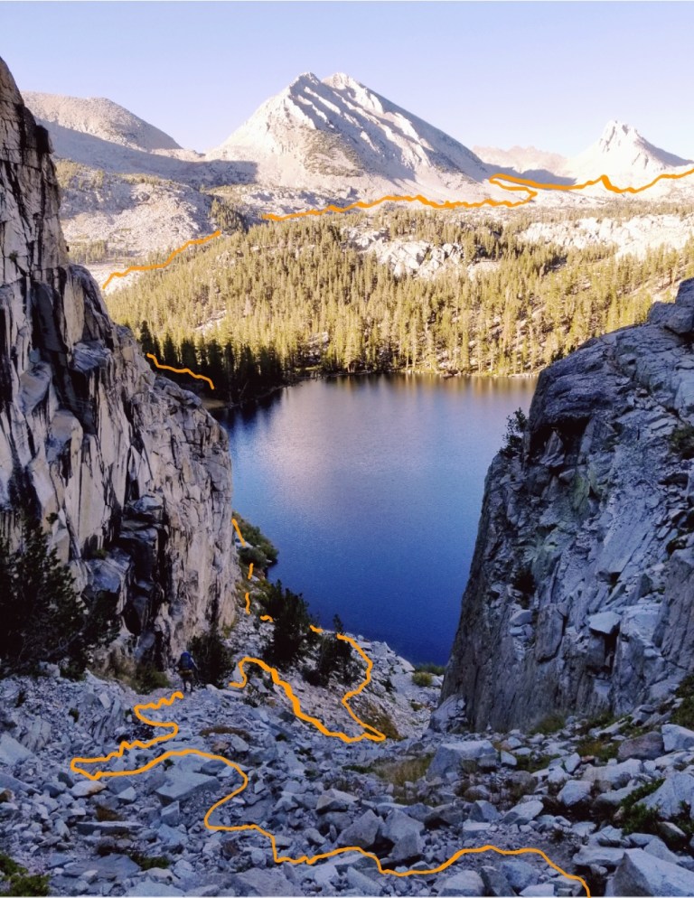
We took our time, took it seriously, going extra slow and being extra careful. It was one of the steepest, rockiest slopes I have ever hiked on, yet I felt an unfamiliar confidence as I picked my way down step by step. I looked down the gully to the lake below, and it was breathtakingly beautiful. Just make it to the lake, I kept thinking, breathe….
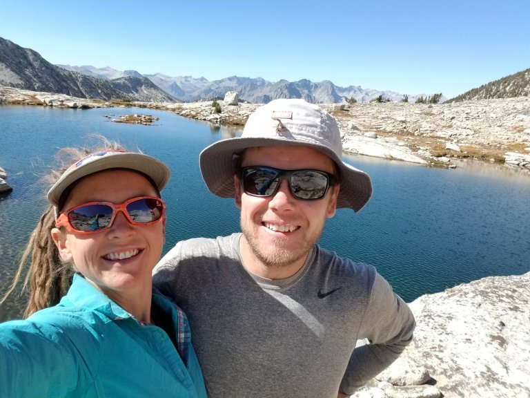
The views across from and above Marion Lake- looking upslope to the creek leading to Lake Basin- are equally awe-striking. Way in the distance, you can see the next High Route objective, the intimidating Frozen Lake Pass that we will traverse tomorrow. Not only that, you can see the entire range which is a backdrop to Lake Basin, dividing the basin itself from the massively spacious moonscape of Upper Basin on the other side, which we know from the PCT/JMT. I am looking forward to entering Upper Basin from Frozen Lake Pass, that’s going to me awesome!
We made it down to Marion Lake safely, finally, and by then it was already closing in on 6:00 pm. There really wasn’t any camping near Marion Lake, otherwise we would have loved to stay there, as it is a truly special place. The lake is surrounded by walls of granite in a big curve, and from the shores of the lake, you can see all three of those gullies that one can conceivably ramble down. Dang they look crazy from here! Looking back at what we just came down from, it looks even worse than from the top looking down. It’s so wild what we just did! Wild and pretty amazing. I feel, for the moment, some of my fears slowly melting away.

We decided to climb up out of the Marion Lake area, and followed the creek upslope, bushwhacking through thick willows for a spell, before settling on a flat spot nestled in the “L” shaped lakes area, as described by Roper. We ended up on a perfectly flat sandy spot protected by a large set of boulders and lodgepoles, facing West, giving us the perfect view of the sun setting as we made camp. On the opposite horizon, the moon was preparing to rise.
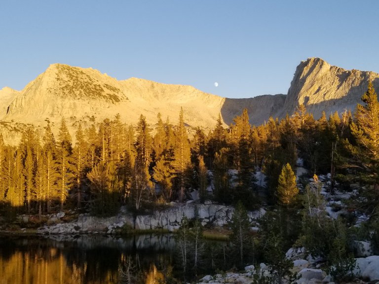

It was a breezy evening at first, which is why we decided to set up the tent, but after the sunset the air became still and the night entirely pleasant. We sat out watching the swelling moon rise and I climbed up to the top of some rocks and experimented with some night photography. I carried a cup of hot Chamomile tea with me and sipped it while my long exposure etched the light onto the digital canvas. The constellations of the heavens were drowned out by moonlight so I focused on capturing the glowing wall that towered around the Lake Basin like a fortress. I stood up there in complete silence, sipping my tea, taking it all in.

Oh, Mary Poppins! I loved your descriptions and beautiful photographs that illustrate your words. Wow, what a place you’re in. It was s much fun to sit down with this read and an after dinner glass of wine!
Yay! Glad u enjoyed it, many more to come! Miss U xxoo
Wow it looks absolutely gorgeous!
https://phoenixslife.com/
Reading about all the fun you have and watching Hurlgoat’s videos. This 66 year old is tired of you guys having fun so I went and bought an 88 liter backpack .hopefully I can run into the both of you back up here, perhaps the Goat Rocks.
Dont pack that pack full!!!