
Journal Excerpt: Okay, what a day! There is so much to tell, but right now I lay horizontal, finally, it’s as if my body doesn’t even know what to do with this comfort. My muscle memory from hiking the PCT is intact. My body knows all the feelings, knows the aches and pains, the stressors, and yet she also knows the agony always only lasts so long, so she also knows the joys, that familiar happy place. She know’s this place, she know’s what’s to come.
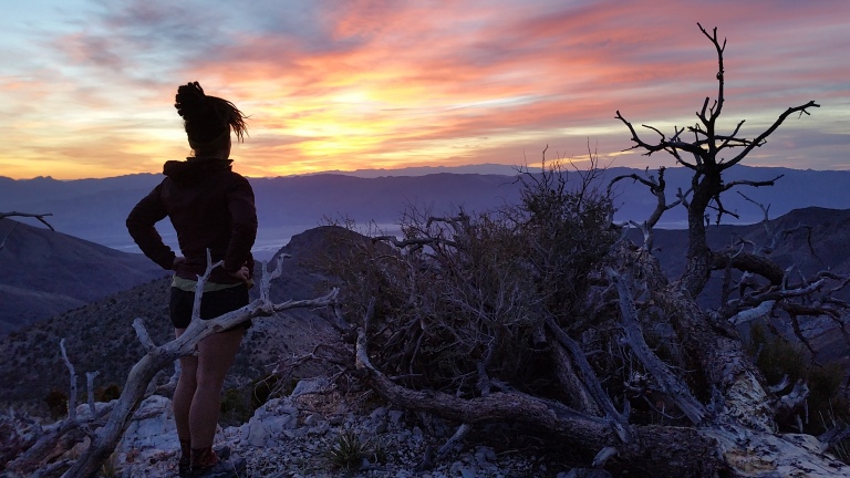
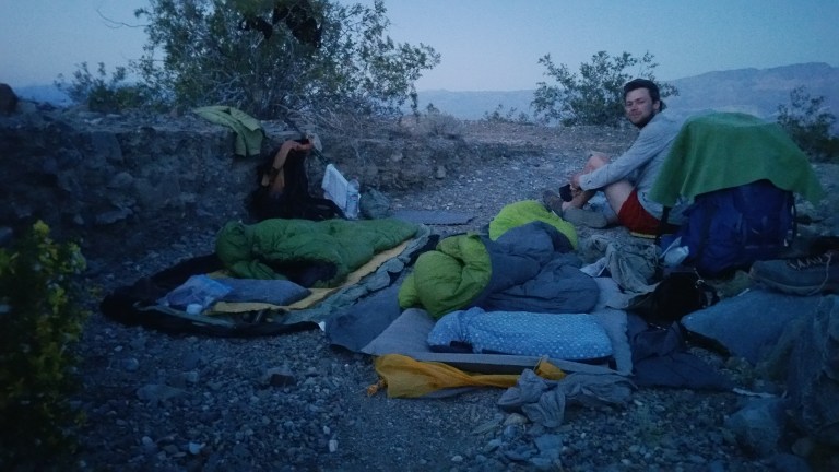
Morning: I woke at 5:00 am to Hurlgoat scruffling and scrunching his stuff and I thought what the hell is he doing in the middle of the night? Then I realized although it was still dark out, it was time to get up. Stars shone brightly, the faintest glow of the promise of day kissed the horizon. I made cool instant coffee, and since I was not yet hungry, I started packing up. Sunrise blessed us with clouds that intensified in color and created a textured backdrop over the distant mountains to the East. I stood on the ledge and sipped my coffee watching the light emerge.
It’s going to be an awesome day….
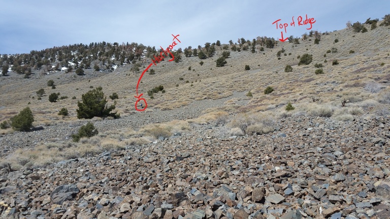
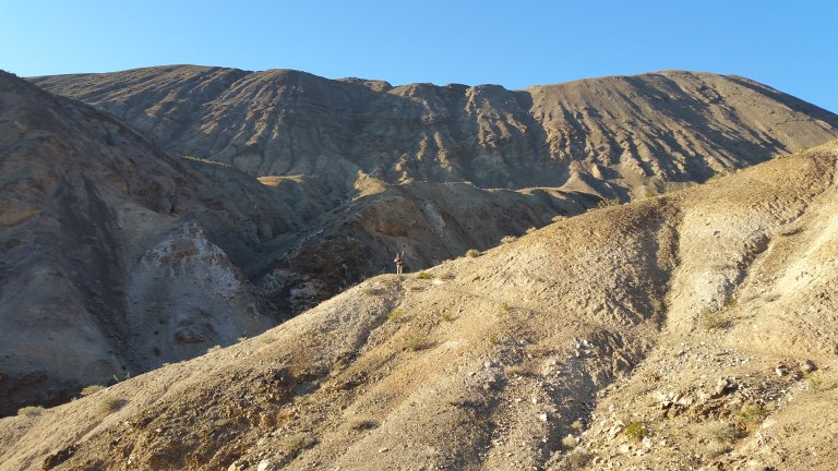
We set off at 6:00 am and first climbed more than 3,000 ft to the trail junction for Telescope peak. This was arguably the most difficult part of the day, especially the last 1,000 ft feet up a sheer slope of rock and talus scree that slipped a great deal with every step. It took over 1 hour to go a mile in this. It was hot but pleasant as the elevation gave a slight break to the hot temps of the day. Along the way, we were surprised to intersect with another hiker. At first we thought he might be hiking the Highest to Lowest, and thought that was pretty cool. When we stopped to chat with him, we found out he was doing a Telescope Peak Summit from Badwater, out and back. Also cool. He had a loaded pack though and looked really tired and really hot. We wished him a safe hike and pressed on.
Hurlgoat was feeling much better this morning and I was so glad we stopped early and got some rest yesterday. He didn’t sleep all that well though, but you wouldn’t know it by the way he hiked today. He was stronger and more himself. Glad for it. I watched him gain some ground above me and choose his own route up the scree slopes. It was interesting to look up at the possibilities on the slope. How shall I get around that talus field? There are plants that look pretty thick over there, I think I will avoid them. Those rocks look smaller, maybe I will try them. Try. Fail. Small rocks are no beuno. Ok, those rocks over there look bigger, I will use their weight to support mine. Try. Slight success? They are loose and tumble as my feet sink deeply into them like quicksand.
Where’s Hurlgoat?
A good place to stop and catch my breath…
Sometimes I would fall to my knees, and try to catch myself from going all the way down. It seemed that no way was the easy way, and that was ok, I signed up for this. I took my time and huffed up and up and up, until finally, we made it to the ridge. On the ridge, there was a nice, flat, compact trail. It was the trail to Telescope Peak’s Summit, another 1.3 miles from where we intersected it. We both took a break on the trail. I was suddenly very hungry and needed to drink as much water as possible to catch up on my hydration. Hike up 10,000 ft to Telescope Peak, Mission Accomplished.
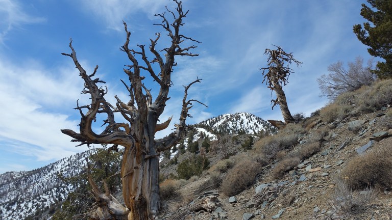
Foxtail Pine and Telescope Peak
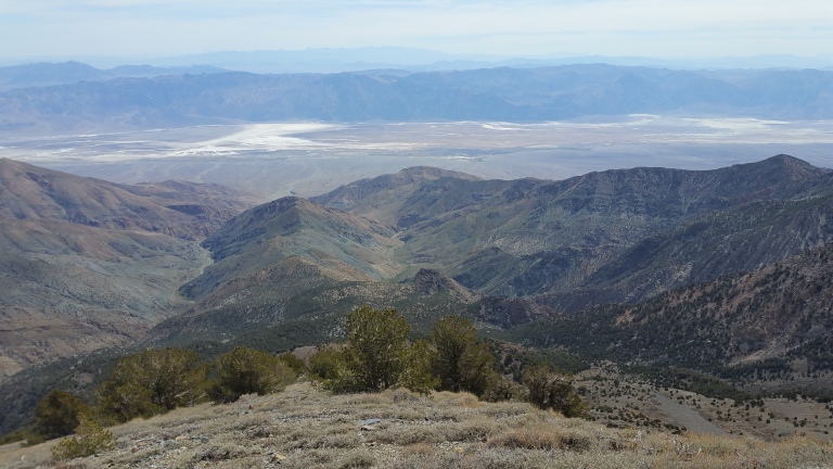
Looking back at BADWATER
Our next mission was to find water in Tuber Canyon. We decided we did not have the time to Summit Telescope, since we were relying on the Spring for water. Our goal for the day was to find the Spring by lunchtime, and then descend all the way to the desert floor, over 7,000 ft below. So we skipped Summiting for now.
From the ridge, we caught our first glimpse of the Sierras!
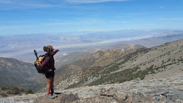
“We’re going….there!”
It was a lovely, and I mean lovely, trail for about 2.5 miles down the ridge. I could not believe how easy the walking felt after what we just did. We crossed paths with some day hikers in this section, they were the 2nd people we saw since we left Badwater a few days ago. They were on their way to the Summit and were awestruck when we told them what we were doing. Just shortly after passing them, we hung a hard Left, down x-c terrain towards Tuber Canyon. Here we go….
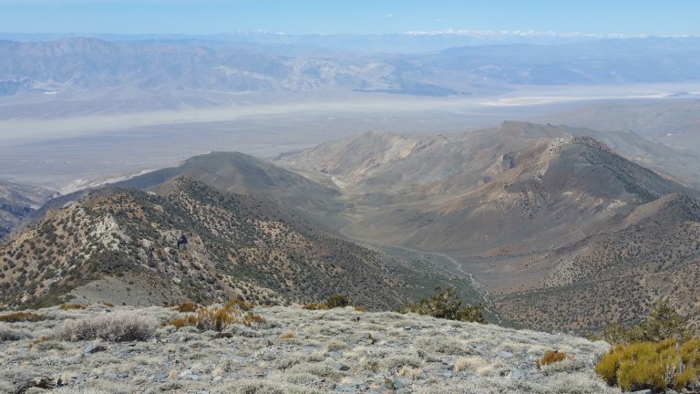
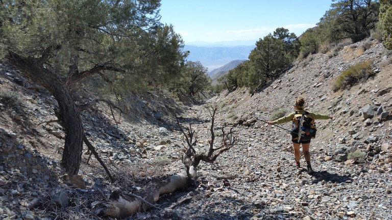
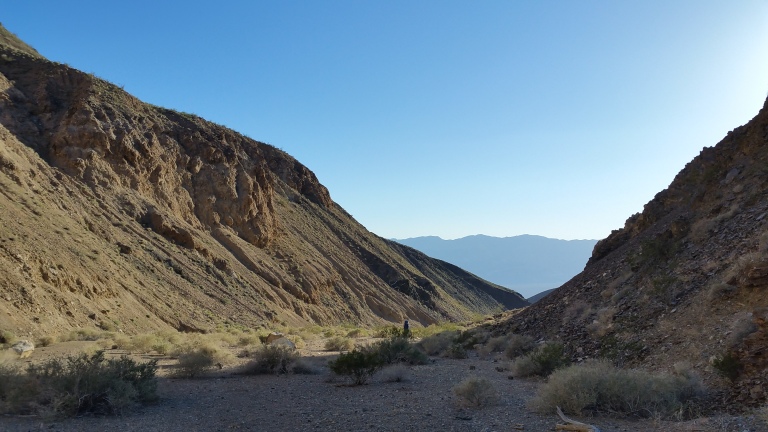
Looking down into Tuber Canyon and Panamint Valley
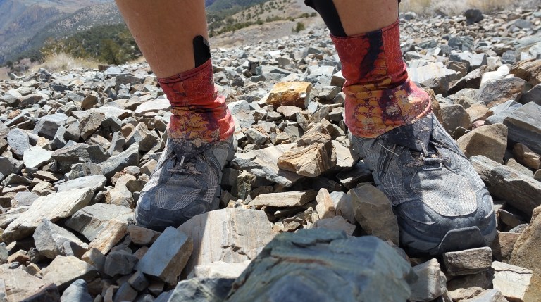
It’s interesting to look down these canyons and wonder where exactly the water you are going to find might be. The space looks so enormous and you just hope that you choose the “right” way. Down, down, down we go. This too, proved to be steep and loose, and there were faint animal use trails that led me in the wrong direction more than once. There were a few sections I had to backtrack and re-set my course to get back on the route. The scree was quite loose and sometimes descending it mimicked skiing. You learn to just go with the momentum and don’t try too much to resist. Save the knees!
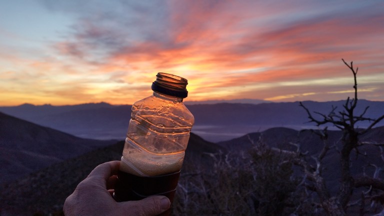
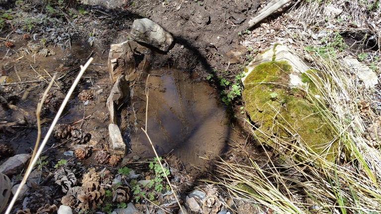
This continued for about 1.5 hrs, and finally, we reached the Spring! It’s actually amazing that in this large expanse of mountains, we were able to locate a Spring that was maybe 2 feet wide and about 50 feet long, flowing at a trickle with lots of overgrown trees all around. But that water, oh my goodness, it was lovely icy cold water from the Earth, what a treat!
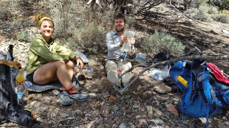
We make-shifted a lopsided place on the ground to sit and eat lunch in the shade, take a break, take the shoes off, and as is my tradition whenever I find ice cold fresh water on trail, I make iced coffee. It’s always fun to tackle the afternoon with a little buzz.
Then it was down down down…Down into the valley where it was 99 F. After lunch, I was a little concerned that we’d be in that steep, loose scree all the way, but fortunately, the grade eased up and there were nice marble sized pebbles that rolled and gave your feet a place to sink in rather than slip down. It was like walking on pillows! The pebbles were just so that you could take large lopes, sinking your feet into them and bounding out, all the way down the canyon for a few miles. The wash in the canyon guided us, and we made great time here. I am having so much fun, I love this!!
Then there were other sections where the canyons narrowed and the sand and soil were more compact. There was a lot more vegetation here and even another place that had water, but you could barely get to it and it was very muddy. I tried to cross over where I thought the route went above the water, but I got stuck in really scratchy brush, cutting up my legs quite a lot, and still could not find the track.
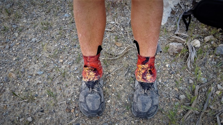
Scratched up a bit
My GPS kept changing it’s mind and I went back and forth, scrambling in the wrong places and re-tracing my steps. Eventually, I figured it out, the track was on the other side of the wash and it climbed way the hell up. I had not expected that. I was frustrated because I felt like I was loosing time, who knows how far Hurlgoat is ahead of me now?
I suppose this would be a good time to mention that I failed to download my maps to my phone GPS, so when I was using my GPS to locate the route, all I could do was orient myself to the red line. I was forced to constantly stop and look at my paper maps, a good exercise anyway, but it took a lot more time to do this, and I kept getting behind Hurlgoat, who had maps on his phone. Lesson learned. Download yer maps.
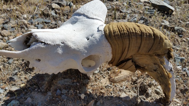
It seemed like he just breezed right through there and I couldn’t figure out how he went so fast. I pressed on, trying to make up the “lost time” but was soon distracted, and rewarded by my tedius efforts, with finding a beautiful specimen of a Big Horn Sheep skull. I was so thrilled and easily spent 10 minutes taking photos and picking it up to inspect it. Time well spent. I love this, I’m so stoked!
Eventually I caught up with Hurlgoat, he had stopped to wait for me, taking a little break in a chill, shady place. This time, there was another section where we climbed up to a ridge South of the wash, and then followed that contour line wrapping and curving around the canyon walls for a couple miles. It was really fun, since the path was packed down and we could walk on it like an actual trail, like you are floating.
It was probably an animal trail originally that people helped to form into a footpath and I thought about how the process of any trail is formed from repeated steps, thousands of them, like water flowing over rock for thousands of years, making a rough surface smooth. The sun was getting lower on the horizon and I could see the mouth of the canyon, where we would emerge into the flat desert again. It seemed at this time, that the toughest part of the day was well behind us and it was now time to relax and cruise.
At the end of the wash and canyon, we emerged onto a gentle dirt road and headed North for a few miles until we found an old, and I mean old, beat up, and I mean beat up, weathered, and I mean weathered, car. The light was hitting it perfectly just then, minutes before the sun set, behind the Panamint Mountains, and we stopped to take photos, which turned into a snack break, our last one before the final miles of the day.


The remainder of the night was dirt road walking and some paved road walking too. Easy peasy lemon squeezy. Despite my fatigue, I was okay with putting in a few more miles and with night hiking under such easy walking circumstances. It was almost a must. Especially since we wanted to make Panamint Springs Resort by lunch tomorrow.
We hiked until 9:00 pm and finally made camp in a sandy ravine just off the dirt track. There was a 3 foot bank of dirt on the side of my bed which I treat as my night stand. The shrub with little yellow flowers was where I hang my underwear to dry in the night breeze. We were camped at 2,300 ft elevation, 70 F, 10:30 pm, time to get to sleep.
Journal Excerpt: Tonight I walked in 75 F night air, under the light of a half moon, uphill on a paved road without my headlamp, through the void. Approaching mile 18 or so, surpassing 14 hours of hiking, feeling a significant amount of discomfort in my feet, my left ankle, and the lopsided weight from my pack shifting all day.
Yet, I am in my happy place. I am meant to do this, this is where I belong. The desert is gray, purple, brown, black. She is so still, so expansive, yet her winds sing to me and her stars glow overhead guiding me on my way. The silhouettes of mountains in the far distance talk to me, call to me, they demarcate this space and give it definition. It is so big and empty here otherwise. This is, Unbounded space at it’s finest.

Exquisite photograhy. Well written. I had to subscribe. This is just great. I am sure Edward Abbey would more than approve. I totally enjoyed it. Looking forward to your next posting.
Hi Yermo, you are too kind! Glad you are enjoying, that encourages me 🙂
You really hit your stride writing this one. I’m enjoying following both of you.
Wow, thank you so much, glad you enjoyed 🙂
Boy, it’s surprising you had to do the catching up. Normally he’s doing the catching up because he films so , so much. I reading your blog because I can’t wait. I am really enjoying your writing skills.
Thank you Willard, Im glad you’re enjoying the adventure with us!
You have such a gift with words, so poetic and beautiful. Your photographs are magnificent, truly capturing the essence of your surrounds. Been following you and Hurlgoat for a while now. It’s such a gift to follow along with your adventures, thank you so much!
Thank you Sarah, I really appreiciate it, and I love to hear whenever someone enjoys following along on our adventures, it means a lot!